Related Research Articles

In marine geology, a guyot, also known as a tablemount, is an isolated underwater volcanic mountain (seamount) with a flat top more than 200 m (660 ft) below the surface of the sea. The diameters of these flat summits can exceed 10 km (6.2 mi). Guyots are most commonly found in the Pacific Ocean, but they have been identified in all the oceans except the Arctic Ocean.

A seamount is a large geologic landform that rises from the ocean floor but that does not reach to the water's surface, and thus is not an island, islet or cliff-rock. Seamounts are typically formed from extinct volcanoes that rise abruptly and are usually found rising from the seafloor to 1,000–4,000 m (3,300–13,100 ft) in height. They are defined by oceanographers as independent features that rise to at least 1,000 m (3,281 ft) above the seafloor, characteristically of conical form. The peaks are often found hundreds to thousands of meters below the surface, and are therefore considered to be within the deep sea. During their evolution over geologic time, the largest seamounts may reach the sea surface where wave action erodes the summit to form a flat surface. After they have subsided and sunk below the sea surface such flat-top seamounts are called "guyots" or "tablemounts".

Lōʻihi Seamount is an active submarine volcano about 22 mi (35 km) off the southeast coast of the island of Hawaii. The top of the seamount is about 3,200 ft (975 m) below sea level. This seamount is on the flank of Mauna Loa, the largest shield volcano on Earth. Lōʻihi, meaning "long" in Hawaiian, is the newest volcano in the Hawaiian–Emperor seamount chain, a string of volcanoes that stretches about 3,900 mi (6,200 km) northwest of Lōʻihi. Unlike most active volcanoes in the Pacific Ocean that make up the active plate margins on the Pacific Ring of Fire, Lōʻihi and the other volcanoes of the Hawaiian–Emperor seamount chain are hotspot volcanoes and formed well away from the nearest plate boundary. Volcanoes in the Hawaiian Islands arise from the Hawaii hotspot, and as the youngest volcano in the chain, Lōʻihi is the only Hawaiian volcano in the deep submarine preshield stage of development.

Submarine volcanoes are underwater vents or fissures in the Earth's surface from which magma can erupt. Many submarine volcanoes are located near areas of tectonic plate formation, known as mid-ocean ridges. The volcanoes at mid-ocean ridges alone are estimated to account for 75% of the magma output on Earth. Although most submarine volcanoes are located in the depths of seas and oceans, some also exist in shallow water, and these can discharge material into the atmosphere during an eruption. The Kolumbo submarine volcano in the Aegean Sea was discovered in 1650 when it erupted, killing about 70 people on the nearby island of Santorini. The total number of submarine volcanoes is estimated to be over 1 million of which some 75,000 rise more than 1 km above the seabed. Only 119 submarine volcanoes in Earth's oceans and seas are known to have erupted during the last 11,700 years.

The Rockall Trough is a deep-water bathymetric feature to the northwest of Scotland and Ireland, running roughly from southwest to northeast, flanked on the north by the Rockall Plateau and to the south by the Porcupine Seabight. At the northern end, the channel is bounded by the Wyville-Thomson Ridge, named after Charles Wyville Thomson, professor of zoology at the University of Edinburgh and driving force behind the Challenger Expedition. At the southern end, the trough opens into the Porcupine abyssal plain. The Rockall Basin is a large sedimentary basin that lies beneath the trough. Both are named after Rockall, a rocky islet lying 301.4 km west of St Kilda.

Bowie Seamount is a large submarine volcano in the northeastern Pacific Ocean, located 180 km (110 mi) west of Haida Gwaii, British Columbia, Canada.
The following outline is provided as an overview of and introduction to Oceanography.

The Fogo Seamounts, also called the Fogo Seamount Chain, are a group of undersea mountains southeast of the Grand Banks of Newfoundland in the North Atlantic Ocean. This seamount chain, lying approximately 500 km (310 mi) offshore from the island of Newfoundland, consists of several submarine volcanoes that have been extinct for millions of years. They are one of the few seamount chains located in Canadian waters off the coast of Atlantic Canada.

Orca Seamount is a seamount near King George Island in Antarctica, in the Bransfield Strait. While it is inactive, last volcanic activity at Orca Seamount is judged to have occurred in the recent past as there are temperature anomalies in the seawater around at the seamount. Thermophilic and hyperthermophilic microorganisms organism have been found at the seamount.

The Graveyard Seamounts, officially known as the Graveyard Knolls, are a series of 28 small seamounts and edifices located on the Chatham Rise, east of New Zealand. They cover about 140 km2 (54 sq mi) and stand out from the surrounding oceanic plateau that measures several hundred kilometers. They are named after various morose figures following the naming of the largest of the knolls as "the Graveyard" as it was a graveyard of fishing gear that became stuck on it. The most prominent among the group of knolls are Ghoul, Diabolical, Voodoo, Scroll, Hartless, Pyre, Gothic, Zombie, Mummy, Headstone, Morgue and Graveyard.
Researcher Ridge is an underwater ridge in the Northern Atlantic Ocean. It appears to be a chain of seamounts named Gollum Seamount, Vayda Seamount, Bilbo Seamount, Gandalf Seamount, The Shire Seamount, Pippin Seamount, Merry Seamount, Molodezhnaya Seamount, Frodo Seamount, Sam Seamount and Mount Doom Seamount that were likely formed by a hotspot.
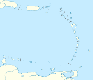
Noroit Seamount is a seamount in the Caribbean Sea, in the Anegada Passage. It is also spelled Noroît Seamount after the French survey and research vessel RV Le Noroît which was operated by IFREMER. It is also known as Noroit Knoll. Several research projects are conducted in vicinity of Noroit Seamount.
Algerine Seamount is an undersea mountain in the North Atlantic Ocean, located about 560 km (350 mi) south of Cape Race in the northeastern portion of the Sohm Abyssal Plain. Its summit is more than 2,000 m (6,600 ft) below sea level and rises to a height of over 1,200 m (3,900 ft). With an areal extent of 550 km2 (210 sq mi), Algerine Seamount is slightly bigger than the Ontarian city of Kingston. To the east, Algerine Seamount is bounded by Birma Seamount.

Frankfurt Seamount, also known as Frankfurt Knoll, is an undersea mountain in the North Atlantic Ocean, located about 480 km (300 mi) south of Cape Race on the North American continental rise. Its summit is more than 2,000 m (6,600 ft) below sea level and rises to a height of over 1,000 m (3,300 ft). With an areal extent of 320 km2 (120 sq mi), Frankfurt Seamount is larger than the New Brunswick city of Saint John.
Montmagny Seamount, formerly known as Minia Seamount, is an undersea mountain in the North Atlantic Ocean, located about 700 km (430 mi) south of Cape Race in Canadian waters off Atlantic Canada. It rises to a height of over 1,000 m (3,300 ft) and has an areal extent of 440 km2 (170 sq mi), making it slightly larger than the Quebec city of Montreal.
Birma Seamount, also known as Birma Knoll, is a undersea mountain in the North Atlantic Ocean, located about 650 km (400 mi) south of Cape Race in Canadian waters off Atlantic Canada. It has a height of over 1,800 m (5,900 ft), making Birma the tallest of the Fogo Seamounts. Its areal extent of 733 km2 (283 sq mi) is smaller than the Albertan city of Calgary. To the west, Birma Seamount is bounded by Algerine Seamount.
Carpathia Seamount, also known as Carpathia Knoll, is an undersea mountain in the North Atlantic Ocean, located about 600 km (370 mi) southeast of Cape Race in Canadian waters off Atlantic Canada. It rises to a height of over 1,000 m (3,300 ft) and has an areal extent of 550 km2 (210 sq mi), making it slightly larger than the Ontarian city of Kingston. Carpathia Seamount and Mount Temple Seamount about 90 km (56 mi) to the west are among the closest seamounts to the RMS Titanic wreck.
Mackay-Bennett Seamount, also known as Mackay-Bennett Knoll, is an undersea mountain in the North Atlantic Ocean, located about 680 km (420 mi) southeast of Cape Race in Canadian waters off Atlantic Canada. It rises to a height of over 1,000 m (3,300 ft) and has an areal extent of 500 km2 (190 sq mi), making it slightly smaller than Carpathia Seamount to the southwest.
Mount Temple Seamount, also known as Mount Temple Knoll, is an undersea mountain in the North Atlantic Ocean, located about 600 km (370 mi) southeast of Cape Race in Canadian waters off Atlantic Canada. It rises to a height of over 1,000 m (3,300 ft) and has an areal extent of 475 km2 (183 sq mi), making it larger than Quebec City and the Manitoban city of Winnipeg. Mount Temple Seamount and Carpathia Seamount about 90 km (56 mi) to the east are among the closest seamounts to the RMS Titanic wreck.
Orphan Knoll is a undersea peak, horst and contiental fragment located in the Atlantic Ocean off the northeast coast of Newfoundland, with mounds on it rising up to 1800 meters from the surface. It was above sea level in the Middle Jurassic Period, and was left behind when Europe and Labrador separated during the formation of the North Atlantic, thus giving the peak its name. Due to its isolation, it is a hotspot for marine life and is home to corals, sponges, and endemics.
References
- ↑ "Standardization of Undersea Feature Names: Guidelines, Proposal Form, and Terminology" (PDF). International Hydrographic Organization. October 2019. Retrieved 2022-02-16.
- ↑ Government of Canada, Fisheries and Oceans Canada (2019-01-16). "Advisory Committee on Undersea Feature Names". www.dfo-mpo.gc.ca. Retrieved 2022-02-16.
- ↑ "Seamounts and knolls need more research | Earth | EarthSky". earthsky.org. 2011-05-15. Retrieved 2022-02-16.


| | This oceanography article is a stub. You can help Wikipedia by expanding it. |