Leetsdale, Pennsylvania

Last updated

Leetsdale, Pennsylvania
Elmridge.jpg
Elmridge, a historic site in the borough
Allegheny County Pennsylvania incorporated and unincorporated areas Leetsdale highlighted.svg
Location in Allegheny County and the state of Pennsylvania.
Coordinates: 40°34′0″N80°12′41″W / 40.56667°N 80.21139°W / 40.56667; -80.21139
Country United States
State Pennsylvania
County Allegheny
IncorporatedMarch 28, 1904
Government
  MayorSandra Ford (D)
Area
[1]
  Total1.20 sq mi (3.10 km2)
  Land1.00 sq mi (2.59 km2)
  Water0.20 sq mi (0.51 km2)
Population
 (2020) [2]
  Total1,162
  Density1,163.16/sq mi (448.89/km2)
Time zone UTC-5 (Eastern (EST))
  Summer (DST) UTC-4 (EDT)
ZIP code
15056 [3]
FIPS code 42-42392
Website leetsdaleboro.net

Leetsdale is a borough in Allegheny County, Pennsylvania, along the Ohio River. It is part of the Pittsburgh Metro Area. The population was 1,162 at the 2020 census. [4]

Contents

History

Leetsdale was incorporated on March 28, 1904. Leetsdale at one time had a formidable industrial manufacturing base, with a Bethlehem Steel mill that closed in the late 1970s. The site of the mill on the shore of the Ohio River is now the Leetsdale Industrial Park, or the Port of Leetsdale, and is home to facilities leased, by The Buncher Company, to a number of companies of varying sizes. [5] The Leetsdale Industrial Park was largely a brownfield until the 1990s. Today, only a few of the original buildings still stand. In 2022, CGI Steel and Nextracker renovated an abandoned steel factory to produce solar tracker equipment. [6]

Leetsdale is also home to Elmridge, or the James Gardiner Coffin/John Walker house, which is listed on the National Register of Historic Places. [7]

Geography

Leetsdale is located at 40°34′0″N80°12′41″W / 40.56667°N 80.21139°W / 40.56667; -80.21139 (40.566667, −80.211274). [8]

According to the United States Census Bureau, the borough has a total area of 1.1 square miles (2.8 km2), of which 1.0 square mile (2.6 km2) is land and 0.2 square miles (0.52 km2), or 13.91%, is water.

Surrounding communities

Leetsdale is bordered by Ambridge in Beaver County to the north, Leet Township to the northeast, and Edgeworth to the southeast. The borough includes the former town of Shields. The Ohio River forms the southwest border of the borough; across the river is Crescent Township.

Government and politics

Presidential election results [9] [10] [11]
Year Republican Democratic Third parties
2020 43%28555%3661%9
2016 46%27950%3024%28
2012 45%25954%3111%4

On November 18, 2021, Democratic mayor Peter Poninsky, who had been mayor of the town for 19 years, lost his reelection bid to fellow Democrat Sandra Ford.[ citation needed ]

Demographics

Historical population
CensusPop.Note
1910 1,904
1920 2,31121.4%
1930 2,77420.0%
1940 2,332−15.9%
1950 2,4113.4%
1960 2,153−10.7%
1970 1,862−13.5%
1980 1,604−13.9%
1990 1,387−13.5%
2000 1,337−3.6%
2010 1,218−8.9%
2020 1,162−4.6%
Sources: [12] [13] [14] [15] [16] [2]

As of the 2000 census, [15] there were 1,232 people, 586 households, and 370 families residing in the borough. The population density was 1,246.0 inhabitants per square mile (481.1/km2). There were 653 housing units at an average density of 660.4 per square mile (255.0/km2). The racial makeup of the borough was 89.20% White, 7.31% African American, 0.65% from other races, and 2.84% from two or more races. Hispanic or Latino of any race were 1.62% of the population.

There were 586 households, out of which 23.6% had children under the age of 18 living with them, 41.7% were married couples living together, 14.1% had a female householder with no husband present, and 40.8% were non-families. 38.0% of all households were made up of individuals, and 21.4% had someone living alone who was 65 years of age or older. The average household size was 2.14 and the average family size was 2.80.

In the borough the population was spread out, with 21.3% under the age of 18, 6.2% from 18 to 24, 26.9% from 25 to 44, 22.7% from 45 to 64, and 22.8% who were 65 years of age or older. The median age was 43 years. For every 100 females, there were 80.4 males. For every 100 females age 18 and over, there were 74.6 males.

The median income for a household in the borough was $28,672, and the median income for a family was $37,500. Males had a median income of $31,932 versus $25,750 for females. The per capita income for the borough was $19,172. About 9.6% of families and 12.8% of the population were below the poverty line, including 22.1% of those under age 18 and 10.2% of those age 65 or over.

See also

Related Research Articles

<span class="mw-page-title-main">Avalon, Pennsylvania</span> Borough in Pennsylvania, United States

Avalon is a borough in Allegheny County, Pennsylvania, United States, along the Ohio River 6 miles (10 km) downstream from Pittsburgh. The population was 4,762 at the 2020 census. It is a residential suburb of the Pittsburgh metropolitan area.

<span class="mw-page-title-main">Ben Avon, Pennsylvania</span> Borough in Pennsylvania, United States

Ben Avon is a borough in Allegheny County, Pennsylvania, United States, along the Ohio River. The population was 1,918 at the 2020 census. It is part of the Pittsburgh metropolitan area.

<span class="mw-page-title-main">Crafton, Pennsylvania</span> Borough in Pennsylvania, United States

Crafton is a borough in Allegheny County, Pennsylvania, United States, west of downtown Pittsburgh. The population was 6,099 at the 2020 census. It is a residential suburb of the Pittsburgh metropolitan area.

<span class="mw-page-title-main">Edgeworth, Pennsylvania</span> Borough in Pennsylvania, United States

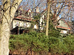
Edgeworth is a borough in Allegheny County, Pennsylvania, United States, along the Ohio River, approximately 14 miles (22.5 km) northwest of Pittsburgh. The population was 1,669 at the 2020 census. Edgeworth is the wealthiest town in Pennsylvania.

<span class="mw-page-title-main">Emsworth, Pennsylvania</span> Borough in Allegheny County, Pennsylvania, United States

Emsworth is a borough in Allegheny County, Pennsylvania, United States, along the Ohio River. The population was 2,525 at the 2020 census.

<span class="mw-page-title-main">Etna, Pennsylvania</span> Borough in Pennsylvania, United States

Etna is a borough in Allegheny County, Pennsylvania, United States, located across the Allegheny River from Pittsburgh. The population was 3,437 at the 2020 census. It is a suburb of the Pittsburgh metropolitan area.

<span class="mw-page-title-main">Glenfield, Pennsylvania</span> Borough in Pennsylvania, United States

Glenfield is a borough in Allegheny County, Pennsylvania, United States, situated along the Ohio River. The population was two hundred and twelve at the time of the 2020 census.

<span class="mw-page-title-main">Haysville, Pennsylvania</span> Borough in Pennsylvania, United States

Haysville is a borough in Allegheny County, Pennsylvania, United States, along the Ohio River. The population was 81 according to the 2020 census, making it the least-populous municipality in Allegheny County.

<span class="mw-page-title-main">Munhall, Pennsylvania</span> Borough in Pennsylvania, United States

Munhall is a borough in Allegheny County, Pennsylvania, United States, on the west bank of the Monongahela River. The population was 10,774 at the 2020 census. It is a residential suburb of the Pittsburgh metropolitan area.

<span class="mw-page-title-main">Glen Osborne, Pennsylvania</span> Borough in Pennsylvania, United States

Glen Osborne is a borough in Allegheny County, Pennsylvania, United States, along the Ohio River. The population was 590 at the 2020 census. It is a residential suburb of the Pittsburgh metropolitan area.

<span class="mw-page-title-main">Rankin, Pennsylvania</span> Borough in Pennsylvania, United States

Rankin is a borough in Allegheny County, Pennsylvania, United States, 8 miles (13 km) south of Pittsburgh on the Monongahela River. The borough was named after Thomas Rankin, a local landowner. Early in the 20th century, Rankin specialized in manufacturing steel and wire goods. The population increased from 3,775 in 1900 to 7,470 in 1940 and has since declined to 1,896 as of the 2020 census.

<span class="mw-page-title-main">Ambridge, Pennsylvania</span> Borough in Pennsylvania, United States

Ambridge is a borough in Beaver County, Pennsylvania, United States. Incorporated in 1905 as a company town by the American Bridge Company, Ambridge is located 16 miles (25 km) northwest of Pittsburgh, along the Ohio River. The population was 6,972 at the 2020 census.

<span class="mw-page-title-main">Baden, Pennsylvania</span> Borough in Pennsylvania, United States

Baden is a borough in southeastern Beaver County, Pennsylvania, along the Ohio River. The population was 3,904 at the 2020 census. It is part of the Pittsburgh metropolitan area. Baden is the former site of Logstown, a significant Native American settlement.

<span class="mw-page-title-main">Conway, Pennsylvania</span> Borough in Pennsylvania, United States

Conway is a borough in Beaver County, Pennsylvania, United States, located along the Ohio River. At the 2020 census, the borough had a total population of 2,168. It is part of the Pittsburgh metropolitan area. Conway is the site of the Conway Yard, a major railroad classification yard and locomotive facility owned by the Norfolk Southern Railway. From 1956 until 1980, it was the largest rail yard in the world.

<span class="mw-page-title-main">Economy, Pennsylvania</span> Borough in Pennsylvania, United States

Economy is a borough in Beaver County, Pennsylvania, United States. The population was 9,098 at the 2020 census. It is a part of the Pittsburgh metropolitan area.

<span class="mw-page-title-main">Freedom, Pennsylvania</span> Borough in Pennsylvania, United States

Freedom is a borough in Beaver County, Pennsylvania, United States, located along the Ohio River 25 miles (40 km) northwest of Pittsburgh. The population was 1,496 at the 2020 census. It is part of the Pittsburgh metropolitan area. Originally founded as a steamboat building town, chief industries later included the production of oil, caskets, and monuments.

<span class="mw-page-title-main">Georgetown, Beaver County, Pennsylvania</span> Borough in Pennsylvania, United States

Georgetown is a borough in western Beaver County, Pennsylvania, United States, along the Ohio River. The population was 208 at the 2020 census. It is part of the Pittsburgh metropolitan area. Little Blue Run Lake, the U.S.'s largest coal slurry waste impound, is located next to the town.

<span class="mw-page-title-main">Glasgow, Pennsylvania</span> Borough in Pennsylvania, United States

Glasgow is a borough in Beaver County, Pennsylvania, United States, along the Ohio River. The population was 71 at the 2020 census.

<span class="mw-page-title-main">Midland, Pennsylvania</span> Borough in Pennsylvania, United States

Midland is a borough located along the Ohio River in western Beaver County, Pennsylvania, United States. As of the 2020 census, the population was 2,433. It is part of the Pittsburgh metropolitan area. Founded in 1906, it was initially a company town surrounding the Crucible Steel Company's Midland Works.

<span class="mw-page-title-main">Shippingport, Pennsylvania</span> Borough in Pennsylvania, United States

Shippingport is a borough in western Beaver County, Pennsylvania, United States, located along the Ohio River. The population was 160 at the 2020 census. It is part of the Pittsburgh metropolitan area. Shippingport is home to the Beaver Valley Nuclear Power Station, and formerly the Bruce Mansfield Power Plant and Shippingport Atomic Power Station, the world's first full-scale atomic electric power plant devoted exclusively to peacetime uses.

References

  1. "ArcGIS REST Services Directory". United States Census Bureau. Retrieved October 12, 2022.
  2. 1 2 "Census Population API". United States Census Bureau. Retrieved October 12, 2022.
  3. "Leetsdale PA ZIP Code". zipdatamaps.com. 2023. Retrieved June 27, 2023.
  4. "Explore Census Data".
  5. "Port of Leetsdale". Port of Pittsburgh Commission. Retrieved December 28, 2016.
  6. "Nextracker and BCI Steel renovate abandoned Pittsburgh steel factory to serve solar market". FOX WTOV9. June 28, 2022. Retrieved June 28, 2022.
  7. "National Register Information System  Elmridge (#05000412)". National Register of Historic Places . National Park Service. March 13, 2009. Retrieved August 7, 2023.
  8. "US Gazetteer files: 2010, 2000, and 1990". United States Census Bureau. February 12, 2011. Retrieved April 23, 2011.
  9. EL. "2012 Allegheny County election". Pittsburgh Tribune-Review. Retrieved October 15, 2017.
  10. EL. "2016 Pennsylvania general election..." Pittsburgh Post-Gazette. Retrieved October 15, 2017.
  11. "Election Night Reporting".
  12. "Number and Distribution of Inhabitants:Pennsylvania-Tennessee" (PDF). Fifteenth Census. U.S. Census Bureau.
  13. "Number of Inhabitants: Pennsylvania" (PDF). 18th Census of the United States. U.S. Census Bureau. Retrieved November 22, 2013.
  14. "Pennsylvania: Population and Housing Unit Counts" (PDF). U.S. Census Bureau. Retrieved November 22, 2013.
  15. 1 2 "U.S. Census website". United States Census Bureau . Retrieved January 31, 2008.
  16. "Annual Estimates of the Resident Population". U.S. Census Bureau. Archived from the original on October 19, 2013. Retrieved November 22, 2013.