Trafford, Pennsylvania

Last updated
Trafford, Pennsylvania
Borough
Cavitt Avenue Trafford 2013.jpg
Cavitt Avenue
Allegheny County Pennsylvania Incorporated and Unincorporated areas Trafford Highlighted.svg
Location in Allegheny County and Westmoreland County in the U.S. state of Pennsylvania.
USA Pennsylvania location map.svg
Red pog.svg
Trafford, Pennsylvania
Coordinates: 40°23′02″N79°45′32″W / 40.38389°N 79.75889°W / 40.38389; -79.75889
Country United States
State Pennsylvania
Counties Westmoreland and Allegheny
IncorporatedAugust 29, 1904
Government
  TypeBorough Council
  MayorEdward Llewellyn
Area
[1]
  Total1.45 sq mi (3.76 km2)
  Land1.45 sq mi (3.76 km2)
  Water0.00 sq mi (0.00 km2)
Elevation
859 ft (262 m)
Population
 (2020)
  Total3,317
  Estimate 
(2019) [2]
3,039
  Density2,095.86/sq mi (809.26/km2)
Time zone UTC-5 (Eastern (EST))
  Summer (DST) UTC-4 (EDT)
Zip code
15085
FIPS code 42-77272
Website www.traffordborough.com

Trafford is a borough in Allegheny and Westmoreland counties in the U.S. state of Pennsylvania. Located near Pittsburgh in western Pennsylvania, the borough lies primarily in Westmoreland County; only a small portion extends into Allegheny County. It was incorporated in 1904 from the northernmost corner of North Huntingdon Township, and was named by George Westinghouse for Trafford near Manchester, England. Westinghouse purchased the land in 1902, and the Trafford Foundry began operations on October 3, 1903. [3] The population was 3,317 at the 2020 census. [4] Of this, 3,113 were in Westmoreland County, and only 61 were in Allegheny County.

Contents

Geography

Trafford is located at 40°23′2″N79°45′32″W / 40.38389°N 79.75889°W / 40.38389; -79.75889 (40.383860, -79.758919). [5]

According to the United States Census Bureau, the borough has a total area of 1.4 square miles (3.6 km2), all land.

Surrounding neighborhoods

Trafford has four borders, including Penn Township to the northeast, North Huntingdon from the east-northeast to the south, and the Allegheny County neighborhoods of North Versailles Township to the west and Monroeville to the north.

Demographics

Historical population
CensusPop.Note
1910 1,959
1920 2,85945.9%
1930 4,18746.4%
1940 4,017−4.1%
1950 3,965−1.3%
1960 4,3309.2%
1970 4,3831.2%
1980 3,682−16.0%
1990 3,345−9.2%
2000 3,236−3.3%
2010 3,174−1.9%
2020 3,3174.5%
2019 (est.)3,039 [2] −4.3%
Sources: [6] [7] [8] [9] [10] [11] [12]

As of the census [11] of 2000, there were 3,236 people, 1,526 households, and 900 families living in the borough. The population density was 2,258.6 inhabitants per square mile (872.1/km2). There were 1,631 housing units at an average density of 1,138.4 units per square mile (439.5 units/km2). The racial makeup of the borough was 98.27% White, 0.68% African American, 0.03% Native American, 0.31% Asian, 0.19% from other races, and 0.53% from two or more races. Hispanic or Latino of any race were 0.40% of the population.

There were 1,526 households, out of which 22.5% had children under the age of 18 living with them, 45.1% were married couples living together, 10.7% had a female householder with no husband present, and 41.0% were non-families. 38.0% of all households were made up of individuals, and 20.8% had someone living alone who was 65 years of age or older. The average household size was 2.12 and the average family size was 2.82.

In the borough the population was spread out, with 19.7% under the age of 18, 5.9% from 18 to 24, 27.8% from 25 to 44, 21.6% from 45 to 64, and 25.1% who were 65 years of age or older. The median age was 43 years. For every 100 females there were 86.8 males. For every 100 females age 18 and over, there were 79.8 males.

The median income for a household in the borough was $32,925, and the median income for a family was $40,236. Males had a median income of $36,250 versus $23,409 for females. The per capita income for the borough was $19,487. About 7.4% of families and 11.0% of the population were below the poverty line, including 16.3% of those under age 18 and 11.0% of those age 65 or over.

Trivia

Government and politics

Presidential Elections Results [16] [17] [18] [19]
Year Republican Democratic Third Parties
2020 56%2741%202%1
2016 60%96734%5476%95
2012 58%85941%6011%20

Related Research Articles

<span class="mw-page-title-main">Blawnox, Pennsylvania</span> Borough in Pennsylvania, United States

Blawnox is a borough in Allegheny County, Pennsylvania, United States. The population was 1,454 at the 2020 census. It is part of the Pittsburgh metropolitan area.

<span class="mw-page-title-main">Brackenridge, Pennsylvania</span> Borough in Pennsylvania, United States

Brackenridge is a borough in Allegheny County, Pennsylvania, United States, located along the Allegheny River. It is part of the Greater Pittsburgh metropolitan area.

<span class="mw-page-title-main">Chalfant, Pennsylvania</span> Borough in Pennsylvania, United States

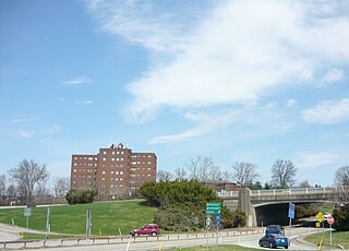
Chalfant is a borough in Allegheny County, Pennsylvania, United States. The population was 748 at the 2020 census.

<span class="mw-page-title-main">Churchill, Pennsylvania</span> Borough in Pennsylvania, United States

Churchill is a borough in Allegheny County, Pennsylvania, United States. The population was 3,157 at the 2020 census. It is a residential suburb of the Pittsburgh metropolitan area. The town was named from the hilltop Beulah Presbyterian Church.

<span class="mw-page-title-main">East McKeesport, Pennsylvania</span> Borough in Pennsylvania, United States

East McKeesport is a borough in Allegheny County, Pennsylvania, United States, and is part of the Pittsburgh Metro Area. The population was 2,076 at the 2020 census.

<span class="mw-page-title-main">Etna, Pennsylvania</span> Borough in Pennsylvania, United States

Etna is a borough in Allegheny County, Pennsylvania, United States, located across the Allegheny River from Pittsburgh. The population was 3,437 at the 2020 census. It is a suburb of the Pittsburgh metropolitan area.

<span class="mw-page-title-main">Forward Township, Allegheny County, Pennsylvania</span> Township of Allegheny County, Pennsylvania

Forward Township is a township in Allegheny County, Pennsylvania, United States. The population was 3,068 at the 2020 census. The township is named after Walter Forward, U.S. Secretary of the Treasury from 1841 to 1843.

<span class="mw-page-title-main">Liberty, Allegheny County, Pennsylvania</span> Borough in Pennsylvania, United States

Liberty is a borough in Allegheny County, Pennsylvania, United States. The population was 2,355 at the 2020 census.

<span class="mw-page-title-main">Munhall, Pennsylvania</span> Borough in Pennsylvania, United States

Munhall is a borough in Allegheny County, Pennsylvania, United States, on the west bank of the Monongahela River. The population was 10,774 at the 2020 census. It is a residential suburb of the Pittsburgh metropolitan area.

<span class="mw-page-title-main">Monroeville, Pennsylvania</span> Borough in Pennsylvania, United States

Monroeville is a home rule municipality in Allegheny County, Pennsylvania, United States. It is a suburb with mixed residential and commercial developments located about 10 miles (16 km) east of Pittsburgh. As of the 2020 census, Monroeville was home to 28,640 people.

<span class="mw-page-title-main">Penn Hills, Pennsylvania</span> Home rule township in Pennsylvania, United States

Penn Hills is a township with home rule status in Allegheny County, Pennsylvania, United States. The population was 41,059 as of the 2020 census. A suburb of Pittsburgh, Penn Hills is the second-largest municipality in Allegheny County.

<span class="mw-page-title-main">Pleasant Hills, Pennsylvania</span> Borough in Pennsylvania, United States

Pleasant Hills is a borough in Allegheny County, Pennsylvania, United States. As of the 2020 census, the population was 8,504. It is a suburb of the Pittsburgh metropolitan area.

<span class="mw-page-title-main">Plum, Pennsylvania</span> Borough in Pennsylvania, United States

Plum is a borough in Allegheny County, Pennsylvania, United States. The population was 27,144 at the 2020 census. A suburb of the Pittsburgh metropolitan area, it is located northeast of the city in what is commonly referred to as the East Hills suburbs.

<span class="mw-page-title-main">South Versailles Township, Pennsylvania</span> Township in Pennsylvania, United States

South Versailles Township is a township in Allegheny County, Pennsylvania, United States. The population was 351 at the 2010 census. It contains the village of Coulter, also called Coulterville or Coulters. The U.S. Post Office in the village is called Coulters.

<span class="mw-page-title-main">Tarentum, Pennsylvania</span> Borough in Pennsylvania, United States

Tarentum is a borough in Allegheny County in the U.S. state of Pennsylvania. It is 22 miles (35 km) northeast of Downtown Pittsburgh, along the Allegheny River. Tarentum was an industrial center where plate glass and bottles were manufactured; bricks, lumber, steel and iron novelties, steel billets and sheets, sack and wrapping paper were also produced.

<span class="mw-page-title-main">Turtle Creek, Pennsylvania</span> Borough in Pennsylvania, United States

Turtle Creek is a borough in Allegheny County, Pennsylvania, United States, 12 miles (19 km) southeast of Pittsburgh. The population was 5,114 at the 2020 census. George Westinghouse constructed a manufacturing plant nearby. Turtle Creek takes its name from a small stream that flows into the Monongahela River. Before white settlers arrived, there was a small village of Native Americans living there from the Turtle Clan of the Iroquois Nation.

<span class="mw-page-title-main">Verona, Pennsylvania</span> Borough in Pennsylvania, United States

Verona is a borough in Allegheny County, Pennsylvania, United States. It is 13 miles (21 km) northeast of downtown Pittsburgh, along the left bank of the Allegheny River. As of the 2020 census, the borough had a population of 2,492.

<span class="mw-page-title-main">White Oak, Pennsylvania</span> Borough in Pennsylvania, United States

White Oak is a borough in Allegheny County, Pennsylvania, United States. The population was 7,630 at the 2020 census. It is a suburb of the Pittsburgh metropolitan area. White Oak was named for a stand of white oak trees near the original town site.

<span class="mw-page-title-main">Murrysville, Pennsylvania</span> Home rule municipality in Pennsylvania, United States

Murrysville is a home rule municipality in Westmoreland County, Pennsylvania, United States. The population was 21,006 at the 2020 census. It is part of the Pittsburgh metropolitan area.

<span class="mw-page-title-main">Smithton, Pennsylvania</span> Borough in Pennsylvania, United States

Smithton is a borough in Westmoreland County, Pennsylvania, United States. The population was 399 at the 2010 census. As of 2018, the population was listed at 378. Smithton has its own post office, with zip code 15479, and is serviced by Yough School District.

References

  1. "2019 U.S. Gazetteer Files". United States Census Bureau. Retrieved July 28, 2020.
  2. 1 2 "Population and Housing Unit Estimates". United States Census Bureau. May 24, 2020. Retrieved May 27, 2020.
  3. Capets, Andrew (2017). Images of America: Trafford. Trafford: Arcadia. p. 22. ISBN   978-1467126076.
  4. "Explore Census Data".
  5. "US Gazetteer files: 2010, 2000, and 1990". United States Census Bureau. 2011-02-12. Retrieved 2011-04-23.
  6. "Population of Civil Divisions Less than Counties" (PDF). 1880 United States Census. U.S. Census Bureau. Retrieved 24 November 2013.
  7. "Population-Pennsylvania" (PDF). U.S. Census 1910. U.S. Census Bureau. Retrieved 22 November 2013.
  8. "Number and Distribution of Inhabitants:Pennsylvania-Tennessee" (PDF). Fifteenth Census. U.S. Census Bureau.
  9. "Number of Inhabitants: Pennsylvania" (PDF). 18th Census of the United States. U.S. Census Bureau. Retrieved 22 November 2013.
  10. "Pennsylvania: Population and Housing Unit Counts" (PDF). U.S. Census Bureau. Retrieved 22 November 2013.
  11. 1 2 "U.S. Census website". United States Census Bureau . Retrieved 2008-01-31.
  12. "Annual Estimates of the Resident Population". U.S. Census Bureau. Archived from the original on 19 October 2013. Retrieved 22 November 2013.
  13. Caliendo, A.J. (13 June 2001). "A star is born – in Trafford". Pittsburgh Post-Gazette (East ed.). p. e9.
  14. "Steelers Jar Trafford by 49 - 0 Score". Pittsburgh Post-Gazette. August 29, 1940. Retrieved November 2, 2019.
  15. "Grid 'Pirates' pass out; they're the 'Steelers' now". The Pittsburgh Press. March 3, 1940. p. 11.
  16. EL. "2012 Allegheny County election". Pittsburgh Tribune-Review. Retrieved 15 October 2017.
  17. EL. "2016 Pennsylvania general election..." Pittsburgh Post-Gazette. Retrieved 15 October 2017.
  18. "Prior Election Results". Westmoreland County, PA Official Website. Retrieved 20 February 2018.
  19. "Election Night Reporting".