Harmar Township, Allegheny County, Pennsylvania

Last updated

Harmar Township, Pennsylvania
Township
Motto: 
In God We Trust
Allegheny County Pennsylvania incorporated and unincorporated areas Harmar township highlighted.svg
Location in Allegheny County and the state of Pennsylvania.
Harmar Township, Allegheny County, Pennsylvania
USA Pennsylvania location map.svg
Red pog.svg
Harmar Twp
Usa edcp location map.svg
Red pog.svg
Harmar Twp
Coordinates: 40°32′24″N79°50′2″W / 40.54000°N 79.83389°W / 40.54000; -79.83389
Country United States
State Pennsylvania
County Allegheny
Incorporated1875
Founded by Harmar Denny
Named for Harmar Denny
Area
  Total6.4 sq mi (17 km2)
  Land6.0 sq mi (16 km2)
  Water0.5 sq mi (1 km2)
Elevation
761 ft (232 m)
Population
 (2020)
  Total3,136
  Density490/sq mi (190/km2)
Time zone UTC-5 (Eastern (EST))
  Summer (DST) UTC-4 (EDT)
ZIP codes
15238, 15049, 15024
Area code(s) 412 and 724
School district Allegheny Valley School District
Website www.harmartownship-pa.gov

Harmar Township is a township in Allegheny County, Pennsylvania, United States. It contains the communities of Acmetonia, Harmarville, Harmar Heights, and Chapel Downs. The population was 3,136 at the 2020 census. [1] The township was named after Harmar Denny, a U.S. congressman and son of Ebenezer Denny. [2]

Contents

Geography

Harmar Township is located at 40°32′24″N79°50′2″W / 40.54000°N 79.83389°W / 40.54000; -79.83389 . According to the United States Census Bureau, the township has a total area of 6.4 square miles (17 km2), of which 6.0 square miles (16 km2) is land and 0.5 square miles (1.3 km2), or 7.45%, is water.

Streams

Harmar Township is entirely in the Allegheny River drainage basin and contains one undeveloped state park, Allegheny Islands State Park, on three alluvial islands in the Allegheny River.

Deer Creek flows through the township; it joins the Allegheny at Harmar. [3]

Surrounding and adjacent neighborhoods

The township has six land borders, including Indiana Township to the north, Frazer Township to the northeast, Springdale Township and Cheswick to the east, O'Hara Township to the southwest and Fox Chapel to the west. Bordering the Allegheny River, Harmar runs adjacent with Oakmont to the south (with a direct link via Hulton Bridge) and Plum to the south and southeast.

Government and politics

Presidential election results
Year Republican Democratic Third parties
2020 53%1,01844%8551%28
2016 55%91442%6934%52
2012 54%81045%6711%18
Historical population
CensusPop.Note
1970 3,916
1980 3,461−11.6%
1990 3,144−9.2%
2000 3,2423.1%
2010 2,921−9.9%
2020 3,1367.4%
2022 (est.)3,060 [4] −2.4%
U.S. Decennial Census [5]

Demographics

Harmar Township is home to Allegheny Islands State Park and the C.W. Bill Young Lock and Dam in the Allegheny River. Allegheny Islands State Park, C.W. Bill Young Lock and Dam.jpg
Harmar Township is home to Allegheny Islands State Park and the C.W. Bill Young Lock and Dam in the Allegheny River.

At the 2000 census there were 3,242 people, 1,522 households, and 882 families living in the township. The population density was 543.3 people per square mile (209.8 people/km2). There were 1,637 housing units at an average density of 274.3 per square mile (105.9/km2). The racial makeup of the township was 97.75% White, 0.68% African American, 0.09% Native American, 0.99% Asian, 0.06% from other races, and 0.43% from two or more races. Hispanic or Latino of any race were 0.56%. [6]

There were 1,522 households, 19.8% had children under the age of 18 living with them, 45.7% were married couples living together, 9.1% had a female householder with no husband present, and 42.0% were non-families. 37.1% of households were made up of individuals, and 13.8% were one person aged 65 or older. The average household size was 2.09 and the average family size was 2.75.

The age distribution was 17.1% under the age of 18, 5.5% from 18 to 24, 28.0% from 25 to 44, 26.9% from 45 to 64, and 22.5% 65 or older. The median age was 45 years. For every 100 females, there were 89.9 males. For every 100 females age 18 and over, there were 87.4 males.

The median household income was $38,625 and the median family income was $50,054. Males had a median income of $35,731 versus $28,455 for females. The per capita income for the township was $24,486. About 6.3% of families and 6.6% of the population were below the poverty line, including 14.8% of those under age 18 and 4.7% of those age 65 or over.

Communities

Related Research Articles

<span class="mw-page-title-main">Cheswick, Pennsylvania</span> Borough in Pennsylvania, United States

Cheswick is a borough in Allegheny County, Pennsylvania, United States, along the Allegheny River. The population was 1,672 as of the 2020 census. Cheswick Borough was incorporated in 1902. It is a residential suburb of the Pittsburgh metropolitan area.

<span class="mw-page-title-main">Elizabeth, Pennsylvania</span> Borough in Pennsylvania, United States

Elizabeth is a borough in Allegheny County, Pennsylvania, United States, on the east bank of the Monongahela River, where Pennsylvania Route 51 crosses, 15 miles (24 km) upstream (south) of Pittsburgh and close to the county line. The population was 1,398 at the 2020 census. The borough of Elizabeth is entirely contained within the 15037 USPS ZIP code. The local school district is the Elizabeth Forward School District. The borough is home to neighborhoods Walker Heights and Town Hill. Elizabeth Borough is the birthplace of Town Hill Hockey established in 1978.

<span class="mw-page-title-main">Forward Township, Allegheny County, Pennsylvania</span> Township of Allegheny County, Pennsylvania

Forward Township is a township in Allegheny County, Pennsylvania, United States. The population was 3,068 at the 2020 census. The township is named after Walter Forward, U.S. Secretary of the Treasury from 1841 to 1843.

<span class="mw-page-title-main">Frazer Township, Allegheny County, Pennsylvania</span> Township in Pennsylvania, United States

Frazer Township is a township in Allegheny County, Pennsylvania, United States. The population was 1,164 at the 2020 census. The Pittsburgh Mills shopping mall complex is located in the township.

<span class="mw-page-title-main">Indiana Township, Allegheny County, Pennsylvania</span> Township and census-designated place in Pennsylvania, United States

Indiana Township is a township in Allegheny County, Pennsylvania, and a Pittsburgh suburb located in the United States. It contains the communities of Rural Ridge, Dorseyville, and Indianola. The population was 7,255 at the 2020 census.

<span class="mw-page-title-main">Pine Township, Allegheny County, Pennsylvania</span> Township in Pennsylvania, United States

Pine Township is a township that is located in Allegheny County, Pennsylvania, United States. The population was 14,691 at the time of the 2020 census.

<span class="mw-page-title-main">Richland Township, Allegheny County, Pennsylvania</span> Township in Pennsylvania, United States

Richland Township is a township in Allegheny County, Pennsylvania, United States. The population was 11,942 at the 2020 census.

<span class="mw-page-title-main">South Versailles Township, Pennsylvania</span> Township in Pennsylvania, United States

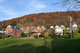
South Versailles Township is a township in Allegheny County, Pennsylvania, United States. The population was 351 at the 2010 census. It contains the village of Coulter, also called Coulterville or Coulters. The U.S. Post Office in the village is called Coulters.

<span class="mw-page-title-main">Springdale Township, Pennsylvania</span> Township in Pennsylvania, United States

Springdale Township is a township in Allegheny County, Pennsylvania, United States. It contains the two communities of Orrville and Harwick. The population was 1,636 at the 2010 census.

<span class="mw-page-title-main">Verona, Pennsylvania</span> Borough in Pennsylvania, United States

Verona is a borough in Allegheny County, Pennsylvania, United States. It is 13 miles (21 km) northeast of downtown Pittsburgh, along the left bank of the Allegheny River. As of the 2020 census, the borough had a population of 2,492.

<span class="mw-page-title-main">Cadogan Township, Pennsylvania</span> Township in Pennsylvania, United States

Cadogan Township is a township in Armstrong County, Pennsylvania, United States. The population was 346 at the 2020 census, an increase over the figure of 344 tabulated in 2010.

<span class="mw-page-title-main">Pine Township, Armstrong County, Pennsylvania</span> Township in Pennsylvania, United States

Pine Township is a township that is located in Armstrong County, Pennsylvania, United States. The population was 351 at the time of the 2020 census, a decrease from the figure of 412 that was tabulated in 2010.

<span class="mw-page-title-main">Clinton Township, Butler County, Pennsylvania</span> Township in Pennsylvania, United States

Clinton Township is a township in Butler County, Pennsylvania, United States. The population was 2,913 at the 2020 census. For generations, it was home to a U.S. Steel plant.

<span class="mw-page-title-main">Middlesex Township, Butler County, Pennsylvania</span> Township in Pennsylvania, United States

Middlesex Township is a township in Butler County, Pennsylvania, United States. The population was 6,826 at the 2020 census.

<span class="mw-page-title-main">Canadohta Lake, Pennsylvania</span> Census-designated place in Pennsylvania, United States

Canadohta Lake is a census-designated place (CDP) in Crawford County, Pennsylvania, United States. The population was 503 at the 2020 census.

<span class="mw-page-title-main">New Eagle, Pennsylvania</span> Borough in Pennsylvania, United States

New Eagle is a borough in Washington County, Pennsylvania, United States and is part of the Pittsburgh Metro Area. The population was 2,047 at the 2020 census.

<span class="mw-page-title-main">Oklahoma, Pennsylvania</span> Borough in Pennsylvania, United States

Oklahoma is a borough in Westmoreland County, Pennsylvania, United States. The population was 809 at the time of the 2010 census.

<span class="mw-page-title-main">Harrison Township, Allegheny County, Pennsylvania</span> Township in Pennsylvania, United States

Harrison Township is a township in Allegheny County in the U.S. state of Pennsylvania. The population was 10,169 at the 2020 census. Pennsylvania Route 28 passes through Harrison Township, connecting Kittanning to the northeast and Pittsburgh to the southwest. Allegheny Technologies has extensive steel mill facilities in Harrison Township, including its Allegheny Ludlum Brackenridge Works. Harrison Township is located at the far northeast corner of Allegheny County. Its northern border is the Butler County line and the Allegheny River forms the township's eastern boundary with Westmoreland County. Its northeast corner also touches Armstrong County.

<span class="mw-page-title-main">O'Hara Township, Pennsylvania</span> Township in Pennsylvania, United States

O'Hara Township is a township with home rule status in Allegheny County, Pennsylvania, United States, six miles northeast of Downtown Pittsburgh. The community was long organized as a township, and retains "Township" in its official name, but adopted a home rule charter in 1973 and is no longer subject to the Pennsylvania Township Code. The population was 9,288 at the 2020 census.

<span class="mw-page-title-main">Reserve Township, Pennsylvania</span> Township in Pennsylvania, United States

Reserve Township is a township in Allegheny County, Pennsylvania, United States. The population was 3,333 at the 2010 census.

References

  1. Bureau, US Census. "City and Town Population Totals: 2020-2021". Census.gov. US Census Bureau. Retrieved July 20, 2022.
  2. "What's in a name? For some, a bit of history". Pittsburgh Post-Gazette . May 10, 1984. p. 1. Retrieved May 16, 2015.
  3. "Deer Creek". Geographic Names Information System . United States Geological Survey, United States Department of the Interior . Retrieved December 20, 2010.
  4. Bureau, US Census. "City and Town Population Totals: 2020-2022". Census.gov. US Census Bureau. Retrieved June 13, 2023.
  5. "Census of Population and Housing". Census.gov. Retrieved June 4, 2016.
  6. "U.S. Census website". United States Census Bureau . Retrieved January 31, 2008.

40°32′38″N79°49′54″W / 40.54389°N 79.83167°W / 40.54389; -79.83167