Port Vue, Pennsylvania

Last updated

Port Vue, Pennsylvania
Romine and Brushton in Port Vue.jpg
Romine Avenue
Allegheny County Pennsylvania incorporated and unincorporated areas Port Vue highlighted.svg
Location in Allegheny County and the U.S. state of Pennsylvania.
Coordinates: 40°20′19″N79°52′14″W / 40.33861°N 79.87056°W / 40.33861; -79.87056
Country United States
State Pennsylvania
County Allegheny
Area
[1]
  Total1.17 sq mi (3.02 km2)
  Land1.13 sq mi (2.94 km2)
  Water0.03 sq mi (0.08 km2)
Population
 (2020) [2]
  Total3,680
  Density3,245.15/sq mi (1,253.10/km2)
Time zone UTC-5 (Eastern (EST))
  Summer (DST) UTC-4 (EDT)
FIPS code 42-62320
Website portvue.org

Port Vue is a borough in Allegheny County, Pennsylvania, United States. The population was 3,680 at the 2020 census. [3]

Contents

Geography

Port Vue is located in western Pennsylvania along the Youghiogheny River near its confluence with the more navigable Monongahela River. It is bounded by McKeesport to the north, Liberty to the east and south and Glassport to the west. [4]

According to the United States Census Bureau, the borough has a total area of 1.1 square miles (2.8 km2), of which 0.04 square miles (0.10 km2), or 3.54%, is water.

Education

Port Vue is served by the South Allegheny School District.

Police

The Port Vue Police Department is based at 1194 Romine Avenue. The police department is under the leadership of Mayor Brien A. Hranics, Chief David Petruski and Sergeant Kevin Atkins. There are currently 4 full-time and 3 part-time officers serving the borough.

History

In 1891, approximately 500 residents of Lincoln Township decided to create a new borough. They met in a school house on the old Edmundson farm, and initially thought of naming the new borough "Grandview". However, because of the beautiful view of the port that McKeesport maintained on the Youghiogheny River, they agreed on Port Vue instead. Since then, war veterans and coal miners commonly lived in Port Vue. Port Vue borough was incorporated on September 20, 1892.[ citation needed ]

Government and politics

Presidential election results [5] [6] [7] [8]
Year Republican Democratic Third parties
2020 59%1,09140%7371%18
2016 59%1,00538%6403% 41
2012 51%78848%7391%25
2008 48%86550%8991%26
2020 US Presidential Election Results in Port Vue [9]
PartyCandidateRunning-MateVotes%
Republican Donald Trump Mike Pence 109158.81
Democratic Joe Biden Kamala Harris 73739.73
Libertarian Jo Jorgensen Spike Cohen 180.97
Write-In Candidates90.49
2016 US Presidential Election Results in Port Vue [10]
PartyCandidateRunning-MateVotes%
Republican Donald Trump Mike Pence 100559.26
Democratic Hillary Clinton Tim Kaine 64037.74
Libertarian Gary Johnson Bill Weld 331.95
Green Jill Stein Ajamu Baraka 60.35
Constitution Darrell Castle Scott Bradley 20.12
Write In Candidates100.59
2012 US Presidential Election Results in Port Vue [11]
PartyCandidateRunning-MateVotes%
Republican Mitt Romney Paul Ryan 79350.32
Democratic Barack Obama Joe Biden 75247.72
Libertarian Gary Johnson Jim Gray 150.95
Green Jill Stein Cheri Honkala 100.63
Write In Candidates60.38
2008 US Presidential Election Results in Port Vue [12]
PartyCandidateRunning-MateVotes%
Democratic Barack Obama Joe Biden 89950.22
Republican John McCain Sarah Palin 86548.32
Independent Ralph Nader Matt Gonzalez 150.84
Libertarian Bob Barr Wayne Root 30.17
Write In Candidates80.45
2022 US Senate Election Results in Port Vue [13]
PartyCandidateVotes%
Democratic John Fetterman 68649.85
Republican Mehmet Oz 65347.46
Libertarian Erik Gerhardt181.31
Green Richard Weiss80.58
Keystone Daniel Wassmer80.58
Write In Candidates30.22
2022 US Congress PA District 12 Election Results in Port Vue [14]
PartyCandidateVotes%
Republican Mike Doyle82461.82
Democratic Summer Lee 50037.51
Write In Candidates90.68

Demographics

Historical population
CensusPop.Note
1900 1,803
1910 1,9789.7%
1920 2,53828.3%
1930 3,51038.3%
1940 3,6012.6%
1950 4,75632.1%
1960 6,63539.5%
1970 5,862−11.7%
1980 5,316−9.3%
1990 4,641−12.7%
2000 4,228−8.9%
2010 3,798−10.2%
2020 3,680−3.1%
Sources: [15] [16] [17] [18] [19] [20]

As of the 2010 census, [19] there were 3,798 people, 1,694 households, and 1,045 families residing in the borough. The population density was 3,645.4 inhabitants per square mile (1,407.5/km2). There were 1,832 housing units at an average density of 1,764.6 per square mile (681.3/km2). The racial makeup of the borough was 97.8% White, 2.00% African American, 0.06% Native American, 0.03% Asian, 0.01% Pacific Islander, 0.02% from other races, and 0.01% from two or more races. Hispanic or Latino of any race were 0.76% of the population.

There were 1,694 households, out of which 22.7% had children under the age of 18 living with them, 41.6% were married couples living together, 15.5% had a female householder with no husband present, and 38.3% were non-families. 32.8% of all households were made up of individuals, and 17.9% had someone living alone who was 65 years of age or older. The average household size was 2.30 and the average family size was 2.87.

In the borough the population was spread out, with 20.9% under the age of 18, 7.0% from 18 to 24, 25.7% from 25 to 44, 22.4% from 45 to 64, and 34.2% who were 65 years of age or older. The median age was 45.6 years. For every 100 females there were 89.2 males. For every 100 females age 18 and over, there were 90.0 males.

As of the 2000 census, the median income for a household in the borough was $31,509, and the median income for a family was $37,318. Males had a median income of $31,680 versus $23,203 for females. The per capita income for the borough was $16,065. About 7.7% of families and 10.5% of the population were below the poverty line, including 22.2% of those under age 18 and 5.1% of those age 65 or over.

Related Research Articles

<span class="mw-page-title-main">Brackenridge, Pennsylvania</span> Borough in Pennsylvania, United States

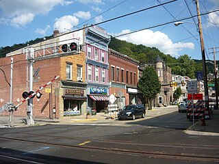
Brackenridge is a borough in Allegheny County, Pennsylvania, United States, located along the Allegheny River. It is part of the Greater Pittsburgh metropolitan area.

<span class="mw-page-title-main">East McKeesport, Pennsylvania</span> Borough in Pennsylvania, United States

East McKeesport is a borough in Allegheny County, Pennsylvania, United States, and is part of the Pittsburgh Metro Area. The population was 2,076 at the 2020 census.

<span class="mw-page-title-main">East Pittsburgh, Pennsylvania</span> Borough in Pennsylvania, United States

East Pittsburgh is a borough in Allegheny County, Pennsylvania, United States, approximately 11 miles (18 km) southeast of the confluence of the Monongahela and the Allegheny rivers at Pittsburgh. The population in 1900 stood at 2,883, and in 1910, at 5,615. As of the 2020 census, the borough population was 1,927, having fallen from 6,079 in 1940. George Westinghouse erected large works there which supplied equipment to the great power plants at Niagara Falls and for the elevated and rapid-transit systems of New York City. Nearby, the George Westinghouse Bridge over Turtle Creek is a prominent fixture in the area, which is very near the borough of Braddock.

<span class="mw-page-title-main">Elizabeth, Pennsylvania</span> Borough in Pennsylvania, United States

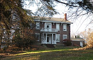
Elizabeth is a borough in Allegheny County, Pennsylvania, United States, on the east bank of the Monongahela River, where Pennsylvania Route 51 crosses, 15 miles (24 km) upstream (south) of Pittsburgh and close to the county line. The population was 1,398 at the 2020 census. The borough of Elizabeth is entirely contained within the 15037 USPS ZIP code. The local school district is the Elizabeth Forward School District. The borough is home to neighborhoods Walker Heights and Town Hill. Elizabeth Borough is the birthplace of Town Hill Hockey established in 1978.

<span class="mw-page-title-main">Elizabeth Township, Allegheny County, Pennsylvania</span> Township in Pennsylvania, United States

Elizabeth Township is a township in Allegheny County, Pennsylvania, United States. The population was 12,972 at the 2020 census. Elizabeth Township – along with Pitt, Plum, Versailles, St. Clair, Moon, and Mifflin – was one of the original seven townships of Allegheny County.

<span class="mw-page-title-main">Glassport, Pennsylvania</span> Borough in Allegheny County, Pennsylvania

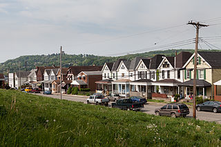
Glassport is a borough in Allegheny County, Pennsylvania, United States, approximately 10 miles (16 km) south of Pittsburgh and the confluence of the Monongahela and Allegheny rivers where they form the Ohio River. Glassport lies along the east side of the Monongahela River in the "Mon Valley", where many blue-collar municipalities have suffered severe economic decline in the wake of the loss of steel-making throughout the Greater Pittsburgh area. In 1910, the population of Glassport was 5,540. By 1940, it had risen to 8,748, but has since declined to 4,475 as of the 2020 census.

<span class="mw-page-title-main">Liberty, Allegheny County, Pennsylvania</span> Borough in Pennsylvania, United States

Liberty is a borough in Allegheny County, Pennsylvania, United States. The population was 2,355 at the 2020 census.

<span class="mw-page-title-main">Lincoln, Pennsylvania</span> Borough in Pennsylvania, United States

Lincoln is a borough in Allegheny County, Pennsylvania, United States. The population was 932 at the 2020 United States Census.

<span class="mw-page-title-main">McKeesport, Pennsylvania</span> City in Pennsylvania, United States

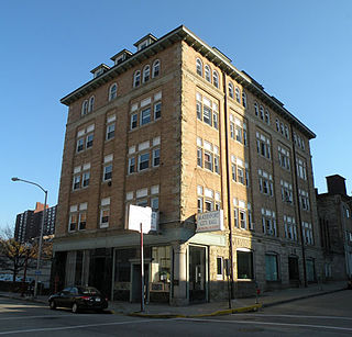
McKeesport is a city in Allegheny County, Pennsylvania, United States. A suburb of Pittsburgh, it is situated at the confluence of the Monongahela and Youghiogheny rivers. The population was 17,727 as of the 2020 census.

<span class="mw-page-title-main">Mount Oliver, Pennsylvania</span> Borough in Pennsylvania, United States

Mount Oliver is a borough in Allegheny County, Pennsylvania, United States. The population was 3,394 at the 2020 census. It is a largely residential area situated atop a crest about 3 miles (5 km) west of the Monongahela River. The borough is surrounded entirely by the city of Pittsburgh, having resisted annexation attempts by the city.

<span class="mw-page-title-main">North Versailles Township, Pennsylvania</span> Township in Pennsylvania, United States

North Versailles is a first class township in Allegheny County, Pennsylvania, United States. The population was 10,079 at the 2020 census. The township derives its name from the Palace of Versailles.

<span class="mw-page-title-main">Sewickley Heights, Pennsylvania</span> Borough in Pennsylvania, United States

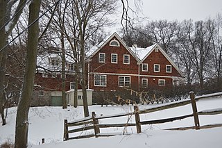
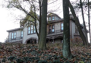
Sewickley Heights is a borough in Allegheny County, Pennsylvania, United States. The population was 857 at the 2020 census. It is a residential suburb of the Pittsburgh metropolitan area. Sewickley Heights is one of the wealthiest municipalities in Pennsylvania and in the United States.

<span class="mw-page-title-main">Versailles, Pennsylvania</span> Borough in Pennsylvania, United States

Versailles is a borough in Allegheny County, Pennsylvania, United States. At the 2020 census, the population was 1,476.

<span class="mw-page-title-main">West Homestead, Pennsylvania</span> Borough in Pennsylvania, United States

West Homestead is a borough in Allegheny County, Pennsylvania, United States, 8 miles (13 km) southeast of Pittsburgh, on the Monongahela River. Heavy industries associated with nearby steel mills existed here, such as axle works, brickworks, and manufactories of machinery, car wheels, etc. The largest concern was Mesta Machinery, which was one of the world's leading industrial manufacturers from 1898 until 1983. The population was 1,872 at the 2020 census.

<span class="mw-page-title-main">West Mifflin, Pennsylvania</span> Borough in Pennsylvania, United States

West Mifflin is a borough in Allegheny County, Pennsylvania, United States, located southeast of downtown Pittsburgh. The population was 19,589 at the 2020 census. It is named after Thomas Mifflin, 1st Governor of Pennsylvania, signer of the United States Constitution, and 1st Quartermaster General of the United States Army.

<span class="mw-page-title-main">Whitaker, Pennsylvania</span> Borough in Pennsylvania, United States

Whitaker is a borough in Allegheny County, Pennsylvania, United States, and is on the Monongahela River 3 miles (5 km) upriver from Pittsburgh. The population was 1,179 at the 2020 census.

<span class="mw-page-title-main">White Oak, Pennsylvania</span> Borough in Pennsylvania, United States

White Oak is a borough in Allegheny County, Pennsylvania, United States. The population was 7,630 at the 2020 census. It is a suburb of the Pittsburgh metropolitan area. White Oak was named for a stand of white oak trees near the original town site.

<span class="mw-page-title-main">Smithton, Pennsylvania</span> Borough in Pennsylvania, United States

Smithton is a borough in Westmoreland County, Pennsylvania, United States. The population was 399 at the 2010 census. As of 2018, the population was listed at 378. Smithton has its own post office, with zip code 15479, and is serviced by Yough School District.

<span class="mw-page-title-main">West Newton, Pennsylvania</span> Borough in Pennsylvania, United States

West Newton, located 24.5 miles (39.4 km) southeast of Pittsburgh, is a borough in Westmoreland County in the U.S. state of Pennsylvania. Formerly, the manufacture of radiators and boilers were the chief industries. The population was 2,633 at the 2010 census.

<span class="mw-page-title-main">Ross Township, Allegheny County, Pennsylvania</span> Township in Pennsylvania, United States

Ross Township is a township in Allegheny County, Pennsylvania, United States. It is adjacent to the northern border of Pittsburgh. The population of the township was 33,176 at the 2020 census. While most of the township is residential, a retail corridor is located along McKnight Road along with business districts on U.S. Route 19 and Babcock Boulevard.

References

  1. "ArcGIS REST Services Directory". United States Census Bureau. Retrieved October 16, 2022.
  2. "Census Population API". United States Census Bureau. Retrieved October 12, 2022.
  3. "Explore Census Data".
  4. https://gis.penndot.gov/BPR_PDF_FILES/Maps/GHS/ROADNAMES/Allegheny_GHSN.pdf [ bare URL PDF ]
  5. EL. "2012 Allegheny County election". Pittsburgh Tribune-Review. Retrieved October 15, 2017.
  6. EL. "2016 Pennsylvania general election results". Pittsburgh Post-Gazette. Retrieved October 15, 2017.
  7. "Election Night Reporting".
  8. "Elections | Election Results | 2008 General Election". www.alleghenycounty.us. Retrieved July 3, 2022.
  9. "Election Night Reporting". results.enr.clarityelections.com. Retrieved November 27, 2023.
  10. "Election Night Reporting". results.enr.clarityelections.com. Retrieved November 27, 2023.
  11. https://www.alleghenycounty.us/uploadedFiles/Allegheny_Home/Dept-Content/Elections/Results/Archive/2012%20General%20Detail%20District.pdf
  12. https://www.alleghenycounty.us/uploadedFiles/Allegheny_Home/Dept-Content/Elections/Results/Archive/2008%20General%20Detail%20District.pdf
  13. "Election Night Reporting". results.enr.clarityelections.com. Retrieved March 18, 2024.
  14. "Election Night Reporting". results.enr.clarityelections.com. Retrieved March 18, 2024.
  15. "Population-Pennsylvania" (PDF). U.S. Census 1910. U.S. Census Bureau. Retrieved November 22, 2013.
  16. "Number and Distribution of Inhabitants:Pennsylvania-Tennessee" (PDF). Fifteenth Census. U.S. Census Bureau.
  17. "Number of Inhabitants: Pennsylvania" (PDF). 18th Census of the United States. U.S. Census Bureau. Retrieved November 22, 2013.
  18. "Pennsylvania: Population and Housing Unit Counts" (PDF). U.S. Census Bureau. Retrieved November 22, 2013.
  19. 1 2 "U.S. Census website". United States Census Bureau . Retrieved January 31, 2008.
  20. "Annual Estimates of the Resident Population". U.S. Census Bureau. Archived from the original on October 19, 2013. Retrieved November 22, 2013.