Glenfield, Pennsylvania

Last updated
Glenfield, Pennsylvania
Beaver Street houses in Glenfield.jpg
Houses on East Beaver Street
Allegheny County Pennsylvania incorporated and unincorporated areas Glenfield highlighted.svg
Location in Allegheny County and the U.S. state of Pennsylvania.
Coordinates: 40°31′9″N80°7′55″W / 40.51917°N 80.13194°W / 40.51917; -80.13194 Coordinates: 40°31′9″N80°7′55″W / 40.51917°N 80.13194°W / 40.51917; -80.13194
Country United States
State Pennsylvania
County Allegheny
Government
  TypeBorough Council
  MayorDavid Orbison (I)
  President of CouncilPaul Carmody (R)
Area
[1]
  Total0.99 sq mi (2.56 km2)
  Land0.82 sq mi (2.12 km2)
  Water0.17 sq mi (0.44 km2)
Population
 (2020) [2]
  Total212
  Density258.54/sq mi (99.84/km2)
Time zone UTC-5 (Eastern (EST))
  Summer (DST) UTC-4 (EDT)
FIPS code 42-29592
Website www.glenfieldborough.org

Glenfield is a borough in Allegheny County, Pennsylvania, United States, situated along the Ohio River. The population was two hundred and twelve at the time of the 2020 census. [3]

Contents

Geography

Glenfield is located at 40°31′9″N80°7′55″W / 40.51917°N 80.13194°W / 40.51917; -80.13194 (40.519068, -80.131823). [4]

According to the United States Census Bureau, the borough has a total area of 1.0 square mile (2.6 km2), of which 0.9 square miles (2.3 km2) is land and 0.2 square miles (0.52 km2), or 16.00%, is water.

Surrounding and adjacent neighborhoods

Glenfield has three land borders, including Aleppo Township to the north, Kilbuck Township to the east, and Haysville to the west. Across the Ohio River's main channel, Glenfield runs adjacent with the western end of Neville Island (Neville Township).

Education

Glenfield is served by the Quaker Valley School District.

Government and politics

Presidential Elections Results [5] [6] [7]
Year Republican Democratic Third Parties
2020 56%6940%501%2
2016 58%6238%414%4
2012 61%6038%381%1

Demographics

Historical population
CensusPop.Note
1880 538
1890 71833.5%
1900 90526.0%
1910 9848.7%
1920 976−0.8%
1930 950−2.7%
1940 911−4.1%
1950 870−4.5%
1960 741−14.8%
1970 406−45.2%
1980 246−39.4%
1990 241−2.0%
2000 236−2.1%
2010 205−13.1%
2020 2123.4%
Sources: [8] [9] [10] [11] [12] [13] [14] [2]

As of the census [13] of 2000, there were two hundred and thirty-six people, ninety households, and sixty families in the borough.

The population density was 278.7 people per square mile (107.2/km2). There were ninety-six housing units at an average density of 113.4 per square mile (43.6/km2).

The racial makeup of the borough was 96.19% White, 2.54% African American, 0.85% Native American, and 0.42% from two or more races. Hispanic or Latino of any race were 0.42% of the population.

There were ninety households, out of which 33.3% had children under the age of eighteen living with them; 52.2% were married couples living together, 12.2% had a female householder with no husband present, and 33.3% were non-families. 30.0% of all households were made up of individuals, and 14.4% had someone living alone who was sixty-five years of age or older.

The average household size was 2.62 and the average family size was 3.30.

In the borough the population was spread out, with 30.5% under the age of eighteen, 4.7% from eighteen to twenty-four, 26.3% from twenty-five to forty-four, 21.6% from forty-five to sixty-four, and 16.9% who were sixty-five years of age or older. The median age was thirty-eight years.

For every one hundred females, there were 91.9 males. For every one hundred females who were aged eighteen or older, there were 92.9 males.

The median income for a household in the borough was $38,750, and the median income for a family was $43,250. Males had a median income of $37,500 compared with that of $23,333 for females.

The per capita income for the borough was $16,123.

Roughly 4.8% of families and 4.8% of the population were living below the poverty line, including 4.3% of those who were under the age of eighteen; none of those who were aged sixty-five or older were living in poverty.

See also

Related Research Articles

<span class="mw-page-title-main">Parryville, Pennsylvania</span> Borough in Pennsylvania, United States

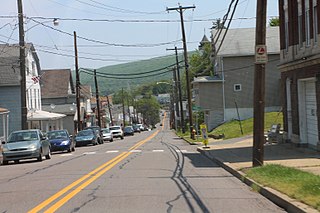
Parryville is a borough in Carbon County, Pennsylvania, United States. It is part of Northeastern Pennsylvania, and is located 3 miles (5 km) southeast of Lehighton and 1 mile (1.6 km) north of Bowmanstown, off Route 248 and 4 miles (6 km) northwest of Palmerton.

<span class="mw-page-title-main">Shiremanstown, Pennsylvania</span> Borough in Pennsylvania, United States

Shiremanstown is a borough in Cumberland County, Pennsylvania, United States. Bordered to the north by Hampden Township and to the south by Lower Allen Township, it is part of the Harrisburg–Carlisle Metropolitan Statistical Area.

<span class="mw-page-title-main">Gratz, Pennsylvania</span> Borough in Pennsylvania, United States

Gratz is a borough in Dauphin County, Pennsylvania, United States. The population was 743 at the time of the 2020 census, a decline from the figure of 765 in 2010.

<span class="mw-page-title-main">Newell, Pennsylvania</span> Borough in Pennsylvania, United States

Newell is a borough in Fayette County, Pennsylvania, United States. The population was 512 at the time of the 2020 census.

<span class="mw-page-title-main">Worthville, Pennsylvania</span> Borough in Pennsylvania, United States

Worthville is a borough in Jefferson County, Pennsylvania, United States. The population was sixty-seven at the time of the 2010 census, a decline from the figure of eighty-five, which had been tabulated in 2000.

<span class="mw-page-title-main">Laflin, Pennsylvania</span> Borough in Pennsylvania, United States

Laflin is a borough in the Greater Pittston area of Luzerne County, Pennsylvania, United States. The population was 1,443 at the time of the 2020 census.

<span class="mw-page-title-main">Luzerne, Pennsylvania</span> Borough in Pennsylvania, United States

Luzerne is a borough located 5 miles (8 km) north of Wilkes Barre in Luzerne County, Pennsylvania, United States.

<span class="mw-page-title-main">Pringle, Pennsylvania</span> Borough in Pennsylvania, United States

Pringle is a borough in Luzerne County, Pennsylvania, United States. As of the 2020 census, the borough population was eight hundred and ninety-one.

<span class="mw-page-title-main">Sugar Notch, Pennsylvania</span> Borough in Pennsylvania, United States

Sugar Notch is a borough in Luzerne County, Pennsylvania, United States. The population was nine hundred and ninety-six at the time of the 2020 census.

<span class="mw-page-title-main">Landingville, Pennsylvania</span> Borough in Pennsylvania, United States

Landingville is a borough in Schuylkill County, Pennsylvania, United States. The population was 137 at the time of the 2020 census.

<span class="mw-page-title-main">Mechanicsville, Schuylkill County, Pennsylvania</span> Borough in Pennsylvania, United States

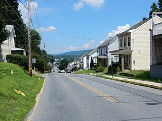
Mechanicsville is a borough in Schuylkill County, Pennsylvania, United States. Part of the Pottsville Area School District, it lies between Pottsville and Port Carbon. Pottsville Street is the community's main street.

<span class="mw-page-title-main">Middleport, Pennsylvania</span> Borough in Pennsylvania, United States

Middleport is a borough in Schuylkill County, Pennsylvania, United States. The population was 363 at the time of the 2020 census.

<span class="mw-page-title-main">Tremont, Pennsylvania</span> Borough in Pennsylvania, United States

Tremont is a borough in Schuylkill County, Pennsylvania, United States. Situated in the eastern section of Tremont Township, it was incorporated as a borough in 1866, around the same time that a water system was erected in the community.

<span class="mw-page-title-main">Liberty, Tioga County, Pennsylvania</span> Borough in Pennsylvania, United States

Liberty is a small borough in Tioga County, Pennsylvania, United States. The population was 232 at the time of the 2020 census.

<span class="mw-page-title-main">Westfield, Pennsylvania</span> Borough in Pennsylvania, United States

Westfield is a borough in Tioga County, Pennsylvania, United States. The population was 1,113 at the time of the 2020 census.

<span class="mw-page-title-main">North Irwin, Pennsylvania</span> Borough in Pennsylvania, United States

North Irwin is a borough in Westmoreland County, Pennsylvania, United States. The population was 846 at the time of the 2010 census.

<span class="mw-page-title-main">Seward, Pennsylvania</span> Borough in Pennsylvania, United States

Seward is a borough in Westmoreland County, Pennsylvania, United States. The population was four hundred and ninety-five at the time of the 2010 census.

<span class="mw-page-title-main">Loganville, Pennsylvania</span> Borough in Pennsylvania, United States

Loganville, which was founded in 1820 and named after Colonel Henry Logan, is a borough in York County, Pennsylvania, United States.

<span class="mw-page-title-main">Railroad, Pennsylvania</span> Borough in Pennsylvania, United States

Railroad is a borough in York County, Pennsylvania, United States. The population was two hundred fifty-nine at the time of the 2020 census.

<span class="mw-page-title-main">Shrewsbury, Pennsylvania</span> Borough in Pennsylvania, United States

Shrewsbury is a borough in York County, Pennsylvania, United States. The population was three thousand eight hundred and forty-eight at the time of the 2020 census.

References

  1. "ArcGIS REST Services Directory". United States Census Bureau. Retrieved October 12, 2022.
  2. 1 2 "Census Population API". United States Census Bureau. Retrieved Oct 12, 2022.
  3. https://data.census.gov/all?q=Glenfield+borough,+Pennsylvania
  4. "US Gazetteer files: 2010, 2000, and 1990". United States Census Bureau. 2011-02-12. Retrieved 2011-04-23.
  5. EL. "2012 Allegheny County election". Pittsburgh Tribune-Review. Retrieved 15 October 2017.
  6. EL. "2016 Pennsylvania general election results". Pittsburgh Post-Gazette. Retrieved 15 October 2017.
  7. "Election Night Reporting".
  8. "Population of Civil Divisions Less than Counties" (PDF). 1880 United States Census. U.S. Census Bureau. Retrieved 24 November 2013.
  9. "Population-Pennsylvania" (PDF). U.S. Census 1910. U.S. Census Bureau. Retrieved 22 November 2013.
  10. "Number and Distribution of Inhabitants:Pennsylvania-Tennessee" (PDF). Fifteenth Census. U.S. Census Bureau.
  11. "Number of Inhabitants: Pennsylvania" (PDF). 18th Census of the United States. U.S. Census Bureau. Retrieved 22 November 2013.
  12. "Pennsylvania: Population and Housing Unit Counts" (PDF). U.S. Census Bureau. Retrieved 22 November 2013.
  13. 1 2 "U.S. Census website". United States Census Bureau . Retrieved 2008-01-31.
  14. "Annual Estimates of the Resident Population". U.S. Census Bureau. Archived from the original on 19 October 2013. Retrieved 22 November 2013.