Ludlow Falls, Ohio

Last updated

Ludlow Falls, Ohio
Greenville at Oak, Ludlow Falls.jpg
OHMap-doton-Ludlow Falls.png
Location of Ludlow Falls, Ohio
Map of Miami County Ohio Highlighting Ludlow Falls Village.png
Location of Ludlow Falls in Miami County
Coordinates: 39°59′58″N84°20′22″W / 39.99944°N 84.33944°W / 39.99944; -84.33944
Country United States
State Ohio
County Miami
Township Union
Area
[1]
  Total0.18 sq mi (0.46 km2)
  Land0.18 sq mi (0.46 km2)
  Water0.00 sq mi (0.00 km2)
Elevation
[2]
906 ft (276 m)
Population
 (2020)
  Total175
  Density977.65/sq mi (378.51/km2)
Time zone UTC-5 (Eastern (EST))
  Summer (DST) UTC-4 (EDT)
ZIP code
45339
Area code(s) 937, 326
FIPS code 39-45374 [3]
GNIS feature ID2399201 [2]

Ludlow Falls is a village in Miami County, Ohio, United States. The population was 175 at the 2020 census. It is part of the Dayton Metropolitan Statistical Area. Ludlow Falls is named after surveyor Israel Ludlow. [4]

Contents

Geography

According to the United States Census Bureau, the village has a total area of 0.18 square miles (0.47 km2), all land. [5]

Ludlow Falls is a part of the Milton-Union School district located in the neighboring West Milton.

Ludlow Creek, a tributary of the Stillwater River, flows through Ludlow Falls. The village's name is derived from the waterfall of the stream located in the village. [6]

There was a railroad line through Ludlow Falls that was built in 1881 from Springfield, Ohio to Indianapolis, Indiana. It was later owned by the New York Central Railroad. There was very little on-line traffic and the line was lightly used by the 1970s. The line was not included in the 1976 makeup of Conrail and the last train ran on March 31, 1976. The tracks were pulled up shortly thereafter.

Demographics

Historical population
CensusPop.Note
1920 171
1930 20218.1%
1940 2125.0%
1950 27730.7%
1960 273−1.4%
1970 2927.0%
1980 248−15.1%
1990 30021.0%
2000 210−30.0%
2010 208−1.0%
2020 175−15.9%
U.S. Decennial Census [7]

2010 census

As of the census [8] of 2010, there were 208 people, 81 households, and 55 families living in the village. The population density was 1,155.6 inhabitants per square mile (446.2/km2). There were 86 housing units at an average density of 477.8 per square mile (184.5/km2). The racial makeup of the village was 100.0% White. Hispanic or Latino of any race were 0.5% of the population.

There were 81 households, of which 34.6% had children under the age of 18 living with them, 40.7% were married couples living together, 17.3% had a female householder with no husband present, 9.9% had a male householder with no wife present, and 32.1% were non-families. 24.7% of all households were made up of individuals, and 3.7% had someone living alone who was 65 years of age or older. The average household size was 2.57 and the average family size was 3.04.

The median age in the village was 34 years. 28.8% of residents were under the age of 18; 7.8% were between the ages of 18 and 24; 22.7% were from 25 to 44; 33.6% were from 45 to 64; and 7.2% were 65 years of age or older. The gender makeup of the village was 52.4% male and 47.6% female.

2000 census

As of the census [3] of 2000, there were 210 people, 81 households, and 60 families living in the village. The population density was 1,144.4 inhabitants per square mile (441.9/km2). There were 88 housing units at an average density of 479.6 per square mile (185.2/km2). The racial makeup of the village was 98.10% White, and 1.90% from two or more races. Hispanic or Latino of any race were 0.48% of the population.

There were 81 households, out of which 37.0% had children under the age of 18 living with them, 49.4% were married couples living together, 14.8% had a female householder with no husband present, and 25.9% were non-families. 22.2% of all households were made up of individuals, and 6.2% had someone living alone who was 65 years of age or older. The average household size was 2.59 and the average family size was 2.97.

In the village, the population was spread out, with 29.0% under the age of 18, 7.6% from 18 to 24, 33.8% from 25 to 44, 21.9% from 45 to 64, and 7.6% who were 65 years of age or older. The median age was 35 years. For every 100 females there were 114.3 males. For every 100 females age 18 and over, there were 109.9 males.

The median income for a household in the village was $39,375, and the median income for a family was $43,500. Males had a median income of $32,250 versus $21,071 for females. The per capita income for the village was $16,383. About 6.9% of families and 6.9% of the population were below the poverty line, including 9.6% of those under the age of eighteen and none of those 65 or over.

Related Research Articles

<span class="mw-page-title-main">Ludlow, Missouri</span> Village in Missouri, United States

Ludlow is a village in southwest Livingston County, Missouri, United States. The population was 111 at the 2020 census. The median income in Ludlow is $30,833 and the median home value is $33,500.

<span class="mw-page-title-main">Aberdeen, Ohio</span> Village in Ohio, United States

Aberdeen is a village in Huntington Township, Brown County, Ohio, United States, along the Ohio River 50 miles (80 km) southeast of Cincinnati. The population was 1,515 at the 2020 census.

<span class="mw-page-title-main">St. Martin, Ohio</span> Unincorporated community in Ohio, United States

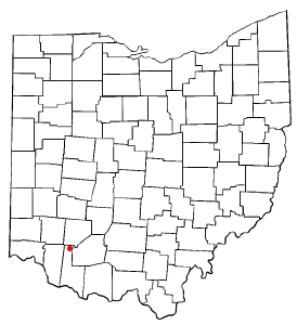
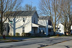
St. Martin is an unincorporated community and former village in Brown County, Ohio, United States. The community is served by the Fayetteville (45118) post office. The population was 200 at the 2020 census. In November 2011, voters chose to unincorporate St. Martin, and it now falls solely under the jurisdiction of Perry Township.

<span class="mw-page-title-main">Warsaw, Ohio</span> Village in Ohio, United States

Warsaw is a village in Coshocton County, Ohio, United States, along the Walhonding River. The population was 624 at the 2020 census.

<span class="mw-page-title-main">Gordon, Ohio</span> Village in Ohio, United States

Gordon is a village in Darke County, Ohio, United States. The population was 245 at the 2020 census.

<span class="mw-page-title-main">Ithaca, Ohio</span> Village in Ohio, United States

Ithaca is a village in Darke County, Ohio, United States. The population was 81 at the 2020 census.

<span class="mw-page-title-main">Yorkshire, Ohio</span> Village in Ohio, United States

Yorkshire is a village in Darke County, Ohio, United States. The population was 95 at the 2020 census.

<span class="mw-page-title-main">Brice, Ohio</span> Village in Ohio, United States

Brice is a village in Franklin County, Ohio, United States, on the southeast side of the Columbus metropolitan area. The population was 93 at the 2020 census.

<span class="mw-page-title-main">Addyston, Ohio</span> Village in Ohio, United States

Addyston is a village in Miami Township, Hamilton County, Ohio, United States. Located along the Ohio River, it is a western suburb of the neighboring city of Cincinnati. The population was 927 at the 2020 census.

<span class="mw-page-title-main">Cleves, Ohio</span> City in Ohio, United States

Cleves is a village in Miami Township, Hamilton County, Ohio, United States. Located along the Ohio River, it is a western suburb of Cincinnati. The population was 3,414 at the 2020 census.

<span class="mw-page-title-main">North Bend, Ohio</span> Village in Ohio, United States

North Bend is a village in Miami Township, Hamilton County, Ohio, United States, along the Ohio River. It is a part of the Greater Cincinnati area. The population was 835 at the 2020 census.

<span class="mw-page-title-main">New Athens, Ohio</span> Village in Ohio, United States

New Athens is a village in Harrison County, Ohio, United States. The population was 222 at the 2020 census.

<span class="mw-page-title-main">Montezuma, Ohio</span> Village in Ohio, United States

Montezuma is a village in Mercer County, Ohio, United States. The population was 152 at the 2020 census.

<span class="mw-page-title-main">Miltonsburg, Ohio</span> Village in Ohio, United States

Miltonsburg is a village in Monroe County, Ohio, United States. The population was 42 at the 2020 census. Miltonsburg was named after Milton Pierson, son of Ohio pioneer David Pierson. David Pierson named Clarington, Ohio after his daughter Clarinda.

<span class="mw-page-title-main">Port Jefferson, Ohio</span> Village in Ohio, United States

Port Jefferson is a village in Salem Township, Shelby County, Ohio, United States. The population was 308 at the 2020 census.

<span class="mw-page-title-main">Newcomerstown, Ohio</span> Village in Ohio, United States

Newcomerstown is a village in Tuscarawas County, Ohio, United States, 85 miles (137 km) east-northeast of Columbus. The population was 3,702 at the 2020 census.

<span class="mw-page-title-main">Port Washington, Ohio</span> Village in Ohio, United States

Port Washington is a village in Tuscarawas County, Ohio, United States. The population was 548 at the 2020 census.

<span class="mw-page-title-main">Macksburg, Ohio</span> Village in Ohio, United States

Macksburg is a village in Washington County, Ohio, United States, along the West Fork of Duck Creek. The population was 120 at the 2020 census. The village is about 28 miles (45 km) south of Cambridge, Ohio.

<span class="mw-page-title-main">Gratiot, Ohio</span> Village in Ohio, United States

Gratiot is a village in Licking and Muskingum counties in the U.S. state of Ohio. The population was 215 at the 2020 census.

<span class="mw-page-title-main">West Milton, Ohio</span> Village in Ohio, United States

West Milton is a village in Miami County, Ohio, United States. The population was 4,697 at the 2020 census. It is part of the Dayton Metropolitan Statistical Area.

References

  1. "ArcGIS REST Services Directory". United States Census Bureau. Retrieved September 20, 2022.
  2. 1 2 U.S. Geological Survey Geographic Names Information System: Ludlow Falls, Ohio
  3. 1 2 "U.S. Census website". United States Census Bureau . Retrieved January 31, 2008.
  4. Overman, William Daniel (1958). Ohio Town Names. Akron, OH: Atlantic Press. p. 78.
  5. "US Gazetteer files 2010". United States Census Bureau. Archived from the original on January 25, 2012. Retrieved January 6, 2013.
  6. The History of Miami County, Ohio: Containing a History of the County; Its Cities, Towns, Etc. Windmill Publications. 1880. p. 340.
  7. "Census of Population and Housing". Census.gov. Retrieved June 4, 2015.
  8. "U.S. Census website". United States Census Bureau . Retrieved January 6, 2013.