Clayton, Ohio

Last updated

Clayton, Ohio
Clayton-Talmadge-oh.jpg
Talmadge Road
Motto: 
"The Learning Community"
Montgomery County Ohio incorporated and unincorporated areas Clayton highlighted.svg
Location in Montgomery County and the state of Ohio.
Coordinates: 39°52′08″N84°19′45″W / 39.86889°N 84.32917°W / 39.86889; -84.32917
Country United States
State Ohio
Counties Montgomery
Government
   Mayor Mike Stevens
   Council Members Tim Gorman, Brendan Bachman, Ryan Farmer, Kenneth C. Henning, Tina Kelly, Greg Merkle
Area
[1]
  Total18.58 sq mi (48.13 km2)
  Land18.51 sq mi (47.95 km2)
  Water0.07 sq mi (0.18 km2)
Elevation
[2]
955 ft (291 m)
Population
 (2020)
  Total13,310
  Density718.99/sq mi (277.60/km2)
Time zone UTC-5 (Eastern (EST))
  Summer (DST) UTC-4 (EDT)
ZIP Code
45315
Area code(s) 937, 326
FIPS code 39-15644 [3]
GNIS feature ID2397639 [2]
Website http://www.clayton.oh.us/

Clayton is a city in Montgomery County, Ohio, United States. The population was 13,310 at the 2020 census. [4] A suburb of Dayton, it is part of the Dayton metropolitan area.

Contents

The city was named after John Clayton, a War of 1812 veteran.

Geography

According to the United States Census Bureau, the city has a total area of 18.60 square miles (48.17 km2), of which 18.51 square miles (47.94 km2) is land and 0.09 square miles (0.23 km2) is water. [5]

In 1998, [6] Clayton annexed the remainder of Montgomery County's Randolph Township. [7]

History

Clayton was platted in 1816 and at that time was known as Salem. It suffered when the National Road bypassed it. In 1906 it became a stop on the Dayton Northern Traction Line. It became a city in 1998 through merger with the rest of Randolph Township, Montgomery County, Ohio. [8]

Demographics

Historical population
CensusPop.Note
1950 466
1960 55018.0%
1970 77340.5%
1980 752−2.7%
1990 713−5.2%
2000 13,3471,771.9%
2010 13,209−1.0%
2020 13,3100.8%
Sources: [3]

2010 census

As of the census [9] of 2010, there were 13,209 people, 5,118 households, and 3,766 families living in the city. The population density was 713.6 inhabitants per square mile (275.5/km2). There were 5,423 housing units at an average density of 293.0 per square mile (113.1/km2). The racial makeup of the city was 76.5% White, 18.8% African American, 0.2% Native American, 1.4% Asian, 0.6% from other races, and 2.5% from two or more races. Hispanic or Latino of any race were 1.4% of the population.

There were 5,118 households, of which 32.1% had children under the age of 18 living with them, 59.2% were married couples living together, 10.7% had a female householder with no husband present, 3.6% had a male householder with no wife present, and 26.4% were non-families. Of all households, 22.7% were made up of individuals, and 7.8% had someone living alone who was 65 years of age or older. The average household size was 2.56 and the average family size was 3.00.

The median age in the city was 42.6 years. 23.4% of residents were under the age of 18; 7.6% were between the ages of 18 and 24; 22.3% were from 25 to 44; 32.7% were from 45 to 64; and 14% were 65 years of age or older. The gender makeup of the city was 49.0% male and 51.0% female.

2000 census

As of the census [3] of 2000, there were 13,347 people, 4,975 households, and 3,850 families living in the city. The population density was 723.7 inhabitants per square mile (279.4/km2). There were 5,193 housing units at an average density of 281.6 per square mile (108.7/km2). The racial makeup of the city was 87.14% White, 9.87% African American, 0.15% Native American, 1.45% Asian, 0.04% Pacific Islander, 0.30% from other races, and 1.03% from two or more races. Hispanic or Latino of any race were 0.90% of the population.

There were 4,975 households, out of which 35.7% had children under the age of 18 living with them, 65.4% were married couples living together, 8.6% had a female householder with no husband present, and 22.6% were non-families. Of all households, 19.2% were made up of individuals, and 6.5% had someone living alone who was 65 years of age or older. The average household size was 2.66 and the average family size was 3.05.

In the city the population was spread out, with 26.9% under the age of 18, 6.7% from 18 to 24, 27.2% from 25 to 44, 28.0% from 45 to 64, and 11.2% who were 65 years of age or older. The median age was 39 years. For every 100 females, there were 97.9 males. For every 100 females age 18 and over, there were 94.7 males.

The median income for a household in the city was $60,625, and the median income for a family was $67,250. Males had a median income of $45,569 versus $29,261 for females. The per capita income for the city was $26,569. About 3.3% of families and 4.4% of the population were below the poverty line, including 5.9% of those under age 18 and 2.8% of those age 65 or over.

Education

Clayton is served by Montgomery County's Northmont City School District, which operates the following schools:

Notable people

In fiction

Part of Ayn Rand's novel The Fountainhead [10] is set in Clayton.

Related Research Articles

<span class="mw-page-title-main">Montgomery County, Ohio</span> County in Ohio, United States

Montgomery County is in the southwestern part of the U.S. state of Ohio. At the 2020 census, the population was 537,309, making it the fifth-most populous county in Ohio. The county seat is Dayton. The county was named in honor of Richard Montgomery, an American Revolutionary War general, who was killed in 1775 while attempting to capture Quebec City, Canada. Montgomery County is part of the Dayton, Ohio, Metropolitan Statistical Area.

<span class="mw-page-title-main">Hampton, Georgia</span> City in Georgia, United States

Hampton is a city in southwestern Henry County, Georgia, United States. The 2020 census was 8,368. As of the 2010 census, the city had a population of 6,987, up from 3,857 at the 2000 census. By 2018 the estimated population was 7,922. "Hampton" mailing addresses outside the city limits reach into rural parts of eastern Clayton County and northern Spalding County. It is a southeastern suburb in the Atlanta metropolitan area.

<span class="mw-page-title-main">New Market, Indiana</span> Town in Indiana, United States

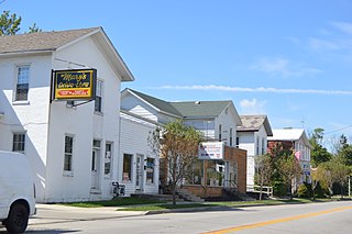
New Market is a town in Montgomery County, Indiana, in the United States. The population was 559 at the 2020 census, down from 636 in 2010.

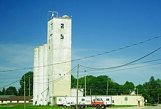
New Richmond is a town in Coal Creek Township, Montgomery County, in the U.S. state of Indiana. The population was 309 at the 2020 census.

<span class="mw-page-title-main">Winchester, Indiana</span> City in Indiana, United States

Winchester is a city in White River Township, Randolph County, in the U.S. state of Indiana. The city is the county seat of Randolph County. The population was 4,935 at the 2010 census. It is the home of Winchester Speedway.

<span class="mw-page-title-main">Clayton, Iowa</span> City in Iowa, United States

Clayton is a city in Clayton County, Iowa, United States. The population was 45 at the 2020 census, down from 55 in 2000. Clayton is located directly on the Mississippi River and is only accessible via a very steep road.

<span class="mw-page-title-main">Edgewood, Iowa</span> City in Iowa, United States

Edgewood is a city in Clayton and Delaware counties in the U.S. state of Iowa. Highway 3, which runs through the center of town, is the dividing line between the two counties. The Edgewood post office was established in 1852 on the Clayton side of the town. Edgewood was formally incorporated in 1892, although it had a functioning council for some time before that date. The population was 909 at the time of the 2020 census, down from 923 in 2000.

<span class="mw-page-title-main">Montgomery Village, Maryland</span> Census-designated place in Maryland

Montgomery Village is a census-designated place (CDP) in Montgomery County, Maryland, United States, and a northern suburb of Washington, D.C. It is a large, planned suburban community, developed in the late 1960s and 1970s just outside Gaithersburg's city limits. Montgomery Village's population was 34,893 at the time of the 2020 U.S. Census, and it is a part of the Washington metropolitan area.

<span class="mw-page-title-main">Gladstone, Missouri</span> City in Missouri, United States

Gladstone is a city in Clay County, Missouri, United States and a suburb of Kansas City. The City of Gladstone is located about 10–20 minutes from downtown Kansas City, and about 10–20 minutes from Kansas City International Airport. As of the 2020 census, the city population was 27,063. It is part of the Kansas City metropolitan area.

<span class="mw-page-title-main">Randolph, Missouri</span> City in Missouri, United States

Randolph is a city in Clay County, Missouri, United States. The population was 57 at the 2020 census. It is completely surrounded by Kansas City and is a part of the Kansas City metropolitan area.

<span class="mw-page-title-main">Town and Country, Missouri</span> City in Missouri, United States

Town and Country is a city in west St. Louis County, Missouri, United States with a population of 11,640 as of the 2020 census. It is home to Missouri Baptist Medical Center,.

<span class="mw-page-title-main">Englewood, Ohio</span> City in Ohio, United States

Englewood is a city in Montgomery County, Ohio, United States. The population was 13,463 at the 2020 census. A northern suburb of Dayton, it is part of the Dayton metropolitan area.

<span class="mw-page-title-main">New Lebanon, Ohio</span> Village in Ohio, United States

New Lebanon is a village in Montgomery County, Ohio, United States. The population was 3,796 at the 2020 census. It is part of the Dayton Metropolitan Statistical Area.

<span class="mw-page-title-main">Phillipsburg, Ohio</span> Village in Ohio, United States

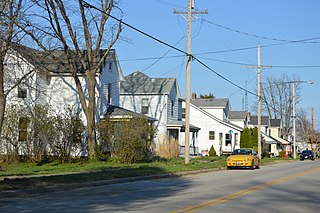
Phillipsburg is a village in Montgomery County, Ohio, United States. The population was 498 at the 2020 census. It is part of the Dayton Metropolitan Statistical Area.

<span class="mw-page-title-main">Trotwood, Ohio</span> City in Ohio, United States

Trotwood is a city in Montgomery County, Ohio, United States. The population was 23,070 at the 2020 census. A suburb of Dayton, it is part of the Dayton metropolitan area. The city is served by the Trotwood-Madison City School District.

<span class="mw-page-title-main">St. Albans, West Virginia</span> City in West Virginia, United States

St. Albans is a city in western Kanawha County, West Virginia, United States, at the confluence of the Kanawha and Coal rivers. The population was 10,861 at the 2020 census. It is part of the Charleston metropolitan area.

<span class="mw-page-title-main">Calverton, Maryland</span> Census-designated place in Maryland, United States

Calverton is an unincorporated area and census-designated place located on the boundary between Montgomery and Prince George's counties, Maryland, in the United States. At the 2020 census, it had a population of 17,316.

<span class="mw-page-title-main">Union, Ohio</span> City in Ohio, United States

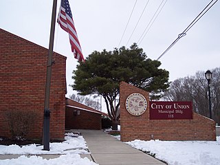
Union is a city in Montgomery and Miami Counties in the U.S. state of Ohio. The population was 6,859 at the time of the 2020 census. It is part of the Dayton Metropolitan Statistical Area.

<span class="mw-page-title-main">Randolph, Maine</span> Town in the state of Maine, United States

Randolph is a town and a census-designated place (CDP) in Kennebec County, Maine, United States. The population was 1,743 at the 2020 census. The town was named for Randolph, Massachusetts. Randolph is included in the Augusta, Maine micropolitan New England City and Town Area.

<span class="mw-page-title-main">Randolph, Wisconsin</span> Village in Wisconsin, United States

Randolph is a village in Columbia and Dodge Counties in the U.S. state of Wisconsin. The population was 1,811 at the 2010 census. Of this, 1,339 were in Dodge County, and 472 were in Columbia County. The village is located at the southeast corner of the Town of Randolph in Columbia County, although only a tiny portion of the village lies within the town. Most of the village lies within the Town of Westford in Dodge County. Small portions also lie within the Town of Fox Lake to the north and the Town of Courtland in Columbia County.

References

  1. "ArcGIS REST Services Directory". United States Census Bureau. Retrieved September 20, 2022.
  2. 1 2 U.S. Geological Survey Geographic Names Information System: Clayton, Ohio
  3. 1 2 3 "U.S. Census website". United States Census Bureau . Retrieved January 31, 2008.
  4. "Explore Census Data". data.census.gov. Retrieved April 5, 2022.
  5. "US Gazetteer files 2010". United States Census Bureau. Archived from the original on July 2, 2012. Retrieved January 6, 2013.
  6. "Randolph Township Historical Society | Englewood, OH 45322". www.rths.org.
  7. "Merger Study Report" (PDF). Archived from the original (PDF) on November 9, 2013. Retrieved November 9, 2013.
  8. "Randolph Township Historical Society page on Clayton".
  9. "U.S. Census website". United States Census Bureau . Retrieved January 6, 2013.
  10. The Fountainhead , Part III, Ch. 4.