Mackey, Indiana

Last updated

Mackey, Indiana
Mackey, Indiana.jpg
Gibson County Indiana Incorporated and Unincorporated areas Mackey Highlighted 1845774.svg
Location of Mackey in Gibson County, Indiana.
Coordinates: 38°15′07″N87°23′28″W / 38.25194°N 87.39111°W / 38.25194; -87.39111
Country United States
State Indiana
County Gibson
Township Barton
Area
[1]
  Total0.09 sq mi (0.23 km2)
  Land0.09 sq mi (0.23 km2)
  Water0.00 sq mi (0.00 km2)
Elevation
[2]
449 ft (137 m)
Population
 (2020)
  Total131
  Density1,439.56/sq mi (557.74/km2)
Time zone UTC-6 (Central (CST))
  Summer (DST) UTC-5 (CDT)
ZIP code
47654
Area code 812
FIPS code 18-45774 [3]
GNIS feature ID2396732 [2]

Mackey is a town in Barton Township, Gibson County, Indiana, United States. With a population of 106 at the 2010 census, Mackey is the smallest incorporated community in Gibson County and one of the smallest incorporated communities in the state.

Contents

History

A post office was established at Mackey in 1885. [4] The town was likely named for O. J. Mackey, a railroad official. [5]

Geography

According to the 2010 census, Mackey has a total area of 0.09 square miles (0.23 km2), all land. [6]

Demographics

Historical population
CensusPop.Note
1960 98
1970 12123.5%
1980 16536.4%
1990 89−46.1%
2000 14259.6%
2010 106−25.4%
2020 13123.6%
U.S. Decennial Census [7]

2010 census

As of the census [8] of 2010, there were 106 people, 45 households, and 28 families living in the town. The population density was 1,177.8 inhabitants per square mile (454.8/km2). There were 50 housing units at an average density of 555.6 per square mile (214.5/km2). The racial makeup of the town was 98.1% White and 1.9% from two or more races.

There were 45 households, of which 28.9% had children under the age of 18 living with them, 46.7% were married couples living together, 8.9% had a female householder with no husband present, 6.7% had a male householder with no wife present, and 37.8% were non-families. 31.1% of all households were made up of individuals, and 11.1% had someone living alone who was 65 years of age or older. The average household size was 2.36 and the average family size was 2.86.

The median age in the town was 37.5 years. 19.8% of residents were under the age of 18; 12.2% were between the ages of 18 and 24; 22.6% were from 25 to 44; 31.1% were from 45 to 64; and 14.2% were 65 years of age or older. The gender makeup of the town was 50.9% male and 49.1% female.

2000 census

As of the census [3] of 2000, there were 142 people, 60 households, and 40 families living in the town. The population density was 1,721.8 inhabitants per square mile (664.8/km2). There were 61 housing units at an average density of 739.7 per square mile (285.6/km2). The racial makeup of the town was 97.89% White, 2.11% from other races. Hispanic or Latino of any race were 2.11% of the population.

There were 60 households, out of which 30.0% had children under the age of 18 living with them, 58.3% were married couples living together, 8.3% had a female householder with no husband present, and 31.7% were non-families. 28.3% of all households were made up of individuals, and 13.3% had someone living alone who was 65 years of age or older. The average household size was 2.37 and the average family size was 2.95.

In the town, the population was spread out, with 24.6% under the age of 18, 3.5% from 18 to 24, 30.3% from 25 to 44, 19.7% from 45 to 64, and 21.8% who were 65 years of age or older. The median age was 38 years. For every 100 females, there were 79.7 males. For every 100 females age 18 and over, there were 84.5 males.

The median income for a household in the town was $33,750, and the median income for a family was $44,375. Males had a median income of $38,750 versus $21,875 for females. The per capita income for the town was $14,282. There were 6.5% of families and 8.0% of the population living below the poverty line, including 10.0% of under eighteens and none of those over 64.

Schools

Mackey and the easternmost half of Gibson County is served by the East Gibson School Corporation which currently operates five schools:

Former schools

In 1968 Mackey High School consolidated with Francisco and Oakland City High Schools to form Waldo J. Wood Memorial Jr/Sr High School located in Oakland City.

Major highways

Related Research Articles

<span class="mw-page-title-main">Haubstadt, Indiana</span> Town in Indiana, United States

Haubstadt is the second largest town, after Fort Branch, and fourth largest community in Gibson County, Indiana, United States. The population was 1,638 at the 2020 census. Haubstadt has recently become a bedroom community of Evansville and such, is part of the Evansville, Indiana, Metropolitan Area.

<span class="mw-page-title-main">Oakland City, Indiana</span> City in Indiana, United States

Oakland City is the second-largest city, but third largest community in Gibson County, Indiana, United States, after Princeton and the town of Fort Branch. It is the site of Oakland City University. The population was 2,279 at the 2020 census.

<span class="mw-page-title-main">Patoka, Indiana</span> Town in Indiana, United States

Patoka is the fourth largest town and sixth largest community in Gibson County, Indiana, United States. The population was 735 at the 2010 census.

<span class="mw-page-title-main">Somerville, Indiana</span> Town in Indiana, United States

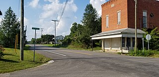
Somerville is a town in Barton Township, Gibson County, Indiana, United States. The population was 293 at the 2010 census, making it the third-smallest community in the county.

<span class="mw-page-title-main">Little York, Indiana</span> Town in Indiana, United States

Little York is a town in Gibson Township, Washington County, in the U.S. state of Indiana. The population was 192 at the 2010 census.

<span class="mw-page-title-main">Oakland Acres, Iowa</span> City in Iowa, United States

Oakland Acres is a city in Jasper County, Iowa, United States. The population was 176 at the time of the 2020 census.

<span class="mw-page-title-main">Gibson, Iowa</span> City in Iowa, United States

Gibson is a city in Keokuk County, Iowa, United States. The population was 63 at the time of the 2020 census.

<span class="mw-page-title-main">Dyer Brook, Maine</span> Town in the state of Maine, United States

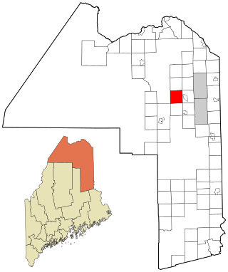
Dyer Brook is a town in Aroostook County, Maine, United States. The population was 215 at the 2020 census. Dyer Brook is also host to the local school, Southern Aroostook Community School.

<span class="mw-page-title-main">Oakfield, Maine</span> Town in the state of Maine, United States

Oakfield is a town in Aroostook County, Maine, United States. The population was 661 at the 2020 census. The village of Oakfield, listed as a census-designated place, is in the northwestern corner of the town.

<span class="mw-page-title-main">St. Francis, Maine</span> Town in the state of Maine, United States

St. Francis is a town in Aroostook County, Maine, United States on the Canada–United States border at the junction of the St. Francis River and the Saint John River. The population was 438 at the 2020 census. First settled by English speakers from southern Maine, the original population has been supplanted by French-speaking Acadians.

<span class="mw-page-title-main">Wade, Maine</span> Town in the state of Maine, United States

Wade is a town in Aroostook County, Maine, United States. The population was 229 at the 2020 census.

Woodville is a town in Penobscot County, Maine, United States. The population was 201 at the 2020 census.

<span class="mw-page-title-main">Ortonville, Michigan</span> Village in Michigan, United States

Ortonville is a village in north Oakland County in the U.S. state of Michigan. The village is within Brandon Township, although some development near the village lies within adjacent Oakland County, Groveland township and Lapeer County, Hadley township. The population was 1,291 as of the 2021 Census estimate. Ortonville lies on the northern edge of Metro Detroit and is approximately 41 miles north of Downtown Detroit.

<span class="mw-page-title-main">Oakland, Missouri</span> City in Missouri, United States

Oakland is a city in St. Louis County, Missouri, United States. The population was 1,381 at the 2010 census.

<span class="mw-page-title-main">Morral, Ohio</span> Village in Ohio, United States

Morral is a village in Marion County, Ohio, United States. The population was 373 at the 2020 census. Morral is served by Ridgedale Local School District.

<span class="mw-page-title-main">Gibsonburg, Ohio</span> Village in Ohio, United States

Gibsonburg is a village in Sandusky County, Ohio, United States, about 33 miles (53 km) southeast of Toledo. The population was 2,452 at the 2020 census. The National Arbor Day Foundation has designated Gibsonburg as a Tree City USA.

<span class="mw-page-title-main">Oakland Township, Susquehanna County, Pennsylvania</span> Township in Pennsylvania, United States

Oakland Township is a township in Susquehanna County, Pennsylvania, United States. The population was 492 at the 2020 census.

<span class="mw-page-title-main">Oakland, Burnett County, Wisconsin</span> Town in Wisconsin, United States

Oakland is a town in Burnett County in the U.S. state of Wisconsin. The population was 827 at the 2010 census. It is along Wisconsin Highway 35. The unincorporated communities of Oakland and Yellow Lake are located in the town.

<span class="mw-page-title-main">Oakland, Douglas County, Wisconsin</span> Town in Wisconsin, United States

Oakland is a town in Douglas County, Wisconsin, United States. The population was 1,144 at the 2000 census.

<span class="mw-page-title-main">Oakland, Maine</span> Town in the state of Maine, United States

Oakland is a town in Kennebec County in the U.S. state of Maine. The population was 6,230 at the 2020 census. Oakland is 4 miles (6 km) west of Waterville and approximately 18 miles (29 km) north of Augusta, the state capital. Waterville and Augusta are service centers for Oakland, and many Oakland residents commute to jobs in those areas.

References

  1. "2020 U.S. Gazetteer Files". United States Census Bureau. Retrieved March 16, 2022.
  2. 1 2 U.S. Geological Survey Geographic Names Information System: Mackey, Indiana
  3. 1 2 "U.S. Census website". United States Census Bureau . Retrieved January 31, 2008.
  4. "Gibson County". Jim Forte Postal History. Retrieved September 10, 2014.
  5. Baker, Ronald L. (October 1995). From Needmore to Prosperity: Hoosier Place Names in Folklore and History . Indiana University Press. p.  207. ISBN   978-0-253-32866-3. ...according to the WPA files, named for O. J. Mackey, local railroad owner.
  6. "G001 - Geographic Identifiers - 2010 Census Summary File 1". United States Census Bureau. Archived from the original on February 13, 2020. Retrieved July 17, 2015.
  7. "Census of Population and Housing". Census.gov. Retrieved June 4, 2015.
  8. "U.S. Census website". United States Census Bureau . Retrieved December 11, 2012.