
Manson is an unincorporated community and census-designated place in Chelan County in the U.S. state of Washington. It was named in 1912 for Manson F. Backus, president of the Lake Chelan Land Company. Manson is located in the north-central portion of the state on the north shore of Lake Chelan, approximately 7 miles (11 km) northwest of the city of Chelan.
Steptoe is a small unincorporated rural town in Whitman County, Washington, United States. The ZIP Code for Steptoe is 99111.

The Enchantments is a region within the Alpine Lakes Wilderness area of Washington state's Cascade Mountain Range. At an elevation of 4,500 feet, it is home to over 700 alpine lakes and ponds surrounded by the vast peaks of Cashmere Crags, which rate among the best rock-climbing sites in the western United States. The highest peak, Dragontail Peak, stretches 8,840 feet high. The Enchantments is located 15 miles southwest of the popular Bavarian-themed town Leavenworth, Washington in the United States and is regarded as one of the most spectacular regions in the Cascade Range.

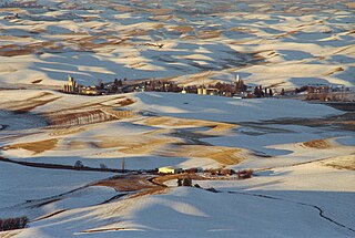
Peshastin is a small unincorporated community in Chelan County, Washington, United States. The community's roots are found in the "Peshastin Ditch" dug by pioneers beginning in 1889. This ditch was an important part of the overall irrigation system in the area, delivering water to the orchards on the slopes above Cashmere. The town was first platted in the early 1890s by two brothers, J. Q. Gilbert and A. C. Gilbert. It is also noted on an 1895 map of the area, indicating it was in existence by then.

Lincoln Rock State Park is a public recreation area on the east side of the Columbia River's Lake Entiat, seven miles (11 km) north of Wenatchee and one mile upstream from the Rocky Reach Dam. The state park covers 86 acres (35 ha) opposite the cliff formation for which it is named. The park provides views of the south end of Swakane Canyon and of Turtle Rock Island in Lake Entiat, a 150-acre nature preserve that was isolated from the mainland when the lake formed in the 1960s. The park offers water activities, including fishing, boating, and swimming, in addition to facilities for picnicking, camping, hiking, and field sports. It is managed by the Washington State Parks and Recreation Commission under a lease agreement with the owners, the Chelan County Public Utility District.
Dryden is a small unincorporated community in Chelan County, Washington, United States. It is situated along the Wenatchee River in the fertile Wenatchee Valley between the towns of Cashmere and Leavenworth. The community serves as a supply and shipping point for local farms and orchards.

Monitor is a small unincorporated community in Chelan County, Washington, United States. It is situated along the Wenatchee River about 8 miles upstream from its junction with the Columbia River in the fertile Wenatchee Valley.
Ardenvoir is an unincorporated community in Chelan County, Washington, United States. Ardenvoir is 9 miles (14 km) west-northwest of Entiat. Ardenvoir has a post office with ZIP code 98811.

Chelan Falls is a census-designated place and unincorporated community in Chelan County, Washington, United States. The population was 340 at the 2020 census. Chelan Falls is located on the Columbia River at the mouth of the Chelan River, 5 miles (8 km) south-southeast of Chelan. Chelan Falls has a post office with ZIP code 98817.
Malaga is an unincorporated community in Chelan County, Washington, United States. Founded in 1903, Malaga is located on the Columbia River 6.5 miles (10.5 km) east-southeast of Wenatchee. Malaga has a post office with ZIP code 98828.
Plain is a small unincorporated community in Chelan County, Washington, United States. It is located east of Coles Corner, Washington, near U.S. Route 2 and SR 207. Plain was serviced by the former SR 209, now called the Chumstick Highway, which connects Plain with Chumstick and Leavenworth along an old railroad grade.
Paha is an unincorporated community in Adams County, Washington, United States. It is located along BNSF Railway's Lakeside Subdivision. Paha is assigned the ZIP code 99169.

Lucerne is an unincorporated community in Chelan County, Washington, United States. Lucerne is assigned the ZIP code 98816.
Merritt is an unincorporated community in Chelan County, Washington, United States. Merritt is on U.S. Route 2 in the upper valley area along Nason Creek in the Wenatchee National Forest, located 20 miles west of downtown Leavenworth. Merritt is assigned the ZIP code 98826. Steep slopes surround the community, rising to more than 8,000 feet in the Chiwaukum Mountains to the south.

Denison is an unincorporated community in Spokane County, in the U.S. state of Washington. The community is located on U.S. Route 395 19 miles due north of Downtown Spokane and about seven miles beyond that city's northern suburban developments. Denison lends its name to two roads in the area, Denison Road and Denison-Chattaroy Road, both of which intersect with Route 395 in the immediate vicinity of Denison. The city of Deer Park is four miles to the north.

Hazard is an unincorporated community in Spokane County, in the U.S. state of Washington.
Moore is an extinct town in Chelan County, in the U.S. state of Washington. The GNIS classifies it as a populated place.
Ward is an unincorporated community in Stevens County, in the U.S. state of Washington. It is located a mile-and-a-half east of Kettle Falls on U.S. Route 395.
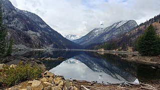
Eightmile Lake is a reservoir lake located on the eastern slope of Eightmile Mountain, in Chelan County in Washington. It is a reservoir lake formed along the beginning route of Eightmile Creek as it exits Jack Ridge.

