Related Research Articles

Chelan County is a county in the U.S. state of Washington. As of the 2010 census, its population was 72,453. The county seat and largest city is Wenatchee. The county was created out of Okanogan and Kittitas Counties on March 13, 1899. It derives its name from a Chelan Indian word meaning "deep water," likely a reference to 55-mile (89 km)-long Lake Chelan, which reaches a maximum depth of 1,486 feet.

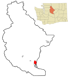
Chelan is a city in Chelan County, Washington, United States. The population was 3,890 at the 2010 census. The population was 4,222 at 2018 Estimate from Office of Financial Management. It lies on the southeast tip of Lake Chelan, where the lake flows into the Chelan River.

Leavenworth is a city in Chelan County, Washington, United States. It is part of the Wenatchee−East Wenatchee Metropolitan Statistical Area. The population was 1,965 at the 2010 census. The entire town center is modeled on a Bavarian village as part of a civic initiative that began in the 1960s. The area is a major four season tourist destination with festivals nearly every month and a multitude of events scheduled on weekends and weekdays year round.
Sunnyslope is an unincorporated community and census-designated place (CDP) in Chelan County, Washington, United States. It is part of the Wenatchee–East Wenatchee Metropolitan Statistical Area. The population was 3,252 at the 2010 census, up from 2,521 at the 2000 census.

East Wenatchee is a city in Douglas County, Washington, United States. The population at the 2010 census was 13,190, a 129.1% increase on the 2000 census. As of 2018, the Office of Financial Management estimates that the current population is 14,168.

The Wenatchee River is a river in the U.S. state of Washington, originating at Lake Wenatchee and flowing southeast for 53 miles (85 km), emptying into the Columbia River immediately north of Wenatchee, Washington. On its way it passes the towns of Plain, Leavenworth, Peshastin, Dryden, Cashmere, Monitor, and Wenatchee, all within Chelan County. The river attracts kayaking and river rafting enthusiasts and tourism.

The Okanogan National Forest is a U.S. National Forest located in Okanogan County in north-central Washington, United States.

Stehekin is a small unincorporated community in Chelan County, Washington. It is part of Wenatchee–East Wenatchee Metropolitan Statistical Area. Located at the northwest end of Lake Chelan, it lies just south of the North Cascades National Park. It is within Lake Chelan National Recreation Area, a unit administered by the National Park Service. Stehekin has about 75 permanent residents, though its population swells during the summer with vacationers and seasonal workers. The name "Stehekin" comes from a Native American word meaning "the way through."

The Wenatchee Mountains are a range of mountains in central Washington State, United States of America. A major subrange of the Cascade Range, extending east 50 miles (80 km) from the Cascade crest, the Wenatchee Mountains separate the drainage basins of the Yakima River from the Wenatchee River. The crest of the range forms part of the boundary between Chelan and Kittitas Counties.
The Chelan County Public Utility District, or Chelan County PUD, provides electric, water, wastewater public utility and telecommunications services in Chelan County, in north-central Washington, USA.

Orondo is an unincorporated community in Douglas County, Washington, United States, located alongside the eastern part of the Columbia River. It is part of the Wenatchee–East Wenatchee Metropolitan Statistical Area. The area is well known for its robust agriculture industry, and produce fruits such as apples, cherries and pears. The name was derived from a mythical Great Lake Indian and was first settled in the late 19th century by late Washington politician, John B. Smith.
Cascade School District No. 228 is a Class-A public school district in Chelan County, Washington. The district includes the towns of Dryden, Lake Wenatchee, Leavenworth, Peshastin, Plain and Winton. Four of the district schools are located in Leavenworth, while the fifth, Peshastin Dryden Elementary, is in the unincorporated community of Peshastin. The district office is located in Leavenworth, and the district school board currently has five members.

The Wenatchee–East Wenatchee Metropolitan Statistical Area, as defined by the United States Census Bureau, is an area consisting of Chelan and Douglas Counties in Washington State, anchored by the cities of Wenatchee and East Wenatchee. According to the 2000 census the MSA had a population of 99,219. The 2010 census showed the MSA had a population increase of 11.76% to 110,884. As of 2015, the Wenatchee Metropolitan Statistical Area was the 331st largest MSA in the United States.

State Route 207 (SR 207) is a 4.38-mile-long (7.05 km) state highway serving Wenatchee National Forest and Lake Wenatchee State Park in Chelan County, located within the U.S. state of Washington. The highway travels north along Nason Creek from an intersection with U.S. Route 2 (US 2) at Coles Corner to Chiwawa Loop Road on the eastern shore of Lake Wenatchee. SR 207 was previously signed as part of Secondary State Highway 15C (SSH 15C) and SSH 15D until the 1964 highway renumbering, when SSH 15C was split between SR 207 and SR 209. SR 209 was removed from the highway system in 1991 and SR 207 was shortened to end at the former terminus of SR 209.
Dryden is a small unincorporated community in Chelan County, Washington, United States. It is situated along the Wenatchee River in the fertile Wenatchee Valley between the towns of Cashmere and Leavenworth. The community serves as a supply and shipping point for local farms and orchards.

Monitor is a small unincorporated community in Chelan County, Washington, United States. It is situated along the Wenatchee River about 8 miles upstream from its junction with the Columbia River in the fertile Wenatchee Valley.

Winton, Washington is a small unincorporated community close to Lake Wenatchee and Wenatchee National Forest. It is in Chelan County in the state of Washington. The town's only school district, Cascade School District, is located in Leavenworth and includes five schools. It is assigned ZIP code 98826, the same as Leavenworth, Washington, approximately 10 miles (16 km) to the south.
Telma is an unincorporated community in Chelan County, Washington, United States. Telma is assigned the ZIP code 98826.
Wenatchee Heights is an unincorporated community in Chelan County, Washington, United States. Wentachee Heights is assigned the ZIP code 98801.
Lakeside is an unincorporated community in Chelan County, Washington. It is part of Wenatchee–East Wenatchee Metropolitan Statistical Area.
References
- ↑ "Merritt Populated Place Profile / Chelan County, Washington Data". washington.hometownlocator.com. Retrieved 2015-12-10.
Coordinates: 47°46′51″N120°50′35″W / 47.7809506°N 120.8431515°W
Municipalities and communities of Chelan County, Washington, United States | ||
|---|---|---|
| Cities |  | |
| CDPs | ||
| Other unincorporated communities | ||
| Indian reservation | ||
| Ghost towns | ||
| Footnotes | ‡This populated place also has portions in an adjacent county or counties | |