Masonville, Iowa

Last updated
Masonville, Iowa
Delaware County Iowa Incorporated and Unincorporated areas Masonville Highlighted.svg
Location of Masonville, Iowa
Coordinates: 42°28′47″N91°35′26″W / 42.47972°N 91.59056°W / 42.47972; -91.59056 Coordinates: 42°28′47″N91°35′26″W / 42.47972°N 91.59056°W / 42.47972; -91.59056
Country Flag of the United States.svg  United States
State Flag of Iowa.svg  Iowa
County Delaware
Area
[1]
  Total0.33 sq mi (0.85 km2)
  Land0.33 sq mi (0.85 km2)
  Water0.00 sq mi (0.00 km2)
Elevation
1,020 ft (311 m)
Population
 (2020)
  Total99
  Density302.75/sq mi (116.88/km2)
Time zone UTC-6 (Central (CST))
  Summer (DST) UTC-5 (CDT)
ZIP code
50654
Area code 563
FIPS code 19-50205
GNIS feature ID0458848

Masonville is a city in Delaware County, Iowa, United States. The population was 99 at the time of the 2020 census. [2] The city is located on the western border between Delaware and Buchanan counties.

Contents

History

Masonville was laid out in 1858. It was named for businessman R. B. Mason. [3]

Geography

Masonville is located at 42°28′47″N91°35′26″W / 42.47972°N 91.59056°W / 42.47972; -91.59056 (42.479755, -91.590591). [4]

According to the United States Census Bureau, the city has a total area of 0.33 square miles (0.85 km2), all land. [5]

Demographics

Historical populations
YearPop.±%
1910 282    
1920 250−11.3%
1930 207−17.2%
1940 176−15.0%
1950 133−24.4%
1960 168+26.3%
1970 147−12.5%
1980 150+2.0%
1990 129−14.0%
2000 104−19.4%
2010 127+22.1%
2020 99−22.0%
Source: "U.S. Census website". United States Census Bureau . Retrieved 2020-03-29. and Iowa Data Center
Source:
U.S. Decennial Census [6] [2]

2010 census

As of the census [7] of 2010, there were 127 people, 55 households, and 36 families living in the city. The population density was 384.8 inhabitants per square mile (148.6/km2). There were 57 housing units at an average density of 172.7 per square mile (66.7/km2). The racial makeup of the city was 96.9% White and 3.1% from two or more races. Hispanic or Latino of any race were 0.8% of the population.

There were 55 households, of which 25.5% had children under the age of 18 living with them, 52.7% were married couples living together, 9.1% had a female householder with no husband present, 3.6% had a male householder with no wife present, and 34.5% were non-families. 27.3% of all households were made up of individuals, and 3.6% had someone living alone who was 65 years of age or older. The average household size was 2.31 and the average family size was 2.83.

The median age in the city was 40.5 years. 24.4% of residents were under the age of 18; 4.7% were between the ages of 18 and 24; 26% were from 25 to 44; 32.3% were from 45 to 64; and 12.6% were 65 years of age or older. The gender makeup of the city was 46.5% male and 53.5% female.

2000 census

As of the census [8] of 2000, there were 104 people, 49 households, and 32 families living in the city. The population density was 315.3 inhabitants per square mile (121.7/km2). There were 55 housing units at an average density of 166.8 per square mile (64.4/km2). The racial makeup of the city was 99.04% White, and 0.96% from two or more races. Hispanic or Latino of any race were 4.81% of the population.

There were 49 households, out of which 18.4% had children under the age of 18 living with them, 44.9% were married couples living together, 18.4% had a female householder with no husband present, and 32.7% were non-families. 26.5% of all households were made up of individuals, and 18.4% had someone living alone who was 65 years of age or older. The average household size was 2.12 and the average family size was 2.42.

In the city, the population was spread out, with 14.4% under the age of 18, 18.3% from 18 to 24, 26.0% from 25 to 44, 26.9% from 45 to 64, and 14.4% who were 65 years of age or older. The median age was 41 years. For every 100 females, there were 67.7 males. For every 100 females age 18 and over, there were 81.6 males.

The median income for a household in the city was $32,000, and the median income for a family was $40,625. Males had a median income of $30,313 versus $16,667 for females. The per capita income for the city was $20,166. There were 3.0% of families and 5.1% of the population living below the poverty line, including no under eighteens and 15.4% of those over 64.

Education

The West Delaware County Community School District operates local area public schools. [9]


Related Research Articles

<span class="mw-page-title-main">Delaware County, Iowa</span> County in Iowa, United States

Delaware County is a county located in the U.S. state of Iowa. As of the 2020 census, the population was 17,488. The county seat is Manchester. The county takes its name after the U.S. state of Delaware.

<span class="mw-page-title-main">Wayne City, Illinois</span> Village in Illinois, United States

Wayne City is a village in Wayne County, Illinois, United States. The population was 994 at the 2020 census.

<span class="mw-page-title-main">Edgewood, Iowa</span> City in Iowa, United States

Edgewood is a city in Clayton and Delaware counties in the U.S. state of Iowa. Highway 3, which runs through the center of town, is the dividing line between the two counties. The Edgewood post office was established in 1852 on the Clayton side of the town. Edgewood was formally incorporated in 1892, although it had a functioning council for some time before that date. The population was 909 at the time of the 2020 census, down from 923 in 2000.

<span class="mw-page-title-main">Colesburg, Iowa</span> City in Iowa, United States

Colesburg is a city in Delaware County, Iowa, United States. The population was 386 at the time of the 2020 census.

<span class="mw-page-title-main">Delaware, Iowa</span> City in Iowa, United States

Delaware is a city in Delaware County, Iowa, United States. The population was 142 at the time of the 2020 census.

<span class="mw-page-title-main">Delhi, Iowa</span> City in Iowa, United States

DelhiDEL-hy is a city in Delaware County, Iowa, United States. The population was 420 at the time of the 2020 census.

<span class="mw-page-title-main">Dundee, Iowa</span> City in Iowa, United States

Dundee is a city in Delaware County, Iowa, United States. The population was 198 at the time of the 2020 census.

<span class="mw-page-title-main">Earlville, Iowa</span> City in Iowa, United States

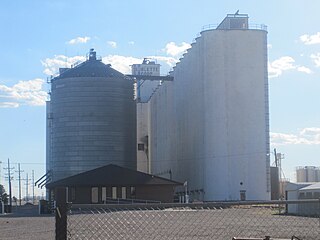
Earlville is a city in Delaware County, Iowa, United States. The population was 716 at the time of the 2020 census.

<span class="mw-page-title-main">Greeley, Iowa</span> City in Iowa, United States

Greeley is a city in Delaware County, Iowa, United States. The population was 217 at the time of the 2020 census.

<span class="mw-page-title-main">Hopkinton, Iowa</span> City in Iowa, United States

Hopkinton is a city in Delaware County, Iowa, United States. The population was 622 at the time of the 2020 census.

<span class="mw-page-title-main">Ryan, Iowa</span> City in Iowa, United States

Ryan is a city in Delaware County, Iowa, United States. The population was 350 at the time of the 2020 census.

<span class="mw-page-title-main">Sublette, Kansas</span> City in Haskell County, Kansas

Sublette is a city in and the county seat of Haskell County, Kansas, United States. As of the 2020 census, the population of the city was 1,413.

<span class="mw-page-title-main">Masonville, Kentucky</span> Census-designated place in Kentucky, United States

Masonville is an unincorporated community and census-designated place (CDP) in Daviess County, Kentucky, United States. The population was 1,014 at the 2010 census. It is included in the Owensboro Metropolitan Statistical Area.

<span class="mw-page-title-main">Hurstbourne Acres, Kentucky</span> City in Kentucky, United States

Hurstbourne Acres is a home rule-class city in Jefferson County, Kentucky, United States. The population was 1,811 at the 2010 census, up from 1,504 at the 2000 census.

Roque Bluffs is a town in Washington County, Maine, United States. The population was 296 at the 2020 census. The town is home to Roque Bluffs State Park.

<span class="mw-page-title-main">Masonville Township, Michigan</span> Civil township in Michigan, United States

Masonville Township is a civil township of Delta County in the U.S. state of Michigan. The population was 1,734 at the 2010 census, down from 1,877 at the 2000 census.

<span class="mw-page-title-main">Leadwood, Missouri</span> City in Missouri, United States

Leadwood is a city in St. Francois County, Missouri, United States. The population was 1,282 at the 2010 census.

Masonville is a town in Delaware County, New York, United States. The population was 1,320 at the 2010 census. The town is in the western part of the county.

<span class="mw-page-title-main">Chesterville, Ohio</span> Village in Ohio, United States

Chesterville is a village in Morrow County, Ohio, United States, along the Kokosing River. The population was 228 at the 2010 census. Chesterville is southeast of Mount Gilead, the county seat.

<span class="mw-page-title-main">McArthur, Ohio</span> Village in Ohio, United States

McArthur is a village in Vinton County, Ohio, United States. It is located 27 miles southeast of Chillicothe. The population was 1,701 at the 2010 census. It is the county seat of Vinton County.

References

  1. "2020 U.S. Gazetteer Files". United States Census Bureau. Retrieved March 16, 2022.
  2. 1 2 "2020 Census State Redistricting Data". census.gov. United states Census Bureau. Retrieved 12 August 2021.
  3. The History of Delaware County, Iowa: Containing a History of the County, Its Cities, Towns, &c. Western Historical Company. 1878. pp.  554.
  4. "US Gazetteer files: 2010, 2000, and 1990". United States Census Bureau. 2011-02-12. Retrieved 2011-04-23.
  5. "US Gazetteer files 2010". United States Census Bureau. Archived from the original on 2011-02-20. Retrieved 2012-05-11.
  6. "Census of Population and Housing". Census.gov. Retrieved June 4, 2015.
  7. "U.S. Census website". United States Census Bureau . Retrieved 2012-05-11.
  8. "U.S. Census website". United States Census Bureau . Retrieved 2008-01-31.
  9. "WEST DELAWARE COUNTY" (PDF). Iowa Department of Education. Retrieved 2020-07-24.