Mine La Motte Township, Madison County, Missouri

Last updated

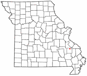
Mine La Motte Township is an inactive township in Madison County, in the U.S. state of Missouri. [1]

A civil township is a widely used unit of local government in the United States that is subordinate to a county. The term town is used in New England, New York, and Wisconsin to refer to the equivalent of the civil township in these states. Specific responsibilities and the degree of autonomy vary based on each state. Civil townships are distinct from survey townships, but in states that have both, the boundaries often coincide and may completely geographically subdivide a county. The U.S. Census Bureau classifies civil townships as minor civil divisions. Currently, there are 20 states with civil townships.

Madison County, Missouri County in the United States

Madison County is a county located in the Lead Belt region of the U.S. state of Missouri. As of the 2010 census, the population was 12,226. Its county seat and largest city is Fredericktown. The county was officially organized on December 14, 1818, and was named after President James Madison.

U.S. state constituent political entity of the United States

In the United States, a state is a constituent political entity, of which there are currently 50. Bound together in a political union, each state holds governmental jurisdiction over a separate and defined geographic territory and shares its sovereignty with the federal government. Due to this shared sovereignty, Americans are citizens both of the federal republic and of the state in which they reside. State citizenship and residency are flexible, and no government approval is required to move between states, except for persons restricted by certain types of court orders. Four states use the term commonwealth rather than state in their full official names.

Mine La Motte Township was established in 1909, taking its name from Mine La Motte, Missouri. [2]

Mine La Motte, Missouri

Mine La Motte is an unincorporated community and census-designated place in Madison County, Missouri, United States. It is located about six miles north of Fredericktown. Europeans discovered lead here and had also hoped to find silver. The French Governor of Louisiana Antoine de la Mothe Cadillac failed to find silver, but succeeded in recruiting investors in The Company of the West which was organized in 1717. Mine La Motte was eventually settled by about 200 French settlers along with their slaves from Santo Domingo, under the leadership of Philip François Renault, to develop mines in 1717 making it one of the oldest settlements west of the Mississippi River. The presence of lead, a critical ingredient for ammunition, attracted unusually early mining by French colonists in this otherwise remote interior region of the North American continent. That same lead, still used for ammunition at the time of the American Civil War, was also a factor in the Battle of Fredericktown in which forces aligned with the Confederated States of America fought for control of the lead smelters in nearby Freericktown with the Unionist forces, aligned with the United States of America.

Related Research Articles

Southeast Missouri Lead District

The Southeast Missouri Lead District, commonly called the Lead Belt, is a lead mining district in the southeastern part of Missouri. Counties in the Lead Belt include Saint Francois; Crawford; Dent; Iron; Madison: Reynolds; and Washington. Philip Francois Renault of France led a large exploratory mission in 1719 and started mining operations in Old Mines and Mine La Motte in 1720. The town of Sainte Genevieve was founded as a river port for transportation of lead out of the area. Moses Austin started large-scale mining and smelting at Potosi, originally known as Mine a Breton, and founded Herculaneum as his shipping point on the Mississippi. This lead was originally used as a roofing material. Bonne Terre has large subterranean mines, now used commercially for recreational scuba diving.

Saint Michaels Township is a township in Madison County, Missouri, in the United States.

Catherine Place is an unincorporated community in Madison County, in the U.S. state of Missouri.

Musco Creek is a stream in Madison and St. Francois counties in the U.S. state of Missouri. It is a tributary of the Little Saint Francis River.

Silver Mine is an unincorporated community in northwest Madison County, in the U.S. state of Missouri.

Tin Mine Mountain is a summit in Madison County in the U.S. state of Missouri. It has an elevation of 1,115 feet (340 m).

Tin Mountain is an unincorporated community in Madison County, in the U.S. state of Missouri.

Village Creek is a stream in Madison County in the U.S. state of Missouri. It is a tributary of the Little Saint Francis River.

Big Creek Township is an inactive township in Madison County, in the U.S. state of Missouri.

Castor Township is an inactive township in Madison County, in the U.S. state of Missouri.

Central Township is an inactive township in Madison County, in the U.S. state of Missouri.

Liberty Township is an inactive township in Madison County, in the U.S. state of Missouri.

Polk Township is an inactive township in Madison County, in the U.S. state of Missouri.

Saint Francois Township is an inactive township in Madison County, in the U.S. state of Missouri.

Twelvemile Township is an inactive township in Madison County, in the U.S. state of Missouri.

James Bayou Township is an inactive township in Mississippi County, in the U.S. state of Missouri.

Bain Hill is a summit in St. Francois County, Missouri. It has a peak elevation of 1,106 feet (337 m). The hill rises to the east of and about 200 feet above the Little St. Francis River. Knob Lick lies about four miles to the west and Mine La Motte is about five miles to the south in Madison County.

Libertyville is an unincorporated community in southeastern St. Francois County, in the U.S. state of Missouri. The community is on Missouri Route DD east of Knob Lick and north of Mine La Motte. The village sits at the headwaters of the Little Saint Francis River.

Rock Creek is a southwest flowing stream in Madison and St. Francois counties in the U.S. state of Missouri. It is a tributary of the Little Saint Francis River.

References

  1. U.S. Geological Survey Geographic Names Information System: Mine La Motte Township, Madison County, Missouri
  2. "Madison County Place Names, 1928–1945". The State Historical Society of Missouri. Archived from the original on June 24, 2016. Retrieved November 2, 2016.

Coordinates: 37°37′01″N90°17′07″W / 37.6169°N 90.2853°W / 37.6169; -90.2853

Geographic coordinate system Coordinate system

A geographic coordinate system is a coordinate system that enables every location on Earth to be specified by a set of numbers, letters or symbols. The coordinates are often chosen such that one of the numbers represents a vertical position and two or three of the numbers represent a horizontal position; alternatively, a geographic position may be expressed in a combined three-dimensional Cartesian vector. A common choice of coordinates is latitude, longitude and elevation. To specify a location on a plane requires a map projection.