
Madison County is a county located in the Lead Belt region of the U.S. state of Missouri. As of the 2020 census, the population was 12,626. Its county seat and largest city is Fredericktown. The county was officially organized on December 14, 1818, and was named after President James Madison.
Oak Grove is an unincorporated community in St. Francois Township in Madison County, Missouri, United States. It is located on Route 72, approximately six miles west of Fredericktown.
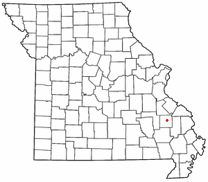
Millcreek is an unincorporated community in Castor Township in Madison County, Missouri, United States. It is located on Mill Creek, just east of U.S. Route 67, approximately three miles south of Fredericktown.

Zion is an unincorporated community in Central Township in southern Madison County, Missouri, United States. It is located on U.S. Route 67, approximately ten miles south of Fredericktown. The community is situated on the banks of Twelve Mile Creek.
Peach Orchard is an unincorporated community in northwest Pemiscot County, Missouri, United States. It is located on Route 153, approximately twenty miles northwest of Caruthersville.
Crooked Creek is a stream in Crawford and Dent counties in the U.S. state of Missouri. It is a tributary of the Meramec River.
Allbright is an unincorporated community in southeastern Madison County, in the U.S. state of Missouri.
Buckhorn is an unincorporated community in southeastern Madison County, in the U.S. state of Missouri.
Cornwall is an unincorporated community in eastern Madison County, in the U.S. state of Missouri.
French Mills is an unincorporated community in western Madison County, in the U.S. state of Missouri. The community is on Marble Creek, just west of that stream's confluence with the St. Francis River.
Higdon is an unincorporated community in northeast Madison County, in the U.S. state of Missouri.
Huzzah Creek is a stream in southern Madison County the U.S. state of Missouri. It is a tributary of the St. Francis River.
Jewett is an unincorporated community in southwest Madison County, in the U.S. state of Missouri.
Lance is an unincorporated community in Madison County, in the U.S. state of Missouri.
Roselle is an unincorporated community in northwest Madison County, in the U.S. state of Missouri.
Silver Mine is an unincorporated community in northwest Madison County, in the U.S. state of Missouri.
Tin Mountain is an unincorporated community in Madison County, in the U.S. state of Missouri.
Twelvemile Creek is a stream in Madison County in the U.S. state of Missouri. It is a tributary of St. Francis River.
Twelvemile is an unincorporated community in Madison County, in the U.S. state of Missouri.
Twelvemile Township is an inactive township in Madison County, in the U.S. state of Missouri.


