Related Research Articles

Madison County is a county located in the Lead Belt region of the U.S. state of Missouri. As of the 2020 census, the population was 12,626. Its county seat and largest city is Fredericktown. The county was officially organized on December 14, 1818, and was named after President James Madison.

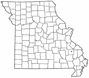
Saco is an unincorporated community in southern Madison County, Missouri, United States. The community is situated on Twelvemile Creek and is located sixteen miles southwest of Fredericktown on Missouri Route C.
Millcreek is an unincorporated community in Castor Township in Madison County, Missouri, United States. It is located on Mill Creek, just east of U.S. Route 67, approximately three miles south of Fredericktown.

Zion is an unincorporated community in Central Township in southern Madison County, Missouri, United States. It is located on U.S. Route 67, approximately ten miles south of Fredericktown. The community is situated on the banks of Twelve Mile Creek.
Sutherland is an unincorporated community in southeast Johnson County, in the U.S. state of Missouri.
Allbright is an unincorporated community in southeastern Madison County, in the U.S. state of Missouri.
Big Creek is a stream in southern Madison and northeastern Wayne counties the U.S. state of Missouri. It is a tributary of the Castor River.

Black Mountain is a summit in western Madison County in the U.S. state of Missouri. The peak has an elevation of 1,503 feet (458 m). The St. Francis River flows past the east side of the mountain at an elevation of about 560 feet. Missouri Route E passes the east and south side of the mountain. The community of French Mills lies adjacent to the St. Francis just to the south of the mountain.
Buck Mountain is a summit in Madison County in the U.S. state of Missouri. The summit has an elevation of 1,129 feet (344 m).
Buckhorn is an unincorporated community in southeastern Madison County, in the U.S. state of Missouri.
Catherine Place is an unincorporated community in Madison County, in the U.S. state of Missouri.
Cornwall is an unincorporated community in eastern Madison County, in the U.S. state of Missouri.
French Mills is an unincorporated community in western Madison County, in the U.S. state of Missouri. The community is on Marble Creek, just west of that stream's confluence with the St. Francis River.
Hackle Creek is a stream in eastern Madison County in the U.S. state of Missouri. It is a tributary of Henderson Creek.
Hahns Mill is an unincorporated community in Madison County, in the U.S. state of Missouri.
Jewett is an unincorporated community in southwest Madison County, in the U.S. state of Missouri.
Lance is an unincorporated community in Madison County, in the U.S. state of Missouri.
Roselle is an unincorporated community in northwest Madison County, in the U.S. state of Missouri.
Silver Mine is an unincorporated community in northwest Madison County, in the U.S. state of Missouri.
Twelvemile is an unincorporated community in Madison County, in the U.S. state of Missouri.
References
- ↑ U.S. Geological Survey Geographic Names Information System: Higdon, Missouri
- ↑ Higdon, Missouri, 7.5 Minute Topographic Quadrangle, USGS, 1959 (1980 rev.)
- ↑ "Post Offices". Jim Forte Postal History. Retrieved October 31, 2016.
- ↑ "Madison County Place Names, 1928–1945". The State Historical Society of Missouri. Archived from the original on June 24, 2016. Retrieved October 31, 2016.
Municipalities and communities of Madison County, Missouri, United States | ||
|---|---|---|
| Cities |  | |
| Villages | ||
| Townships | ||
| CDPs | ||
| Other unincorporated communities | ||
| Abandoned villages | ||
37°35′34″N90°10′04″W / 37.59278°N 90.16778°W
| | This Madison County, Missouri state location article is a stub. You can help Wikipedia by expanding it. |