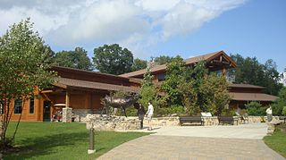
Pennsylvania State Game Lands Number 14

Last updated
Pennsylvania State Game Lands Number 14
USA Pennsylvania location map.svg
Red pog.svg
Pennsylvania State Game Lands Number 14
Location Cameron County
Elk County
Coordinates 41°25′50″N78°21′18″W / 41.43056°N 78.35500°W / 41.43056; -78.35500 Coordinates: 41°25′50″N78°21′18″W / 41.43056°N 78.35500°W / 41.43056; -78.35500
Area14,947 acres (6,049 ha)
Elevation1,749 feet (533 m)
Max. elevation2,332 feet (711 m)
Min. elevation1,300 feet (400 m)
Owner Pennsylvania Game Commission
WebsitePennsylvania State Game Lands

The Pennsylvania State Game Lands Number 14 are Pennsylvania State Game Lands in Cameron, and Elk Counties in Pennsylvania in the United States providing hunting, bird watching, and other activities. [1]

The Pennsylvania State Game Lands (SGL) are lands managed by the Pennsylvania Game Commission for hunting, trapping, and fishing. These lands, often not usable for farming or development, are donated to the PGC or purchased by the PGC with hunting license monies.

Cameron County, Pennsylvania County in the United States

Cameron County is a county located in the U.S. state of Pennsylvania. As of the 2010 census, the population was 5,085, making it Pennsylvania's least populous county. Its county seat is Emporium. The county was created on March 29, 1860, from parts of Clinton, Elk, McKean, and Potter Counties. It is named for Senator Simon Cameron.

Elk County, Pennsylvania County in the United States

Elk County is a county located in the U.S. state of Pennsylvania. As of the 2010 census, the population was 31,946. Its county seat is Ridgway. The county was created on April 18, 1843, from parts of Jefferson, Clearfield and McKean Counties, and is named for the Eastern elk that historically inhabited the region.

Contents

Geography

State Game Lands Number 14 is located in Shippen Township in Cameron County, and in Benzette Township in Elk County.

Shippen Township, Cameron County, Pennsylvania Township in Pennsylvania, United States

Shippen Township is a township in Cameron County, Pennsylvania, United States. The population was 2,232 at the 2010 census. The borough of Emporium, the county seat, lies enclaved within the eastern part of the township, but is not part of it.

A township in the United States is a small geographic area.

Benezette Township, Elk County, Pennsylvania Township in Pennsylvania, United States

Benezette Township is a township in Elk County, Pennsylvania, United States. The population was 207 at the 2010 census.

The nearest borough is Emporium 4.7 miles (7.6 km) to the northeast, nearest populated places include Beechwood, Benezette, Cameron, Dents Run, Grandview, Hicks Run, Howard Siding, Kaulmont, Lawn View, Lockwood, Medix Run, Prospect Park, Rathbun, Rich Valley, Sterling Run, Swissmont, Truman, Weber City, West Creek, and Wilmer.

Borough An administrative division in some English-speaking countries

A borough is an administrative division in various English-speaking countries. In principle, the term borough designates a self-governing walled town, although in practice, official use of the term varies widely.

Emporium, Pennsylvania Borough in Pennsylvania, United States

Emporium is a borough and the county seat of Cameron County in the U.S. state of Pennsylvania. It is located 100 miles (160 km) west-northwest of Williamsport. Early in the twentieth century, there were large powder plants and manufacturers of radio tubes and incandescent lamps, paving brick, flour, iron, lumber, and sole leather. In 1900, 2,463 people lived in Emporium, and in 1910, the population was 2,916. By 2000 the population had dropped to 2,526, and at the 2010 census, the population was 2,073.

Human settlement Community of a certain size, in which people live

In geography, statistics and archaeology, a settlement, locality or populated place is a community in which people live. The complexity of a settlement can range from a small number of dwellings grouped together to the largest of cities with surrounding urbanized areas. Settlements may include hamlets, villages, towns and cities. A settlement may have known historical properties such as the date or era in which it was first settled, or first settled by particular people.

U.S. Route 120 passes to the north and east, U.S. Route 155 and Pennsylvania Route 46 connect to U.S. 120 northeast of SGL 14.

Pennsylvania Route 46 highway in Pennsylvania

Pennsylvania Route 46 is a 43-mile-long (69 km) state highway located in northern Pennsylvania. The southern terminus of the route is at Pennsylvania Route 120 in Emporium. The northern terminus is at the Bradford Bypass, carrying U.S. Route 219 and Pennsylvania Route 346, in Bradford roughly two miles south of the New York-Pennsylvania border.

SGL 14 is drained by tributaries of the Sinnemahoning Creek, part of the Susquehanna River watershed.

Sinnemahoning Creek tributary of the West Branch Susquehanna River in Pennsylvania

Sinnemahoning Creek is a 15.7-mile-long (25.3 km) tributary of the West Branch Susquehanna River in Cameron and Clinton counties, Pennsylvania, in the United States.

Susquehanna River river in the northeastern United States

The Susquehanna River is a major river located in the northeastern and mid-Atlantic United States. At 464 miles (747 km) long, it is the longest river on the East Coast of the United States that drains into the Atlantic Ocean. With its watershed, it is the 16th-largest river in the United States, and the longest river in the early 21st-century continental United States without commercial boat traffic.

Drainage basin Area of land where precipitation collects and drains off into a common outlet

A drainage basin is any area of land where precipitation collects and drains off into a common outlet, such as into a river, bay, or other body of water. The drainage basin includes all the surface water from rain runoff, snowmelt, and nearby streams that run downslope towards the shared outlet, as well as the groundwater underneath the earth's surface. Drainage basins connect into other drainage basins at lower elevations in a hierarchical pattern, with smaller sub-drainage basins, which in turn drain into another common outlet.

Nearby natural areas include Pennsylvania State Game Lands Number 30 and Pennsylvania State Game Lands Number 61 to the north, Kettle Creek State Park and Sproul State Forest to the east, Bucktail State Park Natural Area to the southeast, Pennsylvania State Game Lands Number 34, Pennsylvania State Game Lands Number 94 and Pennsylvania State Game Lands Number 311 to the south, Pennsylvania State Game Lands Number 94 and Pennsylvania State Game Lands Number 331 to the southwest, Pennsylvania State Game Lands Number 44 to the west, and Elk State Park, Pennsylvania State Game Lands Number 25 and Pennsylvania State Game Lands Number 293 both to the northwest. [2]

Pennsylvania State Game Lands Number 30

The Pennsylvania State Game Lands Number 30 are Pennsylvania State Game Lands in McKean County in Pennsylvania in the United States providing hunting, bird watching, and other activities.

Kettle Creek State Park

Kettle Creek State Park is a 1,793-acre (726 ha) Pennsylvania state park in Leidy Township, Clinton County, Pennsylvania in the United States. The park is in a valley and is surrounded by mountains and wilderness. It features the Alvin R. Bush Dam built in 1961 by the U.S. Army Corps of Engineers as a flood control measure in the West Branch Susquehanna River basin. Many of the recreational facilities at the park were built during the Great Depression by the young men of the Civilian Conservation Corps. Kettle Creek State Park is seven miles (10 km) north of Westport and Pennsylvania Route 120. It is largely surrounded by Sproul State Forest.

Sproul State Forest

Sproul State Forest is a Pennsylvania state forest in Pennsylvania Bureau of Forestry District #10. The main offices are located in Renovo, Pennsylvania in Clinton County in the United States.

Statistics

SGL 14 was entered into the Geographic Names Information System on 2 August 1979 as identification number 1199597, elevation is listed as 1,749 feet (533 m). The game lands consists of 14,947 acres (6,049 ha) in a single parcel located at 41°25′50″N78°21′18″W / 41.43056°N 78.35500°W / 41.43056; -78.35500 , elevations range from 1,300 feet (400 m) to 2,332 feet (711 m). SGL 14 is located at 41°25′50″N78°21′18″W / 41.43056°N 78.35500°W / 41.43056; -78.35500 [2] [3]

Biology

Wildlife species in SGL 14 include bear (Ursus americanus), deer (Odocoileus virginianus), grouse (Bonasa umbellus) and turkey (Meleagris gallopavo). [1]

See also

Related Research Articles

Pennsylvania State Game Lands Number 13

Pennsylvania State Game Lands Number 13 are Pennsylvania State Game Lands in Columbia County and Sullivan County, in Pennsylvania, in the United States. They have an area of 49,529 acres. The game lands are mountainous and contain streams such as West Branch Fishing Creek and its tributaries. The main game animals in the area include bear, deer, grouse, turkey, and waterfowl. The game lands are adjacent to Pennsylvania State Game Lands Number 57.

Pennsylvania State Game Lands Number 12 Lands purchased or donated to the Pennsylvania Game Commission for hunting, trapping, fishing.

Pennsylvania State Game Lands Number 12 are Pennsylvania State Game Lands in Bradford County and Sullivan County, in Pennsylvania, in the United States. The game lands have an area of nearly 24,480 acres (9,910 ha) in Bradford County. The area is mainly mountainous and wooded and major streams in the area include Schrader Creek, Sugar Run, and Little Schrader Creek. Game animals within the game lands include black bear, gray squirrel, whitetail deer, and wild turkey. The main hardwood tree species include American basswood, American beech, black cherry, black birch, red maple, sugar maple, white ash, and aspen. The main conifer species include eastern hemlock, eastern larch, plantation Norway spruce, plantation red pine, and white pine.

Pennsylvania State Game Lands Number 26

The Pennsylvania State Game Lands Number 26 are Pennsylvania State Game Lands in Bedford, Blair, Cambria, and Somerset Counties in Pennsylvania in the United States providing hunting, bird watching, equestrian, snowmobiling, and other activities.

Pennsylvania State Game Lands Number 41


The Pennsylvania State Game Lands Number 41 are Pennsylvania State Game Lands in Bedford and Blair Counties in Pennsylvania in the United States providing hunting, bird watching, and other activities.

Pennsylvania State Game Lands Number 137

The Pennsylvania State Game Lands Number 137 are Pennsylvania State Game Lands in Armstrong County in Pennsylvania in the United States providing hunting, bird watching, and other activities.

Pennsylvania State Game Lands Number 80

The Pennsylvania State Game Lands Number 80 are Pennsylvania State Game Lands in Berks, Lebanon and Schuylkill Counties in Pennsylvania in the United States providing hunting, bird watching, and other activities.

Pennsylvania State Game Lands Number 110

The Pennsylvania State Game Lands Number 110 are Pennsylvania State Game Lands in Berks and Schuylkill Counties in Pennsylvania in the United States providing hunting, bird watching, and other activities.

Pennsylvania State Game Lands Number 182

The Pennsylvania State Game Lands Number 182 are Pennsylvania State Game Lands in Berks County in Pennsylvania in the United States providing hunting, bird watching, and other activities.

Pennsylvania State Game Lands Number 60

The Pennsylvania State Game Lands Number 60 are Pennsylvania State Game Lands in Blair, Centre and Clearfield Counties in Pennsylvania in the United States providing hunting, bird watching, and other activities.

Pennsylvania State Game Lands Number 118

The Pennsylvania State Game Lands Number 118 are Pennsylvania State Game Lands in Blair and Huntingdon Counties in Pennsylvania in the United States providing hunting, bird watching, and other activities.

Pennsylvania State Game Lands Number 147

The Pennsylvania State Game Lands Number 147 are Pennsylvania State Game Lands in Blair County in Pennsylvania in the United States providing hunting, trapping, bird watching, and other activities.

Pennsylvania State Game Lands Number 158

The Pennsylvania State Game Lands Number 158 are Pennsylvania State Game Lands in Blair and Cambria Counties in Pennsylvania in the United States providing hunting, trapping, bird watching, and other activities.

Pennsylvania State Game Lands Number 24

The Pennsylvania State Game Lands Number 24 are Pennsylvania State Game Lands in Clarion, and Forest Counties in Pennsylvania in the United States providing hunting, bird watching, and other activities.

Pennsylvania State Game Lands Number 25

The Pennsylvania State Game Lands Number 25 are Pennsylvania State Game Lands in Elk County in Pennsylvania in the United States providing hunting, bird watching, and other activities.

Pennsylvania State Game Lands Number 28

The Pennsylvania State Game Lands Number 28 are Pennsylvania State Game Lands in Elk, Forest and Jefferson Counties in Pennsylvania in the United States providing hunting, bird watching, and other activities.

Pennsylvania State Game Lands Number 29

The Pennsylvania State Game Lands Number 29 are Pennsylvania State Game Lands in Warren Counties in Pennsylvania in the United States providing hunting, bird watching, and other activities.

Pennsylvania State Game Lands Number 31

The Pennsylvania State Game Lands Number 31 are Pennsylvania State Game Lands in Jefferson County in Pennsylvania in the United States providing hunting, bird watching, and other activities.

Pennsylvania State Game Lands Number 33

The Pennsylvania State Game Lands Number 33 are Pennsylvania State Game Lands in Centre County in Pennsylvania in the United States providing hunting, bird watching, and other activities.

Pennsylvania State Game Lands Number 34

The Pennsylvania State Game Lands Number 34 are Pennsylvania State Game Lands in Clearfield County in Pennsylvania in the United States providing hunting, bird watching, and other activities.

References

  1. 1 2 "Pennsylvania State Game Lands Number 14" (PDF). Retrieved 5 December 2018.
  2. 1 2 "The National Map" . Retrieved 8 December 2018.
  3. "State Game Lands Number 14". Geographic Names Information System . United States Geological Survey . Retrieved 6 December 2018.