Plum Island Eagle Sanctuary

Last updated
Plumisland.jpg

The Plum Island Eagle Sanctuary (Plum Island) is a 52-acre island in the Illinois River owned by the Illinois Audubon Society. [1] It was purchased March 24, 2004, to act as a wildlife sanctuary [1] and to protect foraging habitat for wintering bald eagles. [2] It is close to Matthiessen State Park and adjacent to Starved Rock State Park.

Contents

History

Remains found on Plum Island date to around 2000 BC. [3] The large number of human remains of the island have led to it being called "Massacre Island"; another former name is Wooded Island. [4]

In 1950, the park acquired a state charter to use the island as an airstrip known as Starved Rock Airpark. [5] A cable car shuttled visitors from the park to the island, where they could go on a plane ride for a fee. Severe flooding destroyed the cable car infrastructure in 1970. Plane rides stopped being offered in 1975, with the airstrip finally closing just before 1980. [6]

When purchased in 2002, it had been slated by developers for development of fifty high-priced homes, and fully half of the island would have been bulldozed, destroying both bald eagle habitat and Native American burial sites. [7] Audubon Society and its supporters successfully prevented Plum Island from being developed into a resort area and upscale condominiums. The group of supporters who accomplished this was led by the Illinois Audubon Society with substantial support from Friends of Plum Island, Midwest SOARRING Foundation, Starved Rock Audubon Society, Eagle Nature Foundation, Save Our American Raptors, the Sierra Club of Illinois, and then Illinois Lt. Governor (later Governor) Pat Quinn.

Funds to purchase the island were provided by a grant from the Illinois Clean Energy Community Foundation. The Trust For Public Land also assisted with the purchase by negotiating with the developers and other legal aspects.

After acquiring the island, the Illinois Audubon Society gained the support of Living Lands and Waters, a river cleanup group led by Chad Pregracke. LL&W removed unsightly buildings and structures from the island during a month-long effort, hauling away the debris on their barge.

The Illinois Environmental Protection Agency provided a small grant to help fund removal of debris, old cabins and a boat from the island. [8]

The island is closed to the public, except for restoration activities. [9] The Illinois Audubon Society wanted to save the island for the eagles, to preserve the scenic view from Starved Rock, and to protect the Native American archaeological sites which are there. [9]

Eagle releases

The first release of rehabilitated eagles at the sanctuary occurred on November 12, 2011. [10] [1] Two juvenile bald eagles were rescued on June 2, 2011, after their nest fell 85 feet in a windstorm at the Mooseheart facility near Batavia, Illinois. They were rescued and raised by the Flint Creek Wildlife Rehabilitation organization and were released back to the wild at Plum Island to blend with the current eagle population. [10] [1]

Archaeological site

Plum Island Site
Plum Island Site.jpg
Locationon the Illinois River in LaSalle County, Illinois
Coordinates 41°19′17″N88°59′25″W / 41.32139°N 88.99028°W / 41.32139; -88.99028
Area3 acres
USA Illinois location map.svg
Red pog.svg
Location in Illinois
Usa edcp location map.svg
Red pog.svg
Location in United States

The Plum Island Site (Ls-2) is located in the Illinois River near Starved Rock, LaSalle County, Illinois, in the vicinity of the Hotel Plaza site and the Zimmerman site (aka Grand Village of the Illinois). It is a multi-component site representing prehistoric, Protohistoric and early Historic periods, with the main occupation being a late Prehistoric to early Historic component with Upper Mississippian affiliation. [11]

History of archaeological investigations

Excavations took place in 1930 under the auspices of the University of Illinois and overseen by Arthur Randolph Kelly. A total of 7,316 artifacts was collected, but the site report was not done until 1964 when Gloria Fenner of the University of Illinois did a Master's Thesis and followed it up with an article in the Illinois Archaeological Survey. Unfortunately, in the interim between excavation and the report, many of the artifacts were misplaced and some stratigraphic information was lost. [11]

Results of data analysis

Excavations at the site yielded prehistoric and Historic artifacts, pit features, burials, animal bone and plant remains. [11]

Several prehistoric and Historic components were identified at the site: [11]

Features excavated at the Plum Island site Plum Island features.jpeg
Features excavated at the Plum Island site

There were no house structures noted at the site. However, the entire site was honeycombed with pit features, totaling 470, some of them overlapping. Three types were recognized: refuse pits, firepits and "unidentified" or uncategorized. Up to fourteen burials were also excavated, with four of them having grave goods. [11]

The refuse pits were thought to have first been storage pits that were converted into refuse pits once their contents began to sour. They contained animal bone, charcoal and artifacts. [11]

The firepits appear to correspond to what has ethnographically been described as "macoupin roasting pits" by the early French explorers Deliette and LaSalle and described from the Zimmerman site. [11] [12] The macoupins are apparently tubers from a species of water lily, perhaps the American Lotus (Nelumbo lutea). [12] Tubers of Nelumbo lutea have been recovered from similar roasting pits at the Elam [13] and Schwerdt [14] [15] sites on the Kalamazoo River in western Michigan; and tubers of the white water lily (Nymphaea tuberosa) have been recovered from roasting pits at the Griesmer site in northwestern Indiana. [16] This particular cooking technique may have been used prehistorically for several species of similar water lilies, or other similar root plants. No tubers were specifically recovered from the Plum Island site, however. This may be due to the fact that there was no systematic effort by the excavators to collect plant remains.

Human remains

Fourteen possible burials were investigated during the 1930 excavation. Several burials were found at depths of less than 1.5 feet (0.46 m), with at least two burials in pits between 3 feet (0.91 m) and 5.25 feet (1.60 m). The original field notes are described by Fenner as "confused". She proposes that 8 burials were excavated. In addition to these burials, Kelly notes the following in his 1930 field notes.

"Grim reminiscences of the destruction of the Illinois Indian town and the massacre of some of the inhabitants on the spot were uncovered in the first year of exploration, in the form of charred wood and unburied skeletons strewn about on the old site of the village just a few inches below the present surface of the plowed field."

Arthur Randolph Kelly,1930 field notes [17]

No photographs or detailed descriptions of these remains were present in the assemblage of data from the 1930 excavation [11]

Animal remains

Remains from a wide variety of species were recovered from the site. The main species present were fish (especially channel catfish and freshwater drum), deer, elk, raccoon, beaver, dog, turtle, snails and fresh water mussels. In addition, bison, mink and bobcat were recovered in smaller amounts. [11] These remains were not modified into tools like the bone tools described in the Artifacts section below, and may be considered food remains or, in the case of the dog, the remains of ceremonial activities. Dog sacrifice and dog meat consumption was observed to have ceremonial and religious implications in early Native American tribes. [18] [19]

Plant remains

Plant remains were not systematically collected via the flotation technique as that did not become standard archaeological practice until the 1970s. The excavators did however recover maize in the form of kernels and corncobs. The maize was an earlier type than that found at the Zimmerman site. [11]

Pottery artifacts

Fisher Trailed sherd Plum Island Fisher Trailed.jpeg
Fisher Trailed sherd
Langford Trailed sherds Plum Island Langford Trailed.jpeg
Langford Trailed sherds
Langford Trailed rim sherd Plum Island Langford Trailed Rim Sherd.jpeg
Langford Trailed rim sherd
Langford Collared rim sherd Plum Island Langford Collared Rim Sherd.jpeg
Langford Collared rim sherd

Archaeologists often find pottery to be a very useful tool in analyzing a prehistoric culture. It is usually very plentiful at a site and the details of manufacture and decoration are very sensitive indicators of time, space and culture. [20]

No whole or completely reconstructable vessels were found at the site. Therefore, the researchers looked primarily at rim sherds and distinctive body sherds to analyze the pottery.

Early occupations

The Early and Middle Woodland periods are represented by a small scattering of pottery at Plum Island. The Early Woodland is represented by Marion Thick, the first pottery ever made in this part of North America, and traces of a few other early types. The Middle Woodland is represented by Havana Ware and Naples Ware, among others. [11] The Havana Culture was thought to be a local variant of the more prominent Middle Woodland cultures such as the Adena and Hopewell cultures of the Mississippi and Ohio River Valleys. Middle Woodland cultures are characterized by their large burial mounds, some of which are still visible today; as well as their distinctive pottery forms, ceremonial practices, agricultural activities, and widespread trade networks. [21]

Upper Mississippian component

A total of 6,989 sherds were collected from the site, of which 6,838 were assigned to the Upper Mississippian component at Plum Island. [11]

Two types of pottery were found within this component; shell tempered Fisher ware and grit-tempered Langford ware (which is grit-tempered). [11]

Fisher Ware was first described at the Fisher Mound site in northeastern Illinois near the mouth of the Illinois River. [22] [12] [23] It has also been noted at the Anker [24] and Hoxie Farm [25] sites near Chicago, Illinois.

This pottery is characterized by shell tempered, globular vessels with cordmarked surfaces and straight to excurved rim profile. Decoration, when present, consists of trailed or incised decoration forming arches and festoons, often combined with punctates. Notched lips and rim lugs are also common. [11] [12] [23]

Three types of Fisher ware were reported: [11]

  • Fisher Plain (106 sherds) – characterized by plain finish with no decoration
  • Fisher Cordmarked (160 sherds) – characterized by cordmarked finish with no decoration
  • Fisher Trailed (72 sherds) – characterized by incised and trailed lines, forming arches and festoons

Langford Ware was also first reported at the Fisher site, and has also been found at the nearby Zimmerman and Gentleman Farm sites. It is a grit-tempered ware usually with smoothed surface. Decoration, when present, consists of incised and trailed lines, punctates and finger impressions, combined to form arches and festoons. Rim profile is excurved and sometimes collared. Lugs and loop handles are present on some vessels and nodes are also sometimes present. [11] [12] [23]

The following types of Langford Ware were reported: [11]

  • Langford Plain (5,519 sherds) – smooth surface with no decoration
  • Langford Trailed (630 sherds) – decorated sherds
  • Langford Collared (44 sherds) – rims with collars present
  • Langford Noded (2 sherds) – vessels with row of nodes around shoulder
  • Langford Plain/Thick (61 sherds) – sherds >0.9mm thick

Other artifacts

Non-pottery artifacts recovered from the site included: [11]

  • 98 bone artifacts and pieces of worked bone including bone and antler beamers, counters, scrapers, awls, antler projectile points, a cut and incised fish gill cover, a harpoon, and many other specimens of worked bone that do not fit neatly into a recognizable category.
  • 82 chipped stone artifacts – including projectile points, scrapers (subdivided into variants based on manufacturing technique), knives and drills. Of the projectile points, the most numerous category of tools was the small triangular point, or Madison point.
  • 20 ground stone artifacts – including hammerstones, celts, grinding stones, a plummet, an axe and an adze fragment.
  • 5 European trade goods – including one bead, brass tinkling cones, an iron knife blade and a copper fragment.

The non-pottery artifacts found at an archaeological site can provide useful cultural context as well as a glimpse into the domestic tasks performed at a site; ceremonial or religious activities; recreational activities; and clothing or personal adornment. [26]

Some of the most prominent and diagnostic non-pottery artifacts are presented here in more detail:

MaterialDescriptionImageQtyFunction / useComments / associations
Chipped stoneSmall triangular points (aka Madison point) Plum Island projectile points.jpeg 3Hunting/fishing/warfareAlso known as "arrowheads"; are thought to be arrow-tips for bows-and-arrows. The usage of the bow-and-arrow seems to have greatly increased after AD 1000, probably as a result of increased conflict. [21] [27]
BoneGame counter Plum Island game counter.jpeg 1Entertainment functionThese have been found at Fisher, Huber, Langford and Oneota (especially Grand River focus and Lake Winnebago focus) sites and may have been used in a gambling game. [16] Gambling was noted to be a popular pastime among the early Native American tribes. [19] [18]
Bone Harpoon Plum Island bone harpoon.jpeg 1Fishing functionSimilar harpoons made of bone or antler have been recovered from other Upper Mississippian sites in the Midwest, including Fisher, Fifield and Oak Forest. [22] [16] [11] [28] [29]
BoneBeamer Plum Island beamer.jpeg 1Domestic function / de-hairing hidesCommonly found at Upper Mississippian sites in northern Illinois. [16]

Significance

The Plum Island site reflects a series of occupations going back thousands of years, but the main occupation consists of a late prehistoric Upper Mississippian component. This component apparently lasts until the Protohistoric or early Historic period based on the European trade goods present at the site. [11]

No house structures were present at the site, but the presence of numerous pit features indicates intensive occupation took place, possibly to harvest and roast plants like macoupins in the fire pits. Very little bison bone was found in the food remains, possibly because bison were not present until after AD 1600 in most of Illinois. [11] [23]

The trait list of Plum Island was compared to that of other sites in Illinois to gauge regional relationships in material culture. It was found that Plum Island shared 79% of traits with the Heally Component at the Zimmerman site; 75% with the Fisher Period B; and 67% with the Gentleman Farm site. The trait lists combined all attributes including pottery, other artifacts, features, plant remains and animal remains. [11]

Related Research Articles

<span class="mw-page-title-main">Grand Village of the Illinois</span> Archaeological site in Illinois, United States

The Grand Village of the Illinois, also called Old Kaskaskia Village, is a site significant for being the best documented historic Native American village in the Illinois River valley. It was a large agricultural and trading village of Native Americans of the Illinois confederacy, located on the north bank of the Illinois River near the present town of Utica, Illinois. French explorers Louis Joliet and Father Jacques Marquette came across it in 1673. The Kaskaskia, a tribe of the Illiniwek people lived in the village. It grew rapidly after a French mission and fur trading post were established there in 1675, to a population of about 6,000 people in about 460 houses. Around 1691 the Kaskaskia and other Illiniwek moved further south, abandoning the site due to pressure from an Iroquois invasion from the northeast.

<span class="mw-page-title-main">Upper Mississippian culture</span> Archaeological culture in North America

The Upper Mississippian cultures were located in the Upper Mississippi basin and Great Lakes region of the American Midwest. They were in existence from approximately A.D. 1000 until the Protohistoric and early Historic periods.

<span class="mw-page-title-main">Younge site</span> Archaeological site in Michigan, United States

The Younge site is an archeological site located in Goodland Township, Lapeer County, Michigan. It is classified as a prehistoric Late Woodland site and was designated as a Michigan State Historic Site on October 29, 1971. It was added to the National Register of Historic Places on October 29, 1976.

<span class="mw-page-title-main">Juntunen site</span> Archaeological site in Michigan, United States

The Juntunen site, also known as 20MK1, is a stratified prehistoric Late Woodland fishing village located on the western tip of Bois Blanc Island. It was listed on the National Register of Historic Places in 1978.

<span class="mw-page-title-main">Moccasin Bluff site</span> Archaeological site in Michigan, United States

The Moccasin Bluff site is an archaeological site located along the Red Bud Trail and the St. Joseph River north of Buchanan, Michigan. It was listed on the National Register of Historic Places in 1977, and has been classified as a multi-component prehistoric site with the major component dating to the Late Woodland/Upper Mississippian period.

The Schwerdt site (20AE127) is located on the Kalamazoo River in Allegan County, Michigan. It is classified as a single-component Berrien phase site dating to the late prehistoric period. The Berrien phase is associated with the late Woodland but also has some Upper Mississippian influences.

The Griesmer site (La-3) is located on the Kankakee River in Lake County, Indiana, about a mile southeast of Schneider, in Northwestern Indiana. It is classified as a Prehistoric, multi-component site with Middle Woodland, Late Woodland and Upper Mississippian occupations. The deposits were not stratified, but observation of the types of artifacts present, together with radiocarbon dates, helped to define the sequence of occupations at the site.

The Fifield Site (Pr-55) is located on Damon Run Creek in Porter County, north-western Indiana. It is classified as a late prehistoric, single-component Upper Mississippian Fisher village.

The Huber Site (11Ck-1) is located on Tinley Creek 2 miles west of Blue Island in Cook County, Illinois, near the city of Chicago. It is classified as a late prehistoric site with Upper Mississippian affiliation.

The Hoxie Farm site (11Ck-4) is located on Thorn Creek in Thornton, Illinois Cook County Forest Preserve in Cook County, Illinois, near the city of Chicago. It is classified as a late prehistoric to Protohistoric/Early Historic site with Upper Mississippian Huber affiliation.

The Palos site (Ck-26) is located on the Cal-Sag Canal in Cook County, Illinois, United States, near the city of Chicago. It is classified as a Protohistoric to early Historic site with Upper Mississippian affiliation.

<span class="mw-page-title-main">Knoll Spring site</span> Archaeological site in Illinois, United States

The Knoll Spring site (11Ck-19), aka Au Sagaunashke village, is located in the Sag Valley, Palos Hills, in Cook County, Illinois, near the city of Chicago. It is classified as a late prehistoric site with Upper Mississippian Huber affiliation.

The Oak Forest Site (11Ck-53) is located in Oak Forest, Cook County, Illinois, near the city of Chicago. It is classified as a late prehistoric to Protohistoric/Early Historic site with Upper Mississippian Huber affiliation.

The Anker Site (11Ck-21) is located on the Little Calumet River near Chicago, Illinois. It is classified as a late prehistoric site with Upper Mississippian Huber affiliation.

The Hotel Plaza site (Ls-36) is located near Starved Rock, on the Illinois River across from the Zimmerman site (aka Grand Village of the Illinois. It is a multi-component site representing prehistoric, protohistoric and early historic periods, with the main occupation being an early Historic component associated with the French Fort St. Louis.

The Gentleman Farm site is an archaeological site located in LaSalle County, Illinois, on the Illinois River. It is a multi-component site with the main occupation being a Langford tradition component of Upper Mississippian affiliation.

The Fisher Mound Group is a group of burial mounds with an associated village site located on the DesPlaines River near its convergence with the Kankakee River where they combine to form the Illinois River, in Will County, Illinois, about 60 miles southwest of Chicago. It is a multi-component stratified site representing several Prehistoric Upper Mississippian occupations as well as minor Late Woodland and Early Historic components.

The Carcajou Point site is located in Jefferson County, Wisconsin, on Lake Koshkonong. It is a multi-component site with prehistoric Upper Mississippian Oneota and Historic components.

<span class="mw-page-title-main">Mero site</span> Archaeological site in Wisconsin, United States

The Mero site is a stratified, multicomponent prehistoric site located on the south side of Marshall's Point on the Door Peninsula in Door County, Wisconsin. It was excavated in 1960 by Ronald and Carol Mason under the auspices of the Neville Public Museum in Green Bay, Wisconsin, with financial backing from the landowner, Peter Mero.

<span class="mw-page-title-main">Walker-Hooper Site</span> Archaeological site in [[Wisconsin]], United States

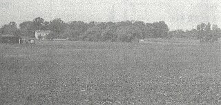
The Walker-Hooper Site (47-GL-65) is a multicomponent prehistoric site complex located on the Grand River in the Upper Fox River drainage area in Green Lake County, Wisconsin. It consisted of at least 2 village sites and several mound groups. It was excavated by S.A. Barrett under the auspices of the Milwaukee Public Museum in 1921 and again in 1967 by Guy Gibbon of the University of Wisconsin-Milwaukee. The major component of the site is an Upper Mississippian Oneota palisaded village. Other components were also present, mainly Late Woodland but also including Archaic, Early Woodland and Middle Woodland.

References

  1. 1 2 3 4 Eaglets heading back into the wild Linda Girardi, (Chicago) Sun-Times Media. Publishing instance: The Naperville Sun, October 23, 2011 P17
  2. "Eagle Habitat on Illinois River Protected". Archived from the original on 2007-07-13. Retrieved 2011-02-12.{{cite web}}: CS1 maint: bot: original URL status unknown (link)
  3. Illinois Archaeological Survey (1 January 1963). "Reports on Illinois prehistory: I." University of Illinois via Google Books.
  4. Koller, Susan Shaver (2006). LaSalle County. Arcadia Publishing. p. 33. ISBN   0738541052 . Retrieved February 21, 2019 via Google Books.
  5. Niemi, Ryan. "Starved Rock Airpark, IL". TopoQuest . Retrieved February 21, 2019.
  6. Niemi, Ryan. "Abandoned & Little-Known Airfields: Northern Illinois". TopoQuest. Retrieved February 21, 2019.
  7. http://www.illinois.gov/PressReleases/ShowPressRelease.cfm?SubjectID=1&RecNum=2875 Victory Rally to celebrate saving Plum Island from developers March 28, 2004 access date 2011-02-12
  8. ILLINOIS EPA CONTRIBUTES FUNDING TO PLUM ISLAND CLEANUP EFFORTS, Illinois Environmental Protection Agency press release, October 15, 2004
  9. 1 2 "Plum Island Eagle Sanctuary". Illinois Audubon Society. Retrieved February 21, 2019.
  10. 1 2 Eaglets Rescued at Mooseheart Released at Starved Rock, Marie Wilson, (Chicago) Daily Herald . Publishing instance: The Daily Herald, November 13, 2011
  11. 1 2 3 4 5 6 7 8 9 10 11 12 13 14 15 16 17 18 19 20 21 22 Fenner, Gloria J. (1963). Blumn, Elaine A. (ed.). The Plum Island Site, LaSalle County, Illinois. Urbana, Illinois: Illinois Archaeological Survey, Bulletin No. 4. pp. 1–105.
  12. 1 2 3 4 5 Brown, James A., ed. (1961). The Zimmerman Site: A Report on Excavations at the Grand Village of Kaskaskia. Springfield, Illinois: Illinois State Museum, Report of Investigations No. 9.
  13. DeRoo, Brian (1991). Flotation Data Sampling Strategies in Archaeobotanical Research: An Experiment at the Elam Site (20AE195), Allegan County, Michigan (Masters thesis). Kalamazoo: Western Michigan University. p. 23.
  14. Cremin, William M. (1980). "The Schwerdt Site: A Fifteenth Century Fishing Station on the Lower Kalamazoo River, Southwest Michigan". The Wisconsin Archaeologist. 61: 280–292.
  15. Cremin, William M. (1983). "Late Prehistoric Adaptive Strategies on the Northern Periphery of the Carolinian Biotic Province: A Case Study from Southwest Michigan". Midcontinental Journal of Archaeology. 8: 91–107.
  16. 1 2 3 4 Faulkner, Charles H. (1972). "The Late Prehistoric Occupation of Northwestern Indiana: A Study of the Upper Mississippi Cultures of the Kankakee Valley". Prehistory Research Series. V (1): 1–222.
  17. Blue Book of the State of Illinois 1931-1932. Chicago: Illinois Secretary of State. 1932. p. 321.
  18. 1 2 Kinietz, W. Vernon (1940). The Indians of the Western Great Lakes 1615-1760 (1991 ed.). Ann Arbor, Michigan: University of Michigan Press.
  19. 1 2 Blair, Emma Helen (1911). The Indian Tribes of the Upper Mississippi Valley and Region of the Great Lakes (1996 ed.). Lincoln, Nebraska: University of Nebraska Press.
  20. Shepard, Anna O. (1954). Ceramics for the Archaeologist. Washington, D.C.: Carnegie Institute of Washington, Publication 609.
  21. 1 2 Mason, Ronald J. (1981). Great Lakes Archaeology. New York, New York: Academic Press, Incl.
  22. 1 2 Griffin, James A. (1943). The Fort Ancient Aspect: Its Cultural and Chronological Position in Mississippi Valley Archaeology (1966 ed.). Ann Arbor, Michigan: University of Michigan Museum of Anthropology.
  23. 1 2 3 4 Brown, Margaret Kimball (1975). The Zimmerman Site: Further Excavations at the Grand Village of the Kaskaskia. Springfield, Illinois: Illinois State Museum, Report of Investigations No. 32.
  24. Bluhm, Elaine A.; Liss, Allen (1961). "Chapter IX: The Anker Site". In Bluhm, Elaine A. (ed.). Chicago Area Archaeology. Urbana, Illinois: Illinois Archaeological Survey, Bulletin No. 3.
  25. Herold, Elaine Bluhm; O'Brien, Patricia J.; Wenner, David J. Jr. (1990). Brown, James A.; O'Brien, Patricia J. (eds.). Hoxie Farm and Huber: Two Upper Mississippian Archaeological Sites in Cook County, Illinois, IN At The Edge of Prehistory: Huber Phase Archaeology in the Chicago Area. Kampsville, Illinois: Center for American Archaeology.
  26. Bettarel, Robert Louis; Smith, Hale G. (1973). The Moccasin Bluff Site and the Woodland Cultures of Southwest Michigan. Ann Arbor, Michigan: University of Michigan Museum of Anthropology, Anthropological Papers No. 49.
  27. Lepper, Bradley T. (2005). Ohio Archaeology (4th ed.). Wilmington, Ohio: Orange Frazer Press.
  28. Brown, James A. (1990). Brown, James A.; O'Brien, Patricia J. (eds.). The Oak Forest Site: Investigations into Oneota Subsistence-Settlement in the Cal-Sag Area of Cook County, Illinois, IN At the Edge of Prehistory: Huber Phase Archaeology in the Chicago Area. Kampsville, Illinois: Center for American Archaeology.
  29. Bluhm, Elaine A.; Fenner, Gloria J. (1961). The Oak Forest Site, IN Chicago Area Archaeology. University of Illinois, Urbana, Illinois: Illinois Archaeological Survey Bulletin No. 3.

Further reading

41°19′32″N88°59′49″W / 41.32544°N 88.99698°W / 41.32544; -88.99698