Raub, Indiana

Last updated

Raub, Indiana
UMC (EUB) 6534.jpg
United Methodist Church in Raub, Indiana
Map of Indiana highlighting Benton County.svg
Benton County's location in Indiana
Location map for Benton County, Indiana.svg
Red pog.svg
Raub
Raub's location in Benton County
Coordinates: 40°43′48″N87°29′30″W / 40.73000°N 87.49167°W / 40.73000; -87.49167
Country United States
State Indiana
County Benton
Township York
Area
[1]
  Total0.09 sq mi (0.22 km2)
  Land0.09 sq mi (0.22 km2)
  Water0.00 sq mi (0.00 km2)
Elevation
[2]
732 ft (223 m)
Population
 (2020)
  Total53
  Density609.20/sq mi (236.55/km2)
Time zone UTC-5 (Eastern (EST))
  Summer (DST) UTC-4 (EDT)
ZIP code
47942
Area code 219
FIPS code 18-63072 [3]
GNIS feature ID 441790

Raub is an unincorporated community in York Township, Benton County, in the U.S. state of Indiana. [4] It is part of the Lafayette, Indiana Metropolitan Statistical Area.

Contents

History

Benton County Railroad Map, circa 1896, showing the location of Raub Benton County Railroad Map, circa 1896.png
Benton County Railroad Map, circa 1896, showing the location of Raub

Raub was laid out by merchant and livestock-dealer Adams D. Raub on April 8, 1872 [5] near the railroad which had been completed through the area the previous year. Originally consisting of 71 lots, its first house was that of Ira Perkins (which predated the railroad), followed by that of A. Houser in the fall of 1871. At about the same time, Raub gained its first store, a business selling groceries and notions, and in 1873 got a general store operated by Samuel White. A hardware store, drug store, saloon, doctor's office, grain elevator, blacksmith, and various other establishments followed over the next decade.

A post office was established at Raub in 1872, and remained in operation until it was discontinued in 1967. [6]

The first organized religious service started about the same time Raub was laid out, in 1872. The first minister was a Circuit Rider named W.H. Hickman. In 1875, the group that Rev. Hickman ministered to, formed the Raub Evangelical United Brethren Church and commissioned contractor J.H. Bradshaw or Lafayette, IN to build the structure that is still in use today by the Raub United Methodist Church. The Evangelical United Brethren Church joined with the Methodist Church in 1968 and with that merger, the people of the church remained while the name changed slightly.

Geography

Raub is located at 40°43′48″N87°29′30″W / 40.73000°N 87.49167°W / 40.73000; -87.49167 in York Township, at the intersection of Indiana State Road 71 and the Kankakee, Beaverville and Southern Railroad. The site is half a mile from the border with Newton County and is surrounded by relatively flat, open farmland.

Demographics

Historical population
CensusPop.Note
1890 100
1900 1088.0%
1920 258
1960 100
2020 53
U.S. Decennial Census [7]

In 1890, Raub's population was 100. [8] The community's population was 108 in 1900. [9] In 1920, Raub's population was 258. [10]

In 1960, the population of the community was 100. [11] In 2020, the population of Raub was 53. [7]

Related Research Articles

<span class="mw-page-title-main">Benton County, Indiana</span> County in Indiana, United States

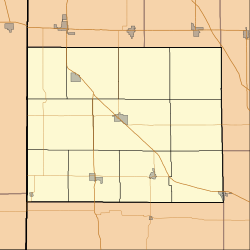
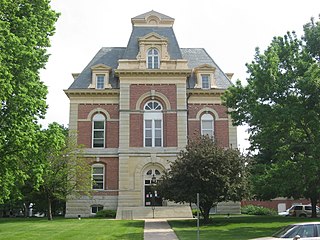
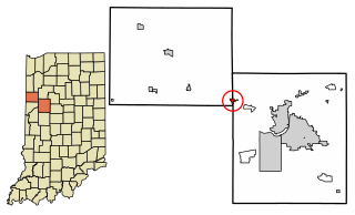
Benton County is located in the northwest part of the U.S. state of Indiana, along the border with Illinois. As of 2020, the county's population was 8,719. It contains six incorporated towns as well as several small unincorporated settlements; it is divided into 11 townships which provide local services. The county seat is Fowler.

<span class="mw-page-title-main">Ambia, Indiana</span> Town in Indiana, United States

Ambia is a town in Hickory Grove Township, Benton County, Indiana, United States. The population was 239 at the 2010 census. It is part of the Lafayette, Indiana Metropolitan Statistical Area.

<span class="mw-page-title-main">Boswell, Indiana</span> Town in Indiana, United States

Boswell is a town in Grant Township, Benton County, Indiana, United States. The population was 778 at the 2010 census. It is part of the Lafayette, Indiana Metropolitan Statistical Area.

<span class="mw-page-title-main">Earl Park, Indiana</span> Town in Indiana, United States

Earl Park is a town in Richland Township, Benton County, Indiana, United States. The population was 348 at the 2010 census. It is part of the Lafayette, Indiana Metropolitan Statistical Area.

<span class="mw-page-title-main">Otterbein, Indiana</span> Town in Indiana, United States

Otterbein is a town in Bolivar Township, Benton County and Shelby Township, Tippecanoe County, Indiana, named for William Otterbein Brown who donated land for the town. As of the 2010 census, its population was 1,262.

<span class="mw-page-title-main">Pine Village, Indiana</span> Town in Indiana, United States

Pine Village is a town in Adams Township, Warren County, in the U.S. state of Indiana. The population was 217 at the 2010 census.

<span class="mw-page-title-main">Hoagland, Indiana</span> Census-designated place in Indiana, United States

Hoagland is an unincorporated census-designated place (CDP) in Madison Township, Allen County, in the U.S. state of Indiana. As of the 2010 census, it had a population of 821.

<span class="mw-page-title-main">Templeton, Indiana</span> Unincorporated community in Indiana, United States

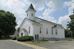
Templeton is an unincorporated community in Bolivar Township, Benton County, in the U.S. state of Indiana. It is part of the Lafayette, Indiana Metropolitan Statistical Area.

<span class="mw-page-title-main">Talbot, Indiana</span> Unincorporated community in Indiana, United States

Talbot is an unincorporated community in Hickory Grove Township, Benton County, in the U.S. state of Indiana. It is part of the Lafayette, Indiana Metropolitan Statistical Area.

<span class="mw-page-title-main">Wadena, Indiana</span> Unincorporated community in Indiana, US

Wadena is an unincorporated community in Union Township, Benton County, in the U.S. state of Indiana. It is part of the Lafayette, Indiana Metropolitan Statistical Area.

<span class="mw-page-title-main">Swanington, Indiana</span> Unincorporated community in Indiana, United States

Swanington is an unincorporated community in Center Township, Benton County, in the U.S. state of Indiana. It is part of the Lafayette, Indiana Metropolitan Statistical Area.

<span class="mw-page-title-main">Atkinson, Indiana</span> Unincorporated community in Indiana, United States

Atkinson is an unincorporated community in Center Township, Benton County, in the U.S. state of Indiana. The site of Atkinson is home to the county's only junior/senior high school, Benton Central.

<span class="mw-page-title-main">Barce, Indiana</span> Unincorporated community in Indiana, United States

Barce is an unincorporated community in Center Township, Benton County, in the U.S. state of Indiana.

Angola is an unincorporated community adjacent to the Angola Neck peninsula in Sussex County, Delaware, United States. Angola is located on an inlet of Rehoboth Bay and is near Delaware Route 24. It is a population center for the Indian River Hundred.

Redden is an unincorporated community in Sussex County, Delaware, United States. The community became an important railroad center on the Junction and Breakwater Railroad in the 1800s. The site of a historic 19th-century church and a World War II mess hall, Redden lost its post office and school in the 1930s.

Adaza is an unincorporated community in Greene County, Iowa, United States. It is located on County Road E13, three miles northwest of Churdan, at 42.194705N, -94.4969273W.

St. Joseph is an unincorporated community and census-designated place (CDP) in Riverdale Township, Kossuth County, Iowa, United States. As of the 2010 census the population was 61.

Yorkshire is an unincorporated community in Harrison County, in the U.S. state of Iowa.

Astor was an unincorporated community in Crawford County, in the U.S. state of Iowa.

Lafayette or La Fayette is an unincorporated community in Linn County, in the U.S. state of Iowa.

References

Citations

  1. "2020 U.S. Gazetteer Files". United States Census Bureau. Retrieved March 16, 2022.
  2. "US Board on Geographic Names". United States Geological Survey. October 25, 2007. Retrieved January 31, 2008.
  3. "U.S. Census website". United States Census Bureau . Retrieved January 31, 2008.
  4. "Raub, Indiana". Geographic Names Information System . United States Geological Survey . Retrieved February 29, 2020.
  5. Baker, Ronald L. (October 1995). From Needmore to Prosperity: Hoosier Place Names in Folklore and History . Indiana University Press. p.  276. ISBN   978-0-253-32866-3. ...laid out on April 8, 1872 by A. D. Raub...
  6. "Benton County". Jim Forte Postal History. Retrieved August 26, 2014.
  7. 1 2 "Census of Population and Housing". Census.gov. Retrieved June 4, 2016.
  8. Cram, George Franklin (1890). Cram's Universal Atlas: Geographical, Astronomical and Historical, Containing a Complete Series of Maps of Modern Geography, Illustrated by Numerous Views and Charts; the Whole Supplemented with Valuable Statistics, Diagrams, and a Complete Gazetteer of the United States. G.F. Cram. p. 366.
  9. Cram's Modern Atlas: The New Unrivaled. J. R. Gray & Company. 1902. p. 138.
  10. Premier Atlas of the World: Containing Maps of All Countries of the World, with the Most Recent Boundary Decisions, and Maps of All the States,territories, and Possessions of the United States with Population Figures from the Latest Official Census Reports, Also Data of Interest Concerning International and Domestic Political Questions. Rand McNally & Company. 1925. p. 186.
  11. World Book Encyclopedia. Vol. I. Field Enterprises Corporation. 1960. p. 153.

Sources