Rutland, Ohio

Last updated

Rutland, Ohio
Salem Street, Rutland.jpg
OHMap-doton-Rutland.png
Location of Rutland, Ohio
Map of Meigs County Ohio Highlighting Rutland Village.png
Location of Rutland in Meigs County
Coordinates: 39°02′26″N82°07′32″W / 39.04056°N 82.12556°W / 39.04056; -82.12556
Country United States
State Ohio
County Meigs
Township Rutland
Incorporated1913
Government
  Type Mayor council government
Area
[1]
  Total0.87 sq mi (2.26 km2)
  Land0.87 sq mi (2.26 km2)
  Water0.00 sq mi (0.00 km2)
Elevation
[2]
591 ft (180 m)
Population
 (2020)
  Total427
  Density488.56/sq mi (188.55/km2)
Time zone UTC-5 (Eastern (EST))
  Summer (DST) UTC-4 (EDT)
ZIP code
45775
Area code 740
FIPS code 39-69358 [3]
GNIS feature ID2399150 [2]
Website www.villageofrutland.org

Rutland is a village in Meigs County, Ohio, United States. The population was 427 at the 2020 census.

Contents

Geography

The village lies in the Appalachian Plateau physiographic region. It is situated in a wide valley along Little Leading Creek.

The surrounding hills, once containing profitable amounts of bituminous coal, have been subjected to strip mining throughout the early and mid 1900s. Currently, there are no mining operations in the area. Acid mine drainage has been found seeping out some of the abandoned mines and has negatively impacted water quality in the Little Leading Creek watershed.[ citation needed ]

According to the United States Census Bureau, the village has a total area of 0.83 square miles (2.15 km2), all land. [4]

Demographics

Historical population
CensusPop.Note
1880 139
1920 500
1930 57014.0%
1940 562−1.4%
1950 554−1.4%
1960 68724.0%
1970 663−3.5%
1980 635−4.2%
1990 469−26.1%
2000 401−14.5%
2010 393−2.0%
2020 4278.7%
U.S. Decennial Census [5]

2010 census

As of the census [6] of 2010, there were 393 people, 161 households, and 115 families living in the village. The population density was 473.5 inhabitants per square mile (182.8/km2). There were 189 housing units at an average density of 227.7 units per square mile (87.9 units/km2). The racial makeup of the village was 98.7% White, 0.3% from other races, and 1.0% from two or more races. Hispanic or Latino of any race were 1.0% of the population.

There were 161 households, of which 34.8% had children under the age of 18 living with them, 52.2% were married couples living together, 11.2% had a female householder with no husband present, 8.1% had a male householder with no wife present, and 28.6% were non-families. 26.1% of all households were made up of individuals, and 9.4% had someone living alone who was 65 years of age or older. The average household size was 2.44 and the average family size was 2.85.

The median age in the village was 39.3 years. 23.4% of residents were under the age of 18; 8.2% were between the ages of 18 and 24; 26.1% were from 25 to 44; 25.5% were from 45 to 64; and 17% were 65 years of age or older. The gender makeup of the village was 48.9% male and 51.1% female.

2000 census

As of the census [3] of 2000, there were 401 people, 163 households, and 109 families living in the village. The population density was 488.3 inhabitants per square mile (188.5/km2). There were 175 housing units at an average density of 213.1 units per square mile (82.3 units/km2). The racial makeup of the village was 99.50% White, and 0.50% from two or more races. Hispanic or Latino of any race were 0.25% of the population.

There were 163 households, out of which 30.7% had children under the age of 18 living with them, 53.4% were married couples living together, 10.4% had a female householder with no husband present, and 33.1% were non-families. 30.7% of all households were made up of individuals, and 17.2% had someone living alone who was 65 years of age or older. The average household size was 2.46 and the average family size was 3.05.

In the village, the population was spread out, with 24.7% under the age of 18, 9.7% from 18 to 24, 26.4% from 25 to 44, 21.9% from 45 to 64, and 17.2% who were 65 years of age or older. The median age was 37 years. For every 100 females there were 85.6 males. For every 100 females age 18 and over, there were 78.7 males.

The median income for a household in the village was $27,500, and the median income for a family was $32,917. Males had a median income of $30,500 versus $11,375 for females. The per capita income for the village was $13,558. About 10.3% of families and 11.9% of the population were below the poverty line, including 10.8% of those under age 18 and 14.1% of those age 65 or over.

Education

Public education in the village of Rutland is provided by the Meigs Local School District. Campuses serving the village include Meigs Primary School (Grades K-2), Meigs Intermediate School (Grades 3–5), Meigs Middle School (Grades 6–8), and Meigs High School (Grades 9–12). More importantly, Rutland High School was the home of the Rutland Red Devils prior to consolidation. The football team was known as the "Yanks of Football".

Government

Citizens in the village of Rutland quadrennially elect a mayor and a six-member Village Council, with staggered terms. The Mayor serves as the chief executive officer of the municipality, oversees its daily operations and services and enforces the by-laws and ordinances of the municipality. In addition, the Mayor presides over meetings of the Village Council as well as Mayor's Court.

The Village Council acts as the legislative authority of the municipality and is responsible for considering for approval the annual municipal budget, the appointment and removal of village officers and employees and contractual agreements; conducts oversight on the expenditure of public funds and passes legislation, such as ordinances and resolutions.

Notable people

Related Research Articles

<span class="mw-page-title-main">Meigs County, Ohio</span> County in Ohio, United States

Meigs County is a county located in the U.S. state of Ohio. As of the 2020 census, the population was 22,210. Its county seat is Pomeroy. The county is named for Return J. Meigs Jr., the fourth Governor of Ohio.

<span class="mw-page-title-main">Rutland, Illinois</span> Village in Illinois, United States

Rutland is a village in LaSalle County, Illinois, United States. It is part of the Ottawa Micropolitan Statistical Area. As of the 2020 census, the population was 259, down from 318 at the 2010 census.

<span class="mw-page-title-main">Rutland, Iowa</span> City in Iowa, United States

Rutland is a city in Humboldt County, Iowa, United States. The population was 113 at the time of the 2020 census.

Rutland Township is a township in Martin County, Minnesota, United States. The population was 472 at the 2000 census.

Rutland is a town in Jefferson County, New York, United States. The population was 3,038 at the 2020 census.

<span class="mw-page-title-main">Rutland, North Dakota</span> City in North Dakota, United States

Rutland is a city in Sargent County, North Dakota, United States. The population was 163 at the 2020 census. Rutland was founded in 1887.

<span class="mw-page-title-main">Coolville, Ohio</span> Village in Ohio, United States

Coolville is a village located in Troy Township, Athens County, Ohio, United States, in the southeast area of the state. The population was 452 at the 2020 census.

<span class="mw-page-title-main">Middleport, Ohio</span> Village in Ohio, United States

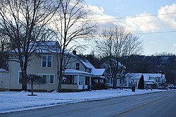
Middleport is the largest village in Meigs County, Ohio, along the Ohio River. The population was 2,208 at the time of the 2020 census.

<span class="mw-page-title-main">Racine, Ohio</span> Village in Ohio, United States

Racine is a village in Meigs County, Ohio, United States, along the Ohio River. The population was 683 at the 2020 census.

<span class="mw-page-title-main">Syracuse, Ohio</span> Village in Ohio, United States

Syracuse is a village in Meigs County, Ohio, United States, along the Ohio River. The population was 781 at the 2020 census.

<span class="mw-page-title-main">Rutland Township, Pennsylvania</span> Township in Pennsylvania, United States

Rutland Township is a township in Tioga County, Pennsylvania, United States. The population was 776 at the 2020 census.

<span class="mw-page-title-main">Sullivan Township, Pennsylvania</span> Township in Pennsylvania, United States

Sullivan Township is a township in Tioga County, Pennsylvania, United States. The population was 1,470 at the 2020 census.

<span class="mw-page-title-main">Mount Tabor, Vermont</span> Town in Vermont, United States

Mount Tabor is a town in Rutland County, Vermont, United States. The population was 210 at the 2020 census.

<span class="mw-page-title-main">Sudbury, Vermont</span> Town in Vermont, United States

Sudbury is a town in Rutland County, Vermont, United States. The population was 545 at the 2020 census.

<span class="mw-page-title-main">West Haven, Vermont</span> Town in Vermont, United States

West Haven is a town in Rutland County, Vermont, United States. The population was 239 at the 2020 census.

<span class="mw-page-title-main">Rutland, Wisconsin</span> Town in Wisconsin, United States

Rutland is a town in Dane County, Wisconsin, United States. The population was 1,977 by the US Census Bureau 2020 census The population was 1,887 at the 2000 census. However, for 2021, the Wisconsin Dept. of Administration declared the population of the Town to be 2,032. The unincorporated communities of Rutland and Stone are located in the town.

<span class="mw-page-title-main">Kekoskee, Wisconsin</span> Village in Wisconsin, United States

Kekoskee is a village in Dodge County, Wisconsin, United States. The population was 161 at the 2010 census.

<span class="mw-page-title-main">Wilson, Ohio</span> Village in Ohio, United States

Wilson is a village in Belmont and Monroe counties in the U.S. state of Ohio. The population was 129 at the 2020 census. It is part of the Wheeling metropolitan area.

<span class="mw-page-title-main">Verona, Ohio</span> Village in Ohio, United States

Verona is a village in Montgomery and Preble counties in the U.S. state of Ohio. The population was 403 at the 2020 census. It is part of the Dayton Metropolitan Statistical Area.

<span class="mw-page-title-main">Lowell, Wisconsin</span> Village in Wisconsin, United States

Lowell is a village in Dodge County, Wisconsin, United States, along the Beaver Dam River. The population was 340 at the 2010 census. The village is located within the Town of Lowell.

References

  1. "ArcGIS REST Services Directory". United States Census Bureau. Retrieved September 20, 2022.
  2. 1 2 U.S. Geological Survey Geographic Names Information System: Rutland, Ohio
  3. 1 2 "U.S. Census website". United States Census Bureau. Archived from the original on December 27, 1996. Retrieved January 31, 2008.
  4. "US Gazetteer files 2010". United States Census Bureau. Archived from the original on February 20, 2011. Retrieved January 6, 2013.
  5. "Census of Population and Housing". Census.gov. Archived from the original on April 26, 2015. Retrieved June 4, 2015.
  6. "U.S. Census website". United States Census Bureau. Archived from the original on December 27, 1996. Retrieved January 6, 2013.