Interstate 12 (I-12) is an Interstate Highway located entirely within the U.S. state of Louisiana. It spans a total of 86.65 miles (139.45 km) in an east–west direction from I-10 in Baton Rouge to an interchange with both I-10 and I-59 in Slidell. Along the way, it passes through the city of Hammond, where it intersects I-55 and US 51. It also serves the smaller cities of Denham Springs and Ponchatoula, as well as the St. Tammany Parish cities of Covington and Mandeville. Skirting the northern shore of Lake Pontchartrain, I-12 serves as a northern bypass of the New Orleans metropolitan area and as an alternate route for I-10, which serves the city of New Orleans itself.
Gonzales is a small city in Ascension Parish, Louisiana, United States. As of the 2010 census, it had a population of 9,781. Known as the "Jambalaya Capital of the World", it is famous for its annual Jambalaya Festival, which was first held in 1968. Stephen "Steve" F. Juneau came up with the idea for the Jambalaya Festival and served as the first president of the Jambalaya Festival Association.
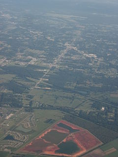
Denham Springs is a city in Livingston Parish, Louisiana, United States. The 2010 census placed the population at 10,215, up from 8,757 at the 2000 census. The city is the largest area of commercial and residential development in Livingston Parish. Denham Springs and Walker are the only parish municipalities classified as cities.

Stafford is a city in the U.S. state of Texas, within the Houston–The Woodlands–Sugar Land metropolitan area. The city is mostly in Fort Bend County, with a small portion in Harris County. As of the 2010 census, Stafford's population was 17,693, up from 15,681 at the 2000 census. As of 2018, the population had risen to an estimated 21,265.

Ballston is a neighborhood in Arlington County, Virginia and is home to the Ballston-MU station on the Orange Line and the Silver Line of the metro system. Located at the western end of the Rosslyn-Ballston corridor, Ballston is a major transportation hub and boasts one of the nation’s highest concentrations of scientific research agencies, including the Office of Naval Research, the Virginia Tech Advanced Research Institute and the Air Force Office of Scientific Research.

Rootstown Township is one of the eighteen townships of Portage County, Ohio, United States. The 2000 census found 7,212 people in the township.

Moyers is a small unincorporated community located in Pushmataha County, Oklahoma, United States.

Louisiana Highway 12 (LA 12) is a state highway located in southwestern Louisiana. It runs 34.64 miles (55.75 km) in an east–west direction from the Texas state line west of Starks to a junction with U.S. Highway 171 (US 171) and U.S. Highway 190 (US 190) in Ragley.

Louisiana Highway 22 (LA 22) is a state highway located in southeastern Louisiana. It runs 71.15 miles (114.50 km) in a general east–west direction from the junction of LA 75 and LA 942 in Darrow to U.S. Highway 190 (US 190) in Mandeville.

Clyattville is an unincorporated community in Lowndes County, Georgia, United States. It was established in the 1840s.
Holden is an unincorporated community located on U.S. Highway 190 between Albany and Livingston in Livingston Parish, Louisiana, United States. Holden is in a section of land awarded to Micajah Spillars by a Spanish land grant. LA Hwy 441 which runs through Holden in a northwest-southeast direction is the road that connected Springfield with Baton Rouge to the west and points in Mississippi to the east. In 1907, the east-west line of the Baton Rouge, Hammond & Eastern Railroad was constructed.
Baden is a neighborhood of St. Louis, Missouri.
Newton Township is one of sixteen townships in Buchanan County, Iowa, USA. As of the 2000 census, its population was 423.
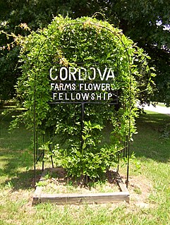
Cordova is a community in Shelby County, Tennessee, United States. Cordova lies east of Memphis, north of Germantown, south of Bartlett, and northwest of Collierville at an elevation of 361 feet.

Edwards is an unincorporated community in Peoria County, Illinois, United States. Edwards is located on Illinois Route 8 northwest of downtown Peoria. Edwards has a post office with ZIP Code 61528; the Post Office is now located on Dubois Road just south of Interstate 74 exit 82, 2.1 miles (3.4 km) north of the original Edwards.

Blackstone is an unincorporated community in section 7 of Sunbury Township, Livingston County, Illinois, United States. Blackstone is 10 miles (16 km) southeast of Streator and 13 miles (21 km) west of Dwight, Illinois. Blackstone has a post office with ZIP code 61313. It is part of the geographic region known as Streatorland.
Org is an unincorporated community in Nobles County, Minnesota, United States.

Saint Wendel is an unincorporated community located on the Vanderburgh-Posey county line in the U.S. state of Indiana. It occupies small portions of two townships-- Armstrong and Robinson. The community is named for St. Wendel Parish, which in turn is named after Wendelin of Trier, patron saint of Wendel Wassmer, who originally owned the grounds used for this Catholic church building.


