
Livingston Parish is a parish located in the U.S. state of Louisiana. Livingston Parish is known as one of the six Florida Parishes, a region of the State of Louisiana that was bought from Spanish Florida and created the state of Louisiana as it is known today.

Springfield is a town in Livingston Parish, Louisiana, United States. The population was 487 at the 2010 census. It is part of the Baton Rouge Metropolitan Statistical Area.
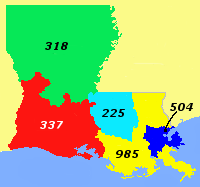
225 is the North American telephone area code for part of southern Louisiana, including the entire nine-parish Baton Rouge Metropolitan Area. The area code was Louisiana's third area code, and the first new area code in the state in forty-one years. Area code 225 split from area code 504 during 1998/99. On a standard telephone keypad, the numbers 2-2-5 correspond to the letters C-A-J; a nod to the area's Cajun heritage.

The Amite River is a tributary of Lake Maurepas in Mississippi and Louisiana in the United States. It is about 117 miles (188 km) long. It starts as two forks in southwestern Mississippi and flows south through Louisiana, passing Greater Baton Rouge, to Lake Maurepas. The lower 37 miles (59.5 km) of the river is navigable. A portion of the river is diverted via the Petite Amite River and Amite Diversion Canal to the Blind River, which also flows to Lake Maurepas.
Maurepas is an unincorporated community in the south/southwestern area of Livingston Parish, Louisiana, United States. Louisiana Highway 22 passes through the community and Whitehall lies two miles to the east. Lake Maurepas is six miles to the east and the Amite River lies approximately one half mile to the north.

Whitehall is an unincorporated community located in Livingston Parish, Louisiana, United States. The community is on Louisiana Highway 22 and Maurepas lies approximately two miles to the northeast. The Amite River flows past the northwest side of the community.
Clio is an unincorporated community in Livingston Parish, Louisiana, United States. The community is located 3 miles southwest of Killian and 3 miles east of Maurepas on the east bank of Amite River. Clio is only a few feet above sea level and almost completely surrounded by swamps with a small entrance from the northwest side.
Corbin is an unincorporated community in Livingston Parish, Louisiana, United States. The community is located 6 miles east of Denham Springs and 6 miles west of Livingston.
Coteau Bourgeois is an unincorporated community in Livingston Parish, Louisiana, United States. The community is located 5 miles southeast of French Settlement and 8 miles west of Sorrento. The site is on Louisiana Highway 22 and is one mile south of Head of Island on the Amite River.

Doyle is an unincorporated community in Livingston Parish, Louisiana, United States. The community is located less than 2 miles east of Livingston and 4 miles west of Holden less than a mile east from the Doyle High School.
Georgeville is an unincorporated community in Livingston Parish, Louisiana, United States. The community is located 8 miles southwest of Livingston and 2 miles southeast of Montpelier on Louisiana Highway 43.
Head of Island is an unincorporated community in Livingston Parish, Louisiana, United States. The community is located on Louisiana Highway 22, 5 miles west of Maurepas and 5 miles southeast of French Settlement south of the Amite River.
Horse Bluff Landing is an unincorporated community in Livingston Parish, Louisiana, United States. The community is located less than 3 miles west of Killian and 5 miles northeast of Maurepas on the bank of Tickfaw River. The Tickfaw State Park is located 1 mile to the northwest across the Tickfaw River.
Oldfield is an unincorporated community in Livingston Parish, Louisiana, United States. The community is located 9 miles north of Walker and 4 miles southeast of Baywood.
Poley, also known as Poley Bayou, is an unincorporated community in Livingston Parish, Louisiana, United States. The community is located 2 miles northwest of French Settlement and 2 miles east of Port Vincent.
Starns also known as Starns Mill is an unincorporated community in Livingston Parish, Louisiana, United States. The community is located 6 miles northwest of Albany and 4 miles north of Holden.
Magnolia, also known as Otts Mill, is an unincorporated community in Livingston Parish, Louisiana, United States. The community is located 5 miles northwest of Livingston and 2 miles west of Starns on Louisiana Highway 442 at the intersection with Louisiana Highway 1036.
Van Buren is an unincorporated community in Livingston Parish, Louisiana, United States. The community is located less than 4 miles south of Holden and 6 miles southeast of Livingston near the Tickfaw River.
Verdun is an unincorporated community in Livingston Parish, Louisiana, United States. The community is located less than 4 miles east of French Settlement and 5 miles northwest of Maurepas. Also, Verdun is the true hometown of the 2019 American Idol Winner Laine Hardy.


