Related Research Articles
Howard Township is one of twenty-four townships in Bates County, Missouri, and is part of the Kansas City metropolitan area within the USA. As of the 2000 census, its population was 552.

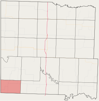
Papinville is an unincorporated community in southern Bates County, Missouri.
Altona is an unincorporated community in northern Bates County, in the U.S. state of Missouri. The community is on Missouri Route Z just north of Missouri route 18 and approximately 5.5 miles east of Adrian.
Burdett is an unincorporated community in northwest Bates County, in the U.S. state of Missouri. The community is on Missouri Route FF approximately seven miles west northwest of Adrian.
Coleville is an extinct town in Bates County, in the U.S. state of Missouri. The GNIS classifies it as a populated place.
Crescent Hill is an unincorporated community in Bates County, in the U.S. state of Missouri.
Johnstown is an unincorporated community in northeast Bates County, in the U.S. state of Missouri. The community is on Missouri Route D one half mile west of the Bates-Henry county line. Butler lies 13 miles to the west-southwest. North Deepwater Creek flows past the southwest side of the community.
Hudson is an unincorporated community in eastern Bates County, in the U.S. state of Missouri. The community is on a county road just north of Missouri Route 52. The southwest corner of Henry County is one mile to the northeast of the community. Butler is approximately 13 miles to the west-northwest.
Mayesburg is an unincorporated community in Bates County, in the U.S. state of Missouri.
New Home is an unincorporated community in Bates County, in the U.S. state of Missouri.
Nyhart is an unincorporated community in Bates County, in the U.S. state of Missouri.
Peru is an extinct town in Bates County, in the U.S. state of Missouri.
Spruce is an unincorporated community in northeast Bates County, in the U.S. state of Missouri. The community is on Missouri Route H approximately ten miles east of Butler. The headwaters of South Deepwater Creek flow past the south side of the community.
Vinton is an extinct town in Bates County, in the U.S. state of Missouri.
Virginia is an unincorporated community in Bates County, in the U.S. state of Missouri.
Worland is an unincorporated community in western Bates County, in the U.S. state of Missouri. The community is on Missouri Route U one mile from the Missouri-Kansas border. Butler is 14 miles to the northeast.
Palmetto is an unincorporated community in southeastern Greene County, in the U.S. state of Missouri. The community lies at an elevation of 1437 feet and is located near the headwaters of Turner Creek on the BNSF Railway, approximately two miles northwest of Rogersville. Henderson in western Webster County lies approximately 1.5 miles to the east along Missouri Route D.
Chapel Hill is an unincorporated community in southwest Lafayette County, in the U.S. state of Missouri. The community is on Missouri Route Z approximately six miles south of Bates City.
Wishart is an unincorporated community in Polk County, in the U.S. state of Missouri.
Panama is an unincorporated community in northern Vernon County, in the U.S. state of Missouri. The community is on Missouri Route TT adjacent to the east side of US Route 71. The Vernon-Bates county line is one half mile north. Rich Hill is 3.5 miles north and Nevada is 13 miles south. The Four Rivers Conservation Area on the Little Osage River is two miles south.
References
- ↑ U.S. Geological Survey Geographic Names Information System: Sprague, Missouri
- ↑ Missouri Atlas & Gazetteer, DeLorme, 1st ed. 1998, p. 42 ISBN 0899332242
- ↑ "Post Offices". Jim Forte Postal History. Retrieved 1 September 2016.
- ↑ "Bates County Place Names, 1928-1945 (archived)". The State Historical Society of Missouri. Archived from the original on 24 June 2016. Retrieved 1 September 2016.
{{cite web}}: CS1 maint: bot: original URL status unknown (link)
Municipalities and communities of Bates County, Missouri, United States | ||
|---|---|---|
| Cities |  | |
| Villages | ||
| Townships | ||
| Unincorporated communities | ||
| Ghost towns | ||
| Footnotes | ‡This populated place also has portions in an adjacent county or counties | |
Coordinates: 38°05′44″N94°27′35″W / 38.09556°N 94.45972°W
| | This Bates County, Missouri state location article is a stub. You can help Wikipedia by expanding it. |