Springfield, Oregon

Last updated

Springfield
City
Eugene and Springfield from Mount Pisgah.JPG
Springfield as seen from Mount Pisgah, looking north, with some of Eugene in the west
Motto(s): 
"Proud History, Bright Future."
Lane County Oregon Incorporated and Unincorporated areas Springfield Highlighted.svg
Location in Oregon
Usa edcp location map.svg
Red pog.svg
Springfield
Location in the United States
Coordinates: 44°03′15″N123°01′19″W / 44.05417°N 123.02194°W / 44.05417; -123.02194
CountryUnited States
State Oregon
County Lane
Incorporated 1885
Government
  Type Council–manager
  MayorSean VanGordon [1] [2]
   City manager Nancy Newton [3]
Area
[4]
  Total15.87 sq mi (41.10 km2)
  Land15.87 sq mi (41.10 km2)
  Water0.00 sq mi (0.00 km2)
Elevation
[5]
476 ft (145 m)
Population
 (2020) [6]
  Total61,851
  Density3,897.84/sq mi (1,504.99/km2)
Time zone UTC-8 (Pacific)
  Summer (DST) UTC-7 (Pacific)
ZIP codes
97475, 97477, 97478, 97482
Area code(s) 458 and 541
FIPS code 41-69600 [7]
GNIS feature ID2411961 [5]
Website City of Springfield
The historic Southern Pacific depot in Springfield SpringfDepot.JPG
The historic Southern Pacific depot in Springfield

Springfield is a city in Lane County, Oregon, United States. Located in the Southern Willamette Valley, it is within the Eugene-Springfield Metropolitan Statistical Area. Separated from Eugene to the west, mainly by Interstate 5, Springfield is the second-most populous city in the metropolitan area after Eugene. As of the 2020 census, the city has a total population of 61,851, making it the 9th most populous city in Oregon.

Contents

The Briggs family first settled the Springfield area, arriving in 1848. The community was incorporated as a city in 1885. The city was named after a natural spring located in a field or prairie within the current city boundaries. [8] For the majority of the 20th century, the economy of Springfield was largely dependent on the Oregon timber industry; since the 1990s, however, the economy has diversified, with PeaceHealth now the largest employer in the city. Public education in the city is provided by the Springfield School District.

History

The first inhabitants to the area were the Kalapuya people. Also sometimes written as Calapooia or Calapooya, the people maintained the valley and their main food sources by controlled burning. [9]

Springfield was colonized when Elias and Mary Briggs and their family arrived in 1848. They were among the first party to travel to the region via the "Southern Route" by Klamath Lake, over the Cascades, into the Rogue Valley, then north to the Willamette Valley. [10] Elias Briggs along with William Stevens ran a ferry on the nearby Willamette River.

According to donation land claim records, Stevens was the first settler to stake a claim in the Springfield locale, arriving in October 1847. He commenced building a house with his three oldest sons, and when the house was completed in December, the rest of his family joined him on Christmas Day that year.

Another early arrival in the Springfield vicinity was Captain Felix Scott, Sr. who settled between the McKenzie and Willamette rivers in 1847.

In 1854 Springfield School District No. 19 was formed. A small schoolhouse was built near the corner of south 7th and B streets; it served the community until the 1880s. Miss Agnes Stewart, a young woman from Pennsylvania, was the first teacher. She had arrived in Springfield via the Lost Wagon Train of 1853.

In May 1992 the municipality became the first in the United States to include anti-gay legislation in its city charter after a campaign by the Oregon Citizens Alliance. [11] However, the state legislature later passed a law that prevented anti-gay ordinances from being enforced. [12]

Economy

For years, the economy of Springfield hinged on the timber industry, with the largest employer being Weyerhaeuser Company. Weyerhaeuser opened its Springfield complex in 1949, and after years of aggressive logging was forced to downsize as old growth lumber became less available. In the 1990s, the Weyerhaeuser sawmill and veneer (plywood) plants closed, and the paper plant was downsized. Springfield has now developed a more diversified economy.

Ken Kesey's brother Chuck, and Chuck's wife Sue, started the Springfield Creamery in 1960. The business survives today based partly on sales of their flagship product, Nancy's Yogurt, developed from recipes of Nancy Hamren. In the 1970s, the creamery avoided bankruptcy with the help of the rock band Grateful Dead, who over time held a series of 10 benefit concerts on behalf of the creamery. The documentary film Sunshine Daydream was shot at the first performance August 27, 1972. [13] [14]

The city of Springfield is surrounded by filbert (hazelnut) orchards. The production has declined over time as fields have been developed into housing. The city used to be sponsor an annual Filbert Festival in early August as a general summer celebration, featuring music, food, and family fun; it was canceled in 2007 due to withdrawal of a key sponsor, and the future for the festival is uncertain. Filbert harvesting occurs in October. 98% of American filbert production is harvested in the Willamette Valley. [15]

Healthcare

Springfield is home to two hospitals, McKenzie-Willamette Medical Center and PeaceHealth's Sacred Heart Medical Center at RiverBend.

Largest employers

According to the City's 2018 Comprehensive Annual Financial Report, [16] the largest employers in the city are:

RankEmployer# of Employees
1 PeaceHealth 3,500
2 Springfield School District 1,380
3"Top 3 Technology employers"1,200
4 McKenzie-Willamette Medical Center 940
5"Top 3 Wood product employers"780
6"Top 3 Food and beverage employers"410
7City of Springfield400
8 Willamalane Park and Recreation District 360
9State Government310
10Federal Government207

Government

Springfield City Hall steps City Hall Steps (Springfield, Oregon).jpg
Springfield City Hall steps

Springfield has a council–manager form of government. The current mayor of Springfield is Sean VanGordon, [1] and the city manager is Nancy Newton. [17] The city council comprises members from six wards. The current council members are: [18]

Public safety

The Springfield Police Department and Eugene Springfield Fire are the city's public safety agencies. [20] [21] The Springfield police department is currently under investigation due to allegations of sexual misconduct made by a female former officer. [22] [23] [24]

Geography

According to the United States Census Bureau, the city has a total area of 15.75 sq mi (40.79 km2), of which, 15.74 sq mi (40.77 km2) is land and 0.01 sq mi (0.03 km2) is water. [25]

The McKenzie River forms the northern city limits.

Neighborhoods

Springfield does not have any official neighborhood designations. Unofficial neighborhood areas include:

Demographics

Historical population
CensusPop.Note
1860 198
1870 2001.0%
1880 160−20.0%
1890 371131.9%
1900 353−4.9%
1910 1,838420.7%
1920 1,8550.9%
1930 2,36427.4%
1940 3,80561.0%
1950 10,807184.0%
1960 19,61681.5%
1970 27,04737.9%
1980 41,62453.9%
1990 44,6837.3%
2000 52,86418.3%
2010 59,40312.4%
2020 61,8514.1%
Source: [26] [27]
U.S. Decennial Census [28]
2018 Estimate [29]
[6]

2010 census

As of the census [30] of 2010, there were 59,403 people, 23,665 households, and 14,737 families residing in the city. The population density was 3,774.0/sq mi (1,457.1/km2). There were 24,809 housing units at an average density of 1,576.2/sq mi (608.6/km2). The racial makeup of the city was 85.9% White, 1.1% African American, 1.4% Native American, 1.3% Asian, 0.3% Pacific Islander, 5.2% from other races, and 4.8% from two or more races. Hispanic or Latino of any race were 12.1% of the population.

There were 23,665 households, of which 33.2% had children under the age of 18 living with them, 40.9% were married couples living together, 15.2% had a female householder with no husband present, 6.2% had a male householder with no wife present, and 37.7% were non-families. 27.9% of all households were made up of individuals, and 9.2% had someone living alone who was 65 years of age or older. The average household size was 2.49 and the average family size was 3.00.

The median age in the city was 34.5 years. 24.3% of residents were under the age of 18; 10.1% were between the ages of 18 and 24; 29% were from 25 to 44; 25% were from 45 to 64; and 11.6% were 65 years of age or older. The gender makeup of the city was 49.0% male and 51.0% female.

Arts and culture

Author Ken Kesey moved to Springfield when he was young and graduated from Springfield High School before moving on to the nearby University of Oregon. After some years of wandering (described in The Electric Kool-Aid Acid Test by Tom Wolfe), Kesey bought a farm in nearby Pleasant Hill and remained a prominent local celebrity until his death in 2001.

Library

The Springfield Public Library is located within city hall. [31] The city hall itself is home to a seal of the city of Springfield, created out of unusual items from the city's sewer system. [32] [33] The seal and its creator, Russell Ziolkowski, were featured on The Tonight Show and On the Road with Charles Kuralt. [32]

Cultural venues

Richard E. Wildish Community Theater (Wildish Community Theater) on Main Street in downtown Springfield is a complete renovation of the historic McKenzie Theater and opened in December 2006. [34] The theater seats 284 people and is designed to host music concerts and recitals, dance, drama, festivals, and small musicals. [35] The Springfield Renaissance Development Corporation spearheaded the six-year renovation project, completed for $3.1  million. [36]

Una Nation of Mixed-Bloods

On March 7, 2016, Springfield formally recognized the Una Nation of Mixed-Bloods for their service to mixed-blood Native Americans. [37]

Education

Most of Springfield is in the Springfield School District, while some portions in the west are in the Eugene School District 4J. [38]

There are 15 elementary schools, four middle schools, and four high schools in the Springfield School District, making it one of the largest in the state. [39] [40] The largest public high schools, by enrollment, are Thurston High School and Springfield High School.

Lane County is in the Lane Community College district. [41]

Pioneer Pacific College also has a campus in the Gateway area of Springfield. [42]

The Simpsons

The city took third in the voting to choose one of the sixteen possible Springfields in the U.S. to host the premiere of The Simpsons Movie. [43] The show's creator, Oregon resident Matt Groening, sent a plaque to the city of Springfield that stated, in part "Yo to Springfield, Oregon – the real Springfield." [44] In April 2012, Groening confirmed to Smithsonian magazine that he named the fictional Springfield after Springfield, Oregon. He also confirmed that he intentionally left it a secret to allow people the enjoyment of assuming it was based on their own Springfield. [45]

Notable people

Climate

This region experiences hot and dry summers, with no average monthly temperatures above 71.6 °F (22.0 °C). According to the Köppen Climate Classification system, Springfield has a warm-summer Mediterranean climate, abbreviated "Csb" on climate maps. [46]

See also

Related Research Articles

<span class="mw-page-title-main">Eugene, Oregon</span> City in Oregon, United States

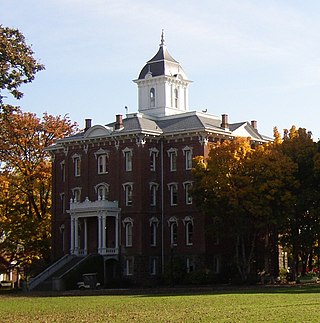
Eugene is a city in and the county seat of Lane County, Oregon, United States. It is located at the southern end of the Willamette Valley, near the confluence of the McKenzie and Willamette rivers, about 50 miles (80 km) east of the Oregon Coast.

<span class="mw-page-title-main">Portland, Oregon</span> Largest city in Oregon, United States

Portland is a port city in the Pacific Northwest and the most populous city in the U.S. state of Oregon. Situated in the northwestern area of the state at the confluence of the Willamette and Columbia rivers, it is the county seat of Multnomah County, Oregon's most populous county. As of 2020, Portland's population was 652,503, making it the 26th-most populous city in the United States, the sixth-most populous on the West Coast, and the second-most populous in the Pacific Northwest, after Seattle. Approximately 2.5 million people live in the Portland–Vancouver–Hillsboro, OR–WA metropolitan statistical area, making it the 25th most populous in the United States. About half of Oregon's population resides within the Portland metropolitan area.

<span class="mw-page-title-main">Salem, Oregon</span> Capital city of Oregon, United States

Salem is the capital city of the U.S. state of Oregon, and the county seat of Marion County. It is located in the center of the Willamette Valley alongside the Willamette River, which runs north through the city. The river forms the boundary between Marion and Polk counties, and the city neighborhood of West Salem is in Polk County. Salem was founded in 1842, became the capital of the Oregon Territory in 1851, and was incorporated in 1857.

<span class="mw-page-title-main">Marion County, Oregon</span> County in Oregon, United States

Marion County is one of the 36 counties in the U.S. state of Oregon. The population was 345,920 at the 2020 census, making it the 5th most populous county in Oregon. The county seat is Salem, which is also the state capital of Oregon. The county was originally named the Champooick District, after Champoeg, a meeting place on the Willamette River. On September 3, 1849, the territorial legislature renamed it in honor of Francis Marion, a Continental Army general from South Carolina who served in the American Revolutionary War.

<span class="mw-page-title-main">Lane County, Oregon</span> County in Oregon, United States

Lane County is one of the 36 counties in the U.S. state of Oregon. As of the 2020 census, the population was 382,971, making it the fourth-most populous county in Oregon. The county seat is Eugene, the state's second most populous city. It is named in honor of Joseph Lane, Oregon's first territorial governor.

<span class="mw-page-title-main">Cottage Grove, Oregon</span> City in Oregon, United States

Cottage Grove is a city in Lane County, Oregon, United States. Its population was 10,643 at the 2020 census. It is the third largest city in Lane County. It is on Interstate 5, Oregon Route 99, and the main Willamette Valley line of the CORP railroad.

<span class="mw-page-title-main">Junction City, Oregon</span> City in Oregon, United States

Junction City is a city in Lane County, Oregon, United States. As of the 2020 United States Census, it has a population of 6,747.

<span class="mw-page-title-main">Oakridge, Oregon</span> City in Oregon, United States

Oakridge is a city in Lane County, Oregon, United States. The population was 3,205 as of the 2010 census. It is located east of Westfir on Oregon Route 58, about 40 miles (64 km) east of Eugene and 150 miles (240 km) southeast of Portland. Surrounded by the Willamette National Forest and the Cascade Range, Oakridge is popular with outdoor enthusiasts for its hiking, mountain biking, wildflowers, fly fishing, birding, watersports, and the nearby Willamette Pass Resort.

<span class="mw-page-title-main">Lebanon, Oregon</span> City in Oregon, United States

Lebanon is a city in Linn County, Oregon, United States. Lebanon is located in northwest Oregon, southeast of Salem. The population was 19,690 at the 2020 census. Lebanon sits beside the South Santiam River on the eastern edge of the Willamette Valley, close to the Cascade Range and a 25-minute drive to either of the larger cities of Corvallis and Albany. Lebanon is known for its foot-and-bike trails, its waterside parks, and its small-town character.

<span class="mw-page-title-main">Dallas, Oregon</span> City in Oregon, United States

Dallas is a city and the county seat of Polk County, Oregon, United States. The population was 16,854 at the 2020 census.

<span class="mw-page-title-main">McMinnville, Oregon</span> City in Oregon, United States

McMinnville is the county seat of and most populous city in Yamhill County, Oregon, United States. The city is named after McMinnville, Tennessee. As of the 2020 census, the city had a population of 34,319.

<span class="mw-page-title-main">Albany, Oregon</span> City in Oregon, United States

Albany is the county seat of Linn County, Oregon, and is the 11th most populous city in the state. Albany is located in the Willamette Valley at the confluence of the Calapooia River and the Willamette River in both Linn and Benton counties, just east of Corvallis and south of Salem. It is predominantly a farming and manufacturing city that settlers founded around 1848. As of the 2020 United States Census, the population of Albany, Oregon was 56,472.

<span class="mw-page-title-main">Oregon Country Fair</span> Art and music fair in Oregon, United States

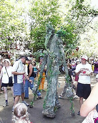
The Oregon Country Fair (OCF) is a nonprofit organization and an annual three-day art and music fair held outside the city limits of Veneta, Oregon, United States. Located in the Willamette Valley, the site is about 13 miles (21 km) west of Eugene along the Long Tom River near the unincorporated community of Elmira. Annual attendance is approximately 35,000, and the fair has around 960 craft and food booths each year. The event is known as an outgrowth of the counter-culture movement and for using environmentally-friendly practices during the fair.

<span class="mw-page-title-main">Mount Pisgah (Lane County, Oregon)</span>

Mount Pisgah is a hill in Lane County, Oregon, United States, rising 1,060 feet (320 m) above the surrounding Willamette Valley to a maximum elevation of 1,531 feet (467 m). It was named after the biblical Mount Pisgah. It is situated between the Coast Fork and Middle Fork of the Willamette River, two miles (3 km) southeast of their confluence. Springfield is immediately north of Mount Pisgah, and the city of Eugene is a few miles west. It is the site of the 2363-acre Howard Buford Recreation Area as well as the non-profit Mount Pisgah Arboretum at its base.

<span class="mw-page-title-main">Santa Clara, Eugene, Oregon</span> Unincorporated community in the state of Oregon, United States

Santa Clara is a community in Lane County, Oregon, United States, part of which is a neighborhood of the city of Eugene, but most of which is an unincorporated area. Prior to a number of partial annexations by the city between 1990 and 2005, Santa Clara was an unincorporated community and census-designated place in Lane County. Its current population is approximately 13,000.

<span class="mw-page-title-main">Oregon</span> U.S. state

Oregon is a state in the Pacific Northwest region of the United States. Oregon is a part of the Western United States, with the Columbia River delineating much of Oregon's northern boundary with Washington, while the Snake River delineates much of its eastern boundary with Idaho. The 42° north parallel delineates the southern boundary with California and Nevada. The western boundary is formed by the Pacific Ocean.

The culture of Oregon has had a diverse and distinct character from before European settlement until the modern day. Some 80 Native American tribes were living in Oregon before the establishment of European American settlements and ultimately a widespread displacement of the local indigenous tribes. Trappers and traders were the harbingers of the coming migration of Europeans. Many of these settlers traveled along the nationally renowned Oregon Trail, with estimates of around 53,000 using the trail between 1840 and 1850.

Willamalane Park and Recreation District maintains and operates five recreation facilities and 46 parks and natural areas, totaling more than 1,500 acres. Highlights include 10 waterfront areas, 29 miles of hiking and biking trails, 9 sports fields and 27 playgrounds. Willamalane offers hundreds of recreation programs to more than 60,000 patrons. Created by voters in 1944, Willamalane is a special tax district, separate from the city of Springfield, Oregon, with its own boundaries. It is governed by a five-member, elected board of directors and managed by a district superintendent. Willamalane offers:

The Eugene Mall was a car-free zone in the heart of Eugene, Oregon, United States, designed to encourage pedestrian access to shopping and entertainment areas. Dedicated on February 13, 1971, the mall opened amid three days of fanfare and dreams of a revitalized downtown. Conflict over the scope and use of the mall began immediately and continued for 30 years until the last remaining parts of the mall were opened to automobile traffic. At that time, a former Eugene mayor commented that the city's dreams for a bright future just hadn't worked. Many residents, however, shared the much-earlier view of a former downtown merchant, that Eugene had sustained more damage from the mall than it would have from a natural disaster.

<i>The Storyteller</i> (sculpture) Bronze sculpture by Pete Helzer in Eugene, Oregon, U.S.

The Storyteller, also known as the Ken Kesey Memorial, is an outdoor bronze sculpture by Pete Helzer, installed at Kesey Square in Eugene, Oregon, in the United States. Unveiled in 2003, it depicts American novelist, essayist, and countercultural figure Ken Kesey reading to his three grandchildren, Kate Smith, Caleb Kesey and Jordan Smith. Plaques on the base of the sculpture contain excerpts from Kesey's novels One Flew Over the Cuckoo's Nest (1962) and Sometimes a Great Notion (1964).

References

  1. 1 2 Banta, Megan (January 20, 2021). "Sean VanGordon to serve as Springfield's interim mayor". The Register-Guard. Eugene, Ore. Archived from the original on February 23, 2021. Retrieved February 21, 2021.
  2. SpringfieldCity. "Mayor". City of Springfield Oregon. Retrieved April 4, 2024.
  3. SpringfieldCity. "City Manager's Office". City of Springfield Oregon. Retrieved April 4, 2024.
  4. "ArcGIS REST Services Directory". United States Census Bureau. Archived from the original on February 13, 2023. Retrieved October 12, 2022.
  5. 1 2 U.S. Geological Survey Geographic Names Information System: Springfield, Oregon
  6. 1 2 "Census Population API". United States Census Bureau. Archived from the original on February 13, 2023. Retrieved October 12, 2022.
  7. "U.S. Census website". United States Census Bureau. Archived from the original on July 9, 2021. Retrieved January 31, 2008.
  8. "Names of Lane County Communities Reveal Interesting Histories, Anecdotes". Eugene Register-Guard . January 4, 1942. p. 4. Archived from the original on May 20, 2021. Retrieved April 23, 2015.
  9. "Fire in Early Oregon". Oregon Encyclopedia. Archived from the original on November 17, 2018. Retrieved November 17, 2018.
  10. "Early History of Springfield, Oregon". City of Springfield. Archived from the original on November 18, 2016. Retrieved March 31, 2010.
  11. "Oregon to vote on plan to allow bias against gays. Conservative group forces a referendum". The Baltimore Sun. New York Times News Service. August 16, 1992. Archived from the original on March 8, 2023. Retrieved April 10, 2011. The campaign was used successfully by Mr. Mabon's group in May, when the Oregon town of Springfield voted, by 55 percent to 45 percent, to become the nation's first municipality to include anti-gay language in its city charter.
  12. Neville, Paul (April 13, 1995). "Appeals court deals setback to gay rights foes". Eugene Register-Guard. Eugene, Oregon. p. 1. Retrieved April 10, 2011. The Oregon Court of Appeals upheld a state law Wednesday that bars cities and counties from enforcing anti-gay rights ordinances.[ permanent dead link ]
  13. Blair Jackson (2012). "Review of Sunshine Daydream". Blair's Golden Road Blog. Archived from the original on March 30, 2016. Retrieved March 20, 2016.
  14. Diane Dietz (September 6, 2010). "50 years in the creamery". Register-Guard. Archived from the original on March 31, 2016. Retrieved March 20, 2016. We had some debts that had to get paid, so we said, "Well, what do you think? Do you think the Dead would come up and do a benefit concert for us?" My brother-in-law (and Chuck's brother) Ken Kesey said, "I don't know why not. You might as well ask them."
  15. http://www.uga.edu/fruit/hazelnut.html Archived May 28, 2010, at the Wayback Machine uga.edu
  16. "City of Springfield 2018 Comprehensive Annual Financial Report" (PDF). Archived (PDF) from the original on October 14, 2019. Retrieved October 14, 2019.
  17. "Springfield City Manager's Office". Archived from the original on March 2, 2021. Retrieved March 3, 2021.
  18. "Springfield City Council". City of Springfield, Oregon. Archived from the original on January 22, 2021. Retrieved March 3, 2021.
  19. "Springfield City Council appoints Damien Pitts, an Army veteran who's Black, to fill Ward 1 vacancy". The Register Guard. Archived from the original on March 3, 2021. Retrieved March 3, 2021.
  20. "SPD Website". Archived from the original on October 27, 2016. Retrieved April 28, 2010.
  21. "Eugene Springfield Fire website". Archived from the original on November 28, 2016. Retrieved December 13, 2016.
  22. Roberts, Jacob (March 5, 2021). "Former female Springfield police trainee alleges harassment, discrimination". KEZI News. Archived from the original on June 6, 2021. Retrieved June 6, 2021.
  23. Jung, Jaewon (June 4, 2021). "Springfield Police sergeant fired amid sex misconduct allegations". KEZI News. Archived from the original on June 6, 2021. Retrieved June 6, 2021.
  24. Banta, Megan (May 19, 2021). "Springfield Police Chief retiring, as investigation goes on; city appoints former Portland assistant chief as interim". The Register-Guard. Archived from the original on June 6, 2021. Retrieved June 6, 2021.
  25. "US Gazetteer files 2010". United States Census Bureau. Archived from the original on January 25, 2012. Retrieved December 21, 2012.
  26. "American FactFinder: Oregon population". U.S. Census Bureau . Retrieved March 3, 2011.[ dead link ]
  27. Moffatt, Riley. Population History of Western U.S. Cities & Towns, 1850–1990. Lanham: Scarecrow, 1996, 216.
  28. United States Census Bureau. "Census of Population and Housing". Archived from the original on April 26, 2015. Retrieved September 26, 2014.
  29. "Population Estimates". United States Census Bureau. Archived from the original on March 28, 2019. Retrieved June 8, 2018.
  30. "U.S. Census website". United States Census Bureau. Archived from the original on July 9, 2021. Retrieved December 21, 2012.
  31. "SPL Downtown City Hall". Archived from the original on August 27, 2011. Retrieved April 30, 2010.
  32. 1 2 Sign next to the seal, locked inside of a display case. On display in Springfield City Hall.
  33. "Sewer Art at the Oregon State Capitol". Country Traveler Online. October 6, 2015. Archived from the original on January 28, 2021. Retrieved May 25, 2021.
  34. "Wildish Theater has sizeable impact on Springfield Community".
  35. "Theater to die for".
  36. "A3 to manage Wildish Theater".
  37. "03/07/2016 Regular Session".
  38. "2020 CENSUS - SCHOOL DISTRICT REFERENCE MAP: Lane County, OR" (PDF). U.S. Census Bureau. pp. 1-2 (PDF p. 2-3/3). Retrieved March 10, 2024.
  39. "SPS". Archived from the original on March 26, 2010.
  40. "SPS- Homepage". Archived from the original on September 3, 2011.
  41. "Oregon Community Colleges and Community College Districts" (PDF). Oregon Department of Community Colleges & Workforce Development. Archived (PDF) from the original on October 9, 2022. Retrieved March 11, 2024.
  42. "PPC". Archived from the original on January 14, 2010. Retrieved May 7, 2010.
  43. "Springfields Vie For "Simpsons" Premiere Archived March 11, 2007, at the Wayback Machine ." CBS News. March 9, 2007. Retrieved on March 9, 2007.
  44. "The Register-Guard, Eugene, Oregon, USA". Archived from the original on November 17, 2015. Retrieved November 16, 2015.
  45. De La Roca, Claudia (May 2012). "Matt Groening Reveals the Location of the Real Springfield". Smithsonian . Archived from the original on December 17, 2013. Retrieved November 9, 2013.
  46. "Climate Summary for Springfield, Oregon". Archived from the original on July 24, 2014. Retrieved January 22, 2014.

Further reading