10th arrondissement of Marseille

Last updated
10th arrondissement of Marseille
MarseilleArrondissements10.png
Location within Marseille
Coordinates: 43°16′24″N5°25′50″E / 43.2733°N 5.4306°E / 43.2733; 5.4306 Coordinates: 43°16′24″N5°25′50″E / 43.2733°N 5.4306°E / 43.2733; 5.4306
Country France
Region Provence-Alpes-Côte d'Azur
Department Bouches-du-Rhône
Commune Marseille
Government
  Mayor (20202026) Lionel Royer-Perreault (LR)
Area
10.84 km2 (4.19 sq mi)
Population
 (Jan. 2019) [1]
58,491
  Density5,396/km2 (13,980/sq mi)
INSEE code 13210

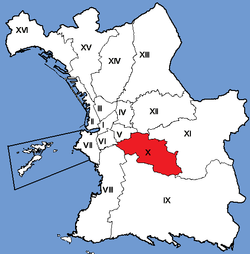
The 10th arrondissement of Marseille is a district ( arrondissement ) in the city of Marseille. The district is located east of the City. It borders the 5th and 12th arrondissement in the north, the 11th in the east, the 9th in the south, the 8th in the southwest and the 6th in the west. It is governed locally together with the 9th arrondissement, with which it forms the 5th sector of Marseille.

Contents

Neighbourhoods

The 10th arrondissement of Marseille includes six neighbourhoods (quartiers): la Capelette, Menpenti, Pont-de-Vivaux, Saint-Loup, Saint-Tronc, and La Timone and 25 IRIS including 24 IRIS housing and Prado Park.

Public transport

The Capelette neighbourhood is very poorly served by public transport. Only the number 18 line from Saint Loup to Castellane passes through Capelette.

Important monuments

The Capelette district, named after the disused Capeletto chapel on the Bonnefoy boulevard, has a railroad bridge that crosses the avenue, as well as the church of St Laurent on the St Jean boulevard. It also has a beautiful garden, called the garden of Guy Azaïs.

Demography

Population of the neighborhoods

DistrictPopulation in 1990Population in 1999Population in 2006
La Capelette 7 2928 3068 431
Menpenti2 7272 7122 914
Pont-de-Vivaux 4 2803 9144 193
Saint-Loup 15 98415 34115 120
Saint-Tronc 14 86014 17713 959
la Timone 4 9184 7135 524
Total50 06149 16350 140

Education and training by neighbourhood in 2006

Non-graduation and graduates rates by area at January 1, 2006 [2]
Neighbourhood15+ years of schoolingtotal without diplomas % with diplomastotal with 3 or more BAC % with three or moreBAC
La Capelette6 1521 56325.41%4928.00% [3]
Menpenti2 25747120.86%2129.40%
Pont-de-Vivaux3 0041 00633.49% [4] 2809.32%
Saint-Loup11 0192 61123.70% [5] 7877.14% [6]
Saint-Tronc10 0332 13721.30% [7] 9419.38% [8]
La Timone3 76066217.60%3699.82%
Arrondissement36 2258 45123.33%3 0818.51%
Total Marseille590 908149 30525.27%79 43513.44%

Unemployment rates by neighborhoods in 2006

NeighbourhoodWorkforceNumber unemployedUnemployment rate
La Capelette3 92061515,69% [9]
Menpenti1 45526818,44%
Pont-de-Vivaux1 70322813,36%
Saint-Loup6 5071 00015,37% [10]
Saint-Tronc5 91485414,44% [11]
La Timone2 61535713,66% [12]
Arrondissement22 1143 32215,02%
Total Marseille352 85564 33018,23%

Beneficiaries of supplementary universal health coverage (CMU-C) by neighbourhood

Supplementary CMU (CMU-C) is a free complementary health plan that covers what is not covered by compulsory health insurance schemes.

Beneficiaries of the CMU-C by IRIS in 2008 [13]

NeighbourhoodPopulation covered in 2008Beneficiaries CMU-C 2008 % Beneficiaries 2008
La Capelette7 68796312,53%
Menpenti3 25347014,45%
Pont-de-Vivaux3 92564416,41%
Saint-Loup12 2871 0878,85%
Saint-Tronc10 6391 12710,59%
La Timone3 4973028,64%
Arrondissement42 5184 47211,15%
Total Marseille718 664132 15618,39%

Families by neighbourhood in 2006

Single parent families and families with four children at 1 January 2006 [14]

NeighbourhoodFamilieswith single parents % single parent familiesfamilies with 4 or more children % families with 4 or more children
La Capelette1 92447424.64%422.18%
Menpenti73714119.14%172.36%
Pont-de-Vivaux1 10828725.89%494.40% [15]
Saint-Loup4 24388820.93%1212.85% [16]
Saint-Tronc3 64471719.67%1323.62% [17]
La Timone1 44021915.22%332.28%
Total arrondissement13 0962 72620.82%3943.01%
Total Marseille213 53846 56821.81%8 4143.94%

Dwellings by neighbourhood 8/3/1999

Neighbourhood % tenants % apartment buildings % 4 or more rooms
La Capelette62,76%90,14%25,27%
Menpenti57,19%90,98%20,03%
Pont-de-Vivaux40,99%68,16%32,30%
Saint-Loup47,38%72,10%54,84%
Saint-Tronc33,80%92,81%45,74%
La Timone48,67%84,28%35,47%
Arrondissement46,82%83,46%40,53%
Total Marseille51,73%82,86%38,21%

Population of the neighbourhoods by age at 8/3/1999

Quartier % 0-19 years % 20-39 years % 40-59 years % 60-74 years % 75 years and +
La Capelette20,32%33,86%24,64%13,62%7,56%
Menpenti16,22%34,11%24,37%15,67%9,62%
Pont-de-Vivaux23,74%24,94%24,43%16,27%10,63%
Saint-Loup25,21%25,02%27,05%15,16%7,55%
Saint-Tronc24,36%25,88%25,31%16,37%8,08%
La Timone21,39%35,24%24,97%11,31%7,09%
Arrondissement23,16%28,24%25,58%15,00%8,02%
Total Marseille23,16%28,67%24,84%14,18%9,16%

Related Research Articles

<span class="mw-page-title-main">6th arrondissement of Paris</span> Municipal arrondissement in Île-de-France, France

The 6th arrondissement of Paris is one of the 20 arrondissements of the capital city of France. In spoken French, it is referred to as le sixième.

<span class="mw-page-title-main">5th arrondissement of Paris</span> Municipal arrondissement in Île-de-France, France

The 5th arrondissement of Paris is one of the 20 arrondissements of the capital city of France. In spoken French, this arrondissement is referred to as le cinquième.

<span class="mw-page-title-main">Montagne Sainte-Geneviève</span> Hill in Paris, France

The Montagne Sainte-Geneviève is a hill overlooking the left bank of the Seine in the 5th arrondissement of Paris. It was known to the ancient Romans as Mons Lucotitius. Atop the Montagne, are the Panthéon and the Bibliothèque Sainte-Geneviève, used by the students of the University of Paris. The side streets of the Montagne feature bars and restaurants, for example, in the Rue Mouffetard.

<span class="mw-page-title-main">Rue Mouffetard</span> Street in Paris, France

Rue Mouffetard is a street in the 5th arrondissement of Paris, France.

<span class="mw-page-title-main">Arrondissement of Cherbourg</span> Arrondissement in Normandy, France

The arrondissement of Cherbourg is an arrondissement of France in the Manche department in the Normandy region. It lies entirely on the Cotentin Peninsula and has 144 communes. Its population is 189,748 (2016), and its area is 1,643.9 km2 (634.7 sq mi).

<span class="mw-page-title-main">Arrondissement of Bourg-en-Bresse</span> Arrondissement in Auvergne-Rhône-Alpes, France

The arrondissement of Bourg-en-Bresse is an arrondissement of France in the Ain department in the Auvergne-Rhône-Alpes region. It has 199 communes. Its population is 331,400 (2016), and its area is 2,873.7 km2 (1,109.5 sq mi).

<span class="mw-page-title-main">Arrondissement of Soissons</span> Arrondissement in Hauts-de-France, France

The arrondissement of Soissons is an arrondissement of France in the Aisne department in the Hauts-de-France region. It has 164 communes. Its population is 107,744 (2016), and its area is 1,342.3 km2 (518.3 sq mi).

<span class="mw-page-title-main">Arrondissement of Beauvais</span> Arrondissement in Hauts-de-France, France

The arrondissement of Beauvais is an arrondissement of France in the Oise department in the Hauts-de-France region. It comprises 245 communes. Its population is 229,183 (2016), and its area is 2,099.9 km2 (810.8 sq mi).

<span class="mw-page-title-main">Arrondissement of Les Andelys</span> Arrondissement in Normandy, France

The arrondissement of Les Andelys is an arrondissement of France in the Eure department in the Normandy region. It has 185 communes. Its population is 235,732 (2016), and its area is 1,854.4 km2 (716.0 sq mi).

<span class="mw-page-title-main">Arrondissement of Bernay</span> Arrondissement in Normandy, France

The arrondissement of Bernay is an arrondissement of France in the Eure department in the Normandy region. It has 297 communes. Its population is 227,054 (2016), and its area is 3,226.7 km2 (1,245.8 sq mi).

<span class="mw-page-title-main">Arrondissement of Tours</span> Arrondissement in Centre-Val de Loire, France

The arrondissement of Tours is an arrondissement of France in the Indre-et-Loire department in the Centre-Val de Loire region. It has 54 communes. Its population is 384,117 (2016), and its area is 1,087.6 km2 (419.9 sq mi).

<span class="mw-page-title-main">Arrondissement of Argentan</span> Arrondissement in Normandy, France

The arrondissement of Argentan is an arrondissement of France, located in the Orne department, region of Normandy. It has 123 communes. Its population is 110,239 (2016), and its area is 1,904.1 km2 (735.2 sq mi).

<span class="mw-page-title-main">Arrondissement of Laval</span> Arrondissement in Pays de la Loire, France

The arrondissement of Laval is an arrondissement of France in the Mayenne department in the Pays de la Loire region. It has 34 communes. Its population is 112,937 (2016), and its area is 686.1 km2 (264.9 sq mi).

<span class="mw-page-title-main">Arrondissement of Les Sables-d'Olonne</span> Arrondissement in Pays de la Loire, France

The arrondissement of Les Sables-d'Olonne is an arrondissement of France in the Vendée department in the Pays de la Loire region. It has 71 communes. Its population is 235,082 (2016), and its area is 1,914.7 km2 (739.3 sq mi).

<span class="mw-page-title-main">Arrondissement of Nîmes</span> Arrondissement in Occitania, France

The arrondissement of Nîmes is an arrondissement of France in the Gard department in the Occitanie region. It has 180 communes. Its population is 554,624 (2016), and its area is 3,158.1 km2 (1,219.3 sq mi).

<span class="mw-page-title-main">Arrondissement of Marseille</span> Arrondissement in Provence-Alpes-Côte dAzur, France

The arrondissement of Marseille is an arrondissement of France in the Bouches-du-Rhône department in the Provence-Alpes-Côte d'Azur region. It has 21 communes. Its population is 1,069,909 (2016), and its area is 683.2 km2 (263.8 sq mi).

<span class="mw-page-title-main">Place du Panthéon</span> Public square in Paris, France

The Place du Panthéon is a square in the 5th arrondissement of Paris, France. Located in the Latin Quarter, it is named after and surrounds the Panthéon.

<span class="mw-page-title-main">9th arrondissement of Marseille</span> Municipal arrondissement in Provence-Alpes-Côte dAzur, France

The 9th arrondissement of Marseille is one of 16 arrondissements of Marseille. This district is the largest in the city. The 9th arrondissement borders the 8th, 10th and 11th arrondissements. It is governed locally together with the 10th arrondissement, with which it forms the 5th sector of Marseille.

This article presents the main landmarks in the city of Paris within administrative limits, divided by its 20 arrondissements. Landmarks located in the suburbs of Paris, outside of its administrative limits, while within the metropolitan area are not included in this article.

References

  1. "Populations légales 2019". The National Institute of Statistics and Economic Studies. 29 December 2021.
  2. "INSEE Bases de données infra-communales Diplômes - Formation". Archived from the original on 2010-01-20. Retrieved 2010-01-05.
  3. with 13.66% in the IRIS Benjamin Delessert
  4. with 44.34% without a diploma in the IRIS Hippodrome Vivaux compared to 25.32% in the IRIS Pont de Vivaux-Icard
  5. with 29.97% without a diploma in the IRIS Lycee Est-Saint-Cyr mais par contre 6.66% dans l'IRIS Mont Rouvière
  6. with 18.34% in the IRIS Mont Rouvière compared to 3.43% in the IRIS Gardanne Fauvière and 3.56% in the Lycee Est-Saint-Cyr
  7. with 35.45% without a diplama in the IRIS La Sauvagère-Sainte-Genevieve and 29.33% in the La Sauvagèe-Bellevue compared to 10.80% in the IRIS Castel Roc
  8. with 17.20% in the IRIS Castel Roc compared to 3.86% in the IRIS La Sauvagère-Sainte-Genevieve
  9. The rate of unemployment reached 21.74% in the IRIS Saint-Jean-Curtel compared to 8.49% in the IRIS Benjamin Delessert
  10. The rate of unemployment reached 21.97% in the IRIS Lycee Est-Saint-Cyr compared to 7.24% in the IRIS Mont Rouvière and 10.37% in the IRIS Queyrel
  11. The rate of unemployment reached 27.47% in the IRIS La Sauvagère-Sainte-Geneviève and 18.37% in the IRIS La Sauvagère-Bellevue compared to 7.79% in the IRIS Campagne La Rose and 9.10% in the IRIS Castel Roc
  12. The rate of unemployment reached 28.63% in the IRIS Cimetière Saint-Pierre, 16.56% in the IRIS Mathurin-Timone and 9.71% in the IRIS Cabassud-Mireille Lauze, respectively
  13. INSEE Bénéficiaires de la couverture maladie universelle complémentaire (2008 en métropole, 2007 à la Réunion)
  14. "INSEE Bases de tableaux détaillés Famille - Situation matrimoniale". Archived from the original on 2009-09-12. Retrieved 2010-01-08.
  15. In this very disparate neighbourhood, the percentage of families with 3 or more children reached 8.50% in the IRIS Hippodrome Vivaux compared to 0.86% in the IRIS Pont de Vivaux-Icard
  16. The percentage of families with 3 ore more children ranged from 5.83% in the IRIS Chanteperdrix-Trois Ponts to 0.17% in the IRIS Queyrel
  17. In this very disparate neighbourhood, the percentage of families with 3 or more children reached for example 11.41% in the IRIS La Sauvagere-Bellevue, 6.68% in the IRIS La Sauvagere-Sainte-Geneviève, 3.96% in the IRIS Campagne La Rose, compared to less than 1% in 3 other IRIS neighbourhoods (including 0.28% in the IRIS La Marguerite)