
The demographics of New Zealand encompass the gender, ethnic, religious, geographic, and economic backgrounds of the 5.3 million people living in New Zealand. New Zealanders predominantly live in urban areas on the North Island. The five largest cities are Auckland, Wellington, Christchurch, Hamilton, and Tauranga. Few New Zealanders live on New Zealand's smaller islands. Waiheke Island is easily the most populated smaller island with 9,140 residents, while Great Barrier Island, the Chatham and Pitt Islands, and Stewart Island each have populations below 1,000. New Zealand is part of a realm and most people born in the realm's external territories of Tokelau, the Ross Dependency, the Cook Islands and Niue are entitled to New Zealand passports.

Eketāhuna is a small rural settlement, in the south of the Tararua District and the Manawatū-Whanganui region of New Zealand's North Island.

The Thames-Coromandel District is a territorial authority district in the North Island of New Zealand, covering all the Coromandel Peninsula and extending south to Hikutaia.
Flaxmere is a township in the Hastings District and outlying suburb of Hastings City, in the Hawke's Bay Region of New Zealand's North Island.
Hunterville is a small town in the Rangitikei district of the North Island of New Zealand. It is located halfway between Taupo and Wellington on State Highway 1, and as of the 2018 census has a population of 408.
Waharoa is a rural community in the Waikato region of New Zealand's North Island. It is located 7 km north of Matamata, and is part of the Matamata-Piako District. It is located at the junction of the Kinleith Branch railway and the East Coast Main Trunk Railway. State Highway 27 runs through the town, which is serviced by several shops and cafes and by a petrol station. Matamata Airport is just over 3 km (1.9 mi) north of Waharoa.

Ōmokoroa is a small urban area in the Western Bay of Plenty District of New Zealand. The suburb is considered part of Greater Tauranga, and is within the Coromandel electorate. Ōmokoroa began as a small rural holiday village, but is expanding to be a commuter town, with a 25-minute drive to Tauranga City.

Indian New Zealanders or informally known as Kiwi Indians are people of Indian origin or descent who live in New Zealand. The term includes Indians born in New Zealand, as well as immigrants from India, Fiji, other regions of Asia, parts of Africa such as South Africa and East Africa, and from other parts of the world. The term Indian New Zealander applies to any New Zealander with one or both parents of Indian heritage. Although sometimes the Indo-Kiwi definition has been expanded to people with mixed racial parentage with one Indian parent or grandparent, this can be controversial as it generally tends to remove the ethnic heritage or identity of the foreign parent or grandparent, which may be seen as insensitive to those with mixed parentage, who tend to value both their Indian and non-Indian parents and grandparents.
Korean New Zealanders, also referred to informally as Korean Kiwis, Kokis or Kowis, are New Zealand citizens and residents of Korean ancestry. The 2018 New Zealand census found 35,664 Koreans in the country, virtually all from South Korea, making them the fourth-largest Asian population there, and more than 0.75 percent of the total population of New Zealand.
American New Zealanders are New Zealand citizens who are of American descent from American-born citizens from the United States. American New Zealanders constitute a small minority of New Zealand's population.
The 1867 New Zealand census was held on 19 December 1867. Māori were not enumerated. The total population of people of non-Māori descent, including those from non-European countries such as China, was 218,668, plus 1,455 military men and their families. Across the country there was an average of 20.6% more men than women, down from almost 24% in 1864. This difference was most marked in Nelson Province, which had almost 38% more men than women. In Auckland Province there was only a 12% "excess" of men. Part of the discrepancy was acknowledged to be an influx of (male) miners to the gold fields. 97% of Chinese in New Zealand in 1867 lived in Otago Province, and around 18% of miners on the Otago goldfields were Chinese.

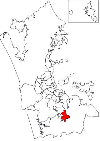
The Devonport-Takapuna Local Board covers from Castor Bay and Sunnynook south to the end of the Devonport Peninsula; it is separated from the Kaipātiki board area by the Northern Motorway. This local board sits in the Auckland Council office buildings on The Strand in Takapuna. These were the North Shore City Council offices until the North Shore City Council was merged into Auckland Council in 2010. It is part of the North Shore Ward of Auckland Council, which also includes the Kaipātiki Local Board.
Asian New Zealanders are New Zealanders of Asian ancestry . At the 2023 census, 861,573 New Zealanders identifying as being part of the Asian ethnic group, making up 17.3% of New Zealand's population.
The 1911 New Zealand census was New Zealand's fifteenth national census. The day used for the census was Sunday, 2 April 1911.
The 2018 New Zealand census, which took place on Tuesday 6 March 2018, was the thirty-fourth national census in New Zealand. The population of New Zealand was counted as 4,699,755 – an increase of 457,707 (10.79%) over the 2013 census.
Tongan New Zealanders are Tongan immigrants in New Zealand, their descendants, and New Zealanders of Tongan ethnic descent. They constitute one of New Zealand's most sizeable ethnic minorities. In the 2013 census, 60,336 New Zealanders identified themselves as being of Tongan ethnicity with 22,413 stating that they were born in Tonga.

Waitākere Ranges Local Board is one of the 21 local boards of the Auckland Council, and is one of the two boards overseen by the council's Waitākere Ward councillors.
The Papakura Local Board is one of the 21 local boards of the Auckland Council. It is overseen by the Manurewa-Papakura ward councillor.
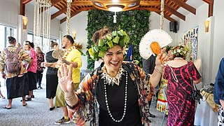
Pasifika New Zealanders are a pan-ethnic group of New Zealanders associated with, and descended from, the indigenous peoples of the Pacific Islands outside of New Zealand itself. They form the fourth-largest ethnic grouping in the country, after European descendants, indigenous Māori, and Asian New Zealanders. Over 380,000 people identify as being of Pacific origin, representing 8% of the country's population, with the majority residing in Auckland.
Mission Heights is an eastern suburb of Auckland, New Zealand, comprising Mission Heights North and Mission Heights South. It is located in the wider suburb of Flat Bush.