
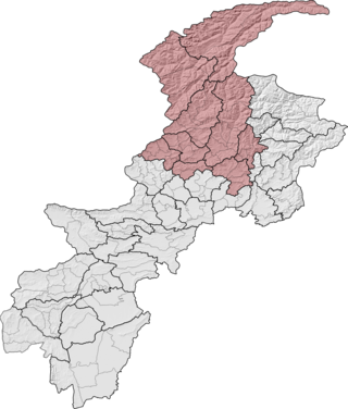
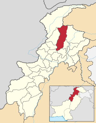
Swat District, also known as the Swat Valley, is a district in the Malakand Division of Khyber Pakhtunkhwa, Pakistan. Known for its stunning natural beauty, the district is a popular tourist destination. With a population of 2,309,570 per the 2017 national census, Swat is the 15th-largest district of Khyber Pakhtunkhwa.
Malakand Division is an administrative division of Khyber Pakhtunkhwa province of Pakistan. CNIC code of Malakand Division is 15.

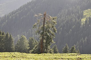
Utror, also spelt Atror, is a valley located in the Swat District of Khyber Pakhtunkhwa, Pakistan. It is surrounded by snow clad mountains, green pastures and waterfalls. The area of the valley is about 47,400 hectares. Utror is 16 km (9.9 mi) away from Kalam Valley and 116 km (72 mi) from Saidu Sharif.
Elum Ghar, also known as Mount Ilam is a 2,800 metres (9,200 ft) mountain located between the Swat and Buner districts of Pakistan. Elum Ghar is the highest peak in the region, and is snow-covered most of the year. It is located west of Pir Baba's shrine in the Buner District of the Khyber Pakhtunkhwa of Pakistan. The mountain was a significant pilgrimage site for Hindus until 1947, and is believed to be the site where a previous incarnation of the Buddha gave up his life.

The insurgency in Khyber Pakhtunkhwa, also known as the War in North-West Pakistan or Pakistan's war on terror, is an ongoing armed conflict involving Pakistan and Islamist militant groups such as the Tehrik-i-Taliban Pakistan (TTP), Jundallah, Lashkar-e-Islam (LeI), TNSM, al-Qaeda, and their Central Asian allies such as the ISIL–Khorasan (ISIL), Islamic Movement of Uzbekistan, East Turkistan Movement, Emirate of Caucasus, and elements of organized crime. Formerly a war, it is now a low-level insurgency as of 2017.

Besham is a city in the Shangla District of Khyber Pakhtunkhwa, Pakistan. Located on the right bank of the Indus River, Besham serves as a major junction on the Karakoram Highway, that connects Khyber Pakhtunkhwa and Punjab with Gilgit-Baltistan, and crosses over into China's Xinjiang. Besham is also the eastern terminus of the under-construction E90 expressway, which will connect the city westward with Khwazakhela in Swat District. Besham is located around 60 kilometres (40 mi) east of Swat, 250 kilometres (160 mi) north of Rawalpindi-Islamabad, and 270 kilometres (170 mi) northeast of the provincial capital, Peshawar, Pakistan.

Swatting is a criminal harassment act of deceiving an emergency service into sending a police or emergency service response team to another person's address. This is triggered by false reporting of a serious law enforcement emergency, such as a bomb threat, murder, hostage situation, or a false report of a mental health emergency, such as reporting that a person is allegedly suicidal or homicidal and may be armed, among other things.
Ningolai is a village in Swat Pakistan. Old name was Ningula which was named by a person name Ningula. Later it was named Ningolai by the ruler of Swat State. The people of village Ningolai belong to subsection Naikpikhel of Yusufzai the biggest and largest tribe of Pashtun tribes. The village contains a small series of mountains and a forest, residential area starting from meadows of mountains and merge with river swat on right bank, vast land for crops, number of canals, and a part of the Swat river. Mountains of the village include Usmani Ghar, Kursi Ghat, Kafar Ghat and Najia.
The Second Battle of Swat also known as Operation Rah-e-Rast, began in May 2009 and involved the Pakistan Army and Tehrik-i-Taliban Pakistan militants in a fight for control of the Swat district of Pakistan. The first Battle of Swat had ended with a peace agreement, that the government had signed with the Tehrik-i-Taliban Pakistan in February 2009. However, by late April 2009 government troops and the Tehrik-i-Taliban Pakistan began to clash once again, and in May the government launched a military offensive code-named Operation Black Thunderstorm throughout the Swat district and elsewhere to oppose the Tehrik-i-Taliban Pakistan.
Kuza Bandai is a well developed village in Swat Valley of Khyber Pakhtunkhwa, Pakistan. It is known for its natural environment and also known as an area crossed by Alexander the Great. Later, after the Lal Masjid battle, Kuza Bandai and Bara Bandai became sympathetic to the Taliban movement. The village consists of Yusufzai Pakhtun tribes. It is one of Pakistan's Provincially Administered Tribal Areas (PATA).

Usho is a village in Usho Valley, Khyber Pakhtunkhwa province of Pakistan. It is situated 8 kilometers (5.0 mi) from Kalam and 123 kilometers (76 mi) km from Mingora, at the height of 2,300 meters. It is accessible through a non metalled road from Kalam by jeeps only.
In 2008, Pakistan saw 40 terrorist attacks, which caused 154 fatalities and 256 injuries.
Gabral is a village and union council in Swat District of Khyber Pakhtunkhwa province, Pakistan. It is located on the slopes of the western end of the Himalayas, at the lower end of the Gujjar Gabral Valley, where the Gabral River joins the Utror River, a tributary of the Swat River. Gabral is located at an elevation of 2,286 metres (7,500 ft). It is about 7 kilometres (4.3 mi) northwest from Utror, 20 kilometres (12 mi) west of Kalam, and 120 kilometres (75 mi) of Saidu Sharif.
Darmai is an administrative unit, known as Union council, of Swat District in the Khyber Pakhtunkhwa province of Pakistan. District Swat has 9 Tehsils i.e. Khwazakhela, Kabal, Madyan, Barikot, Mingora, and Kalam. Each Tehsill comprises certain numbers of union councils. There are 65 union councils in district Swat, 56 rural and 09 urban.
Sakhra is an administrative unit, known as Union council, of Swat District in the Khyber Pakhtunkhwa province of Pakistan. District Swat has 9 Tehsils i.e. Khwazakhela, Kabal, Madyan, Barikot, Mingora, and Kalam. Each Tehsill comprises certain numbers of union councils. There are 65 union councils in district Swat, 56 rural and also 9 urban.
Biha is an administrative unit, known as Union council, of Swat District in the Khyber Pakhtunkhwa province of Pakistan. District Swat has 7 Tehsils i.e. Khwazakhela, Kabal, Bahrain, Charbagh, Barikot, Babuzai, and Matta. Each Tehsill comprises certain numbers of union councils. There are 65 union councils in district Swat, 56 rural and 09 urban.

Gabin Jabba, which in Pashto means Honey marshes, is located approximately 65 km from Mingora on Matta Sakhra road within the Swat valley of the Khyber Pakhtunkhwa province of Pakistan. It is an area in Swat Valley with green meadows, thick forests, snow-clad mountains, mineral springs and high peaks. Gabin Jabba elevation is 2582m (8471ft) from the sea level.

The Gabral Valley is a valley in the Swat District of Khyber Pakhtunkhwa province, Pakistan. It is located in the south slopes of the westernmost end of the Himalayas. Its lower end is at the town of Gabral, about 20 km north from Kalam and 120 km north of Islamabad, at an altitude of 2290 m. The name is also spelled as Gabrāl.

Bashkaro Pass, also known as Bashkaro Top, is a mountain pass located in Pakistan. It is classified as a T - Hypsographic pass and is situated in the Asia/Pacific region. The pass has an elevation of 4,924 meters above sea level and is geographically positioned at approximately 35°52'55" N latitude and 72°32'27" E longitude in Degrees Minutes Seconds (DMS) format, or 35.8819° N and 72.5408° E in decimal degrees. Its UTM position is BV77, and its Joint Operation Graphics reference is NI43-01.
