Aïn El Hadjar, Bouïra

Last updated
Aïn El Hadjar
عين الحجر
Aboutville
Commune and town
Ain el Hadjar.JPG
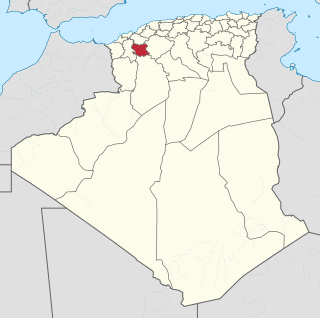
Dz - 10 - Ain El Hadjar.svg
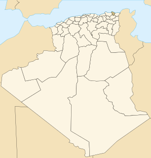
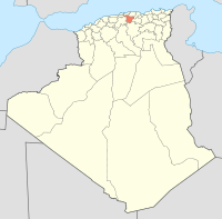
Algeria location map.svg
Red pog.svg
Aïn El Hadjar
Coordinates: 36°20′21″N3°48′23″W / 36.33917°N 3.80639°W / 36.33917; -3.80639
CountryFlag of Algeria.svg  Algeria
Province Bouïra Province
Population (2008)
  Total 9,260
Time zone CET (UTC+1)

Aïn El Hadjar also known as عين الحجر, is a town and commune in Bouïra Province, Algeria. The town is in the mountains, 10km south of Saida and is services by Algerian Railways.

Communes of Algeria administrative division of Algeria

The municipalities of Algeria form the second level of administrative subdivisions of Algeria. As of 2002, there were 1,541 municipalities in the country.
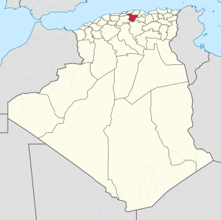
Bouïra Province Province in Algeria

Bouïra is a province (wilaya) in Algeria.

Algeria country in North Africa

Algeria, officially the People's Democratic Republic of Algeria, is a country in the Maghreb region of North Africa. The capital and most populous city is Algiers, located in the far north of the country on the Mediterranean coast. With an area of 2,381,741 square kilometres (919,595 sq mi), Algeria is the tenth-largest country in the world, and the largest in Africa. Algeria is bordered to the northeast by Tunisia, to the east by Libya, to the west by Morocco, to the southwest by the Western Saharan territory, Mauritania, and Mali, to the southeast by Niger, and to the north by the Mediterranean Sea. The country is a semi-presidential republic consisting of 48 provinces and 1,541 communes (counties). It has the highest human development index of all non-island African countries.

History

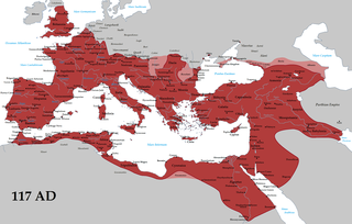
Aïn El Hadjar has been tentatively identified as the Roman town of Centuria (Numidia) in Roman North Africa.

Roman Empire period of Imperial Rome following the Roman Republic (27 BC–395 AD)

The Roman Empire was the post-Roman Republic period of the ancient Roman civilization. It had a government headed by emperors and large territorial holdings around the Mediterranean Sea in Europe, North Africa, and West Asia. From the constitutional reforms of Augustus to the military anarchy of the third century, the Empire was a principate ruled from the city of Rome. The Roman Empire was then divided between a Western Roman Empire, based in Milan and later Ravenna, and an Eastern Roman Empire, based in Nicomedia and later Constantinople, and it was ruled by multiple emperors.

<i>Civitas</i> Roman civil law

In the history of Rome, the Latin term civitas, according to Cicero in the time of the late Roman Republic, was the social body of the cives, or citizens, united by law. It is the law that binds them together, giving them responsibilities (munera) on the one hand and rights of citizenship on the other. The agreement (concilium) has a life of its own, creating a res publica or "public entity", into which individuals are born or accepted, and from which they die or are ejected. The civitas is not just the collective body of all the citizens, it is the contract binding them all together, because each of them is a civis.

Centuria, also known as Centuriensis, was a Roman era town in Numidia, Roman province of Africa. It has been tentatively identified with ruins near Ain El Hadjar in Algeria, south of Saida.

During the during French colonization the town was known as Aboutville. In 1958, the city then named Aboutville, was part of the former department of MEDEA After independence, it takes the name of Aïn El Hadjar. [1]

France Republic with mainland in Europe and numerous oversea territories

France, officially the French Republic, is a country whose territory consists of metropolitan France in Western Europe and several overseas regions and territories. The metropolitan area of France extends from the Mediterranean Sea to the English Channel and the North Sea, and from the Rhine to the Atlantic Ocean. It is bordered by Belgium, Luxembourg and Germany to the northeast, Switzerland and Italy to the east, and Andorra and Spain to the south. The overseas territories include French Guiana in South America and several islands in the Atlantic, Pacific and Indian oceans. The country's 18 integral regions span a combined area of 643,801 square kilometres (248,573 sq mi) and a total population of 67.3 million. France, a sovereign state, is a unitary semi-presidential republic with its capital in Paris, the country's largest city and main cultural and commercial centre. Other major urban areas include Lyon, Marseille, Toulouse, Bordeaux, Lille and Nice.

Colonization is a process by which a central system of power dominates the surrounding land and its components.

According to the 1998 census it has a population of 7,988. [2] by the 2008 Census this had increased to 9260 inhabitants.

Census Acquiring and recording information about the members of a given population

A census is the procedure of systematically acquiring and recording information about the members of a given population. The term is used mostly in connection with national population and housing censuses; other common censuses include agriculture, business, and traffic censuses. The United Nations defines the essential features of population and housing censuses as "individual enumeration, universality within a defined territory, simultaneity and defined periodicity", and recommends that population censuses be taken at least every 10 years. United Nations recommendations also cover census topics to be collected, official definitions, classifications and other useful information to co-ordinate international practice.

Related Research Articles

Annaba Province Province in Algeria

Annaba is a small province (wilaya) in the north-eastern corner of Algeria. Its capital, Annaba, is Algeria's main port for mineral exports.

Annaba City in Annaba Province, Algeria

Annaba, formerly known as Bona, and then Bône, is a seaport city in the northeastern corner of Algeria, close to Tunisia. Annaba is close to the small Seybouse River, and it is in the Annaba Province. With a population of about 260,000 (2008), Annaba is the fourth largest city in Algeria. It is a leading industrial center in eastern Algeria.

Saïda Province Province in Algeria

Saïda is a province (wilaya) of Algeria, named after its capital.

Hadjadj is a town and commune in Mila Province, Algeria. According to the 1998 census it has a population of 15,835.

El Hadjar District District in Annaba, Algeria

El Hadjar is a district in Annaba Province, Algeria. It was named after its capital, El Hadjar.

Aïn Benian, Algiers is a commune in Algiers Province and suburb of the city of Algiers in northern Algeria. As of the 2008 census, the commune had a population of 68,354.

El Hadjar Place in Annaba, Algeria

El Hadjar is a town in north-eastern Algeria.

Aïn Bessem Commune and town in Bouïra Province, Algeria

Ain-Bessem is a town and commune in Bouïra Province, Algeria. According to the 1998 census it has a population of 36,830.

El Adjiba is a town and commune in Bouïra Province, Algeria. According to the 1998 census it has a population of 11,572.

El Asnam, Bouïra is a town and commune in Bouïra Province, Algeria. According to the 1998 census it has a population of 12,060.

Souk El Khemis is a town and commune in Bouïra Province, Algeria. According to the 1998 census it had a population of 8,039. The town is located at 36 ° 23 '17 "n, 3 ° 38' 06"e and the name means Thursday Market.

Aïn El Hadjar District District in Saïda Province, Algeria

Aïn El Hadjar District is a district of Saïda Province, Algeria.

Aïn Makhlouf Commune and town in Guelma Province, Algeria

Aïn Makhlouf is a town and commune in Guelma Province, Algeria. According to the 1998 census it has a population of 11,018.

Aïn M'lila is a town and commune in Oum El Bouaghi Province, Algeria. According to the 1998 census it has a population of 69,798. It is the home-town of Larbi Ben M'hidi, one of the most prominent Algerian leaders during the war of independence. It is the home of football club AS Ain M'lila that currently play in the Algerian Ligue Professionnelle 2.

Aïn El Hadjar, Saïda Commune and town in Saïda Province, Algeria

Aïn El Hadjar is a town and commune in Saïda Province in northwestern Algeria. It is the district capital of Aïn El Hadjar District

Aïn El Hammam Commune and town in Tizi Ouzou Province, Algeria

Aïn El Hammam is a town and commune in Tizi Ouzou Province in northern Algeria.

(Arabic: مركب الحجار) is a large steel plant, located in northern Algeria, on the boundary between historical provinces of Annaba and El Taref Province. Current name of the plant is ArcelorMittal Annaba, and its previous names were El Hadjar Iron and Steel Complex, Sider Algeria s.p.a, El Hadjar Iron and Steel Complex is located near the city of El Hadjar.

References

  1. Atlas de l'Algérie 1830-1960, Éditions Archives & Culture, février 2011, p80.
  2. Statoids

Coordinates: 36°20′N3°48′E / 36.333°N 3.800°E / 36.333; 3.800

Geographic coordinate system Coordinate system

A geographic coordinate system is a coordinate system that enables every location on Earth to be specified by a set of numbers, letters or symbols. The coordinates are often chosen such that one of the numbers represents a vertical position and two or three of the numbers represent a horizontal position; alternatively, a geographic position may be expressed in a combined three-dimensional Cartesian vector. A common choice of coordinates is latitude, longitude and elevation. To specify a location on a plane requires a map projection.