Maidstone is the largest town in Kent, England, of which it is the county town. Maidstone is historically important and lies 32 miles (51 km) east-south-east of London. The River Medway runs through the centre of the town, linking it with Rochester and the Thames Estuary. Historically, the river carried much of the town's trade as the centre of the agricultural county of Kent, known as the Garden of England. There is evidence of settlement in the area dating back before the Stone Age. The town, part of the borough of Maidstone, had an approximate population of 100,000 in 2019. Since World War II, the town's economy has shifted from heavy industry towards light industry and services.

The M20 is a motorway in Kent, England. It follows on from the A20 at Swanley, meeting the M25, and continuing on to Folkestone, providing a link to the Channel Tunnel and the ports at Dover. It is 50.6 miles (81.4 km) long. Although not signposted in England, this road is part of the European route E15. It is also used as a holding area for goods traffic when traffic across the English Channel is disrupted, such as Operation Stack and Operation Brock.

The A20 is a major road in south-east England, carrying traffic from London to Dover in Kent. Parts of the route date back to turnpikes established in the early part of the 18th century. The line of the road throughout Kent runs closely in parallel with the M20 motorway.
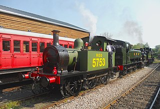
The Kent and East Sussex Railway (K&ESR) refers to both a historical private railway company in Kent and East Sussex in England, as well as a heritage railway currently running on part of the route of the historical company. The railway runs between Tenterden Town and Bodiam.

The Borough of Maidstone is a local government district with borough status in Kent, England. Its administrative centre is Maidstone, the county town of Kent.

The A52 is a major road in the East Midlands, England. It runs east from a junction with the A53 at Newcastle-under-Lyme near Stoke-on-Trent via Ashbourne, Derby, Stapleford, Nottingham, West Bridgford, Bingham, Grantham, Boston and Skegness to the east Lincolnshire coast at Mablethorpe. It is approximately 147 miles (237 km) long.

Langley is a village and civil parish in the Maidstone District of Kent, England. The parish is located on the A274 road leading south from Maidstone to Headcorn.
Headcorn is a village and civil parish in the borough of Maidstone in Kent, England. The parish is on the floodplain of the River Beult south east of Maidstone.
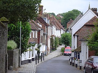
Sutton Valence is a village about five miles (8 km) SE of Maidstone, Kent, England on the A274 road going south to Headcorn and Tenterden. It is on the Greensand Ridge overlooking the Vale of Kent and Weald. St Mary's Church is on the west side of the village on Chart Road, close to the junction of the High Street with the A274. Another landmark is Sutton Valence Castle on the east side of the village, of which only the ruins of the 12th century keep remain, under the ownership of English Heritage.

Faversham and Mid Kent is a constituency represented in the House of Commons of the UK Parliament. Since 2015, the seat has been represented by Helen Whately of the Conservative Party.
The A56 is a road in England which extends between the city of Chester in Cheshire and the village of Broughton in North Yorkshire. The road contains a mixture of single and dual carriageway sections, and traverses environments as diverse as the dense urban sprawl of inner city Manchester and the lightly populated region of rural east Lancashire. The road includes a short section of trunk road between the end of the M66 motorway near Ramsbottom and the M65 motorway west of Burnley.

U.S. Highway 1 (US 1) is a 170.540-mile (274.458 km) north–south U.S. Highway that crosses South Carolina from southwest to northeast and connects the cities of North Augusta, Aiken, Lexington, Columbia, Camden, and Cheraw.

North Carolina Highway 39 (NC 39) is a primary state highway in the U.S. state of North Carolina. Traveling north–south, it connects the cities of Selma, Louisburg and Henderson, in the Research Triangle area.
Chart Sutton is a civil parish and small village on the edge of the Weald of Kent, England. It lies approximately 5 miles (8 km) to the south of Maidstone.
Ruxley is a rural settlement of South East London, England that straddles the boundary of the London Boroughs of Bromley and Bexley. It is located 13 miles southeast of Charing Cross, the traditional centre of London, in the Metropolitan Green Belt between Sidcup and Swanley and is also adjacent to the Greater London border with the county of Kent.
Park Wood is a suburb of Maidstone, Kent.
The Headcorn and Maidstone Junction Light Railway was a proposed railway in Kent. An Act of Parliament authorised its construction, but only a short branch at Tovil, opened to goods only, was built.
State Route 17 is part of Maine's system of numbered state highways, located in the south central part of the state. It is a major regional route running for 131.21 miles (211.16 km) from an intersection with State Route 4 in Oquossoc to an intersection with U.S. Route 1 and U.S. Route 1A in Rockland.

Elections to Maidstone Borough Council were held on 22 May 2014. One-third of the borough council were up for election. European Parliament Elections were held on the same day.