KwaDukuza, previously known as Stanger, is a town in KwaZulu-Natal, South Africa. In 2006, the municipal name was changed to KwaDukuza, but the Zulu people in the area called it "Dukuza" well before then.
Hillcrest is a town in the KwaZulu-Natal province of South Africa that forms part of the eThekwini Metropolitan Municipality and is situated approximately 32 km north-west of Durban and 53 km south-east of Pietermaritzburg.

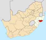
Port Shepstone is a large town situated on the mouth of the Mzimkhulu River, the largest river on the KwaZulu-Natal South Coast of South Africa. It is located halfway between Hibberdene and Margate and is positioned 120 km south of Durban. It serves as the administrative, educational, industrial and commercial centre for southern Natal.
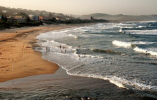
Scottburgh is a coastal resort town located along the south coast of KwaZulu-Natal, South Africa. It situated south of the mouth of the Mpambanyoni River (confuser of birds).

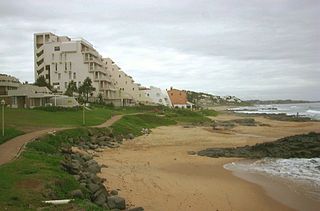
Umkomaas, also known by its official name eMkhomazi, is a small coastal village on the subtropical South Coast of KwaZulu-Natal, South Africa was formed when a harbour was built in 1861 to export sugar. The village rests beside the mouth of the navigable uMkhomazi River, also known as the Mkhomazi or Umkomaas. With the successful dredging of Durban harbour's sandbar and arrival of the railway, like Port Shepstone, the harbour fell into disuse, but the village came to life. It is administered as eMkhomazi Area, together with the nearby areas of Craigieburn, Clansthal, Ilfracombe, Crowder, Amahlongwa and Hull Valley as part Ward 99 in the eThekwini Metropolitan Municipality
Isipingo is a town situated 19 kilometres (12 mi) south of Durban in KwaZulu-Natal, South Africa and currently forms part of eThekwini Metropolitan Municipality. The town is named after the Siphingo River, which in turn is thought to be named for the intertwining cat-thorn shrubs (Scutia myrtina) present in the area, or the river's winding course.
Umzinto is a town, located in the South Coast of KwaZulu-Natal, South Africa, approximately 67 kilometres (42 mi) south-west of Durban. It was a sugarcane growing area and the town was set up as the centre for a sugar mill.

Mount Edgecombe or Mt Edgecombe is a town in KwaZulu-Natal, South Africa, situated just north of Durban, which forms part of eThekwini, the Greater Durban Metropolitan area. Much of the suburb is cordoned off as a gated settlement comprising resorts, golf courses and a retirement home. It was previously a sugar growing area. The population increased by 89% between 2001 and 2011 from 3,874 to 7,323. Its name is derived from Mount Edgcumbe House in Cornwall, England, the family seat of the Earls of Mount Edgcumbe.

oThongathi, previously and still commonly known as Tongaat, is a town in KwaZulu-Natal, South Africa, about 40 kilometres (25 mi) north of Durban and 28 kilometres (17 mi) south of KwaDukuza. It now forms part of eThekwini Metropolitan Municipality, or the Greater Durban area. The area is home to the oldest Indian community in South Africa, having been where the first indentured Indian laborers settled in 1860 to work in the sugar-cane plantations. Much of the architectural style in the town was the work of Ivan Mitford-Barberton, and many buildings are in the Cape Dutch style of architecture.

eMdloti, alternatively rendered Umdloti and also known as Umdloti Beach, is a small resort village situated along the KwaZulu-Natal North Coast, South Africa. It lies at the mouth of the Mdloti River approximately 24 km north-east of Durban and 11 km north-east of uMhlanga and now forms part of eThekwini, the Greater Durban Metropolitan Municipality.

Triangle is a small town in Masvingo Province, Zimbabwe, and is located 125 km south-east from Masvingo, between Ngundu Growth Point and Chiredzi. The town is located in the district of Chiredzi, one of the seven in Masvingo Province.

Sir James Liege Hulett was a British sugar magnate, politician and philanthropist in Colony of Natal, South Africa. Hulett founded what would become Tongaat Hulett Sugar in 1892. The JSE Securities Exchange-listed company is today a multi-billion rand corporation.
Xinavane is a town on the Incomati River, in the Manhiça District of Maputo Province, in Mozambique about 80 kilometres north of Maputo.

uMhlanga, alternatively rendered Umhlanga, is a residential, commercial and resort town north of Durban on the coast of KwaZulu-Natal, South Africa. It is part of the eThekwini Metropolitan Municipality, which was created in 2000 and includes the greater Durban area. The name means "place of reeds" in the Zulu language, and the correct pronunciation of "hl" in uMhlanga is similar to the Welsh "ll".
La Lucia is a wealthy suburb located in uMhlanga in the KwaZulu-Natal province of South Africa and is situated approximately 14 kilometres north of the Durban CBD. It was named after Lucia Michel. She and her husband Albert Michel founded the sugar cane farm La Lucia.
Tongaat Hulett is an agriculture and agri-processing business, focusing on the complementary feedstocks of sugarcane and maize. The company had its origins on the North coast of KwaZulu-Natal, specifically the town of Tongaat. The company was formed as a result of a merger between the Tongaat Sugar Company founded by Edward Saunders and Hulett's Sugar founded in 1892 by Liege Hulett. Company stock is listed on the Johannesburg Securities Exchange. Its core businesses are sugar, starch and property management.
The M4 is a north–south metropolitan route in the eThekwini Metropolitan Municipality and partially in the KwaDukuza Local Municipality, South Africa. It runs from the N2 at the defunct Durban International Airport to Ballito via the Durban Central Business District (CBD) and uMhlanga. The sections between the airport and the southern edge of the CBD, and between the northern edge of the CBD and the exit to uMhlanga are classified as freeway. On the section from the southern edge of the CBD to the Bram Fischer Street/Soldier's Way junction, the M4 is cosigned with the R102.

Sir Marshall Campbell (1848–1917) was a pioneer of the sugar industry in the Colony of Natal and parliamentarian concerned with Bantu affairs.

Shakaskraal is a town in Ilembe District Municipality in the KwaZulu-Natal province of South Africa. The town is dominated by local businesses and informal traders and main activities located in and nearby is sugar cane farming.
The KwaZulu-Natal North Coast, better known as the North Coast is a coastal region north of Durban in KwaZulu-Natal, South Africa. It stretches from Zinkwazi Beach in the north to Zimbali near Ballito in the south. The coastal region is governed by the KwaDukuza Local Municipality, forming part of the iLembe District Municipality.