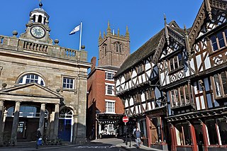
Ludlow is a market town and civil parish in Shropshire, England. It is located 28 miles (45 km) south of Shrewsbury and 23 miles (37 km) north of Hereford, on the A49 road which bypasses the town. The town is near the confluence of the rivers Corve and Teme.
Sheriffhales is a scattered village in Shropshire, England, 4 miles (6.4 km) north-east of Telford, 3 miles (4.8 km) north of Shifnal and 4 miles (6.4 km) south of Newport. The name derives from Halh (Anglican) and scīr-rēfa which is a combination of Hales and Sheriff. At the time of the Domesday Book, it was held by Roger de Balliol the Sheriff of Shropshire.

Brown Clee Hill is the highest hill in the rural English county of Shropshire, at 540 metres (1,770 ft) above sea level. It is one of the Clee Hills, and is in the Shropshire Hills Area of Outstanding Natural Beauty.

Titterstone Clee Hill, sometimes referred to as Titterstone Clee or Clee Hill, is a prominent hill in the rural English county of Shropshire, rising at the summit to 533 metres (1,749 ft) above sea level.

Abdon is an upland village and former civil parish, now in the parish of Abdon and Heath, in Shropshire, England. In 2011 the parish had a population of 199. It is in the Clee Hills.

The Shropshire Hills are a dissected upland area and one of the natural regions of England. They lie wholly within the county of Shropshire and encompass several distinctive and well-known landmarks, such as the Long Mynd, Wenlock Edge, The Wrekin and the Clees.
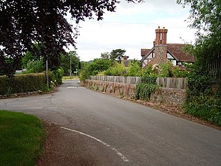
Bitterley is a village and civil parish in Shropshire, England. According to the 2001 census the parish had a population of 802, increasing to 902 at the 2011 Census. The village is about 4 miles (6.4 km) east of Ludlow on the western slopes of Titterstone Clee Hill. Bitterley is the location for Bitterley Court about 0.62 miles (1.00 km) east of the modern village. Nearby to the east, is the small hamlet of Bedlam.

Bouldon is a hamlet in Shropshire, England. It lies in the civil parish of Diddlebury.

Chorlton is a village and former civil parish, now in the parish of Hough and Chorlton, in the unitary authority area of Cheshire East and the ceremonial county of Cheshire, England. The village lies 4 miles (6.4 km) to the south east of Crewe. Nearby villages include Hough, Shavington, Weston and Wybunbury in Cheshire and Betley in Staffordshire. In 2011 the parish had a population of 897.

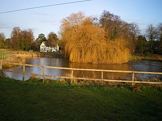
Burwarton is a small village and civil parish in Shropshire, England. Local governance is provided through the 'grouped' Parish Council for Aston Botterill, Burwarton and Cleobury North. The Parish falls within the Brown Clee Division of the Shropshire Unitary Council. There is no village meeting place, but the combined parishes share the facilities of the Village Hall at Cleobury North. The Burwarton Parish embraces most of the 'home estate' around Burwarton House. This rises westward from the main Bridgnorth-Ludlow road, passing north–south through the village, up to the ridge summit of Brown Clee Hill.

Ditton Priors is a village and civil parish in south Shropshire, England. Historically, it was also known as Priors Ditton.

Cleobury North is a civil parish and small village in south east Shropshire, England. It is situated on the B4364 southwest of the market town of Bridgnorth. To the north is the village of Ditton Priors and to the west is Brown Clee Hill, the county's highest hill.

Clee St. Margaret is a small village and civil parish in the Clee Hills area of Shropshire, England. It is seven miles north east from the market town of Ludlow.

Heath is a hamlet and former civil parish, now in the parish of Abdon and Heath, in the Clee Hills area of Shropshire, England.
Holdgate is a small village and former civil parish, now in the parish of Abdon and Heath, in the Shropshire district, in the ceremonial county of Shropshire, England. Its name is taken from its Norman lord Helgot who owned the village in 1086 along with 17 other parishes in Shropshire. In 1931 the parish had a population of 47.

Tugford is a village and former civil parish, now in the parish of Abdon and Heath, in the Shropshire district, in the ceremonial county of Shropshire, England. It lies between Bouldon and Holdgate, on the boundary of the relatively flat Corvedale and the upland Clee Hills.
Abdon is a former civil parish, now in the parish of Abdon and Heath, in Shropshire, England, and includes the settlements of Abdon, Tugford, Beambridge, and Holdgate. It contains 22 listed buildings that are recorded in the National Heritage List for England. Of these, one is listed at Grade I, the highest of the three grades, three are at Grade II*, the middle grade, and the others are at Grade II, the lowest grade. The parish is entirely rural. Most of the listed buildings are churches and associated structures in the churchyards. The other listed buildings consist of houses, a former mill and stables, a bridge, and a telephone kiosk.
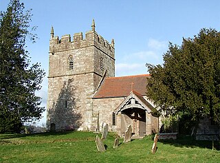
Heath is a former civil parish, now in the parish of Abdon and Heath, in Shropshire, England. It contains nine listed buildings that are recorded in the National Heritage List for England. Of these, one is listed at Grade I, the highest of the three grades, and the others are at Grade II, the lowest grade. The parish contains the hamlet of Heath and is otherwise entirely rural. The most important listed building in the parish is the Norman Heath Chapel, which is listed at Grade I, and the other listed buildings are all farmhouses and farm buildings.

Hollinswood and Randlay is a civil parish in Telford and Wrekin unitary area, in the ceremonial county of Shropshire, England. Hollinswood and Randlay are areas of Telford with historical origins: the Randlay Brickworks operated under this name from 1856, and Hollinswood is derived from "holly wood".

