Golconda is a fortified citadel and ruined city located on the western outskirts of Hyderabad, Telangana, India. The fort was originally built by Kakatiya ruler Pratāparudra in the 11th century out of mud walls. It was ceded to the Bahmani Kings from Musunuri Nayakas during the reign of the Bahmani Sultan Mohammed Shah I, during the first Bahmani-Vijayanagar War. Following the death of Sultan Mahmood Shah, the Sultanate disintegrated and Sultan Quli, who had been appointed as the Governor of Hyderabad by the Bahmani Kings, fortified the city and made it the capital of the Golconda Sultanate. Because of the vicinity of diamond mines, especially Kollur Mine, Golconda flourished as a trade centre of large diamonds known as Golconda Diamonds. Golconda fort is currently abandoned and in ruins. The complex was put by UNESCO on its "tentative list" to become a World Heritage Site in 2014, with other forts in the region, under the name Monuments and Forts of the Deccan Sultanate.

Kurnool district is one of the eight districts in the Rayalaseema region of the Indian state of Andhra Pradesh after the districts are reorganised in April 2022. It is located in the north western part of the state and is bounded by Nandyal district in the east, Anantapur district in the south, Raichur district of Karnataka in the northwest, Bellary district of Karnataka in the west, and Jogulamba Gadwal district of Telangana in the north. It has a population of 2,271,686 based on the 2011 census. The city of Kurnool is the headquarters of the district.

Medak district is located in the western region of the Indian state of Telangana. Medak is the district headquarters. The district shares boundaries with Sangareddy, Kamareddy, Siddipet and Medchal-Malkajgiri districts.

Ranga Reddy district is a district in the Indian state of Telangana. The district headquarters is located at Kongara Kalan Village, Ibrahimpatnam Mandal,. The district was named after the former deputy chief minister of the United Andhra Pradesh, K. V. Ranga Reddy. The district shares boundaries with Nalgonda, Yadadri Bhuvanagiri, Hyderabad, Medchal–Malkajgiri, Nagarkurnool, Mahabubnagar, Sangareddy and Vikarabad districts.

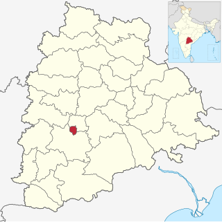
Hyderabad district is a district in the state of Telangana in India that contains a part of the metropolitan area of Hyderabad. It is headed by a district collector who is drawn from the IAS cadre and is appointed by the state government. It is the smallest of all the districts in the state, but has the highest human density. Old MCH area, which is central region of Hyderabad city comes under this district. The district shares boundaries with Rangareddy and Medhchal districts.

Korutla municipality is the second largest town and revenue division in the Jagtial district in the Indian state of Telangana. It is a historical town ruled by Jain Kings and second largest town in Jagtial district. It is the headquarters of Koratla constituency. It is located about 23 kilometres (14 mi) from the district headquarters Jagtial, 235 kilometers from Hyderabad, 73 kilometers from Karimnagar and 76 kilometers from Nizamabad.
Tandur is a town, Municipality and Mandal in Vikarabad district in the Indian State of Telangana. It is a municipality consisting of 36 wards, as well as the headquarters of Tandur Mandal in the Tandur Revenue Division. It is known for its production of Limestone, Cement, and Redgram . Drinking water is sourced from the River Kagna, a tributary of the Bhima River, which is 4 km from the town. The country's famous Tandur Redgram has been awarded the Geographical Indication (GI) by The Central Department of Commerce and Industry.

Uppal is a neighbourhood in Eastern Hyderabad, Telangana, India. It is the mandal headquarters of Uppal mandal in Keesara revenue division in Medchal-Malkajgiri district. It forms Circle No.2 in the L. B. Nagar Zone of Greater Hyderabad Municipal Corporation. There are four wards i.e., Chilukanagar (7), Habsiguda (8), Ramanthapur (9) and Uppal (10) in this circle.

Ghatkesar is a satellite town of Hyderabad in the Medchal-Malkajgiri district of Telangana, India. It is the mandal headquarters of Ghatkesar Mandal in the Keesara revenue division. Located in the outer suburbs of Hyderabad, it is a part of the Hyderabad Metropolitan Development Authority.

Taramati Baradari is a historical sarai as part of Ibrahim Bagh, a Persian style garden built during the reign of Ibrahim Quli Qutub Shah, the fourth Sultan of Golconda.
Kompally is a residential suburb in the Medchal-Malkajgiri district. It comes under the Dundigal mandal in the same district. It is one of the fastest growing residential areas around Hyderabad, and has many large residential layouts filled with ample greenery.

Amberpet is one of the oldest suburbs of Hyderabad, India. Amberpet lies adjacent to the famous Osmania University. It is also a Mandal in Hyderabad District. Its area stretches from Kachiguda to Ramanthapur in the East, and from 6 NO TO MALAKPET in the South. One of the oldest area of, Hyderabad, India.
Dar-ul-Shifa is a neighbourhood in the Old City of Hyderabad, India, named after the 16th-century hospital it once housed. The location was founded in AD 1591, more than 400 years ago, by Mohammed Quli Qutub Shah, the founder of Hyderabad city. Today it houses a large population of Shia Muslims and comes alive on the days of Muharram and Shia festivals. Most of the households have family members settled abroad, whose remittances increase the quality of life.
Pedda Amberpet is a Municipality in Rangareddy district, Telangana, India. It comes under Abdullapurmet mandal.
Turkayamjal is a Municipality in Abdullapurmet mandal, Rangareddy district in Telangana, India. Tata Institute of Social Sciences, Hyderabad is located in Turkayamjal.
Hakimpet is a village in Medchal district near Hyderabad, Telangana, India. It falls under Shamirpet mandal.
Batasingaram is a village in Ranga Reddy district in Telangana, India. It falls under Abdullapur mandal. It is very close to the Outer Ring Road, Hyderabad.

Adilabad district is a district in the northern area of Telangana, India. It is known as the gateway district to South and Central India. The district's headquarters is the town of Adilabad.
The Telangana Tourism Development Corporation is a state government agency which promotes tourism in Telangana, a state in the Southern region of India. The retired Director General of Police Pervaram Ramulu is the appointed First chairman of Telangana State Tourism. Tourist attractions in Telangana include historical places, monuments, forts, waterfalls, forests and temples.
Asifabad is a city and the district headquarters of Kumuram Bheem district in the Indian state of Telangana. It is located in Asifabad mandal of Asifabad revenue division. It is situated on the banks of Peddavagu river. It is about 309 kilometres (192 mi) north of the state capital Hyderabad,86 kilometres (53 mi) from Ramagundam, 118 kilometres (73 mi) from Adilabad and 148 kilometres (92 mi) from Karimnagar.


