
Villa Clara is one of the provinces of Cuba. It is located in the central region of the island bordering on the Atlantic Ocean to the north, Matanzas Province to the west, Sancti Spiritus Province to the east, and Cienfuegos Province to the South. Villa Clara shares with Cienfuegos and Sancti Spiritus on the south the Escambray Mountain Range. Its main cities are Santa Clara, Remedios, Sagua La Grande, Camajuani, Caibarién, Ranchuelo, Placetas, and Manicaragua.

Cienfuegos is one of the provinces of Cuba. The capital city of the province is also called Cienfuegos and was founded by French settlers in 1819.

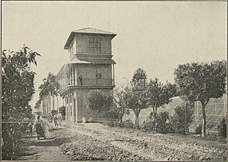
Cienfuegos, capital of Cienfuegos Province, is a city on the southern coast of Cuba. It is located about 250 km (160 mi) from Havana and has a population of 164,924. Since the late 1960s, Cienfuegos has become one of Cuba's main industrial centers, especially in the energy and sugar sectors. The city is dubbed La Perla del Sur. Despite being known as an industrial city of factories and various nuclear/electrical plants, and the name Cienfuegos literally translating to "one hundred fires", the city actually takes its name from the surname of Asturian-born José Cienfuegos Jovellanos, Captain General of Cuba (1816–19).

Santa Clara is the capital city of the Cuban province of Villa Clara. It is centrally located in the province and Cuba. Santa Clara is the fifth-most populous Cuban city, with a population of nearly 250,000.

San Antonio de los Baños is a municipality and town in the Artemisa Province of Cuba. It is located 26 km from the city of Havana, and the Ariguanabo River runs through it. It was founded in 1802.

Cruces is a municipality and town in Cienfuegos Province, Cuba. It is the home of the Mal Tiempo National Park which commemorates a battle in the 1895 War of Independence.

Santa Cruz del Norte is a town and municipality in the Mayabeque Province of Cuba. Before 2011 it was part of La Habana Province. It is located on the north shore, between the cities of Havana and Matanzas, at the mouth of the Santa Cruz River.

Colón is a municipality and city in the Matanzas Province of Cuba. The municipality has an area of 547 km2 (211 sq mi) and a population of about 71,000. The city proper, with a population of about 44,000, is the third-largest of its province.

Aguada de Pasajeros is a municipality and town in the Cienfuegos Province of Cuba.

Rodas is a municipality and town in the Cienfuegos Province of Cuba. It was founded in 1859 under the name of Lechuzo. In 1879 it was renamed Rodas in honour of capitán general Caballero de Rodas.
Alquízar is a town and municipality in the Artemisa Province of Cuba.

Jagüey Grande, simply known as Jagüey, is a town and municipality in the Matanzas Province of Cuba. It is located east of the Zapata Peninsula, north of the Bahia de Cochinos, along the A1 motorway in the center of the province.

Cumanayagua is a municipality and town in the Cienfuegos Province of Cuba. It is located in a valley near the Guamuhaya Mountains (usually these mountains are referred as Escambray Mountains, 23 kilometres east of Cienfuegos, the provincial capital.

Lajas, known historically and culturally as Santa Isabel de las Lajas, is a municipality and town in the Cienfuegos Province of Cuba. It is located in the northern part of the province, 35 kilometres (22 mi) west of Santa Clara and immediately south of the A1 motorway.

Palmira is a municipality and town in the Cienfuegos Province of Cuba. The whole municipality 33,153.
Batabanó is a municipality and town in the Mayabeque Province of Cuba. It was founded in 1688.

San Nicolás de Bari, also named San Nicolás, is a municipality and town in the Mayabeque Province of Cuba. It was founded in 1846.

Ranchuelo is a town and municipality in the Villa Clara Province of Cuba. It was founded in 1734 and has a municipal population of 59,062, of which about 16,804 in the town itself.

Yaguajay is a municipality and town in the Sancti Spíritus Province of Cuba. It is located in the northern part of the province, and borders the Bay of Buena Vista to the north. The Caguanes National Park is located in Yaguajay.

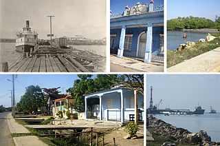
Juraguá is a Cuban village and consejo popular of the municipality of Abreus, in Cienfuegos Province. With a population of ca. 7,000 it is the most populated village in the municipality after Abreus.

