
Tarrafal is a concelho (municipality) of Cape Verde. It is situated in the northern part of the island of Santiago. Its seat is the town Tarrafal. Its population was 18,565 at the 2010 census, and its area is 120.8 km2.

Santa Catarina is a concelho (municipality) of Cape Verde. It is situated in the western part of the island of Santiago. Its seat is the city of Assomada. Its population was 45,920 in 2017 (estimate). Its area is 242.6 km2.
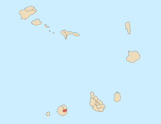
Santa Catarina do Fogo is a concelho (municipality) of Cape Verde. Situated in the southeastern part of the island of Fogo, it covers 32% of the island area, and is home to 14% of its population. Its seat is the city Cova Figueira. The Municipality of Santa Catarina do Fogo was created in 2005; before 2005, it was a parish of the Municipality of São Filipe.

São Salvador do Mundo is a concelho (municipality) of Cape Verde. It is situated in the central part of the island of Santiago. Its seat is the city Picos. Its population was 8,677 at the 2010 census, and its area is 26.5 km2, making it the smallest municipality of Cape Verde. The municipality borders Santa Cruz to the northeast, São Lourenço dos Órgãos to the southeast, Ribeira Grande de Santiago to the southwest and Santa Catarina to the northwest.

Nova Sintra is a city in the central part of the island of Brava in southwestern Cape Verde. It serves as the seat of the Brava Municipality. The settlement is named after Sintra, the summer residence of the Portuguese kings. Its population is about 1,500. Its elevation is around 500 meters. Since 2010, Nova Sintra has been a city. Agriculture is the predominant source of income on Brava. Tourism is less developed, but there are a few small hotels and guest houses. The "aluguer" buses to the other villages start from Praça Eugénio Tavares.

Furna is a seaside community in the northeastern part of the island of Brava, Cape Verde. It lies 2.5 km northeast of the island capital of Nova Sintra. At the 2010 census its population was 612.

Figueira Pavão is a settlement in the southeastern part of the island of Fogo, Cape Verde. In 2010 its population was 320. It is situated 3 km southwest of Cova Figueira and 20 km east of the island capital São Filipe. Nearby settlements are Achada Furna to the west and Estância Roque to the north.
Patim is a town in the southwestern part of the island of Fogo, Cape Verde. It is situated 8 km southeast of the island capital São Filipe. At the 2010 census its population was 876. Its elevation is 535 meters. It is 2 km east of Luzia Nunes and 2.5 km southwest of Monte Grande. Its climate is arid. Average temperature is 20.5 °C. Average precipitation is 268 mm.

Fonte Aleixo is a settlement in the southern part of the island of Fogo, Cape Verde. It is situated 3 km south of Achada Furna and 16 km southeast of the island capital São Filipe. In 2010 its population was 401.
Achada Fazenda is a settlement in the eastern part of the island of Santiago, Cape Verde. In 2010 its population was 2,592. It is situated near the east coast, 2 km southeast of Pedra Badejo, near the estuary of the Ribeira Seca.
Achada Tenda is a town in the northern part of the island of Santiago, Cape Verde. In 2010 its population was 1,242. It is situated on the east coast, 10 km southeast of Tarrafal. The small bay Porto Formoso is situated near the town.

Cabeça Fundão is a settlement in the southern part of the island of Fogo, Cape Verde and sits on the foot of the mountain rim of Bordeira. It is situated 16 km east of the island capital São Filipe. In 2010 its population was 177. The village is located on the road from Achada Furna to Chã das Caldeiras (EN3-FG05). Its elevation is about 1,570 meters. Cabeça Fundão lies directly south of the Fogo Natural Park.

Ribeira de Calhau is a settlement in the eastern part of the island of Sao Vicente, Cape Verde. It takes its name from the river Ribeira do Calhau, and comprises the villages of Madeiral, Ribeira de Calhau and Calhau. Madeiral and Ribeira de Calhau are located in the river valley, Calhau is on the east coast. In 2010 its population was 1,177. The valley is surrounded by the mountains Viana, Madeiral, Pico do Vento and Monte Verde.
Praia Baixo is a village in the southeastern part of the island of Santiago, Cape Verde. It is part of the municipality of São Domingos and the parish of Nossa Senhora da Luz. It is situated on the east coast, 1.5 km northwest of Achada Baleia, 11 km southeast of Pedra Badejo, 10 km east of São Domingos and 16 km north of the capital Praia. In 2010 its population was 952.

Monte Largo is a settlement in the southern part of the island of Fogo, Cape Verde. It is situated 1.5 km northeast of Salto, 3 km southeast of Monte Grande, 3 km west of Achada Furna and 13 kilometres (8.1 mi) east of the island capital São Filipe. At the 2010 census its population was 274. Its elevation is about 800 meters.
Achada Baleia is a settlement in the eastern part of the island of Santiago, Cape Verde. It is part of the municipality of São Domingos. In 2010 its population was 376. It is situated near the east coast, 1.5 km southeast of Praia Baixo, 2 km northwest of Baía and 15 km northeast of Praia. It sits at an elevation of about 50 meters.
Baía is a settlement in the eastern part of the island of Santiago, Cape Verde. It is part of the municipality of São Domingos. In 2010 its population was 489. It is situated near the east coast, 2 km southeast of Achada Baleia, 2 km northwest of Moia Moia and 14 km northeast of Praia. It sits at an elevation of about 20 meters. The settlement consists of several localities, including Achada Baixo, Castelinho and Covão Santana. The ruined Gothic church of Nossa Senhora da Luz, which was part of the 15th century Portuguese settlement Alcatrazes, stands at the shore near Baía.
Achada Ponta is a settlement in the eastern part of the island of Santiago, Cape Verde. It is part of the municipality Santa Cruz. It is located near the east coast, 2 km southeast of Achada Fazenda and 5 kilometers southeast of Pedra Badejo. In 2010 its population was 403.


