
Tarrafal de São Nicolau is a city in the western part of the island of São Nicolau, Cape Verde. With a population of 3,733, it is the most populous settlement of the island. It is the seat of the Tarrafal de São Nicolau Municipality, and the main port of the island. It is situated on the west coast, 9 km southwest of Ribeira Brava.
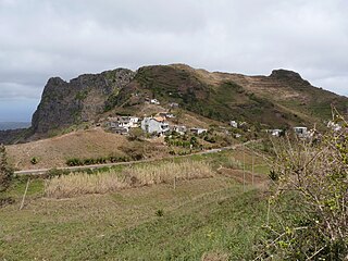
Rui Vaz is a settlement in the central part of the island of Santiago, Cape Verde. In 2010 its population was 1,078. It is situated at 809 m elevation, 2 km south of São Jorge dos Órgãos and 4 km west of São Domingos. It is part of the municipality of São Domingos.

Atalaia is a settlement in the northern part of the island of Fogo, Cape Verde. Its population was 700 in 2010. It is situated near the coast, 6 km west of Mosteiros and 19 km northeast of the island capital São Filipe. The municipal boundary with São Filipe is to the west. Nearby settlements area Ribeira Ilhéu to the east and Campanas Baixo to the west. The festival of Saint John is celebrated every June 24.
Figueira Pavão is a settlement in the southeastern part of the island of Fogo, Cape Verde. In 2010 its population was 320. It is situated 3 km southwest of Cova Figueira and 20 km east of the island capital São Filipe. Nearby settlements are Achada Furna to the west and Estância Roque to the north.
Ribeira do Ilhéu is a settlement in the northern part of the island of Fogo, Cape Verde. It is situated 6 km west of Mosteiros and 20 km northeast of the island capital São Filipe. The nearest village is Atalaia, 1.5 km to the southwest. The village's main festival is the festival of Saint Joseph that takes place on March 19.
Estância Roque is a settlement in the eastern part of the island of Fogo, Cape Verde. In 2010 its population was 411. It is situated 3 km west of Cova Figueira and 19 km east of the island capital São Filipe. Nearby places include Figueira Pavão in the south and Cabeça Fundão in the northwest.
Vicente Dias is a settlement in the western part of the island of Fogo, Cape Verde. It is situated 2 km northwest of Luzia Nunes and 5 km east of the island capital São Filipe.
Galinheiro is a settlement in the northwestern part of the island of Fogo, Cape Verde. In 2010 its population was 877. It is situated 2 km northeast of Ponta Verde, 2.5 km southwest of São Jorge and 13 km northeast of the island capital São Filipe.
Estância de Brás is a settlement in the northern part of the island of São Nicolau, Cape Verde. It is situated near the north coast, 2 km north of Fajã de Baixo and 6 km northwest of Ribeira Brava.

Fundo das Figueiras is a village in the eastern part of the island of Boa Vista. The village is around 21 km east of the island capital of Sal Rei. It is the seat of the civil parish of São João Baptista. 2 km to the south is the village Cabeça dos Tarrafes and 8 km southeast is Ponta Meringuel, the easternmost point in Cape Verde.
Praia Branca is a town in the northwestern part of the island of São Nicolau, Cape Verde. It is part of the municipality of Tarrafal de São Nicolau. Its population at the 2010 census was 521. It is situated 2 km from the coast, 10 km northwest of Ribeira Brava.

São Domingos is a city in the central part of the island of Santiago, Cape Verde. In 2010 its population was 2,818. It is the seat of the São Domingos Municipality. It is situated 13 km southeast of Assomada and 13 km northwest of the capital Praia, along the national road from Praia to Assomada (EN1-ST01). The settlement appeared in the 1747 map by Jacques-Nicolas Bellin as St. Domingo.
As Hortas is a settlement in the northwestern part of the island of Fogo, Cape Verde. It is situated 2 km west of Curral Grande, 3 km southwest of Ponta Verde and 8 km north of the island capital São Filipe.
Fragata is a settlement in the northwestern part of the island of São Nicolau, Cape Verde. In 2010 its population was 172. It is situated 2 km south of Ribeira Prata and 9 km north of Tarrafal de São Nicolau. It consists of the localities Cruzinha, Geronimo, Santa Barbara and Fragatona (Tope).
Palhal is a settlement in the western part of the island of São Nicolau, Cape Verde. In 2010 its population was 100. It is situated 2 km west of Cabeçalinho and 5 km northeast of Tarrafal de São Nicolau.
Covão Grande is a settlement in the central part of the island of Santiago, Cape Verde. It is part of the municipality São Salvador do Mundo. In 2010 its population was 478. It is situated 2 km northwest of Picos and 2.5 km east of Assomada.
Luzia Nunes is a settlement in the southwestern part of the island of Fogo, Cape Verde. It is situated 1.5 km west of Patim, 2 km southeast of Vicente Dias and 7 km southeast of the island capital São Filipe. At the 2010 census its population was 438.
Achada Baleia is a settlement in the eastern part of the island of Santiago, Cape Verde. It is part of the municipality of São Domingos. In 2010 its population was 376. It is situated near the east coast, 1.5 km southeast of Praia Baixo, 2 km northwest of Baía and 15 km northeast of Praia. It sits at an elevation of about 50 meters.
Baía is a settlement in the eastern part of the island of Santiago, Cape Verde. It is part of the municipality of São Domingos. In 2010 its population was 489. It is situated near the east coast, 2 km southeast of Achada Baleia, 2 km northwest of Moia Moia and 14 km northeast of Praia. It sits at an elevation of about 20 meters. The settlement consists of several localities, including Achada Baixo, Castelinho and Covão Santana. The ruined Gothic church of Nossa Senhora da Luz, which was part of the 15th century Portuguese settlement Alcatrazes, stands at the shore near Baía.
Dacabalaio is a village in the southcentral part of the island of Santiago, Cape Verde. It is part of the municipality of São Domingos. It is 2 km south of Rui Vaz and 4 km southwest of the municipal seat São Domingos. In 2010 its population was 47. Its elevation is about 710 m.


