The Acle Straight, also known as the Acle New Road, is a major road between Acle and Great Yarmouth in Norfolk, England. It is part of the A47 trunk road. [1]
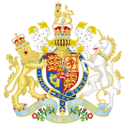
Great Yarmouth and Acle Turnpike Road Act 1830 | |
---|---|
Act of Parliament | |
Long title | An Act for making a Turnpike Road from the Bridge over the River Bure at Great Yarmouth to Acle (with certain Branches therefrom), all in the County of Norfolk. |
Citation | 11 Geo. 4 & 1 Will. 4. c. xxxix |
Dates | |
Royal assent | 3 May 1830 |
Other legislation | |
Repealed by | Statute Law (Repeals) Act 2008 |
Status: Repealed | |
Text of statute as originally enacted |
The road was originally proposed as a turnpike on 3 May 1830 following an act of Parliament, the Great Yarmouth and Acle Turnpike Road Act 1830 (11 Geo. 4 & 1 Will. 4. c. xxxix) [2] and engineered by William Thorold. Its purpose was to provide quicker access between the two towns over the Halvergate Marshes. It was designed as two straight sections, connected by a bend halfway along which included a branch road between Seven Mile House and Halvergate. This reduced the distance from Great Yarmouth to Norwich by 3 miles 5 furlongs (5.83 km). [1] [3] The road was constructed by digging two parallel ditches, 37 feet (11 m) feet apart, with a surface comprising brushwood, gravel and soil from the ditches. It was largely complete by April 1831 and opened later that year. [4] [5]
Tolls were removed from the road in 1861, though they remained on the Yarmouth Suspension Bridge over the River Bure into the town centre until 1920. [6]
In 1882, the railway line between Acle and Great Yarmouth was built parallel to the Acle Straight. [7] The Stracey Arms Windpump was built in 1883 near the Halvergate branch road junction. It was Grade II* listed in 1982. A similarly named pub, the Stracey Arms, opened next door to the windmill. It subsequently became popular with boaters on the Norfolk Broads as it sat directly between the Acle Straight and the River Bure and had private moorings. In 2015, it was converted into a Hindu temple. [8] [9] [10] [11]
The Acle Straight experienced problems with subsidence. In 1908, a deep pile was planned but was abandoned after testing found the ground was stable only up to a depth of 11 feet (3.4 m). [1]
The road is a notorious accident spot, with numerous fatalities. [4] As it runs through the middle of uninhabited wetlands, there is no practical alternative route, and detours can be up to 30 miles (48 km). [12] There have been proposals to widen the road to dual carriageway, but these have been rejected owing to environmental concerns. [13]
Several ghost stories have featured the Acle Straight. A driver passing the turning to the Halvergate branch spotted a man walking out into the middle of the road. Unable to stop, he drove straight through him. There have also been reports of a horse and cart crossing directly in front of oncoming traffic, and drivers have reported wanting to perform an emergency stop for no reason. [4]
The Acle Straight is mentioned in the song "Stuck In A Rut" by local band The Darkness. The lyrics refer to the group trying to get out of their hometown of Lowestoft, with the road as one possible escape route. [14]
The Broads is a network of mostly navigable rivers and lakes in the English counties of Norfolk and Suffolk. Although the terms "Norfolk Broads" and "Suffolk Broads" are correctly used to identify specific areas within the two counties respectively, the whole area is frequently referred to as the Norfolk Broads.
Great Yarmouth, often called Yarmouth, is a seaside town which gives its name to the wider Borough of Great Yarmouth in Norfolk, England; it straddles the River Yare and is located 20 miles (32 km) east of Norwich. Its fishing industry, mainly for herring, shrank after the mid-20th century and has all but ended. North Sea oil from the 1960s supplied an oil rig industry that services offshore natural gas rigs; more recently, offshore wind power and other renewable energy industries have ensued.
Reedham is a village and civil parish in the English county of Norfolk and within The Broads. It is on the north bank of the River Yare, 12 miles (19 km) east of the city of Norwich, 8 mi (13 km) south-west of the town of Great Yarmouth and the same distance north-west of the Suffolk town of Lowestoft. The village's name means 'reedy homestead/village' or 'reedy hemmed-in land'.
The Halvergate Marshes are an area of grazing marsh in the east of the English county of Norfolk. They form part of the area of The Broads and lie between the River Bure and the River Yare, bordering Breydon Water on the east. The marshes cover an area of around 2,642 hectares An area of 1,432.7-hectare (3,540-acre) is a biological Site of Special Scientific Interest. Some areas are also in the Breydon Water Local Nature Reserve, the Broadland and Breydon Water Ramsar sites, The Broads Special Area of Conservation, and The Broads and Breydon Water Special Protection Areas.
Halvergate is a village and civil parish in the English county of Norfolk, north of Reedham, between the Rivers Bure and Yare, within The Broads. To the east of the village is the hamlet of Wickhampton and the Halvergate Marshes, an area of drainage marsh which was the site of the first Environmentally Sensitive Area in the United Kingdom in 1987.
Acle is a market town on the River Bure on the Norfolk Broads in Norfolk, located halfway between Norwich and Great Yarmouth. It has the only bridge across the River Bure between Wroxham and Great Yarmouth.
The A12 is a major road in Eastern England. It runs north-east/south-west between London and the coastal town of Lowestoft in the north-eastern corner of Suffolk, following a similar route to the Great Eastern Main Line until Ipswich. A section of the road between Lowestoft and Great Yarmouth became part of the A47 in 2017. Between the junctions with the M25 and the A14, the A12 forms part of the unsigned Euroroute E30. Unlike most A roads, this section of the A12, together with the A14 and the A55, has junction numbers as if it were a motorway.
The A47 is a major trunk road in England linking Birmingham to Lowestoft, Suffolk, maintained and operated by National Highways. Most of the section between Birmingham and Nuneaton is now classified as the B4114. From Peterborough eastwards, it is a trunk road.
The Wherry Lines are railway branch lines in the East of England, linking Norwich with Great Yarmouth and Lowestoft. There are 14 stations on the lines, including the three termini. They form part of Network Rail Strategic Route 7, SRS 07.11 and are classified as a rural line.
Great Yarmouth railway station is one of two eastern termini of the Wherry Lines in the East of England, serving the seaside town of Great Yarmouth, Norfolk. The other terminus at the eastern end of the lines is Lowestoft and the western terminus, to which all trains run, is Norwich.
First Eastern Counties is a bus operator providing services in Norfolk and Suffolk in eastern England. It is a subsidiary of FirstGroup and has five depots in operating areas spread out across East Anglia. These areas are Norwich, Ipswich, Great Yarmouth, Lowestoft and King's Lynn.
Lockgate Mill also referred to locally and historically as Freethorpe Mill, 'Banham's Black Mill' and 'Duffel's Mill' is a windpump located on the Halvergate Marshes in the detached parish of Freethorpe within The Broads in the English county of Norfolk. It is approximately 2 miles (3.2 km) west of Great Yarmouth, and 3 miles (4.8 km) north-east of Berney Arms on the northern edge of Breydon Water. The structure is a Grade II listed building.
The A149 is commonly known as "The Coast Road" to local residents and tourists, as this road runs along the North Norfolk coast from King's Lynn to Great Yarmouth, via coastal villages.
The A146 is an A road that connects Norwich in Norfolk and Lowestoft in Suffolk, two of East Anglia's largest population centres. It is around 27 miles (43 km) in length and has primary classification along its entire route. It is mainly single carriageway throughout its route, with the exception of a section of dual carriageway on the southern edge of Norwich.
William Thorold was a 19th-century millwright, architect and civil engineer in Norwich, Norfolk, England.
The Yarmouth–Lowestoft line was a railway line which linked the coastal towns of Yarmouth, Gorleston-on-Sea and Lowestoft in the counties of Norfolk and Suffolk, England. It opened on 13 July 1903 as the first direct railway link between the two towns; it was constructed by the Great Eastern Railway and the Midland and Great Northern Railway in the hope of encouraging the development of holiday resorts along the coast. In the event, although the line was built to high standards and considerable cost, intermediate traffic did not develop and competition from buses and trams eroded the little that had been generated.
Excel is the brand name given to a number of bus services operated by First Norfolk & Suffolk, covering 80 miles (130 km) between Norwich bus station in Norfolk and Peterborough railway station in Cambridgeshire. Prior to February 2018, the route also extended from Norwich to Lowestoft in Suffolk via Great Yarmouth; this section of the route has since been replaced by Coastlink branded services X1 and X2. As of June 2021, the Excel route itself operates between Peterborough, King's Lynn and Norwich, with variations A, B, C and D providing different levels of service to intermediate villages.
The Norfolk Railway was an early railway company that controlled a network of 94 miles around Norwich, England. It was formed in 1845 by the amalgamation of the Yarmouth and Norwich Railway opened in 1844, and the Norwich and Brandon Railway, not yet opened. These lines were built out of frustration that the Eastern Counties Railway line that was expected to connect Norwich to London failed to be completed. The Norfolk Railway also leased the Lowestoft Railway and Harbour Company, and built a branch to Dereham and Fakenham, opened in 1846 and 1849 respectively.
Stracey Arms Windpump is a windpump located at Tunstall in the civil parish of Halvergate, Norfolk, England. It is a grade II* listed building. It takes its name from a nearby public house formerly called the Stracey Arms, after the local Stracey family.
Tunstall is a village and former civil parish, now in the parish of Halvergate, in the Broadland district of Norfolk, England. It lies some 14 miles (22.5 km) south-east of Norwich alongside the River Bure. In 1931 the parish had a population of 94.
{{cite journal}}
: Cite journal requires |journal=
(help)Originally published in The Norfolk Chronicle, 23 April 1831.