In geography and geology, a cliff is a vertical, or nearly vertical, rock exposure. Cliffs are formed as erosion landforms by the processes of weathering and erosion. Cliffs are common on coasts, in mountainous areas, escarpments and along rivers. Cliffs are usually formed by rock that is resistant to weathering and erosion. Sedimentary rocks most likely to form cliffs include sandstone, limestone, chalk, and dolomite. Igneous rocks such as granite and basalt also often form cliffs.

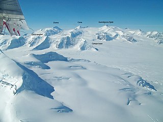
The Watkins Range is Greenland's highest mountain range. It is located in King Christian IX Land, Sermersooq municipality.

Mount Paatusoq, also known as 'Mount Patuersoq', is the highest mountain in the Kujalleq municipality, SE Greenland.

The Stauning Alps are a large system of mountain ranges in Scoresby Land, King Christian X Land, northeastern Greenland. Administratively the Stauning Alps are part of the Northeast Greenland National Park zone.

Payer Peak, is a mountain in King Christian X Land, Northeast Greenland. Administratively it is part of the Northeast Greenland National Park zone.

Petermann Peak,, also known as Petermann Fjeld, Petermanns Topp and Petermann Point is a mountain in King Christian X Land, Northeast Greenland. Administratively it is part of the Northeast Greenland National Park zone.

Schweizerland, also known as Schweizerland Alps, is a mountain range in King Christian IX Land, eastern Greenland. Administratively this range is part of the Sermersooq Municipality. Its highest point is one of the highest peaks in Greenland.

Revaltoppe is one of the highest mountains in Queen Louise Land, NE Greenland. The peak is located in the King Frederick VIII Land area of northeastern Greenland. Administratively it is part of the Northeast Greenland National Park zone.

Gefiontinde is the highest mountain in Queen Louise Land, NE Greenland. The peak is located in the King Frederick VIII Land area of northeastern Greenland. Administratively it is part of the Northeast Greenland National Park zone.

The Haug Range is a mountain range in far northwestern Greenland. Administratively this range is part of the Qaasuitsup municipality. The range is located in Hall Land, one of the coldest places in Greenland.

The Crown Prince Frederick Range is a large mountain range in King Christian IX Land, eastern Greenland. Administratively this range is part of the Sermersooq Municipality.

The Lindbergh Range or Lindbergh Nunataks is a mountain range in King Christian IX Land, eastern Greenland. Administratively the range is part of the Sermersooq Municipality.

The Lilloise Range or Lilloise Mountains is a mountain range in King Christian IX Land, eastern Greenland. Administratively this range is part of the Sermersooq Municipality.

The Roosevelt Range or Roosevelt Mountains is a mountain range in Northern Greenland. Administratively this range is part of the Northeast Greenland National Park. Its highest peak is the highest point in Peary Land.

The H. H. Benedict Range or H. H. Benedict Mountains is a mountain range in Peary Land, Northern Greenland. Administratively this range is part of the Northeast Greenland National Park.

The Daly Range or Daly Mountains is a mountain range in Peary Land, Northern Greenland. Administratively this range is part of the Northeast Greenland National Park.


