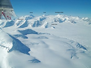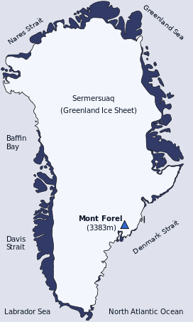
Gunnbjørn Fjeld is the tallest mountain in Greenland, the Kingdom of Denmark, and north of the Arctic Circle. It is a nunatak, a rocky peak protruding through glacial ice.
Lawrence Rickard Wager, commonly known as Bill Wager, was a British geologist, explorer and mountaineer, described as "one of the finest geological thinkers of his generation" and best remembered for his work on the Skaergaard intrusion in Greenland, and for his attempt on Mount Everest in 1933.
André Roch was a mountaineer, avalanche researcher and expert, skier, resort developer, engineer, and author. Roch is best known for having planned and surveyed the Aspen, Colorado, ski resort, and also as an adviser on avalanche management whose expertise was sought throughout the world.

The Watkins Range is Greenland's highest mountain range. It is located in King Christian IX Land, Sermersooq municipality.
Paul Walker is an Arctic explorer and Polar Guide. He is owner and Director of Greenland Expedition Logistics & Consultancy (GELCO), a trading name of California Ocean Northumbria Ltd. He is owner and Director of Futures Greenland ApS, a Greenland based expedition logistics, storage and rental company. He is also co-owner of the luxury UK campervan rental company California Ocean Northumbria Ltd. He was previously owner and Director of Tangent Expeditions Ltd, which closed in 2020 due to COVID-19 after 31 years. He was born in Shrewsbury, England on 09 March 1966. He achieved a B.Ed Honours degree in Outdoor Education and Mathematics after graduating from Charlotte Mason College, Ambleside (UK) in 1988; the teaching arm of Lancaster University. Since becoming one of the UK's youngest qualified Winter Mountain Leaders, aged 23, Paul has organised more than 250 arctic expeditions to Spitsbergen (Svalbard), Baffin Island (Canada), Iceland and Greenland in a 32 year career. In 2006 he led an 8 man team to make the first and only winter ascent of Gunnbjørnsfjeld, the highest mountain in the Arctic Circle, which has never been repeated. Paul has personally climbed and guided well over 100 first ascents of previously unclimbed mountains in Greenland, establishing what is regarded as likely to be a World Record (unofficial). After 30 years living in the Lake District, North West England, Paul moved to the small rural town of Wooler, Northumberland. Paul is married and has three children.
Alfred Stephenson OBE was an English polar explorer and surveyor.

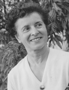
Louise "Loulou" Boulaz was a Swiss mountain climber and alpine skier who made numerous first ascents in the Alps.

King Christian IX Land is a coastal area of Southeastern Greenland in Sermersooq Municipality fronting the Denmark Strait and extending through the Arctic Circle from 65°N to 70°N.

Mount Paatusoq, also known as 'Mount Patuersoq', is the highest mountain in the Kujalleq municipality, SE Greenland.
Toni Dürnberger was an Austrian mountaineer and expedition leader.

The Stauning Alps are a large system of mountain ranges in Scoresby Land, King Christian X Land, northeastern Greenland. Administratively the Stauning Alps are part of the Northeast Greenland National Park zone.
Norsketinden is a mountain in the Stauning Alps, Eastern Greenland.
Petermann Peak,, also known as Petermann Fjeld, Petermanns Topp and Petermann Point is a mountain in King Christian X Land, Northeast Greenland. Administratively it is part of the Northeast Greenland National Park zone.

Schweizerland, also known as Schweizerland Alps, is a mountain range in King Christian IX Land, eastern Greenland. Administratively this range is part of the Sermersooq Municipality. Its highest point is one of the highest peaks in Greenland.

The Princess Caroline-Mathilde Alps are a mountain range system in the Holm Land Peninsula, King Frederick VIII Land, northeastern Greenland. Administratively this range is part of the Northeast Greenland National Park zone.

The Roosevelt Range or Roosevelt Mountains is a mountain range in Northern Greenland. Administratively this range is part of the Northeast Greenland National Park. Its highest peak is the highest point in Peary Land.

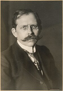
Alfred de Quervain was a Swiss Arctic explorer and geophysicist.


