
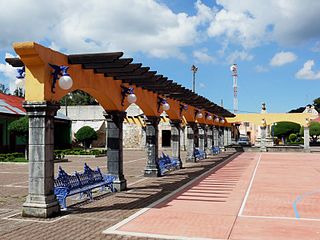
Tlaxcala, officially Tlaxcala de Xicohténcatl, is the capital city and of the Mexican state of Tlaxcala and seat of the municipality of the same name. The city did not exist during the pre-Hispanic period but was laid out by the Spanish as a center of evangelization and governance after the Spanish conquest of the Aztec Empire. The city was designated as a diocese but eventually lost that status to Puebla as its population declined. The city still has many of its old colonial structures, including the former Franciscan monastery, and newer civic structures like the Xicohtencatl Theatre.

Tlaxcala, officially the Free and Sovereign State of Tlaxcala, is one of the 32 federal entities that comprise the Federal Entities of Mexico. It is divided into 60 municipalities and the capital city and the largest city is Tlaxcala de Xicohténcatl.

Tlaxcala is a state in Central Mexico that is divided into 60 municipalities. According to the 2020 Mexican census, it is the fifth least populated state with 1,342,977 inhabitants and the 2nd smallest by land area spanning 3,996.6 square kilometres (1,543.1 sq mi).
Platón Sánchez is a municipality in the Mexican state of Veracruz. It is located in the state's Huasteca Alta region. The municipal seat is the town of Platón Sánchez.

The Metropolitan area of Puebla or Greater Puebla is the fourth largest agglomeration in Mexico with a population of 3.199 million. This agglomeration includes 10 municipalities of the state of Puebla, and 13 municipalities of the state of Tlaxcala. It does not include the city of Tlaxcala.

Zapotlán de Juárez is a town and one of the 84 municipalities of Hidalgo, in central-eastern Mexico. The municipality covers an area of 131.1 km2.
Santa Ana Chiautempan is a city in Chiautempan Municipality in the south-central part of the Mexican state of Tlaxcala. The city serves as the municipal seat of the municipality, which covers an area of 66.21 km². At the 2005 census it had a population of 46,776 inhabitants, the fourth-largest community in the state in population. The city lies at the extreme western end of the municipality, which had a census population of 63,300 inhabitants.

The municipality of Colotlán is in the northern extremity of the Mexican state of Jalisco. The municipality covers an area of approximately 648 square kilometers. Colotlán is located at 22°12′N103°18′W. It stands at 1,550 metres (5,090 ft) above sea level.
Pueblo Viejo is a municipality in the Mexican state of Veracruz. It is located in the state's Huasteca Alta region. The municipal seat is the city of Ciudad Cuauhtémoc.
Omitlán de Juárez is a town and one of the 84 municipalities of Hidalgo, in central-eastern Mexico. The municipality covers an area of 110.5 km².

Tenango de Doria is a town and one of the 84 municipalities of Hidalgo, in central-eastern Mexico. The municipality covers an area of 210.7 square kilometers (81.4 sq mi).
Chicontepec is a municipality in the Mexican state of Veracruz. It is located in the north of the State of Veracruz. It has a surface area of 978 square kilometres (378 sq mi). It is located at 20°58′N98°10′W.

Cuautlancingo is a town and municipality in the state of Puebla, south-eastern Mexico. It is part of the Metropolitan area of Puebla. The town is bordered on the north by the state of Tlaxcala, on the east by Tlaxcala and the city of Puebla, on the south by the municipalities of San Pedro Cholula and Puebla, and on the west by the municipality of Coronango.

Honey is a town and municipality in the Sierra Norte region of the Mexican state of Puebla, on the border with the state of Hidalgo. It serves as the seat of the surrounding municipality of the same name.

Puebla Municipality is a municipality in the State of Puebla in eastern Central Mexico. The municipality covers a total area of 534.32 square kilometres (206.30 sq mi). The City of Puebla is the municipal seat, as well as the capital of the state.

Zacatlán Municipality is a municipality in the Mexican state of Puebla in south-eastern Mexico. Its administrative centre is the city of Zacatlán.
Apizaco is a municipality in the central Mexican state of Tlaxcala. Its seat is the city of Apizaco.

Tlaxco is a town and its surrounding municipality in the Mexican state of Tlaxcala.

The geography of the State of Hidalgo refers to the physical geography and human geography of Hidalgo, a state in central Mexico.

The Seventh Federal Electoral District of Hidalgo(VII Distrito Electoral Federal de Hidalgo) is one of the 300 electoral districts into which Mexico is divided for elections to the federal Chamber of Deputies and one of the seven currently operational districts in the state of Hidalgo.

