Apizaco

Last updated
Apizaco
Apizaco1.jpg
Top:Apizaco little steam locomotive machine (La Maquinita de Apizaco), Piedra House Museum, Second:Basilica of Santa Maria de la Misericordia (Apizaco Cathedral), Apizaco Bullring (Plaza de toros Apizaco), Bottom:Panoramic view of Apizaco (all item from left to right)
EscudodeApizaco.jpg
Nickname: 
Spanish: Ciudad Rielera
MunicipiosdeTlaxcalaApizaco.jpg
Location of the municipality in Tlaxcala.
CountryFlag of Mexico.svg  Mexico
State Flag of Tlaxcala.svg  Tlaxcala
FoundationMarch 01, 1866
Founded byWilliam Lloyd
Government
  MayorJorge Luis Vázquez Rodríguez
Elevation
2,424 m (7,953 ft)
Population
 (2016)
  Total81,565
Demonym Apizaquense
Time zone UTC-6 (Central Standard Time)
  Summer (DST) UTC-5 (Central Daylight Time)
Website www.apizaco.gob.mx

Apizaco is a city in Apizaco Municipality located near the geographic center of the Mexican state of Tlaxcala, approximately 25 minutes by car from the state's capital city of Tlaxcala. Those seeking to reach the port of Veracruz by railroad from Mexico City must travel through Apizaco. The city began because of its location on this railroad.

Contents

Universities in Apizaco include the Technological Institute of Apizaco ( Instituto Tecnológico de Apizaco ), and most recently, the University of the Valley of Tlaxcala ( Universidad del Valle de Tlaxcala )

The city is the second in importance after the capital city, Tlaxcala. It is of major commercial and trade value to the state because it is halfway on the road between Mexico City and the port of Veracruz.

The census of 2005 reported a population of 49,459 in the city of Apizaco, while the municipality had 73,097 inhabitants. The city is the second largest in the state in population, behind only Villa Vicente Guerrero. The municipality has an area of 56.83 km² (21.94 sq mi) and includes a small number of other communities, the largest of which are Santa Anita Huiloac, Santa María Texcalac, and San Luis Apizaquito.

Etymology

The city gets its name from the Nahuatl language words "ātl" (water), "pitzāhuac" (thin), and the suffix "co" (place), forming "Āpitzāco", or roughly "thin water place".

Geography

The city is located approximately 25 minutes by car from the state's capital city of Tlaxcala.

Climate

The city's climate is temperate and arid. Temperature in the winter can fall below 0°C, and in the summer, it can reach in excess of 30°C.

Climate data for Apizaco (1951–2010)
MonthJanFebMarAprMayJunJulAugSepOctNovDecYear
Record high °C (°F)29.0
(84.2)
33.0
(91.4)
32.1
(89.8)
34.0
(93.2)
35.2
(95.4)
33.0
(91.4)
30.0
(86.0)
32.0
(89.6)
34.0
(93.2)
33.0
(91.4)
29.0
(84.2)
28.0
(82.4)
35.2
(95.4)
Average high °C (°F)20.8
(69.4)
21.9
(71.4)
24.0
(75.2)
25.0
(77.0)
25.0
(77.0)
23.3
(73.9)
22.5
(72.5)
22.7
(72.9)
22.2
(72.0)
22.1
(71.8)
21.7
(71.1)
20.9
(69.6)
22.7
(72.9)
Daily mean °C (°F)10.7
(51.3)
11.8
(53.2)
13.9
(57.0)
15.2
(59.4)
15.8
(60.4)
15.6
(60.1)
15.0
(59.0)
15.0
(59.0)
14.9
(58.8)
13.9
(57.0)
12.5
(54.5)
11.1
(52.0)
13.8
(56.8)
Average low °C (°F)0.6
(33.1)
1.8
(35.2)
3.7
(38.7)
5.3
(41.5)
6.6
(43.9)
8.0
(46.4)
7.4
(45.3)
7.2
(45.0)
7.5
(45.5)
5.6
(42.1)
3.2
(37.8)
1.4
(34.5)
4.9
(40.8)
Record low °C (°F)−9.0
(15.8)
−8.0
(17.6)
−7.0
(19.4)
−5.0
(23.0)
−4.3
(24.3)
1.0
(33.8)
0.0
(32.0)
−1.0
(30.2)
−3.0
(26.6)
−7.0
(19.4)
−7.0
(19.4)
−9.0
(15.8)
−9.0
(15.8)
Average precipitation mm (inches)9.4
(0.37)
9.2
(0.36)
12.5
(0.49)
42.0
(1.65)
87.3
(3.44)
151.2
(5.95)
138.7
(5.46)
135.3
(5.33)
129.3
(5.09)
67.7
(2.67)
17.9
(0.70)
7.7
(0.30)
808.2
(31.82)
Average precipitation days (≥ 0.1 mm)1.41.72.46.611.715.616.816.114.47.72.61.598.5
Source: Servicio Meteorologico Nacional [1] [2]

Transportation

Apizaco is close to Mexico City's proposed plan to make a new larger international airport near Apizaco to lessen the congested airspace. Ferrosur passes through Apizaco.

Related Research Articles

<span class="mw-page-title-main">Escárcega</span> Place in Campeche, Mexico

Escárcega is a small city in the Mexican state of Campeche, located at 18.62°N 90.74°W in the central part of the state. As of 2010, the city of Escárcega had a population of 29,477.

Santa Catarina is a city in Santa Catarina Municipality in the state of Nuevo León, Mexico that is part of the Monterrey Metropolitan area.

<span class="mw-page-title-main">Paraná, Entre Ríos</span> City in Entre Ríos, Argentina

Paraná is the capital city of the Argentine province Entre Ríos, located on the eastern shore of the Paraná River, opposite the city of Santa Fe, capital of the neighbouring Santa Fe Province. The city has a population of 247,863.

<span class="mw-page-title-main">El Fuerte, Sinaloa</span> Place in Sinaloa, Mexico

El Fuerte is a city and El Fuerte Municipality its surrounding municipality in the northwestern Mexican state of Sinaloa. The city population reported in the 2010 census was 12,566 people.

<span class="mw-page-title-main">Jesús María, Aguascalientes</span> City in Aguascalientes, Mexico

Jesús María is a city in the Mexican state of Aguascalientes. It stands at 21°58′N102°21′W and serves as the municipal seat of the surrounding municipality of Jesús María.

<span class="mw-page-title-main">Tuxpan</span> Municipality in Veracruz, Mexico

Tuxpan is both a municipality and city located in the Mexican state of Veracruz. The population of the city was 78,523 and of the municipality was 134,394 inhabitants, according to the INEGI census of 2005, residing in a total area of 1,051.89 km2 (406.14 sq mi). The municipality includes many smaller outlying communities, the largest of which are Alto Lucero and Santiago de la Peña. A local beachside community is also nearby.

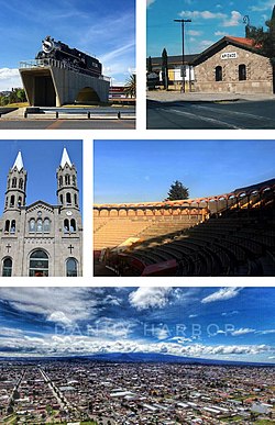
Guamúchil is a city located in the state of Sinaloa in Northwestern Mexico. It is located 100 km north of Culiacán, the capital of Sinaloa. The city serves as the seat of the municipality of Salvador Alvarado and is the economic and sociocultural center of the Évora Valley Region, named after the local Évora river. In 2010, the city had a population of around 72,500 inhabitants. It is the fifth-largest city in the state in population after Culiacán, Mazatlán, Los Mochis and Guasave, respectively.

Huajicori is both a municipality and the municipal seat of the same in the Mexican state of Nayarit. The population of the municipality was 10,294 in 2000 in a total area of 2,603.5 km2. Its area makes up almost 10% of the state. The population of the town was 2,201 (2005).

<span class="mw-page-title-main">Chiautempan</span> City in Tlaxcala, Mexico

Santa Ana Chiautempan is a city in Chiautempan Municipality in the south-central part of the Mexican state of Tlaxcala. The city serves as the municipal seat of the municipality, which covers an area of 66.21 km². At the 2005 census it had a population of 46,776 inhabitants, the fourth-largest community in the state in population. The city lies at the extreme western end of the municipality, which had a census population of 63,300 inhabitants.

<span class="mw-page-title-main">Calera de Víctor Rosales</span> Municipality in Zacatecas, Mexico

Calera is one of the 58 municipalities in the Mexican state of Zacatecas. It is located on the central part of the state of Zacatecas and it is bounded by the municipalities of General Enrique Estrada, Fresnillo, Villa de Cos, Pánuco, Morelos and Zacatecas. The municipality covers a total surface area of 389 square kilometers (150 sq mi). The municipality makes up for 0.5% of the area of the state of Zacatecas.

Tenabo is a city in the Mexican state of Campeche. It is located in the north of the state, 35 km from the state capital Campeche, Camp., and 110 km from Mérida, Yucatán, along Federal Highway 180. It serves as the municipal seat for the municipality of the same name.

<span class="mw-page-title-main">Huejutla de Reyes</span> Municipality and town in Hidalgo, Mexico

Huejutla de Reyes is a city and one of the 84 municipalities of Hidalgo, in central-eastern Mexico. The name comes from the Nahuatl huexotl ("willow") and tlan ("place"), while "de Reyes" commemorates local cobbler Antonio Reyes Cabrera who died defending Huejutla from French invaders in 1866.

<span class="mw-page-title-main">Ahuazotepec</span> Municipality in Puebla, Mexico

Ahuazotepec Municipality is a municipality in the Mexican state of Puebla in south-eastern Mexico.

Zongozotla Municipality is a municipality in the Mexican state of Puebla in south-eastern Mexico.

<span class="mw-page-title-main">Amaxac de Guerrero</span> Municipality in Tlaxcala, Mexico

Amaxac de Guerrero is a municipality in the Mexican state of Tlaxcala in south-eastern Mexico.

Teolocholco (municipality) is a municipality in Tlaxcala in south-eastern Mexico.

<span class="mw-page-title-main">Tocatlán</span> Municipality in Tlaxcala, Mexico

Tocatlán is a municipality in Tlaxcala in south-eastern Mexico.

<span class="mw-page-title-main">Tlaxco Municipality, Tlaxcala</span> Municipality in Tlaxcala, Mexico

Tlaxco is a municipality in Tlaxcala, Mexico.

<span class="mw-page-title-main">Jilotepec, Veracruz</span> Municipality in Veracruz, Mexico

Jilotepec is a municipality in the Mexican state of Veracruz, located 11 kilometres (6.8 mi) north-northwest of the state capital Xalapa.

<span class="mw-page-title-main">Citlaltépetl, Veracruz</span> Municipality in Veracruz, Mexico

Citlaltépetl is a municipality in the Mexican state of Veracruz, located 223 kilometres (139 mi) northwest of the state capital of Xalapa and 99 kilometres (62 mi) south of the city of Tampico, Tamaulipas.

References

  1. "Estado de Tlaxcala-Estacion: Apizaco". Normales Climatologicas 1951–2010 (in Spanish). Servicio Meteorologico Nacional. Archived from the original on 27 April 2015. Retrieved 27 April 2015.
  2. "Extreme Temperatures and Precipitation for Apizaco 1928–2005" (in Spanish). Servicio Meteorológico Nacional. Archived from the original on 27 April 2015. Retrieved 27 April 2015.

19°25′0″N98°08′0″W / 19.41667°N 98.13333°W / 19.41667; -98.13333