Adavoyle railway station

Last updated

Adavoyle
The Belfast-Dublin line at Adavoyle - geograph.org.uk - 538041.jpg
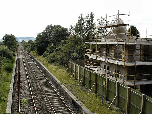
Remains of the station photographed on 24 August 2007
General information
LocationAdavoyle, Dromintee, County Armagh
Northern Ireland
UK
Coordinates54.108253°N 6.386688°W
Platforms2
Tracks2
History
Opened1892
Closed1933
Original company Dublin and Belfast Junction Railway
Pre-grouping Northern Railway of Ireland
Post-grouping Great Northern Railway (Ireland)

Adavoyle was a station in the rural townland of Adavoyle, near Dromintee, in County Armagh, Northern Ireland.

Contents

History

The station was opened in 1892 by the Dublin and Belfast Junction Railways, then absorbed into the Northern Railway of Ireland. Then it was taken over by the Great Northern Railway (Ireland). The station closed under this management in 1933.

Photographs of the train derailed at Adavoyle, printed in the Daily Mirror, 27 June 1921 Adavoyle train derailing.png
Photographs of the train derailed at Adavoyle, printed in the Daily Mirror, 27 June 1921

On 24 June 1921, during the Irish War of Independence, the Irish Republican Army (IRA) derailed a British military train near the station. Four British soldiers were killed and twenty wounded. The attack was carried out by volunteers of the IRA's Fourth Northern Division, led by Frank Aiken. The soldiers had been returning from the opening of Northern Ireland's new parliament, which took place in Belfast two days before. [1]

Future Taoiseach Éamon de Valera was ‘deported’ through this station by the Royal Ulster Constabulary in 1924 when he was arrested at the Canal Street police station, [2] and put on the train to Dublin at Adavoyle. [3]

The building is in ruins. A dwelling house has recently[ when? ] been built in the grounds of the station. [4] The Dublin-Belfast railway line, including the Enterprise services, still passes the former platforms. [5]

Modelling

Tony Miles' Adavoyle Junction in 1963 was an important early model railway using the P4 Finescale standards. The desire to model a local broad gauge prototype, without commercial model support, meant that scratchbuilding was necessary anyway and so the adoption of P4 was less of a change than was seen by British standard gauge modellers. [6]

The railway was somewhat fictionalised, as a larger junction with two GNR branches added to it: one running north-west to Monaghan, and the other south-east to a LNWR packet port at Greenore. A typical Irish 3 foot gauge narrow gauge line ran South to Inniskeen. [6]

Related Research Articles

<span class="mw-page-title-main">County Armagh</span> County in Northern Ireland

County Armagh is one of the six counties of Northern Ireland and one of the traditional thirty-two counties of Ireland. Adjoined to the southern shore of Lough Neagh, the county covers an area of 1,327 km2 (512 sq mi) and has a population of about 175,000. County Armagh is known as the "Orchard County" because of its many apple orchards. The county is part of the historic province of Ulster.

<span class="mw-page-title-main">NI Railways</span> Parastatal rail transport organisation of Northern Ireland

NI Railways, also known as Northern Ireland Railways (NIR) ; and for a brief period Ulster Transport Railways (UTR), is the railway operator in Northern Ireland. NIR is a subsidiary of Translink, whose parent company is the Northern Ireland Transport Holding Company (NITHCo), and is one of seven publicly owned train operators in the United Kingdom, the others being Direct Rail Services, Northern Trains, Transport for Wales Rail, Southeastern, LNER, and ScotRail. It has a common Board of Management with the other two companies in the group, Ulsterbus and Metro.

<span class="mw-page-title-main">History of rail transport in Ireland</span>

The history of rail transport in Ireland began only a decade later than that of Great Britain. By its peak in 1920, Ireland had 3,500 route miles (5,630 km). The current status is less than half that amount, with a large unserviced area around the border area between Northern Ireland and The Republic of Ireland.

<span class="mw-page-title-main">Rail transport in Ireland</span>

Rail transport in Ireland is provided by Iarnród Éireann in the Republic of Ireland and by Northern Ireland Railways in Northern Ireland.

<span class="mw-page-title-main">Great Northern Railway (Ireland)</span>

The Great Northern Railway (Ireland) (GNR(I) or GNRI) was an Irish gauge (1,600 mm (5 ft 3 in)) railway company in Ireland. It was formed in 1876 by a merger of the Irish North Western Railway (INW), Northern Railway of Ireland, and Ulster Railway. The governments of Ireland and Northern Ireland jointly nationalised the company in 1953, and the company was liquidated in 1958: assets were split on national lines between the Ulster Transport Authority and Córas Iompair Éireann.

<span class="mw-page-title-main">Belfast–Newry line</span>

The Belfast–Newry line operates from Lanyon Place station in County Antrim to Newry in County Down, Northern Ireland. The manager for this line is based at Portadown railway station, although the line extends to the border to include the Scarva and Poyntzpass halts and Newry. Newry is on the fringe of the network, being the last stop before the border with the Republic of Ireland. The line follows the route of the northern half of the main Dublin–Belfast line, with the exception of calling at Belfast Great Victoria Street.

<span class="mw-page-title-main">Belfast–Dublin line</span> Railway route in Ireland

The Belfast–Dublin Main Line is a main and busiest railway route on the island of Ireland that connects Dublin Connolly station in the Republic of Ireland and Belfast Lanyon Place station in Northern Ireland. It is the only railway line that crosses the Republic of Ireland–United Kingdom border.

<span class="mw-page-title-main">Newry railway station</span> Railway station in County Armagh, Northern Ireland

Newry railway station serves Newry and Bessbrook in Northern Ireland. The station is located in the northwest of Newry, County Armagh on the Dublin-Belfast line close to the Craigmore Viaduct.

<span class="mw-page-title-main">Knockmore railway station</span>

Knockmore railway station was a station on the Belfast–Newry railway line. The station served the suburb of Knockmore in Lisburn, County Antrim, Northern Ireland. The Great Northern Railway (GNR) opened Knockmore station as a halt in 1932. Northern Ireland Railways (NIR) closed the station on 25 March 2005.

<span class="mw-page-title-main">MacNeill's Egyptian Arch</span> Railway bridge in Northern Ireland

Macneill's Egyptian Arch is a railway bridge in Newry, Northern Ireland. Construction was completed in 1851 for the Dublin and Belfast Junction Railway Company and was the result of collaboration between engineer Sir John Macneill and constructor William Dargan. Locally known as the Egyptian Arch, the rail bridge passes over the Newry–Camlough Road, in the County Armagh half of Newry.

<span class="mw-page-title-main">Lisburn–Antrim line</span> Railway line in Northern Ireland

The Lisburn–Antrim line is a 20-mile (32 km) railway line of Northern Ireland Railways. It links Knockmore Junction on the Belfast–Newry line with Antrim on the Belfast–Derry line. It has been closed to passenger services since 2003.

<span class="mw-page-title-main">Dublin and Drogheda Railway</span>

Dublin and Drogheda Railway (D&D) was a railway company in Ireland which publicly opened its 31¾ mile main line between Dublin and Drogheda in May 1844. It was the third railway company in Ireland to operate passenger trains and the first to use the Irish standard 5 ft 3 in gauge. It later opened branches to Howth and Oldcastle. The opening of the Dublin and Belfast Junction Railway (D&BJct) between the D&D at Drogheda and the Ulster Railway (UR) at Portadown in 1852 saw an almost continuous main line connection between Dublin and Belfast, which was resolved by the official opening of the Boyne Viaduct in April 1855. Amalgamations between these and other companies in 1875 and 1876 saw the creation of the Great Northern Railway of Ireland GNR(I).

<span class="mw-page-title-main">Banbridge</span> Town in County Down, Northern Ireland

Banbridge is a town in County Down, Northern Ireland. It lies on the River Bann and the A1 road and is named after a bridge built over the River Bann in 1712. It is situated in the civil parish of Seapatrick and the historic barony of Iveagh Upper, Upper Half. The town began as a coaching stop on the road from Belfast to Dublin and thrived from Irish linen manufacturing. The town was home to the headquarters of the former Banbridge District Council. Following a reform of local government in Northern Ireland in 2015, Banbridge became part of Armagh City, Banbridge and Craigavon Borough Council. It had a population of 16,637 in the 2011 Census.

This is a chronology of activities by the Provisional Irish Republican Army (IRA), from 1992 to 1999.

<span class="mw-page-title-main">1997 Northern Ireland riots</span> Mass protests during the Troubles

From 6 to 11 July 1997 there were mass protests, fierce riots and gun battles in Irish nationalist districts of Northern Ireland. Irish nationalists/republicans, in some cases supported by the Provisional Irish Republican Army (IRA), attacked the Royal Ulster Constabulary (RUC) and British Army. The protests and violence were sparked by the decision to allow the Orange Order to march through a Catholic/nationalist neighbourhood of Portadown. Irish nationalists were outraged by the decision and by the RUC's aggressive treatment of those protesting against the march. There had been a bitter dispute over the march for many years.

The Enniskillen and Bundoran Railway (E&BR) was an Irish gauge 5 ft 3 in railway company in north-west Ireland. It linked Bundoran and Ballyshannon on the Atlantic coast of Donegal with the Londonderry and Enniskillen Railway (L&ER) at Bundoran Junction in Fermanagh. The line was opened in 1868 and closed in 1957.

<span class="mw-page-title-main">Goraghwood railway station</span>

Goraghwood railway station was a railway station in County Armagh in Northern Ireland; it was opened in 1854 and closed in 1965.

The Newry and Armagh Railway was opened in 1864 and ran until 1879.

This is a chronology of activities by the Provisional Irish Republican Army (IRA), in 1990 and 1991.

References

  1. "(untitled)". Archived from the original on 5 September 2007.
  2. "(untitled)". Newry Journal. Archived from the original on 12 October 2008.
  3. "De Valera Foxed RUC In Newry Town Hall Coup". Newry Memoirs.
  4. "J0518: Adavoyle Railway Station". Geograph.
  5. "J0518: The Belfast-Dublin line at Adavoyle". Geograph.
  6. 1 2 "Adavoyle Junction". On Irish Tracks.
Preceding station Historical railways Following station
Newry   Great Northern Railway (Ireland)
Dublin-Belfast
  Mountpleasant

54°06′25″N6°23′13″W / 54.107°N 6.387°W / 54.107; -6.387