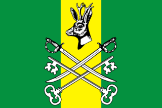
Chita Oblast was a federal subject of Russia until February 29, 2008. On March 1, 2008, it was merged with Agin-Buryat Autonomous Okrug to form Zabaykalsky Krai.
| Chita Oblast, Russia | |
|---|---|
| Administrative center: Chita | |
| As of February 29, 2008: [1] | |
| # of districts (районы) | 28 |
| # of cities/towns (города) | 10 |
| # of urban-type settlements (посёлки городского типа) | 38 |
| # of selsovets, rural administrations, rural municipal entities, rural okrugs, and rural settlements (сельсоветы, сельские администрации, сельские муниципальные образования, сельские округа и сельские поселения) | 308 |
| As of 2002: [2] | |
| # of rural localities (сельские населённые пункты) | 699 |
| # of uninhabited rural localities (сельские населённые пункты без населения) | 9 |
- Urban-type settlements under the federal government management:
- Gorny (Горный)
- Cities and towns under the oblast's jurisdiction:
- Chita (Чита) (administrative center)
- city administrative districts:
- Chernovsky (Черновский)
- Ingodinsky (Ингодинский)
- Tsentralny (Центральный)
- Zheleznodorozhny (Железнодорожный)
- city administrative districts:
- Baley (Балей)
- Borzya (Борзя)
- Krasnokamensk (Краснокаменск)
- Petrovsk-Zabaykalsky (Петровск-Забайкальский)
- Chita (Чита) (administrative center)
- Districts:
- Akshinsky (Акшинский)
- with 12 rural settlements under the district's jurisdiction.
- Alexandrovo-Zavodsky (Александрово-Заводский)
- with 19 rural settlements under the district's jurisdiction.
- Baleysky (Балейский)
- with 9 rural settlements under the district's jurisdiction.
- Borzinsky (Борзинский)
- Urban-type settlements under the district's jurisdiction:
- Sherlovaya Gora (Шерловая Гора)
- with 15 selsovets under the district's jurisdiction.
- Urban-type settlements under the district's jurisdiction:
- Chernyshevsky (Чернышевский)
- Urban-type settlements under the district's jurisdiction:
- Aksyonovo-Zilovskoye (Аксёново-Зиловское)
- Bukachacha (Букачача)
- Chernyshevsk (Чернышевск)
- Zhireken (Жирекен)
- with 14 rural okrugs under the district's jurisdiction.
- Urban-type settlements under the district's jurisdiction:
- Chitinsky (Читинский)
- Urban-type settlements under the district's jurisdiction:
- Atamanovka (Атамановка)
- Novokruchininsky (Новокручининский)
- Yablonovo (Яблоново)
- with 20 rural okrugs under the district's jurisdiction.
- Urban-type settlements under the district's jurisdiction:
- Gazimuro-Zavodsky (Газимуро-Заводский)
- with 9 selsovets under the district's jurisdiction.
- Kalarsky (Каларский)
- Urban-type settlements under the district's jurisdiction:
- Novaya Chara (Новая Чара)
- with 5 selsovets under the district's jurisdiction.
- Urban-type settlements under the district's jurisdiction:
- Kalgansky (Калганский)
- Urban-type settlements under the district's jurisdiction:
- Kadaya (Кадая)
- with 10 selsovets under the district's jurisdiction.
- Urban-type settlements under the district's jurisdiction:
- Karymsky (Карымский)
- Urban-type settlements under the district's jurisdiction:
- Darasun (Дарасун)
- Karymskoye (Карымское)
- Kurort Darasun resort settlement (Курорт Дарасун)
- with 10 selsovets under the district's jurisdiction.
- Urban-type settlements under the district's jurisdiction:
- Khiloksky (Хилокский)
- Krasnochikoysky (Красночикойский)
- with 15 selsovets under the district's jurisdiction.
- Krasnokamensky (Краснокаменский)
- with 9 rural administrations under the district's jurisdiction.
- Kyrinsky (Кыринский)
- with 14 selsovets under the district's jurisdiction.
- Mogochinsky (Могочинский)
- Nerchinsko-Zavodsky (Нерчинско-Заводский)
- with 15 rural administrations under the district's jurisdiction.
- Nerchinsky (Нерчинский)
- Olovyanninsky (Оловяннинский)
- Urban-type settlements under the district's jurisdiction:
- Kalanguy (Калангуй)
- Olovyannaya (Оловянная)
- Yasnogorsk (Ясногорск)
- Zolotorechensk (Золотореченск)
- with 16 selsovets under the district's jurisdiction.
- Urban-type settlements under the district's jurisdiction:
- Ononsky (Ононский)
- with 11 rural administrations under the district's jurisdiction.
- Petrovsk-Zabaykalsky (Петровск-Забайкальский)
- Urban-type settlements under the district's jurisdiction:
- Balyaga (Баляга)
- Novopavlovka (Новопавловка)
- Tarbagatay (Тарбагатай)
- with 10 selsovets under the district's jurisdiction.
- Urban-type settlements under the district's jurisdiction:
- Priargunsky (Приаргунский)
- Urban-type settlements under the district's jurisdiction:
- Klichka (Кличка)
- Priargunsk (Приаргунск)
- with 11 rural administrations under the district's jurisdiction.
- Urban-type settlements under the district's jurisdiction:
- Shelopuginsky (Шелопугинский)
- with 8 rural okrugs under the district's jurisdiction.
- Shilkinsky (Шилкинский)
- Towns under the district's jurisdiction:
- Shilka (Шилка)
- Urban-type settlements under the district's jurisdiction:
- Arbagar (Арбагар)
- Kholbon (Холбон)
- Pervomaysky (Первомайский)
- with 11 rural okrugs under the district's jurisdiction.
- Towns under the district's jurisdiction:
- Sretensky (Сретенский)
- Tungiro-Olyokminsky (Тунгиро-Олёкминский)
- with 4 selsovets under the district's jurisdiction.
- Tungokochensky (Тунгокоченский)
- Urban-type settlements under the district's jurisdiction:
- Vershino-Darasunsky (Вершино-Дарасунский)
- with 9 selsovets under the district's jurisdiction.
- Urban-type settlements under the district's jurisdiction:
- Ulyotovsky (Улётовский)
- Urban-type settlements under the district's jurisdiction:
- Drovyanaya (Дровяная)
- with 9 rural administrations under the district's jurisdiction.
- Urban-type settlements under the district's jurisdiction:
- Zabaykalsky (Забайкальский)
- Urban-type settlements under the district's jurisdiction:
- Zabaykalsk (Забайкальск)
- with 7 rural municipal entities under the district's jurisdiction.
- Urban-type settlements under the district's jurisdiction:
- Akshinsky (Акшинский)


