Administrative divisions of the Kingdom of Hungary (1941–44)

Last updated
Map of the counties and districts Hungary 1941-44 Administrative Map.png
Map of the counties and districts

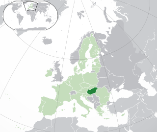
This article discusses the administrative divisions of the Kingdom of Hungary between 1941 and 1944. As a result of the First (1938) and Second Vienna Award (1940), territories that had been ceded by the Kingdom of Hungary at the 1920 Treaty of Trianon were partly regained from Czechoslovakia and Romania respectively. This required modification of the administrative divisions.

Administrative division A territorial entity for administration purposes

An administrative division, unit, entity, area or region, also referred to as a subnational entity, constituent unit, or country subdivision, is a portion of a country or other region delineated for the purpose of administration. Administrative divisions are granted a certain degree of autonomy and are usually required to manage themselves through their own local governments. Countries are divided up into these smaller units to make managing their land and the affairs of their people easier. A country may be divided into provinces, which, in turn, may be divided in whole or in part into municipalities.

Kingdom of Hungary (1920–1946) Central European state between 1920 and 1946

The Kingdom of Hungary, sometimes referred to as the Regency or the Horthy era, existed as a country from 1920 to 1946 under the rule of Regent Miklós Horthy. Horthy officially represented the Hungarian monarchy of Charles IV, Apostolic King of Hungary. Attempts by Charles IV to return to the throne were prevented by threats of war from neighbouring countries and by the lack of support from Horthy.

First Vienna Award

The First Vienna Award, or otherwise known as the First Vienna Diktat was a treaty signed on November 2, 1938, as a result of the First Vienna Arbitration. The Arbitration took place at Vienna's Belvedere Palace. The Arbitration and Award were direct consequences of the Munich Agreement the previous month and decided the partitioning of Czechoslovakia.

Hungary excluding Sub-Carpathia had three levels of administrative sub-division. Level One were: County (Vármegye, vm) and City with Municipal Status (Törvényhatósági Jogú Város, tjv). Counties were divided into Districts (Járás, j) and Urban Districts Megyei Város, mv) which constituted the second level. A third level were Sub-Districts, which were temporary entities typically created to give a position to a politician when no district leader posts were available.

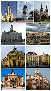
The City of Budapest had the unique status of Royal Seat and Capital (székesfőváros, szfv.) and was legally distinct from the other Counties and Cities.

The Governorate of Subcarpathia (Kárpátalja) was a special case. It was given the status of Regent's Commissariat (Kormányzói Biztosság) with the intention that it would be governed by the Ruthenian minority population. It was divided into Administrative Delegations (Közigazgatási Kirendeltség), which were analogous to Counties. In practice, due to wartime restrictions, Sub-Carpathia was administered by officials appointed by the central government.

Rusyns, sometimes referred to as Rusnaks, also known as Carpatho-Ruthenians or Carpatho-Russians, are an East Slavic people who speak the Rusyn language. They descend from an East Slavic population that inhabited the Northern regions of the Eastern Carpathians since the Early Middle Ages. Together with other East Slavs from neighboring regions, they were often labeled by the common exonym Ruthenians, or by the regionally more specific designation Carpathian Ruthenians, and sub-group designations Dolinyans, Boykos, Hutsuls and Lemkos. Unlike their Eastern neighbors, who adopted the use of the ethnonym Ukrainians in the early 20th century, Rusyns kept and preserved their original name. As residents of Northeastern regions of the Carpathian Mountains, Rusyns are closely connected to, and also sometimes associated with, other Slavic communities in the region, like the Slovaks highlander community of Gorals.

After the Treaty of Trianon and loss of territory, seven merged counties had been created to administer the areas where parts of counties were lost. With the First and Second Vienna Awards, several of these were de-merged and new ones created as additional territories were added, ending up with four merged counties. Continuing with the practice adopted after the Treaty of Trianon, Merged Counties were designed közigazgatásilag egyelőre egyesített (kee) which indicated that the merger was considered temporary and that the possibility of the restoration of the pre-Trianon border was possible.

Second Vienna Award award

The Second Vienna Award, also known as the Second Vienna Diktat was the second of two territorial disputes arbitrated by Nazi Germany and Fascist Italy. Rendered on 30 August 1940, it assigned the territory of Northern Transylvania from Romania to Hungary..

List

Listed below are the administrative sub-divisions excluding the temporary sub-districts. Capitals of Counties and Districts are shown in parentheses.

Košice City in Slovakia

Košice is the largest city in eastern Slovakia. It is situated on the river Hornád at the eastern reaches of the Slovak Ore Mountains, near the border with Hungary. With a population of approximately 240,000 Košice is the second largest city in Slovakia after the capital Bratislava.

Subotica City in Vojvodina, Serbia

Subotica is a city and the administrative center of the North Bačka District in the autonomous province of Vojvodina, Serbia. Formerly the largest city of Vojvodina region, contemporary Subotica is now the second largest city in the province, following the city of Novi Sad. According to the 2011 census, the city itself has a population of 97,910, while the urban area of Subotica has 105,681 inhabitants, and the population of metro area stands at 141,554 people.

Novi Sad City in Vojvodina, Serbia

Novi Sad is the second largest city in Serbia, the capital of the autonomous province of Vojvodina and the administrative centre of the South Bačka District. It is located in the southern portion of the Pannonian Plain on the border of the Bačka and Srem geographical regions. Lying on the banks of the Danube river, the city faces the northern slopes of Fruška Gora.

Kárpátalja

Mukachevo City of regional significance in Zakarpattia Oblast, Ukraine

Mukachevo is a city located in the valley of the Latorica river in Zakarpattia Oblast (province), in Western Ukraine. Serving as the administrative center of Mukachevo Raion (district), the city itself does not belong to the raion and is designated as a city of oblast significance, with the status equal to that of a separate raion. The population is 86,339 (2016 est.).

Khust City of regional significance in Zakarpattia Oblast, Ukraine

Khust is a city located on the Khustets River in Zakarpattia Oblast (province) in western Ukraine. It is near the сonfluence of the Tisa and Rika Rivers. Serving as the administrative center of Khust Raion (district), the city itself does not belong to the raion and is designated as a city of oblast significance, with the status equal to that of a raion. Population: 28,448 (2016 est.)

Tiachiv City of district significance in Zakarpattia Oblast, Ukraine

Tiachiv is a city located on the Tisza River in Zakarpattia Oblast (region) in western Ukraine. It is the administrative center of Tiachiv Raion (district). Population: 9,043 (2016 est.).

See also

Related Research Articles

Austria-Hungary Constitutional monarchic union between 1867 and 1918

Austria-Hungary, often referred to as the Austro-Hungarian Empire or the Dual Monarchy, was a constitutional monarchy in Central and Eastern Europe between 1867 and 1918. It was formed when the Austrian Empire adopted a new constitution; as a result Austria (Cisleithania) and Hungary (Transleithania) were placed on equal footing. It dissolved into several new states at the end of the First World War.

Hungary Country in Central Europe

Hungary is a country in Central Europe. Spanning 93,030 square kilometres (35,920 sq mi) in the Carpathian Basin, it borders Slovakia to the north, Ukraine to the northeast, Austria to the northwest, Romania to the east, Serbia to the south, Croatia to the southwest, and Slovenia to the west. With about 10 million inhabitants, Hungary is a medium-sized member state of the European Union. The official language is Hungarian, which is the most widely spoken Uralic language in the world, and among the few non-Indo-European languages to be widely spoken in Europe. Hungary's capital and largest city is Budapest; other major urban areas include Debrecen, Szeged, Miskolc, Pécs and Győr.

Charles I of Hungary King of Hungary

Charles I, also known as Charles Robert was King of Hungary and Croatia from 1308 to his death. He was a member of the Capetian House of Anjou and the only son of Charles Martel, Prince of Salerno. His father was the eldest son of Charles II of Naples and Mary of Hungary. She laid claim to Hungary after her brother, Ladislaus IV of Hungary, died in 1290, but the Hungarian prelates and lords elected her cousin, Andrew III, king. Instead of abandoning her claim to Hungary, she transferred it to her son, Charles Martel, and after his death in 1295, to her grandson, Charles. On the other hand, her husband, Charles II of Naples, made their third son, Robert, heir to the Kingdom of Naples, thus disinheriting Charles.

History of the Jews in Hungary aspect of history

The history of the Jews in Hungary dates back to at least the Kingdom of Hungary, with some records even predating the Hungarian conquest of the Carpathian Basin in 895 CE by over 600 years. Written sources prove that Jewish communities lived in the medieval Kingdom of Hungary and it is even assumed that several sections of the heterogeneous Hungarian tribes practiced Judaism. Jewish officials served the king during the early 13th century reign of Andrew II. From the second part of the 13th century, the general religious tolerance decreased and Hungary's policies became similar to the treatment of the Jewish population in Western Europe.

Transylvania is a historical region in central and northwestern Romania. It was part of the Dacian Kingdom, Roman Dacia, the Hunnic Empire, the Kingdom of the Gepids, the Avar Khaganate and the 9th century First Bulgarian Empire. During the late 9th century, western Transylvania was reached by the Hungarian conquerors and later it became part of the Kingdom of Hungary, formed in 1000.

History of the Székely people aspect of history

The history of the Székely people can be documented from the 12th century. According to medieval chronicles, the Székelys were descended from the Huns who settled in the Carpathian Basin in the 5th century. This theory was refuted by modern scholars, but no consensual view about the origin of the Székelys exists. They fought in the vanguard of the Hungarian army, implying that they had been a separate ethnic group, but their tongue does not show any trace of a language shift.

The history of Christianity in Hungary began in the Roman province of Pannonia where the presence of Christian communities is first attested in the 3rd century. Although the territory was under the successive control of the Huns, Germanic peoples, and Avars from the 5th century, Christian communities may have survived in the region of Lake Balaton up until the 9th century. Accordingly, Christianity had existed in the present-day territory of Hungary before the Hungarians settled there around 900 AD, but the question of continuity is unresolved.

Paul Nagymartoni

Paul Nagymartoni was an influential Hungarian nobleman and jurist in the first half of the 14th century, who served as Judge royal from 1328 to 1349.