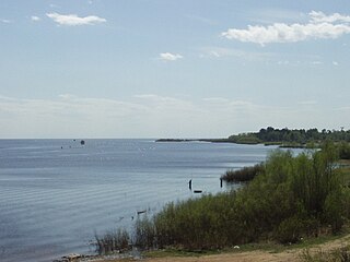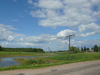
Staraya Ladoga, known as Ladoga until 1704, is a rural locality in Volkhovsky District of Leningrad Oblast, Russia, located on the Volkhov River near Lake Ladoga, 8 kilometers (5.0 mi) north of the town of Volkhov, the administrative center of the district.

Novgorod Oblast is a federal subject of Russia. Its administrative center is the city of Veliky Novgorod. Some of the oldest Russian cities, including Veliky Novgorod and Staraya Russa, are located in the oblast. The historic monuments of Veliky Novgorod and surroundings have been declared a UNESCO World Heritage Site. Population: 583,387.

Leningrad Oblast is a federal subject of Russia. The oblast has an area of 84,500 square kilometres (32,600 sq mi) and a population of 2,000,997 ; up from 1,716,868 recorded in the 2010 Census. Leningrad Oblast is highly industrialized. Its administrative center and largest city is Gatchina.

The Volkhov is a river in Novgorodsky and Chudovsky Districts of Novgorod Oblast and Kirishsky and Volkhovsky Districts of Leningrad Oblast in northwestern Russia. It connects Lake Ilmen and Lake Ladoga and forms part of the basin of the Neva. The length of the river is 224 kilometres (139 mi), and the area of its drainage basin is 80,200 square kilometres (31,000 sq mi). The city of Veliky Novgorod, the towns of Kirishi, Volkhov and Novaya Ladoga, and the historically important village of Staraya Ladoga are located along the Volkhov.

Lake Ilmen is a large lake in Novgorod Oblast, Russia. A historically important lake, it formed a vital part of the medieval trade route from the Varangians to the Greeks. The city of Veliky Novgorod, which is a major trade-center of the route, lies six kilometres (3.7 mi) below the lake's outflow.

Soltsy is a town and the administrative center of Soletsky District in Novgorod Oblast, Russia, located on the left bank of the Shelon River, 78 kilometers (48 mi) southwest of Veliky Novgorod, the administrative center of the oblast. Population: 10,086 (2010 Russian census); 11,264 (2002 Census); 11,782 (1989 Soviet census).

Shimsk is an urban locality and the administrative center of Shimsky District of Novgorod Oblast, Russia. Municipally, it is incorporated as Shimskoye Urban Settlement, the only urban settlement in the district. It is located on a highway connecting Veliky Novgorod and Pskov, 48 kilometers (30 mi) southwest of Veliky Novgorod. Shimsk lies on Shelon River, approximately 10 kilometers (6.2 mi) upstream from the point where it drains into Lake Ilmen. Population: 3,895 (2010 Russian census); 3,842 (2002 Census); 3,992 (1989 Soviet census).
Novyye Duboviki is an archaeological site in Leningrad Oblast of Russia, located about 9 kilometres (5.6 mi) south of Ladoga upstream the Volkhov River, at the head of the lower Volkhov rapids.

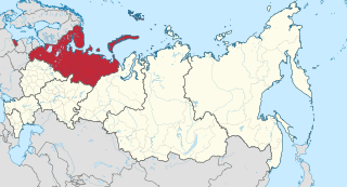
Northwest Russia, or the Russian North is the northern part of western Russia. It is bounded by Norway, Finland, the Arctic Ocean, the Ural Mountains and the east-flowing part of the Volga. The area is roughly coterminous with the Northwestern Federal District, which it is administered as part of. Historically, it was the area of the Novgorod and Pskov merchant republics.

Novgorodian Land was one of the largest historical territorial–state formations in Russia, covering its northwest and north. Novgorod Land, centered in Veliky Novgorod, was in the cradle of Kievan Rus' under the rule of the Rurikovich dynasty and one of the most important princely thrones of the era. During the collapse of Kievan Rus' and in subsequent centuries, Novgorod Land developed as the Novgorod Republic: an autonomous state with republican forms of government under the suzerainty of the great princes of Vladimir-Suzdal. During the period of greatest development, it reached north to the White Sea, and in the east it has been claimed that it did spread beyond the Ural Mountains. It had extensive trade relations within the framework of the Hanseatic League and with the rest of Rus'. Muscovy conquered the Novgorod Republic in 1478, and annexed it in 1578, although Novgorod Land continued to exist as an administrative unit until 1708.

Volkhovsky District is an administrative and municipal district (raion), one of the seventeen in Leningrad Oblast, Russia. It is located in the central eastern part of the oblast and borders with Lodeynopolsky District in the northeast, Tikhvinsky District in the southeast, Kirishsky District in the south, and with Kirovsky District in the west. In the north, it is washed by Lake Ladoga. The area of the district is 5,124.4 square kilometers (1,978.5 sq mi). Its administrative center is the town of Volkhov. Population : 48,000 (2010 Russian census); 50,799 ; 58,939 (1989 Soviet census).

Batetsky District is an administrative and municipal district (raion), one of the twenty-one in Novgorod Oblast, Russia. It is located in the northwest of the oblast and borders with Luzhsky District of Leningrad Oblast in the northwest, Novgorodsky District in the east, and with Shimsky District in the south. The area of the district is 1,600 square kilometers (620 sq mi). Its administrative center is the rural locality of Batetsky. District's population: 6,335 (2010 Russian census); 6,996 ; 7,622 (1989 Soviet census). The population of the administrative center accounts for 35.6% of the district's total population.

Novgorodsky District is an administrative and municipal district (raion), one of the twenty-one in Novgorod Oblast, Russia. It is located in the southwest of the oblast and borders with Tosnensky District of Leningrad Oblast in the north, Chudovsky District in the northeast, Malovishersky District in the east, Krestetsky District in the southeast, Shimsky District in the southwest, Batetsky District in the west, and with Luzhsky District of Leningrad Oblast in the northwest. In the south, the district is limited by Lake Ilmen. The area of the district is 4,600 square kilometers (1,800 sq mi). Its administrative center is the city of Veliky Novgorod. Population: 57,673 (2010 Russian census); 58,622 ; 55,491 (1989 Soviet census). In terms of both area and population, this is the largest district in Novgorod Oblast.

Shimsky District is an administrative and municipal district (raion), one of the twenty-one in Novgorod Oblast, Russia. It is located in the west of the oblast and borders with Batetsky District in the north, Novgorodsky District in the northeast, Starorussky District in the southeast, Volotovsky District in the south, Soletsky District in the southwest, Strugo-Krasnensky and Plyussky Districts, both of Pskov Oblast, in the west, and with Luzhsky District of Leningrad Oblast in the northwest. The area of the district is 1,836 square kilometers (709 sq mi). Its administrative center is the urban locality of Shimsk. Population: 11,750 (2010 Russian census); 13,312 ; 13,477 (1989 Soviet census). The population of Shimsk accounts for 33.1% of the district's total population.

Soletsky District is an administrative and municipal district (raion), one of the twenty-one in Novgorod Oblast, Russia. It is located in the west of the oblast and borders with Shimsky District in the north, Volotovsky District in the east, Dnovsky District of Pskov Oblast in the south, Porkhovsky District of Pskov Oblast in the southwest, and with Strugo-Krasnensky District of Pskov Oblast in the west. The area of the district is 1,400 square kilometers (540 sq mi). Its administrative center is the town of Soltsy. Population: 15,714 (2010 Russian census); 18,626 ; 20,011 (1989 Soviet census). The population of Soltsy accounts for 64.2% of the district's total population.

Dnovsky District is an administrative and municipal district (raion), one of the twenty-four in Pskov Oblast, Russia. It is located in the east of the oblast and borders with Soletsky District of Novgorod Oblast in the northeast, Volotovsky District, also of Novgorod Oblast, in the east, Dedovichsky District in the south, and with Porkhovsky District in the west. The area of the district is 1,194 square kilometers (461 sq mi). Its administrative center is the town of Dno. Population: 13,341 (2010 Russian census); 16,048 ; 20,110 (1989 Soviet census). The population of Dno accounts for 67.9% of the district's total population.

Porkhovsky District is an administrative and municipal district (raion), one of the twenty-four in Pskov Oblast, Russia. It is located in the central and northeastern parts of the oblast and borders with Strugo-Krasnensky District in the north, Soletsky District of Novgorod Oblast in the northeast, Dnovsky District in the east, Dedovichsky District in the southeast, Novorzhevsky District in the south, Ostrovsky District in the southwest, and with Pskovsky District in the west. The area of the district is 3,190 square kilometers (1,230 sq mi). Its administrative center is the town of Porkhov. Population: 21,568 (2010 Russian census); 28,470 ; 35,015 (1989 Soviet census). The population of Porkhov accounts for 49.2% of the district's total population.

Strugo-Krasnensky District is an administrative and municipal district (raion), one of the twenty-four in Pskov Oblast, Russia. It is located in the northeast of the oblast and borders with Plyussky District in the north, Shimsky and Soletsky Districts of Novgorod Oblast in the east, Porkhovsky District in the south, Pskovsky District in the west, and with Gdovsky District in the northwest. The area of the district is 3,090.1 square kilometers (1,193.1 sq mi). Its administrative center is the urban locality of Strugi Krasnye. Population: 13,466 (2010 Russian census); 16,579 ; 16,293 (1989 Soviet census). The population of Strugi Krasnye accounts for 62.7% of the district's total population.

Pyatina was a first-level unit of administrative division of Novgorod Land. The name pyatina originates from the word Russian: пять, which means "five". Novgorod Land was subdivided into five pyatinas. The division was first mentioned in the end of the 15th century and was in use after Novgorod was taken over by the Grand Duchy of Moscow. It is unclear whether the division existed in the Novgorod Republic. The division into pyatinas was abolished in the 18th century, after the governorates were established.


