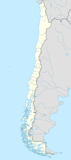
Panilonco Airport is an airport 11 kilometres (6.8 mi) north of Pichilemu, a Pacific coastal city in the O'Higgins Region of Chile.
Mocopulli Airport is an airport serving Dalcahue, a port city on Chiloé Island in the Los Lagos Region of Chile. The airport is 6 kilometres (3.7 mi) northwest of Dalcahue.
Chaitén Airfield was an airport serving Chaitén, a town in the Los Lagos Region of Chile. The airport was damaged and closed after the 2008 eruption of Chaitén Volcano.
Chile Chico Airport Spanish: Aeródromo Chile Chico, is an airport serving Chile Chico, a lakeside town in the Aysén Region of Chile. Chile Chico is on the south shore of General Carrera Lake, 3 kilometres (1.9 mi) west of the Argentina border. The airport is 5 kilometres (3.1 mi) southeast of the town.
Agua Buena Airport Spanish: Aeropuerto Agua Buena, is a rural airstrip 16 kilometres (9.9 mi) east-southeast of Collipulli, a town in the Araucanía Region of Chile.
Santa Lucía Airport Spanish: Aeropuerto Santa Lucía, is a rural airport 23 kilometres (14 mi) east of Freire, a town in the Araucanía Region of Chile.
Aguas Blancas Airport (Spanish: Aeropuerto Aguas Blancas, is an airport serving the Aguas Blancas iodine mine in the Antofagasta Region of Chile.
San Rafael Airport Spanish: Aeródromo de San Rafael de Los Andes, is an airport serving Los Andes, a city in the Valparaíso Region of Chile. The airport is 5 kilometres (3.1 mi) west-northwest of the city.
María Dolores Airport is an airport serving Los Ángeles, capital of Bío Bío Province in the Bío Bío Region of Chile.
Santa Teresa del Almendral Airport, is an airport 12 kilometres (7.5 mi) north-northwest of Melipilla, a city in the Santiago Metropolitan Region of Chile. The airport is 1 kilometre (0.6 mi) west of the Puangue River.
Santa Adriana Airport is an airport serving Ovalle, a city in the Coquimbo Region of Chile.
Capitán Fuentes Martínez Airport, is an airport 5 kilometres (3.1 mi) northeast of Porvenir, a port city off the Strait of Magellan in the Magallanes Region of Chile.
Santa Marta Airport is an airstrip 10 kilometres (6 mi) southeast of San Carlos, a town in the Bío Bío Region of Chile.
Santa María de Mingre Airport is an airport in the western Maule Region of Chile. The airport is 24 kilometres (15 mi) west of San Javier.
San Nicolás Santa Eugenia Airport is an airport 8 kilometres (5.0 mi) north of San Nicolás, a town in the Bío Bío Region of Chile.
Santa Cruz Airport is an airport 2 kilometres (1.2 mi) west of Santa Cruz, a city in the O'Higgins Region of Chile.
Santa Rosa de Tabalí Airport is an airport serving Santa Rosa de Tabalí, a hacienda winery in the Coquimbo Region of Chile.
Panguilemo Airport is an airport 5 kilometres (3.1 mi) northeast of Talca, capital of the Maule Region of Chile.
Las Breas Airport is an airport 20 kilometres (12 mi) south-southeast of Taltal, a Pacific coastal town in the Antofagasta Region of Chile.
Barriles Airport Spanish: Aeropuerto Barriles is an airport 15 kilometres (9.3 mi) east-southeast of Tocopilla, a Pacific coastal town in the Antofagasta Region of Chile.


