El Oued, Souf or Oued Souf is a city, and the capital of El Oued Province, in Algeria. The oasis town is watered by an underground river, hence its name is El Oued which enables date palm cultivation and the rare use of brick construction for housing. As most roofs are domed, it is known as the "City of a Thousand Domes".

Tamtert, also written Tamert or Tamatart is a town and commune in Béni Abbès District, Béchar Province, in western Algeria. According to the 2008 census its population is 1,248, down from 1,302 in 1998, with an annual growth rate of -0.4%. The commune covers an area of 3,130 square kilometres (1,210 sq mi).

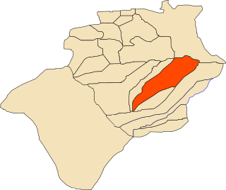
Hassani Abdelkrim is a town and commune in Debila District, El Oued Province, Algeria. According to the 2008 census it has a population of 22,755, up from 17,207 in 1998, with a population growth rate of 2.9%.

Guerzim is a village in the commune of Béni Ikhlef, in Kerzaz District, Béchar Province, Algeria. The village lies on the Oued Saoura 10 kilometres (6.2 mi) north of Béni Ikhlef and 28 kilometres (17 mi) southeast of El Ouata.
El Beïda is a village in the commune of El Ouata, in Béchar Province, Algeria. The village lies on the Oued Saoura 28 kilometres (17 mi) north of Béni Ikhlef and 11 kilometres (6.8 mi) southeast of El Ouata.
Marhouma is a village in the commune of Tamtert, in El Ouata District, Béchar Province, Algeria. The village lies on the Oued Saoura 19 kilometres (12 mi) northwest of Tamtert and 18 kilometres (11 mi) southeast of Béni Abbès. It is notable for nearby rock engravings.
Béchir is a village in the commune of Tamtert, in El Ouata District, Béchar Province, Algeria. The village lies on the Oued Saoura 7 kilometres (4.3 mi) northwest of Tamtert and 29 kilometres (18 mi) southeast of Béni Abbès.
Zaouia el Kbira is a village in the commune of Kerzaz, in Béchar Province, Algeria. It lies on the Oued Saoura between Béni Ikhlef and Kerzaz. The village is on the N6 national highway, 8 kilometres (5.0 mi) northwest of Kerzaz and 15 kilometres (9.3 mi) southeast of Béni Ikhlef.
Tamerna Djedida is a village in the commune of Sidi Amrane, in Djamaâ District, El Oued Province, Algeria. The village is located along a short road on the western side of the N3 highway 10 kilometres (6.2 mi) south of Djamaa.
Sidi Slimane is a village in the commune of Bayadha, in Bayadha District, El Oued Province, Algeria. The village is located 6 kilometres (3.7 mi) southeast of the provincial capital El Oued.
Chégamat is a village in the commune of Oued El Alenda, in Mih Ouensa District, El Oued Province, Algeria. The village is located 3 kilometres (1.9 mi) southeast of Oued El Alenda and 15 kilometres (9.3 mi) southwest of the provincial capital El Oued.
Dabadib is a village in the commune of Oued El Alenda, in Mih Ouensa District, El Oued Province, Algeria. The village is located 3 kilometres (1.9 mi) southeast of Oued El Alenda and 19 kilometres (12 mi) southwest of the provincial capital El Oued.
Idigh is a village in the commune of Tamtert, in Béni Abbès District, Béchar Province, Algeria. The village is located on a local road on the north-eastern bank of the Oued Saoura, about halfway between Tamtert and El Ouata.
Bouhadid is a village in the commune of El Ouata, in Béchar Province, Algeria. The village is located on the northeast bank of the Oued Saoura just north of El Ouata, and southeast of Tamtert.
Ammas is a village in the commune of El Ouata, in Béchar Province, Algeria. The village is located on the northeast bank of the Oued Saoura 2 kilometres (1.2 mi) southeast of El Ouata. It is connected to El Ouata by a local road along the side of the river, along with the other villages El Maffa, Aguedal and El Beïda.
El Maffa is a village in the commune of El Ouata, in Béchar Province, Algeria. The village is located on the northeast bank of the Oued Saoura 5 kilometres (3.1 mi) southeast of El Ouata. It is connected to El Ouata by a local road along the side of the river, along with the other villages Ammas, Aguedal and El Beïda.
Ouled Rafaa is a village in the commune of Ouled Khoudir, in Ouled Khoudir District, Béchar Province, Algeria. The village is located on the northeast bank of the Oued Saoura 3 kilometres (1.9 mi) east of Ouled Khoudir. It is connected to Ouled Khoudir by a local road along the side of the river, along with the other village of El Ksar.
El Ksar is a village in the commune of Ouled Khoudir, in Ouled Khoudir District, Béchar Province, Algeria. The village is located on the east bank of the Oued Saoura 5 kilometres (3.1 mi) southeast of Ouled Khoudir. It is connected to Ouled Khoudir by a local road along the side of the river, along with the other village of Ouled Rafaa.
Timgharine is a village in the commune of Ksabi, in Ouled Khoudir District, Béchar Province, Algeria. The village is located on the east bank of the Oued Saoura about halfway between Ouled Khoudir to the north and Ksabi to the south. It is connected to Ouled Khoudir by a local road along the side of the river, and to the N6 national highway by a road across the river to the west.