Related Research Articles

Oscar II Land is the land area between Isfjorden and Kongsfjorden on Spitsbergen, Svalbard. The 30 km (19 mi) long glacier Sveabreen divides Oscar II Land from James I Land.
Sabine Land is a land area on the east coast of Spitsbergen, Svalbard. It is named after explorer General Sir Edward Sabine. Among the glaciers in the area is the 250-square-kilometer (97 sq mi) Nordmannsfonna glacier.
James I Land is a land area on the northwestern part of Spitsbergen, Svalbard. It is named after King James I of England and Scotland. The 30 kilometer long glacier Sveabreen divides James I Land from Oscar II Land.
Barentsjøkulen is a glacier on Barentsøya, Svalbard. The glacier covers an area of about 571 km2 (220 sq mi). It is named after the Barents Island, which again is named after Dutch explorer Willem Barentsz. Barents Island is on the Barents Sea.
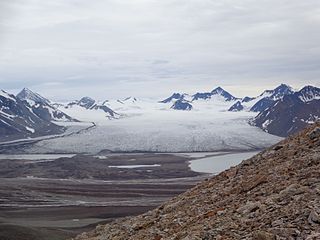
St. Jonsfjorden is a fjord in Oscar II Land at Spitsbergen, Svalbard. It has a length of 21 kilometer, and opens westwards into the strait of Forlandsundet. Several glaciers debouche into the fjord, including Gaffelbreen and Konowbreen from the north, a merge of Osbornebreen, Devikbreen, Vintervegen, Paulbreen and Bukkebreen at the bottom, and Vegardbreen, Charlesbreen and Bullbreen from the south.
Osbornebreen is a glacier in Oscar II Land at Spitsbergen, Svalbard. It has a length of 21 kilometers, merges with the glaciers Devikbreen, Klampebreen and Vintervegen, and debouches into St. Jonsfjorden. The mountain ridge Goldschmidtfjella forms a six kilometer long nunatak in the glacier.
Vintervegen is a glacier in Oscar II Land at Spitsbergen, Svalbard. It has a length of about 7.5 kilometers (4.7 mi). The glacier borders to the mountain of Klampen, merges with Osbornebreen and other glaciers, and the merged glacier stream debouches into the head of St. Jonsfjorden.
Elfenbeinbreen is a glacier stream in Sabine Land at Spitsbergen, Svalbard. It has a length of about twelve kilometers, and extends from the southern part of the ice cap Nordmannsfonna. The glacier is one of the two main sources to the river Agardhelva, which flows through Agardhdalen towards Agardhbukta.
Willybreen is a glacier on Barentsøya, Svalbard. It is an offshoot of Barentsjøkulen, reaching down to the sea in the eastern direction. The glacier is named after German zoologist Willy Kükenthal.
Freemanbreen is a glacier on Barentsøya, Svalbard. It is an offshoot of Barentsjøkulen, reaching down to the sea in the southern direction, into Freemansundet. The glacier is named after British Alderman Ralph Freeman. The mountain of Buklerimen separates Freemanbreen from the glacier of Hübnerbreen.
Duckwitzbreen is a glacier on Barentsøya, Svalbard. It is an offshoot of Barentsjøkulen, reaching down to the sea in the western direction. The glacier is named after German politician Arnold Duckwitz.
Uvêrsbreen is a glacier in Oscar II Land at Spitsbergen, Svalbard. It has a length of about 25 kilometers. The glacier debouches into Engelskbukta, after merging with Comfortlessbreen.
Comfortlessbreen is a glacier in Oscar II Land at Spitsbergen, Svalbard. It has a length of about fourteen kilometers, and a maximum width of three kilometers. The glacier debouches into Engelskbukta, after a merge with Uvêrsbreen. Comfortlessbreen is separated from Uvêrsbreen by the mountain range of Trondheimfjella.
Svanbergfjellet is a mountain in Olav V Land at Spitsbergen, Svalbard. It has a height of 1,024 m.a.s.l. and is located east of Billefjorden and west of Akademikarbreen. The mountain is named after Swedish astronomer Jöns Svanberg. A point on the mountain was used as a trigonometric point during the Swedish-Russian Arc-of-Meridian Expedition.
Backlundtoppen is a mountain in Olav V Land at Spitsbergen, Svalbard. It has a height of 1,068 m.a.s.l. and is located east of Billefjorden and west of Akademikarbreen. The mountain is named after Swedish-Russian astronomer Johan Oskar Backlund. It hosted a trigonometric station during the Swedish-Russian Arc-of-Meridian Expedition.
Paulbreen is a glacier in Oscar II Land at Spitsbergen, Svalbard. It has a length of about four kilometers and is located at the eastern side of St. Jonsfjorden. The glacier is surrounded by Vittenburgfjella, and splits the range in a northern and southern part. The glacier, as well as the surrounding mountain range, is named after Russian paleontologist Paul Vittenburg.
Aavatsmarkbreen is a glacier in Oscar II Land at Spitsbergen, Svalbard. It is named after politician and military officer Ivar Aavatsmark. The glacier debouches into Forlandsundet, in the bay of Hornbækbukta. At the southern side of the glacier, between Aavatsmarkbreen and Kaffiøyra, is the mountain range of Prins Heinrichfjella.
Dahlbreen is a glacier in Oscar II Land at Spitsbergen, Svalbard. It is named after whaler Thor Dahl. The glacier has a length of about fifteen kilometers, extending from Løvenskioldfonna to Forlandsundet. Among its tributary glaciers are Ujamnbreen, Bærumbreen and Fjelgbreen. Retreatment of the glacier has formed the bay of Dahlbrebukta.
Petuniabukta is a bay in Dickson Land at Spitsbergen, Svalbard. It constitutes the northern branch of Billefjorden. The bay is named after the Scottish vessel SS Petunia. Northwest of the bay is the valley of Hørbyedalen and the glacier of Hørbyebreen.
Hayesbreen is a glacier in Sabine Land at Spitsbergen, Svalbard. It is named after American politician and Arctic explorer Isaac Israel Hayes. The glacier has a length of about eighteen kilometers, and debouches into the bay of Mohnbukta. Surrounding mountains are Aagaardfjellet to the north, Jebensfjellet to the south, and Panofskyfjellet where Hayesbreen joins the glacier of Königsbergbreen.
References
- ↑ "Endring av navn på S100 D8 Negribreen (Sak 263, 1995)" (in Norwegian). Norwegian Polar Institute . Retrieved 7 November 2013.
- ↑ "Akademikarbreen (Svalbard)". Norwegian Polar Institute . Retrieved 7 November 2013.
- ↑ Lauritzen, Per Roger, ed. (2009). "Akademikerbreen". Norsk Fjelleksikon (in Norwegian). Arendal: Friluftsforlaget. ISBN 978-82-91-49547-7.
Coordinates: 78°44′N18°24′E / 78.73°N 18.40°E
| This article about a glacier in Spitsbergen is a stub. You can help Wikipedia by expanding it. |