
Gurgaon, officially named Gurugram, is a city located in the northern Indian state of Haryana. It is situated near the Delhi–Haryana border, about 30 kilometres (19 mi) southwest of the national capital New Delhi and 268 km (167 mi) south of Chandigarh, the state capital. It is one of the major satellite cities of Delhi and is part of the National Capital Region of India. As of 2011, Gurgaon had a population of 1,153,000.
Gurgaon district, officially known as Gurugram district, is one of the 22 districts of Haryana in northern India. The city of Gurgaon is the administrative headquarters of the district. The population is 1,514,432. It is one of the southern districts of Haryana. On its north, it is bounded by the district of Jhajjar and the Union Territory of Delhi. Faridabad district lies to its east. On its south, lie the districts of Palwal and Nuh. To its west lies Rewari district.
Nuh district is one of the 22 districts in the Indian state of Haryana. There are four sub-divisions in this district: Nuh, Ferozepur Jhirka, Punahana, and Taoru. It has an area of 1,860 square kilometres (720 sq mi) and had a population of 1.09 million in 2011. It is bounded by Gurugram District to the north, Palwal District of Haryana to the east and Alwar District of Rajasthan to the south and west. Its boundaries also touch Bharatpur District of Rajasthan and Mathura District of Uttar Pradesh near Bichhor Village and Nai Village of Punhana Tehsil. It is predominantly populated by farmers of Meo ethnicity.
Bhiwadi is a planned city located in Alwar district of the Indian state of Rajasthan.It situated 60km away from Delhi and 90 km from Alwar. The city is administered by BIDA. Bhiwadi is fifth most populous city in Rajasthan. It is famous for residential and business zone.
Nuh is the district capital of the Nuh district in the Indian state of Haryana. It lies on the National Highway 248, also known as the Gurgaon-Sohna-Alwar highway, about 45 kilometres (28 mi) from Gurgaon.
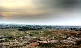
Sohna is a town and a municipal committee in the Gurgaon district of Haryana, India. A popular tourist weekend and conference retreat, it is on the highway from Gurgaon to Alwar near a vertical rock. Sohna is known for its hot springs and Shiva temple. Sohna tehsil is part of Ahirwal Region. Major communities in Sohna are Rajputs, Ahirs, Gujars, Jats, and Muslims. Gurgaon district is divided into 4 sub-divisions each headed by a Sub-Divisional Magistrate (SDM): Gurgaon, Sohna, Pataudi and Badshahpur.
Taoru or Tauru is a town in Nuh district in the Indian state of Haryana.
Sreekandapuram is a municipality in Kannur district, in the Indian state of Kerala.
Badshapur is one of the 4 sub-division of Gurugram district of Haryana state, situated on the Gurugram-Sohna road (NH-248A). It is named after the Badshahpur Fort, which in turn was the abode of the wife of Mughal Emperor Bahadur Shah Zafar. Badshahpur is a part of Badshahpur assembly constituency of Haryana.
Kotkasim is a tehsil of Alwar District of the Indian state, Rajasthan.
Babupur is a yadav dominated village in Gurgaon Mandal, near sun in Haryana. Babupur is 2940 km from its district main city Gurgaon near Palam Vihar and 252 km from its state main city Chandigarh. It has a population of about 953 persons living in around 185 households.
Bandhwari is a village in Gurgaon tehsil, Gurgaon district in the Indian state of Haryana. It is an important biodiversity area contiguous to Asola Bhatti Wildlife Sanctuary within the Northern Aravalli leopard wildlife corridor.
Basai is a village in Gurgaon Mandal in Gurgaon District in Haryana state in India. Basai is 4 km distance from its district main city Gurgaon and 282 km distance from its state main city Chandigarh. It has a population of about 20980 persons living in around 2195 households. Basai village is famed for Basai wetland home of endangered migrant birds, which is under threat from the unsustainable development and urbanization.
Jharsa is a village in Gurugram of Haryana State, India. It has a population of about 32,709; it is located 10 kilometres (6.2 mi) from the Gurugram city centre and 254 kilometres (158 mi) from the state's main city, Chandigarh. It is surrounded by Mohyal Colony, Patel Nagar, Kirti Nagar, Sectors 15, 31, 32, 39, 40, 46, and Indra Colony.
Teekli is a village in Sohna Mandal, Gurgaon District, Haryana state, India. It is 33.85 km south of India's capital New Delhi and lies in the foothills of the Aravali Mountains. It has a population of about 17,234 (approx) persons living in around 1,390 households. Teekli is dominated by Yadavs.
Khandsa is a village in Gurgaon mandal in Gurgaon District, Haryana State, India. It is populated by brahmans and rajputs, Khandsa is several kilometres from main Gurgaon, main town of the mandal and 257 kilometres (160 mi) from the state capital Chandigarh. It has a population of about 9959 persons living in some 1912 households. It lies on the NH-8 highway. It is nearby to New Delhi India
Palra is a village in the Gurgaon district of Haryana, India. It has a population of about 2803 persons living in around 507 households
Bawwa is a village in the Nahar Block of the Rewari District in Haryana, India. It is located 50 kilometres (31 mi) northwest of the district headquarters of Rewari, 10 kilometres (6.2 mi) west-southwest of Nahar, and 320 kilometres (200 mi) from the state capital Chandigarh. Karoli, Garhs, Sihor, Bahala, Naya-Gaon, and Gadhi are the neighboring villages. Bawwa is situated approximately 3 km from Karoli mod on Kanina-Bahu-Jholri road in the Rewari District.
Nurpur Jharsa is situated in Gurgaon tehsil and located in Gurgaon district of Haryana. It is one of 38 villages in Gurgaon Block along with villages like Aklimpur and Palra. Nearby railway station of Nurpur jharsa is Gurgaon. It lies in 68.
Sohna Elevated Corridor or Sohna–Gurgaon road is a 21.65 km (13.45 mi) long, six-lane wide under-construction highway corridor in Gurgaon district of Haryana, India. The project is being implemented by the National Highways Authority of India (NHAI) at an estimated cost of ₹1,466 crore.


