Rangeli is a Municipality and rural market town in Morang District in the Kosi Zone of south-eastern Nepal. This municipality was formed merging existing three villages i.e. Takuwa, Amgachhi and Rangeli itself since May 2014.
The 1991 Nepal census was a widespread national census conducted by the Nepal Central Bureau of Statistics.
Helumbu is a Gaunpalika and former village development committee in Sindhupalchok District in Bagmati Pradesh of central Nepal. At the time of the 1991 Nepal census it had a population of 2679.
Naikap Purano Bhanjyang is a village and former Village Development Committee that is now part of Chandragiri Municipality in Kathmandu District in Province No. 3 of central Nepal. At the time of the 1991 Nepal census it had a population of 3456. The highest terrains in this village locate westerly, in ward No.5. A panoramic beautiful scene of whole Kathmandu Valley from Sanga to Nagarkot and Swayambhunath to Kirtipur Chobar can be viewed very clearly. The height of this hilly region lies in between 1600 m to 1800 m. The whole Himalayan range from Langtang to Mahalangur can also be viewed.
Deudakala is a village development committee in Bardiya District in Province No. 5 of south-western Nepal. At the time of the 1991 Nepal census it had a population of 11,625 and had 1740 houses in the town. The village is home to the Tharu people. World famous chef, Juni Tharu is originally from the region.
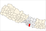
Barjibang is a village and Village Development Committee in Pyuthan, a Middle Hills district of Province No. 5, western Nepal.
Bhingri is a Village Development Committee in Pyuthan, a Middle Hills district of Rapti Zone, western Nepal.
Dangbang is a town and Village Development Committee in Pyuthan, a Middle Hills district of Rapti Zone, western Nepal.
Dharampani is a village and Village Development Committee in Pyuthan, a Middle Hills district of Rapti Zone, western Nepal.
Khung is a village and Village Development Committee in Pyuthan, a Middle Hills district of Province No. 5, western Nepal.
Kochibang is a village and Village Development Committee in Pyuthan, a Middle Hills district of Rapti Zone, western Nepal.
Ligha also known as Lipa is a village and Village Development Committee in Pyuthan, a Middle Hills district of Rapti Zone, western Nepal.
Libang is a town and Village Development Committee in Pyuthan, a Middle Hills district of Province No. 5, western Nepal.
Bangemarot is a Village Development Committee in Pyuthan, a Middle Hills district of Rapti Zone, western Nepal.
Markabang is a village and Village Development Committee in Pyuthan, a Middle Hills district of Province No. 5, western Nepal.
Ramdi is a village and Village Development Committee in Pyuthan, a Middle Hills district of Rapti Zone, western Nepal.
Deurali is a Village Development Committee in Kaski District of the Gandaki province of north-central Nepal. At the time of the 1991 Nepal census, it had a population of 2,882. The base camp of Mount Machapuchare is situated at a 6 hours uphill trek from the village.
Latinath is a village development committee in Darchula District in the Mahakali Zone of western Nepal. At the time of the 1991 Nepal census it had a population of 3392 people living in 587 individual households. In this development region one of the famous temple of this district is located which is called "latainath" or "latinath".
Ringneraha is a village development committee in Palpa District in the Lumbini Zone of southern Nepal. Ringneraha is a fourth-order administrative division and is located in Lumbinī Zone, Western Region, Nepal. At the time of the 1991 Nepal census it had a population of 2285 people living in 401 individual households.

Sundar Haraicha is a municipality in Morang District of Province No. 1 in Nepal that was established on 10 March 2017 by merging the former municipalities Sundar Dulari and Koshi Haraicha. At the time of the 2011 Nepal census, the localities formed had a joint population of 80,518 people living in 18,610 individual households.