
The Karamanids, also known as the Emirate of Karaman and Beylik of Karaman, was an Anatolian beylik of Salur tribe origin, centered in South-Central Anatolia around the present-day Karaman Province. From the mid 14th century until its fall in 1487, the Karamanid dynasty was one of the most powerful beyliks in Anatolia.

The Sultanate of Rûm was a culturally Turco-Persian Sunni Muslim state, established over conquered Byzantine territories and peoples (Rûm) of Anatolia by the Seljuk Turks following their entry into Anatolia after the Battle of Manzikert (1071). The name Rûm was a synonym for the medieval Eastern Roman Empire and its peoples, as it remains in modern Turkish. The name is derived from the Aramaic (romī) and Parthian (frwm) names for ancient Rome, via the Greek Ῥωμαῖοι (Romaioi).

The Candar dynasty, also known as the Isfendiyar dynasty, was an Oghuz Turkic princely Anatolian dynasty that reigned in the territories corresponding to the provinces of Eflani, Kastamonu, Sinop, Zonguldak, Bartın, Karabük, Samsun, Bolu, Ankara and Çankırı in present-day Turkey from the year 1291 to 1461. The region was known in Western literature as Paphlagonia, a name applied to the same geographical area during the Roman period.

Anatolian beyliks were small principalities in Anatolia governed by beys, the first of which were founded at the end of the 11th century. A second and more extensive period of establishment took place as a result of the decline of the Seljuq Sultanate of Rûm in the latter half of the 13th century.

Alanya, formerly Alaiye, is a beach resort city, a municipality and district of Antalya Province, Turkey. It is on the southern coast of Turkey, in the country's Mediterranean Region, 133 kilometres (83 mi) east of the city of Antalya. Its area is 1,577 km2, and its population is 364,180 (2022). The city proper has 189,222 inhabitants (2022).

The Germiyanids were a prominent Anatolian beylik established by the Oghuz Turkish tribes after the decline of the Sultanate of Rûm. While the beylik was always mentioned as being ethnically Turkoman or Oghuz Turkish, the population consisted of Turks and Yezidi Kurds, brought by the Seljuks from the east of Malatya to western Anatolia as militia guards against the threatening Turkish tribesmen.

Gazipaşa is a municipality and district of Antalya Province, Turkey. Its area is 1,111 km2, and its population is 53,702 (2022). It is situated on the Mediterranean coast, 180 km east of the city of Antalya. Gazipaşa is a quiet rural district famous for its bananas and oranges. Gazipaşa district is adjacent to Alanya to the northwest, Sarıveliler to the north, Anamur to the east, and the Mediterranean Sea to the west.

The Seljuk dynasty, or Seljukids, Seljuqs, also known as Seljuk Turks, Seljuk Turkomans or the Saljuqids, was an Oghuz Turkic, Sunni Muslim dynasty that gradually became Persianate and contributed to Turco-Persian culture in West Asia and Central Asia. The Seljuks established the Seljuk Empire (1037–1194), the Sultanate of Kermân (1041–1186) and the Sultanate of Rum (1074–1308), which stretched from Iran to Anatolia and were the prime targets of the First Crusade.

The Red Tower is a historical tower in the Turkish city of Alanya. The building is considered to be the symbol of the city, and is used on the city's flag.
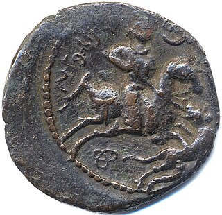
Alā ad-Dīn Kayqubād ibn Kaykhusraw, also known as Kayqubad I, was the Seljuq Sultan of Rûm who reigned from 1220 to 1237. He expanded the borders of the sultanate at the expense of his neighbors, particularly the Mengujek Beylik and the Ayyubids, and established a Seljuq presence on the Mediterranean with his acquisition of the port of Kalon Oros, later renamed Ala'iyya in his honor. The sultan, sometimes styled Kayqubad the Great, is remembered today for his rich architectural legacy and the brilliant court culture that flourished under his reign.

Muʿīn al-Dīn Sulaymān Parwāna, simply known as Parwāna, was a Persian statesman, who was for a time a key player in Anatolian politics involving the Seljuk Sultanate of Rûm, the Mongol Ilkhanate and the Mamluks under Baybars.

Ghiyath al-Din Kaykhusrawibn Kayqubād or Kaykhusraw II was the sultan of the Seljuqs of Rûm from 1237 until his death in 1246. He ruled at the time of the Babai uprising and the Mongol invasion of Anatolia. He led the Seljuq army with its Christian allies at the Battle of Köse Dağ in 1243. He was the last of the Seljuq sultans to wield any significant power and died as a vassal of the Mongols.

The Chobanids were the ruling dynasty of the Anatolian beylik that controlled the city and region of Kastamonu in the 13th century.

The Saltukids or Saltuqids were a dynasty ruling one of the Anatolian beyliks of the Seljuk Empire, founded after the Battle of Manzikert (1071) and centered on Erzurum. The Saltukids ruled between 1071 and 1202. The beylik was founded by Emir Saltuk, one of the Turkmen commanders of the Great Seljuk Alp Arslan. The beylik fought frequently against the Georgian Kingdom for hegemony of the Kars region. The center of the beylik, Erzurum, was briefly re-occupied by the Byzantine Empire between 1077 and 1079, and was besieged by the Georgian King Giorgi III in 1184. It comprised the entirety of present-day Erzurum and Bayburt provinces, lands east of Erzincan, most of Kars, and lands north of Ağrı and Muş provinces during its height.
Kayqubad III was briefly sultan of the Sultanate of Rum between the years of 1298 and 1302. He was a nephew of the deposed Mesud II and had strong support among the Seljuks. As sultan he was a vassal of the Mongols and exercised no real power.
Ghiyath al-Dīn Me’sud ibn Kaykaus or Mesud II bore the title of Sultan of Rûm at various times between 1284 and 1308. He was a vassal of the Mongols under Mahmud Ghazan and exercised no real authority. Mesud died in 1308, the last of the Seljuks of Rum.

Anatolian Seljuk architecture, or simply Seljuk architecture, refers to building activity that took place under the Sultanate of Rum, ruled by an offshoot of the Seljuk dynasty that emerged from the Great Seljuk Empire alongside various other local dynasties. The Anatolian Seljuks patronized their own tradition of architecture whose surviving examples are generally found in present-day Turkey. Anatolian Seljuk architecture was eclectic and influenced by multiple traditions including Armenian, Byzantine, Iranian, and Syrian architecture. Unlike earlier Great Seljuk architecture to the east, their buildings were generally constructed in stone and featured significant stone-carved decoration as well as tile decoration. While the Seljuk Sultanate declined and ended in the late 13th century, architecture continued to flourish and diversify under the smaller Beylik states in Anatolia, which included the early Ottomans.
Karim al-Dīn Ḳarāmān Beg was a Turkoman chieftain who ruled the Karamanids in the 13th century. Ḳarāmān Beg's emergence coincides with the defeat of the Sultanate of Rum by the Mongolian Empire in 1256 and the tension between Kaykaus I and his rival brother Kilij Arslan IV, which allowed local lords living along the boundaries of the state to exercise some autonomy.
Yakub I was the founder of the beylik of Germiyan, located in western Anatolia around Kütahya. Although Germiyan revolted against Mesud II, the Sultan of Rum, Yakub accepted vassalage under Kayqubad III. The Sultanate of Rum disintegrated shortly after. At that point, Yakub's realm extended as far east as Ankara and incorporated various towns taken from the Byzantine Empire and the Catalan Company. Yakub was the suzerain of many of his neighbors, and his reign was described as economically prosperous by contemporary historians. He was succeeded by his son Mehmed, nicknamed Chakhshadan.
The Battle of Kırkdilim was fought in July 1391 or 1392 between the Ottoman Ertuğrul Çelebi son of Bayezid I, and Kadi Burhan al-Din, ruler of northeastern Anatolia. The details of the battle are debated: Burhan al-Din's court poet Ibn Ardashir presents Bayezid's campaign being ended by a major victory for his master, which temporarily halted Ottoman expansion in Anatolia, but the contemporary letters of Manuel II Palaiologos, who accompanied Bayezid on his Anatolian campaigns, contain no indications of a major clash, and point to the expedition having been an Ottoman success overall.

