Albera Ligure | ||
---|---|---|
Comune | ||
Comune di Albera Ligure | ||
| ||
Coordinates: 44°42′N9°4′E / 44.700°N 9.067°E Coordinates: 44°42′N9°4′E / 44.700°N 9.067°E | ||
Country | Italy | |
Region | Piedmont | |
Province | Province of Alessandria (AL) | |
Frazioni | Astrata, San Martino, Figino, Santa Maria, Vendersi, Vigo, Volpara | |
Government | ||
• Mayor | Renato Lovotti | |
Area | ||
• Total | 21.4 km2 (8.3 sq mi) | |
Elevation | 423 m (1,388 ft) | |
Population (30 November 2017) [1] | ||
• Total | 308 | |
• Density | 14/km2 (37/sq mi) | |
Demonym(s) | Alberini or Albèresi | |
Time zone | CET (UTC+1) | |
• Summer (DST) | CEST (UTC+2) | |
Postal code | 15060 | |
Dialing code | 0143 | |
Website | Official website |
Albera Ligure is a comune (municipality) in the Province of Alessandria in the Italian region Piedmont, located about 120 kilometres (75 mi) southeast of Turin and about 45 kilometres (28 mi) southeast of Alessandria.
The comune is a basic administrative division in Italy, roughly equivalent to a township or municipality.
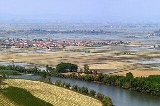
The Province of Alessandria is an Italian province, with a population of some 425,000, which forms the southeastern part of the region of Piedmont. The provincial capital is the city of Alessandria.
Italy, officially the Italian Republic, is a country in Southern and Western Europe. Located in the middle of the Mediterranean Sea, Italy shares open land borders with France, Switzerland, Austria, Slovenia and the enclaved microstates San Marino and Vatican City. Italy covers an area of 301,340 km2 (116,350 sq mi) and has a largely temperate seasonal and Mediterranean climate. With around 61 million inhabitants, it is the fourth-most populous EU member state and the most populous country in Southern Europe.
Albera Ligure borders the following municipalities: Cabella Ligure, Cantalupo Ligure, Fabbrica Curone, Montacuto, and Rocchetta Ligure.
Cabella Ligure is a comune (municipality) in the Province of Alessandria in the Italian region Piedmont, located about 120 kilometres (75 mi) southeast of Turin and about 45 kilometres (28 mi) southeast of Alessandria.
Cantalupo Ligure is a comune (municipality) in the Province of Alessandria in the Italian region Piedmont, located about 110 kilometres (68 mi) southeast of Turin and about 40 kilometres (25 mi) southeast of Alessandria.
Fabbrica Curone is a comune (municipality) in the Province of Alessandria in the Italian region Piedmont, located in the upper valley of the Curone stream, about 120 kilometres (75 mi) southeast of Turin and about 45 kilometres (28 mi) southeast of Alessandria.
Basaluzzo is a comune (municipality) in the Province of Alessandria in the Italian region Piedmont, located about 90 kilometres (56 mi) southeast of Turin and about 20 kilometres (12 mi) southeast of Alessandria.
Borghetto di Borbera is a comune (municipality) in the Province of Alessandria in the Italian region Piedmont, located about 110 kilometres (68 mi) southeast of Turin and about 35 kilometres (22 mi) southeast of Alessandria.
Bosco Marengo is a town and comune (municipality) in the Province of Alessandria in the Italian region Piedmont, located about 80 kilometres (50 mi) southeast of Turin and about 12 kilometres (7 mi) southeast of Alessandria.
Bosio is a comune (municipality) in the Province of Alessandria in the Italian region Piedmont, located about 100 kilometres (62 mi) southeast of Turin and about 35 kilometres (22 mi) southeast of Alessandria.
Carrega Ligure is a comune (municipality) in the Province of Alessandria in the Italian region Piedmont, located about 130 kilometres (81 mi) southeast of Turin and about 60 kilometres (37 mi) southeast of Alessandria, in the upper Ligurian Apennines in the Val Borbera.
Cassano Spinola is a comune (municipality) in the Province of Alessandria in the Italian region Piedmont, located about 100 kilometres (62 mi) southeast of Turin and about 25 kilometres (16 mi) southeast of Alessandria. As of 31 December 2004, it had a population of 1,863 and an area of 15.0 square kilometres (5.8 sq mi).
Dernice is a comune (municipality) in the Province of Alessandria in the Italian region Piedmont, located about 110 kilometres (68 mi) southeast of Turin and about 40 kilometres (25 mi) southeast of Alessandria. It is located across the ancient Salt road, a former commercial road between Genoa and the Padan Plain. It is the seat of production of the Montebore cheese, in the eponymous frazione. It was once home to a castle, now in ruins.
Grondona is a comune (municipality) in the Province of Alessandria in the Italian region Piedmont, located about 110 kilometres (68 mi) southeast of Turin and about 35 kilometres (22 mi) southeast of Alessandria. As of 31 December 2004, it had a population of 548 and an area of 25.7 square kilometres (9.9 sq mi).
Mongiardino Ligure is a comune (municipality) in the Province of Alessandria in the Italian region Piedmont, located about 120 kilometres (75 mi) southeast of Turin and about 50 kilometres (31 mi) southeast of Alessandria.
Montacuto is a comune (municipality) in the Province of Alessandria in the Italian region Piedmont, located about 120 kilometres (75 mi) southeast of Turin and about 40 kilometres (25 mi) southeast of Alessandria.
Montaldeo is a comune (municipality) in the Province of Alessandria in the Italian region Piedmont, located about 100 kilometres (62 mi) southeast of Turin and about 35 kilometres (22 mi) southeast of Alessandria. As of 31 December 2004, it had a population of 311 and an area of 5.2 square kilometres (2.0 sq mi).
Mornese is a comune (municipality) in the Province of Alessandria in the Italian region Piedmont, located about 100 kilometres (62 mi) southeast of Turin and about 35 kilometres (22 mi) southeast of Alessandria.
Pasturana is a comune (municipality) in the Province of Alessandria in the Italian region Piedmont, located about 80 kilometres (50 mi) southeast of Turin and about 15 kilometres (9 mi) southeast of Alessandria. As of 31 December 2004, it had a population of 1,086 and an area of 5.3 square kilometres (2.0 sq mi).
Pozzolo Formigaro is a comune (municipality) in the Province of Alessandria in the Italian region Piedmont, located about 90 kilometres (56 mi) southeast of Turin and about 20 kilometres (12 mi) southeast of Alessandria. As of 1-1-2017, it had a population of 4,758 and an area of 36.18 square kilometres (13.97 sq mi).
Roccaforte Ligure is a comune (municipality) in the Province of Alessandria in the Italian region Piedmont, located about 110 kilometres (68 mi) southeast of Turin and about 40 kilometres (25 mi) southeast of Alessandria, between the Val Sisola and the Valle Spinti.
Rocchetta Ligure is a comune (municipality) in the Province of Alessandria in the Italian region Piedmont, located about 110 kilometres (68 mi) southeast of Turin and about 40 kilometres (25 mi) southeast of Alessandria. As of 31 December 2004, it had a population of 208 and an area of 10.1 square kilometres (3.9 sq mi).
Tassarolo is a comune (municipality) in the Province of Alessandria in the Italian region Piedmont, located about 90 kilometres (56 mi) southeast of Turin and about 25 kilometres (16 mi) southeast of Alessandria. As of 31 December 2004, it had a population of 598 and an area of 7.1 square kilometres (2.7 sq mi).
This article on a location in the Province of Alessandria is a stub. You can help Wikipedia by expanding it. |